Long-Lived Tornado in Eastern Wyoming Saturday
Special Stories
28 Jul 2018 7:50 PM
A mature tornado lasted approximately 45 minutes in eastern Wyoming Saturday, plenty of time for several pairs of eyes to get a look at it.
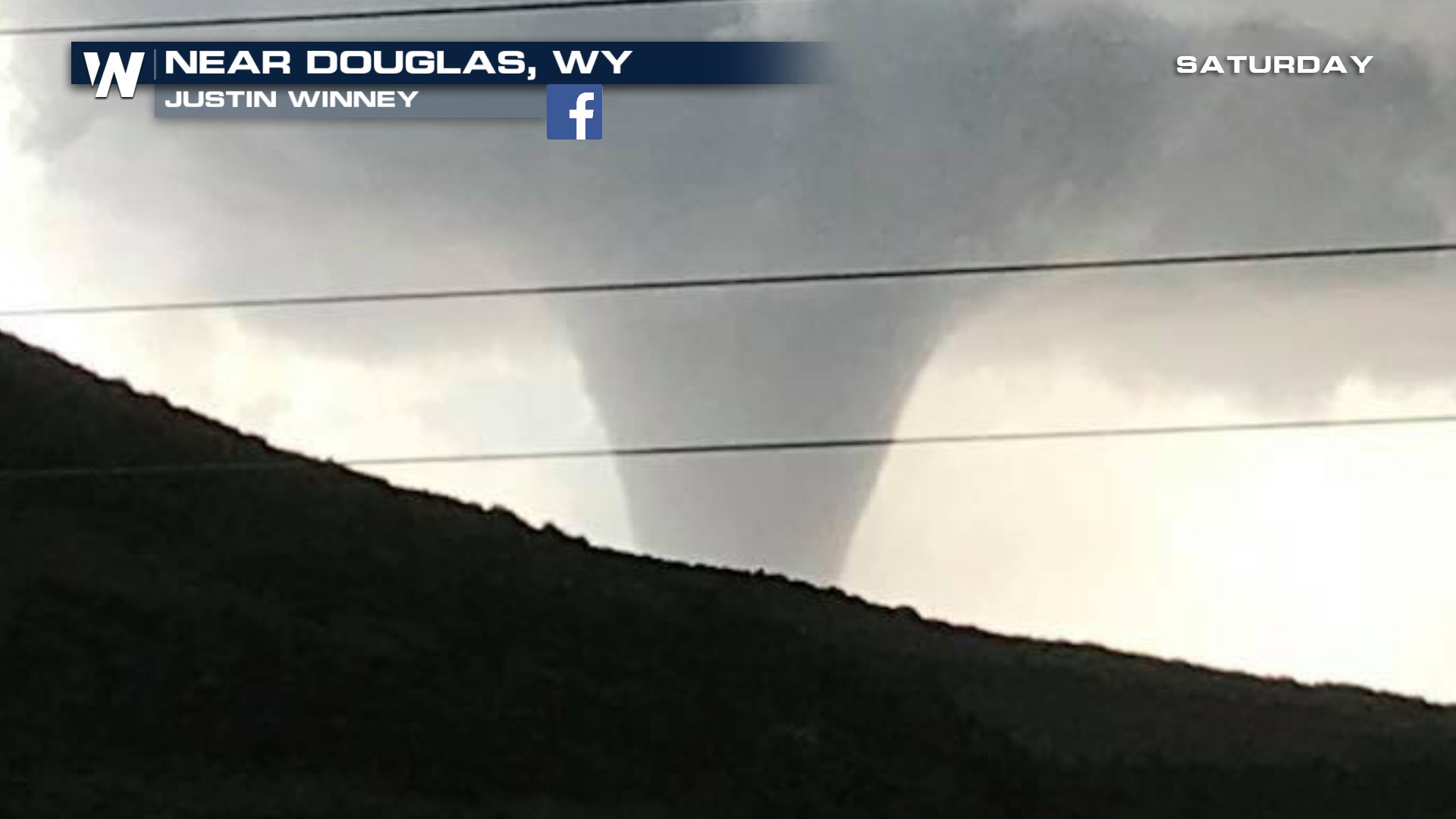 Taken Saturday, July 28 courtesy Justin Winney
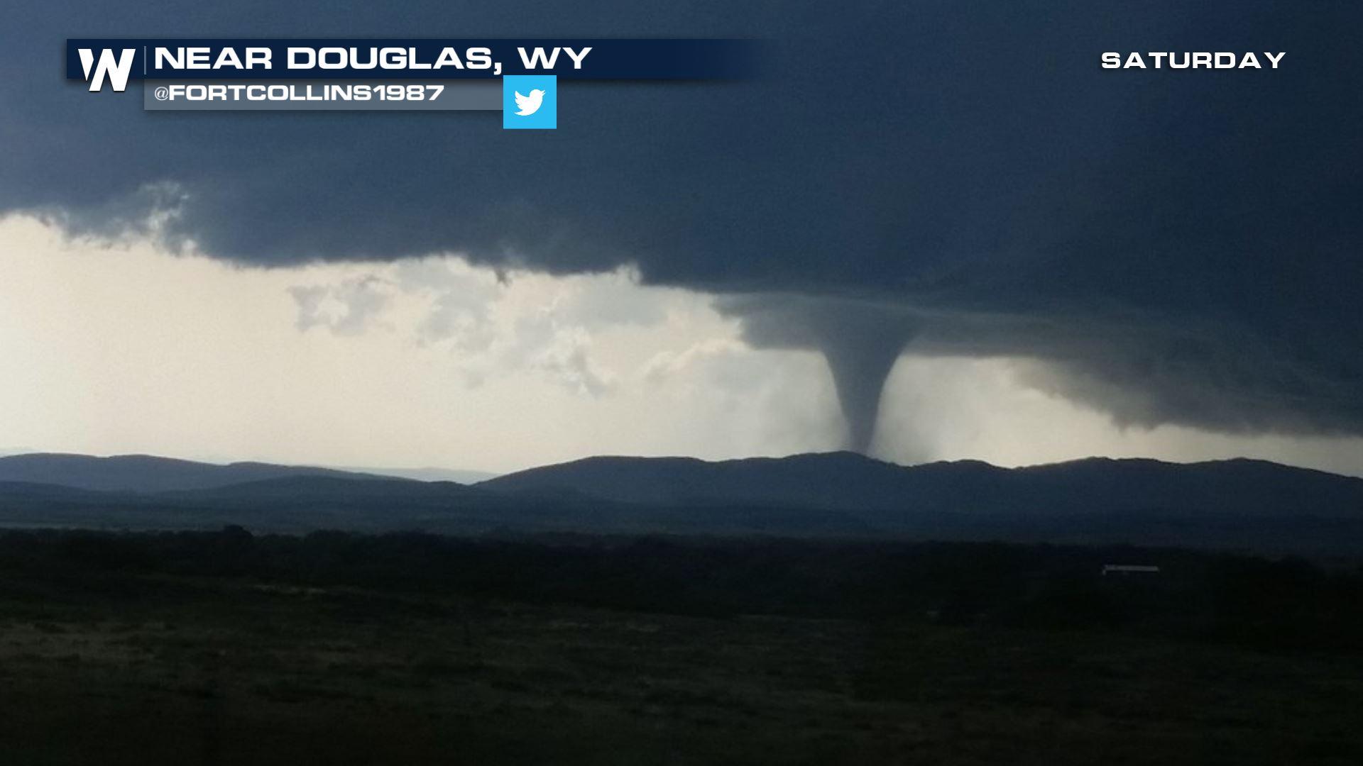
 Taken Saturday, July 28 courtesy Twitter User @FortCollins1987
https://www.facebook.com/WeatherNation/videos/10156695069744874/
The earliest tornado report came in around 3:51 p.m. local time of a tornado touching down approximately five miles southwest of Douglas, Wyoming. That trained spotter report then prompted the National Weather Service office to continue the tornado warning for an observed tornado. The final report of this storm came around 4:39 p.m. local time when law enforcement noted a tornado moving to the southeast.
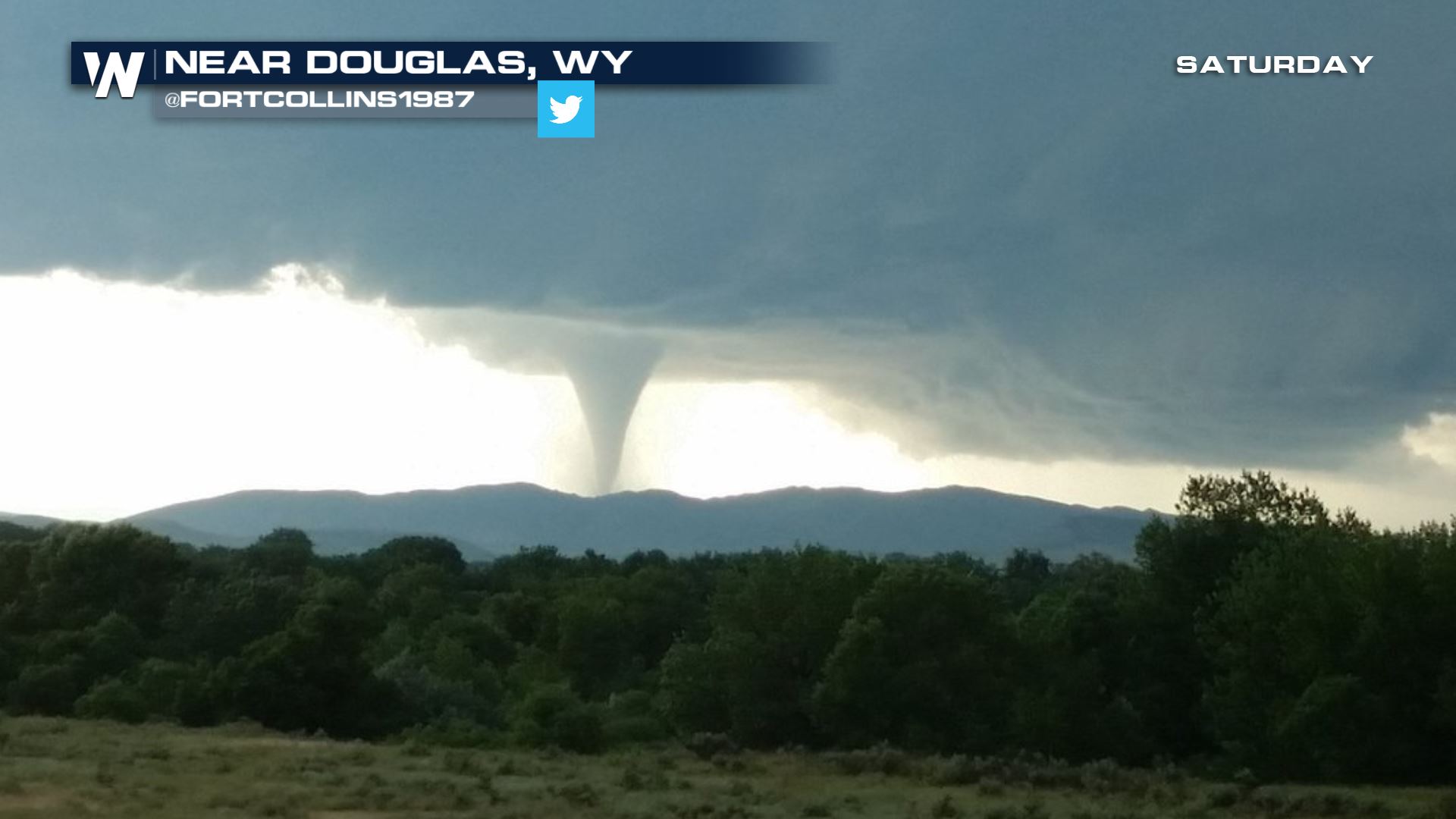
Taken Saturday, July 28 courtesy Twitter User @FortCollins1987
https://www.facebook.com/WeatherNation/videos/10156695069744874/
The earliest tornado report came in around 3:51 p.m. local time of a tornado touching down approximately five miles southwest of Douglas, Wyoming. That trained spotter report then prompted the National Weather Service office to continue the tornado warning for an observed tornado. The final report of this storm came around 4:39 p.m. local time when law enforcement noted a tornado moving to the southeast.
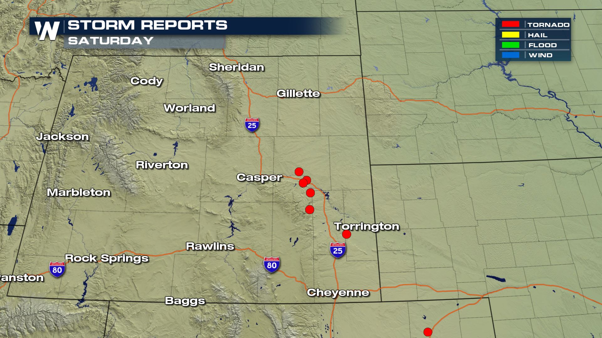 Tornado reports (shown in red) from Saturday, July 28
Where are the storms going now?
The thunderstorms will continue to move to the southeast through Colorado, Nebraska, Kansas and possibly as far south/east as Oklahoma and Missouri Saturday night into early Sunday morning.
Tornado reports (shown in red) from Saturday, July 28
Where are the storms going now?
The thunderstorms will continue to move to the southeast through Colorado, Nebraska, Kansas and possibly as far south/east as Oklahoma and Missouri Saturday night into early Sunday morning.
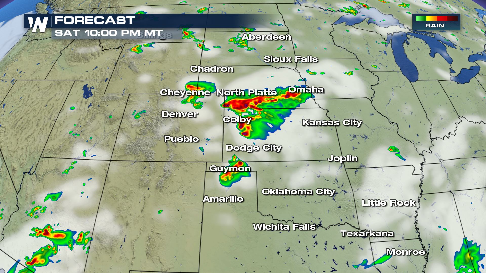 Forecast radar around 10 p.m. mountain time Saturday, July 28
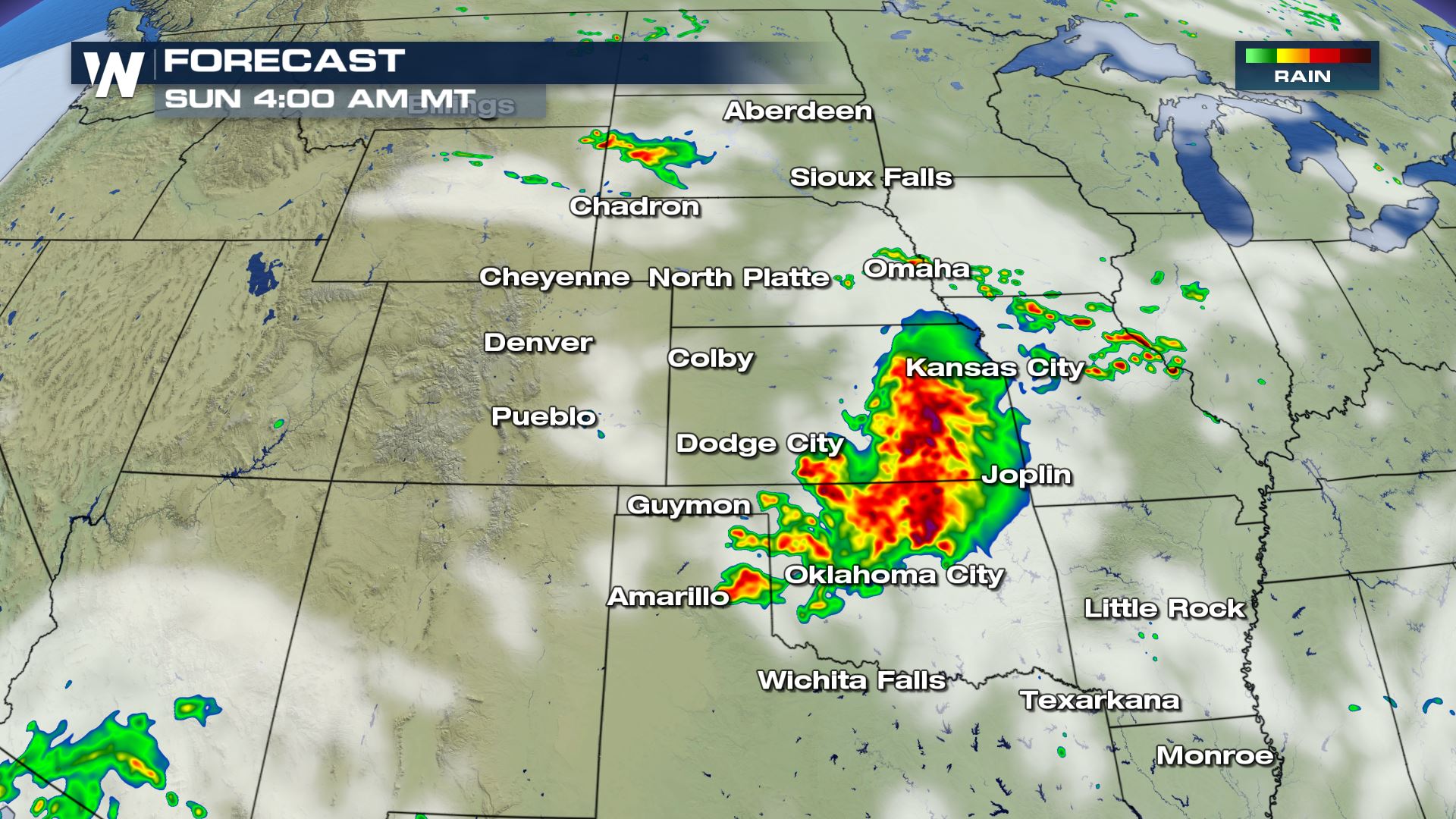 Forecast radar early Sunday morning, July 29
Make sure you have a way of getting weather warnings overnight as these thunderstorms could hold together fairly well and deep into the night. We will continue to keep you updated here, on social media, and all of our platforms.
For WeatherNation, Meteorologist Steve Glazier
(Cover picture courtesy Twitter User @FortCollins1987)
Forecast radar early Sunday morning, July 29
Make sure you have a way of getting weather warnings overnight as these thunderstorms could hold together fairly well and deep into the night. We will continue to keep you updated here, on social media, and all of our platforms.
For WeatherNation, Meteorologist Steve Glazier
(Cover picture courtesy Twitter User @FortCollins1987)
Taken Saturday, July 28 courtesy Justin Winney
Taken Saturday, July 28 courtesy Twitter User @FortCollins1987
https://www.facebook.com/WeatherNation/videos/10156695069744874/
The earliest tornado report came in around 3:51 p.m. local time of a tornado touching down approximately five miles southwest of Douglas, Wyoming. That trained spotter report then prompted the National Weather Service office to continue the tornado warning for an observed tornado. The final report of this storm came around 4:39 p.m. local time when law enforcement noted a tornado moving to the southeast.
Tornado reports (shown in red) from Saturday, July 28
Where are the storms going now?
The thunderstorms will continue to move to the southeast through Colorado, Nebraska, Kansas and possibly as far south/east as Oklahoma and Missouri Saturday night into early Sunday morning.
Forecast radar around 10 p.m. mountain time Saturday, July 28
Forecast radar early Sunday morning, July 29
Make sure you have a way of getting weather warnings overnight as these thunderstorms could hold together fairly well and deep into the night. We will continue to keep you updated here, on social media, and all of our platforms.
For WeatherNation, Meteorologist Steve Glazier
(Cover picture courtesy Twitter User @FortCollins1987)All Weather News
More
Flash Flooding for the Carolinas This Week
Another stalled front in the Carolinas is for
22 Jul 2026 10:50 AM

Another Round of Storms Targets the Northeast
Another cold front is dropping east and will
22 Jul 2026 10:45 AM

Pacific Northwest Fires Bringing Down the Air Quality
Conditions have been really dry out west. We'
22 Jul 2026 10:45 AM

Tropical Storm Bertha Continues Westward Along the Gulf Coast
AtlanticTropical Storm Bertha is moving slowl
22 Jul 2026 10:30 AM

Another Round of Severe Weather for the Upper Midwest and Great Lakes
The upper-level low train continues to keep t
21 Jul 2026 1:45 AM

Air Quality Improvements in the Forecast
Wildfires burning in Northwestern Ontario, Ca
20 Jul 2026 7:20 PM

Monsoon Moisture Brings Weekend Flood Threat
The monsoon has returned to the southwestern
19 Jul 2026 1:30 AM