Major Changes to NOAA's June Outlook
Special Stories
2 Jun 2020 2:00 AM
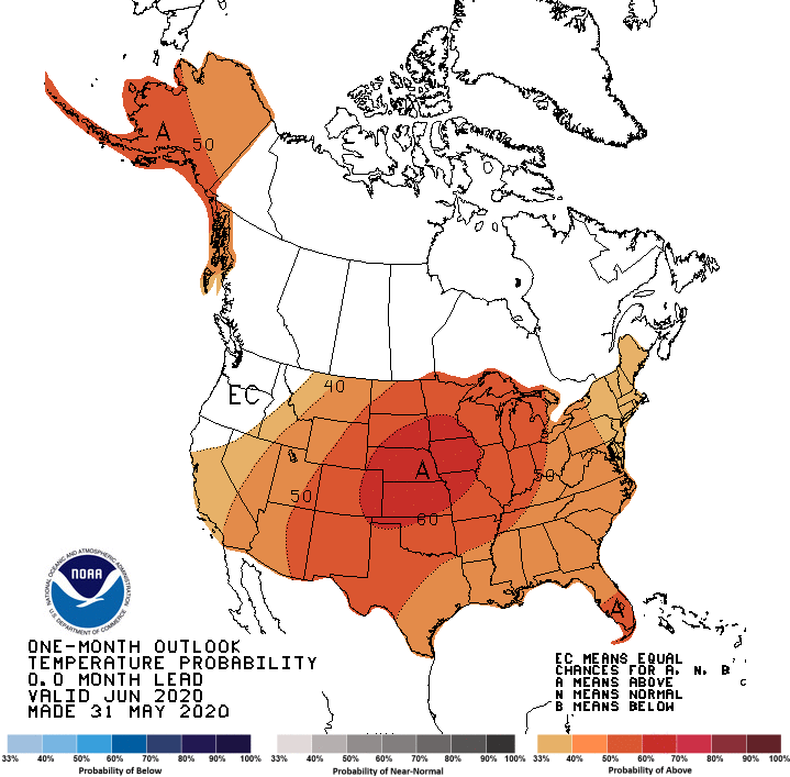
Significant changes were made to the June outlook, issued Sunday by NOAA's Climate Prediction Center. Warmth is still expected for most of the nation, but the focus is on the Plains with odds greater than 60% for above average temperatures over the next 30 days. The previous forecast, issued on May 21st, had the Plains seeing equal chances for above or below average temperatures this month. The West, South, and East are still expected to see warmer than normal weather.
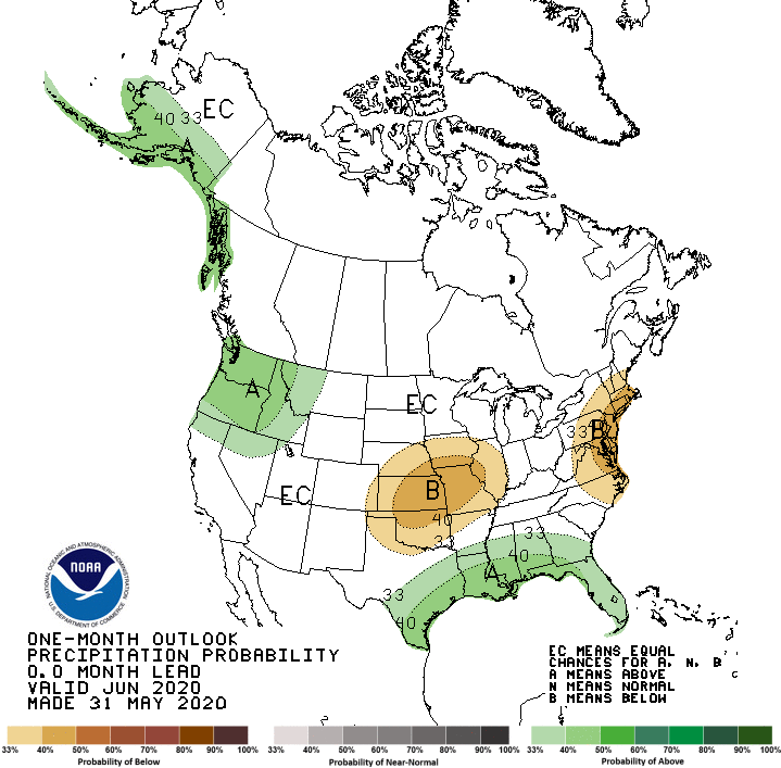
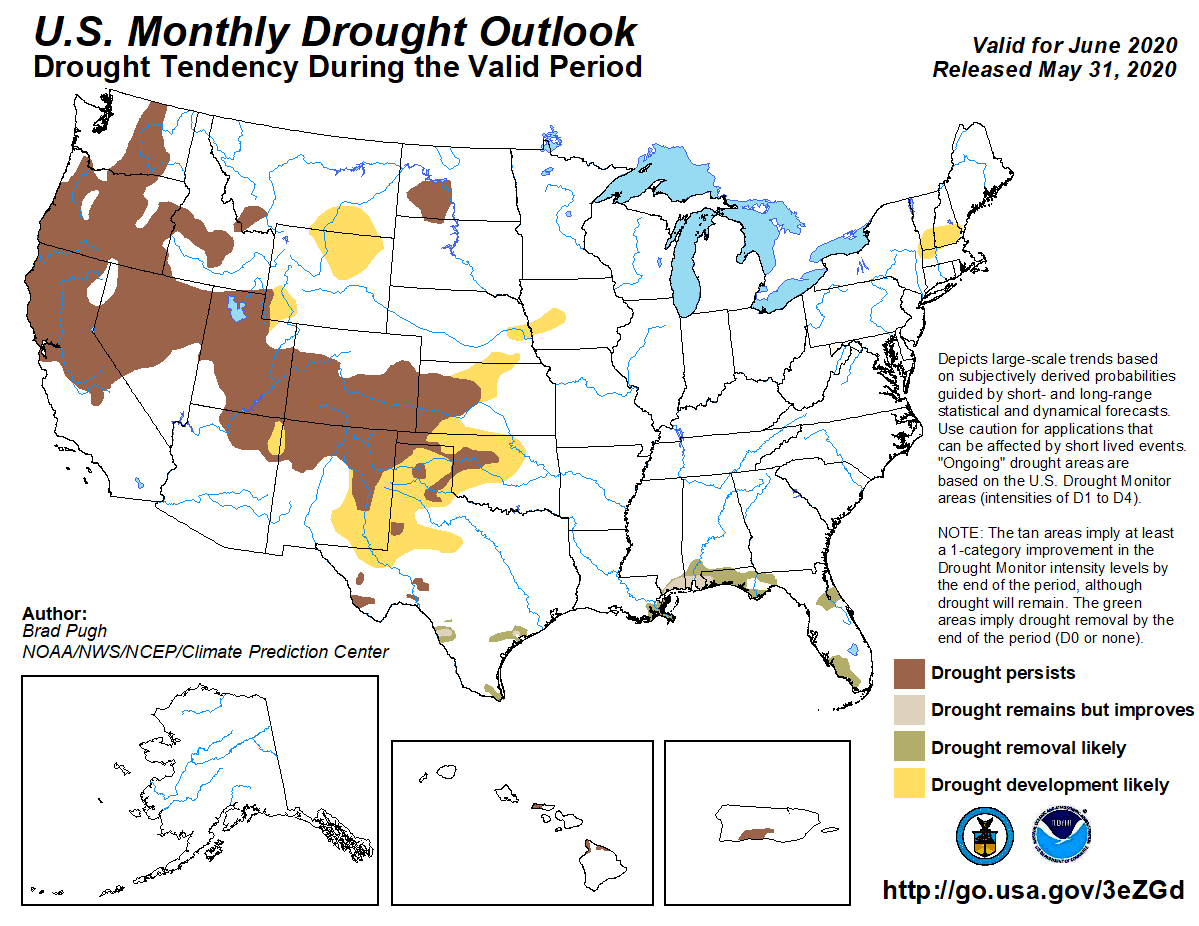
 Notable changes were also made to the precipitation forecast. The Northwest is now expected to be wetter than average (the earlier issued forecast had drier than normal). That may help drought conditions in the West, but not enough to bring an end to the dry conditions. Odds favor below normal precipitation in the Central Plains (another flip-flop), which may lead to some drought development this month. Another new pocket of drier than normal weather is forecast along the Eastern Seaboard. The Southeast is still forecast to see above normal precipitation.
 The outlook for the month ahead was based primarily on model guidance and current climate conditions. Neutral sea surface temperatures are expected to continue in the Pacific Ocean, meaning no El Nino or La Nina.
Forecast model guidance changes to circulation patterns support the changes to the revised forecast. A ridge of high pressure is now expected over the middle of the nation, leading to warm and dry conditions across the Plains. In the Northwest, a predicted trough aloft for the first half of the month will lead to better chances for precipitation.
 Notable changes were also made to the precipitation forecast. The Northwest is now expected to be wetter than average (the earlier issued forecast had drier than normal). That may help drought conditions in the West, but not enough to bring an end to the dry conditions. Odds favor below normal precipitation in the Central Plains (another flip-flop), which may lead to some drought development this month. Another new pocket of drier than normal weather is forecast along the Eastern Seaboard. The Southeast is still forecast to see above normal precipitation.

 The outlook for the month ahead was based primarily on model guidance and current climate conditions. Neutral sea surface temperatures are expected to continue in the Pacific Ocean, meaning no El Nino or La Nina.
Forecast model guidance changes to circulation patterns support the changes to the revised forecast. A ridge of high pressure is now expected over the middle of the nation, leading to warm and dry conditions across the Plains. In the Northwest, a predicted trough aloft for the first half of the month will lead to better chances for precipitation.
The outlook for the month ahead was based primarily on model guidance and current climate conditions. Neutral sea surface temperatures are expected to continue in the Pacific Ocean, meaning no El Nino or La Nina.
Forecast model guidance changes to circulation patterns support the changes to the revised forecast. A ridge of high pressure is now expected over the middle of the nation, leading to warm and dry conditions across the Plains. In the Northwest, a predicted trough aloft for the first half of the month will lead to better chances for precipitation.All Weather News
More