Marco a Post-Tropical Cyclone; Final Advisory Issued
Special Stories
25 Aug 2020 4:00 AM
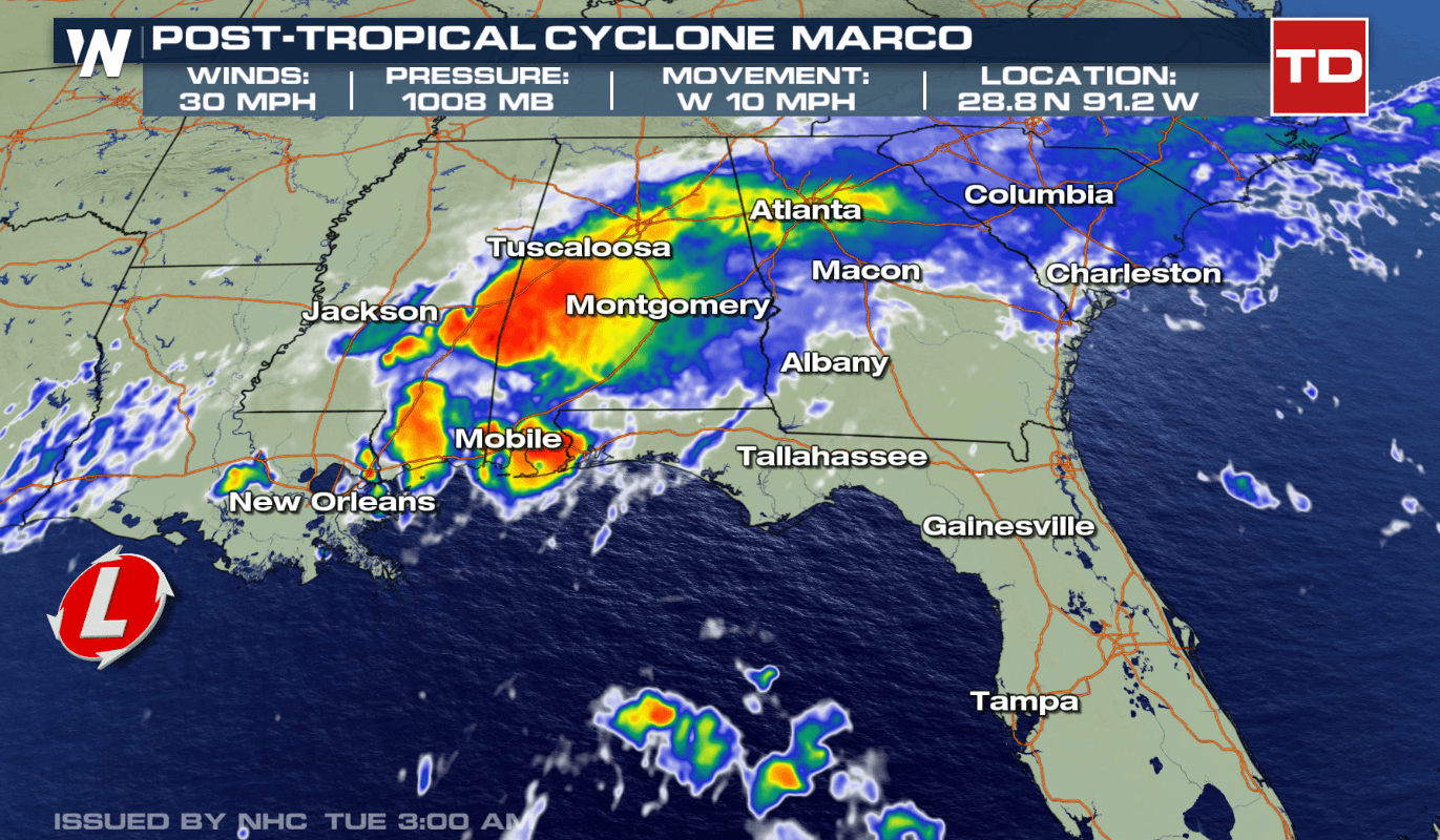
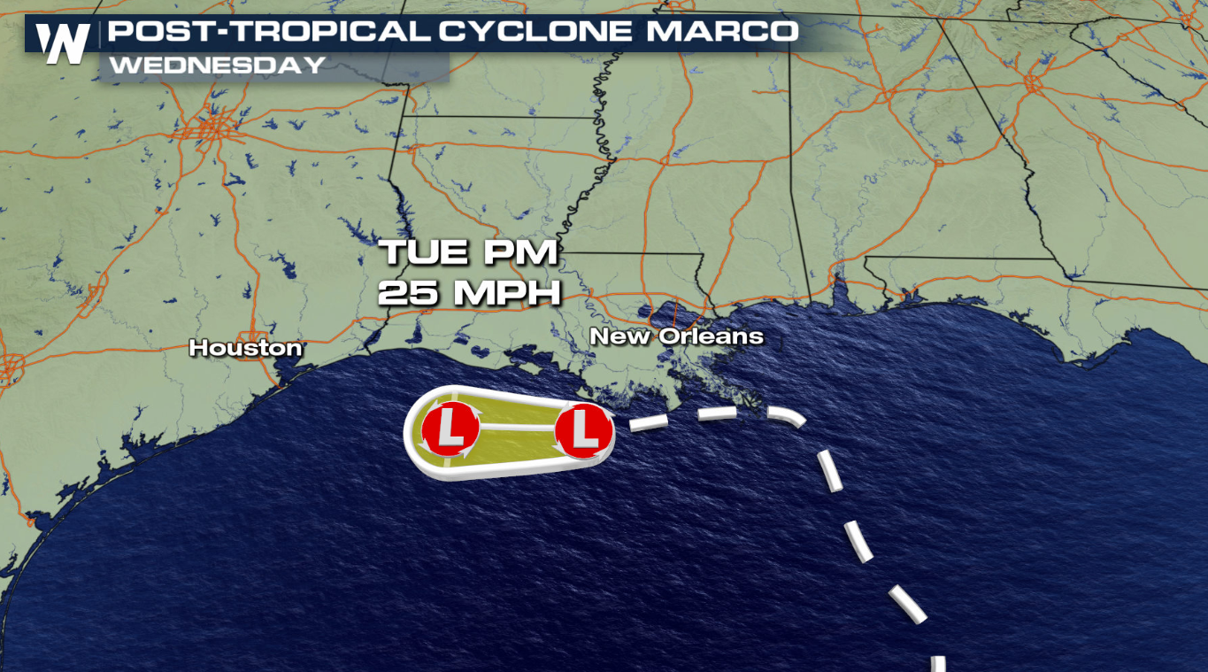
According to the National Hurricane Center (NHC), Marco is now a Post-Tropical Cyclone. The NHC issued their final advisory on the storm, with maximum sustained winds at 30 mph, a central pressure of 1008 mb, and moving west at 10 mph. The final track keeps Marco skirting just south along the Louisiana Coast through today and continuing to weaken, likely dissipating.
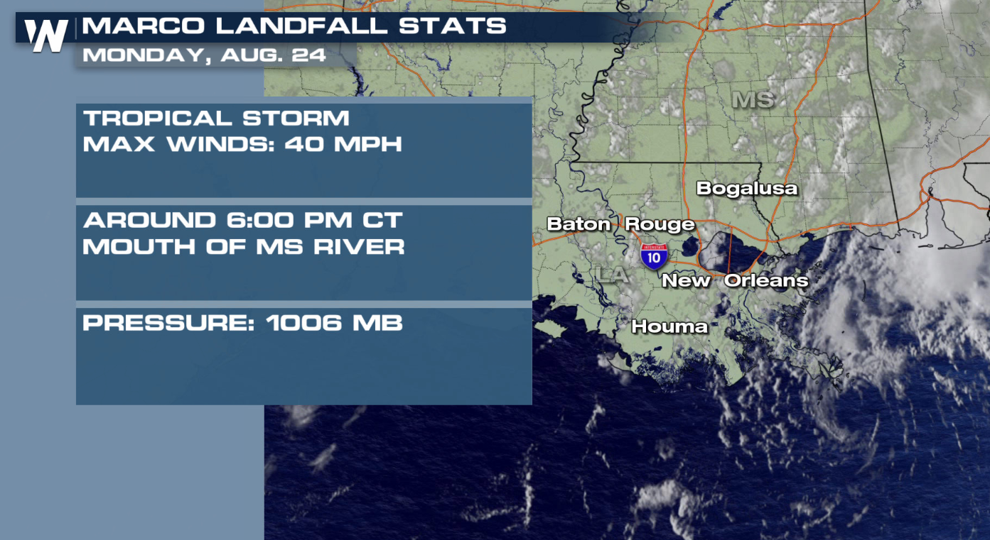
 Earlier on Monday evening, at about 6:00 PM CT, Marco officially made landfall at the mouth of the Mississippi River in the outer Marshlands of Louisiana.
 NOTE: All tropical watches, warnings, and alerts, including storm surge, have been discontinued.
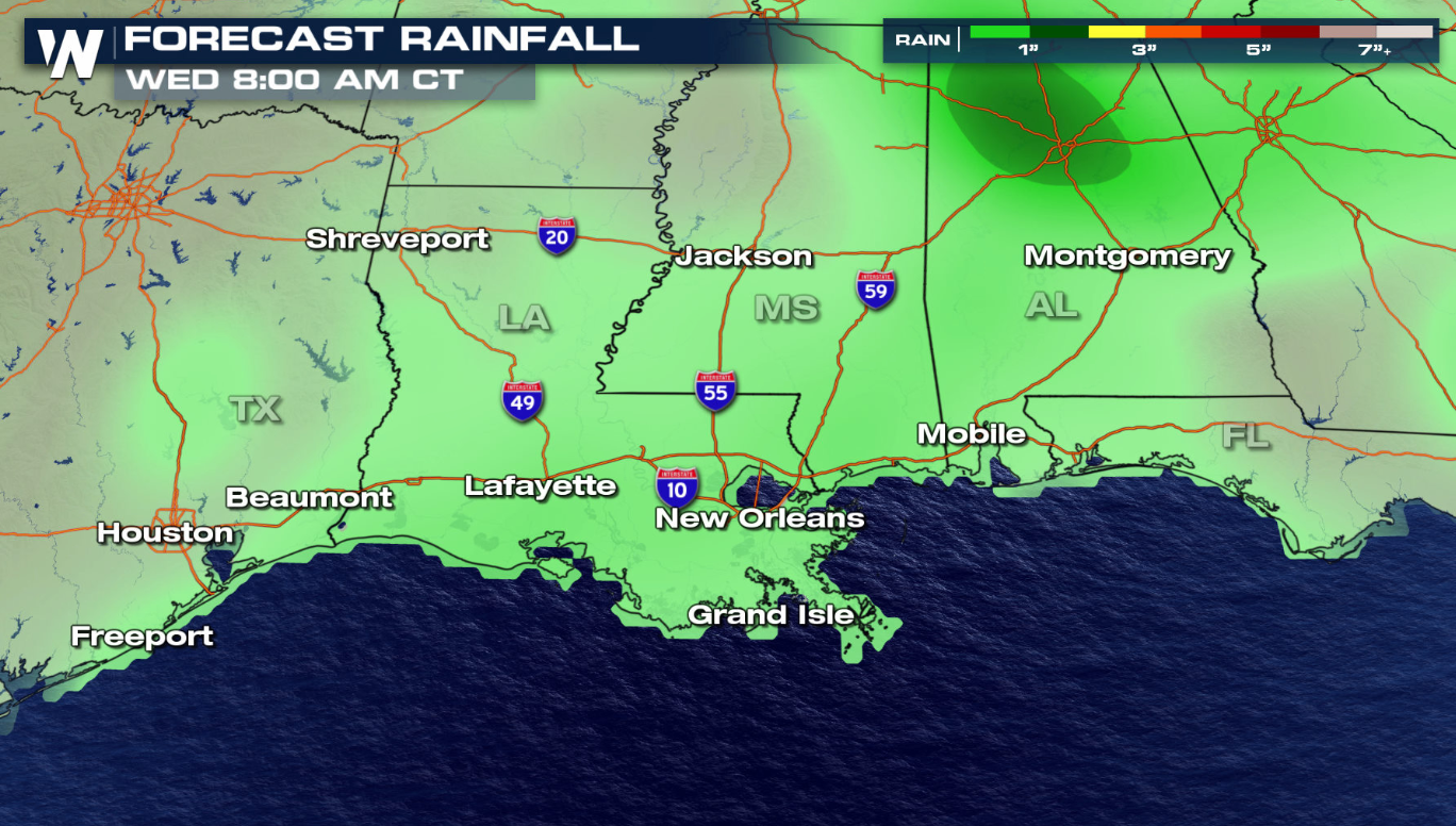
Marco could still produce rainfall totals of 1 to 4 inches across the central U.S. Gulf coast with isolated even higher. That may result in urban or stream flooding. Here's the latest forecast on rainfall potential with Marco.
NOTE: All tropical watches, warnings, and alerts, including storm surge, have been discontinued.
Marco could still produce rainfall totals of 1 to 4 inches across the central U.S. Gulf coast with isolated even higher. That may result in urban or stream flooding. Here's the latest forecast on rainfall potential with Marco.
 This isn't the only storm! You can read more about Laura, the next storm coming into the Gulf of Mexico here.
Earlier on Monday evening, at about 6:00 PM CT, Marco officially made landfall at the mouth of the Mississippi River in the outer Marshlands of Louisiana.
NOTE: All tropical watches, warnings, and alerts, including storm surge, have been discontinued.
Marco could still produce rainfall totals of 1 to 4 inches across the central U.S. Gulf coast with isolated even higher. That may result in urban or stream flooding. Here's the latest forecast on rainfall potential with Marco.
This isn't the only storm! You can read more about Laura, the next storm coming into the Gulf of Mexico here.All Weather News
More


Another Day of Heat For the West Before Changes
This week, an upper level ridge has taken ove
24 Jun 2026 1:45 AM

I-95 Corridor Under Severe Risk Today
Devastating storms ripped through the heartla
23 Jun 2026 10:00 PM

Summer Solstice Kicks Off Father's Day Sunday
Fathers across the country will have to share
21 Jun 2026 5:20 PM

Flood Risk Continues This Weekend for the Gulf Coast States
Numerous flash flood warnings were issued as
21 Jun 2026 1:15 PM

Dry T-Storms & Fire Danger in the West
A weak low-pressure system moving through the
20 Jun 2026 1:40 PM