Massive Storm Unleashes In The Atlantic
Special Stories
15 Feb 2020 4:00 PM
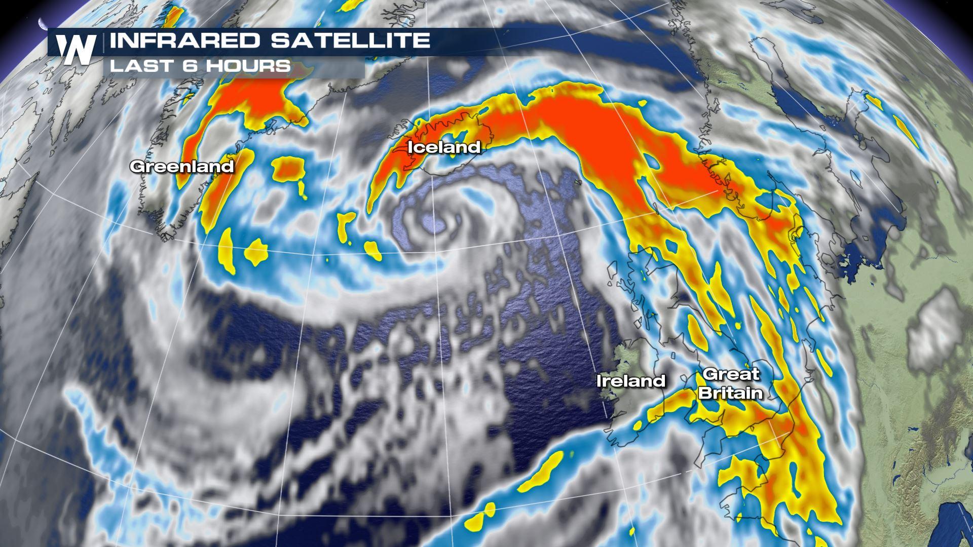
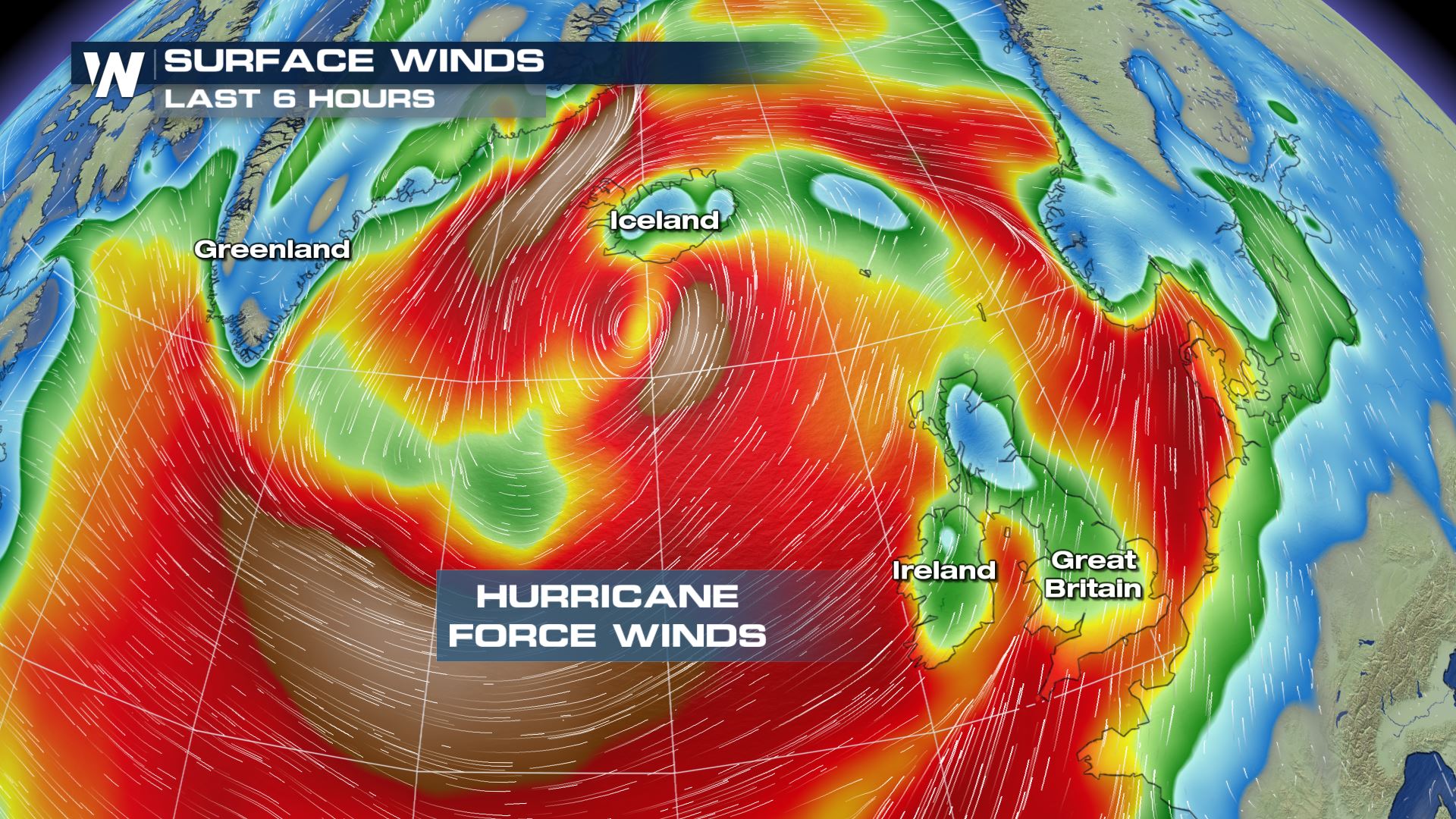
A sprawling storm system in the northern Atlantic is generating hurricane-force winds while sloshing waves up to 50 feet high!
https://twitter.com/WeatherNation/status/1228802665989234689
https://twitter.com/NOAASatellites/status/1228035253790339073
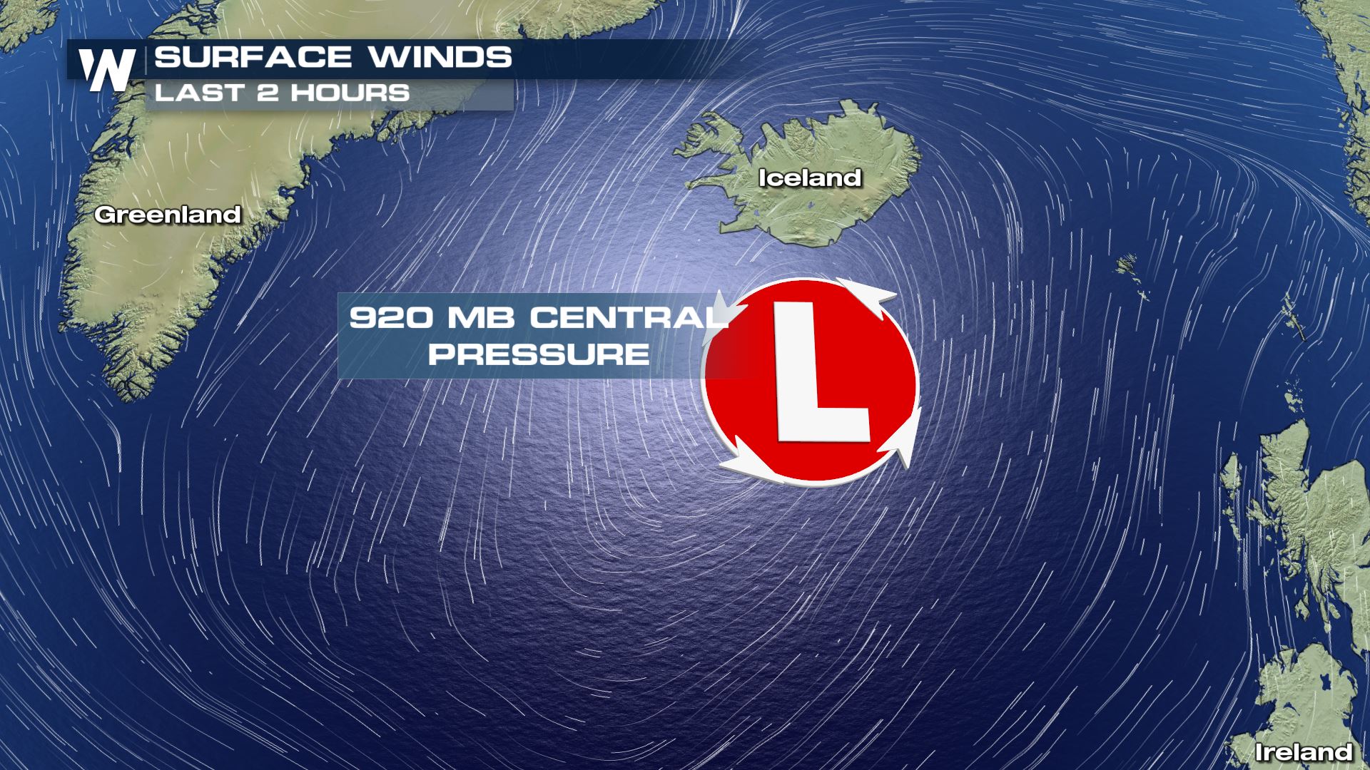
This area of low pressure has been undergoing "rapid cyclogenesis" meaning that the central pressure has dropped very quickly in a short amount of time. Sometimes we see this within hurricanes in the Atlantic Ocean during the summer months. This particular storm can be equated to a hurricane too, if you compare the central minimum pressure. This storm's central pressure was down to 920 millibars Saturday. If found in a hurricane in the summer months, that would compare to a major category 4 (or stronger) hurricane!
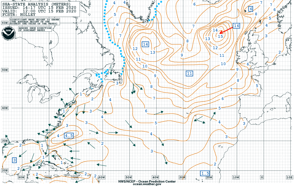 This image above, courtesy the Ocean Prediction Center, shows the estimated wave heights across the Atlantic. Important note: These numbers are in meters! This equates to 50-foot waves.
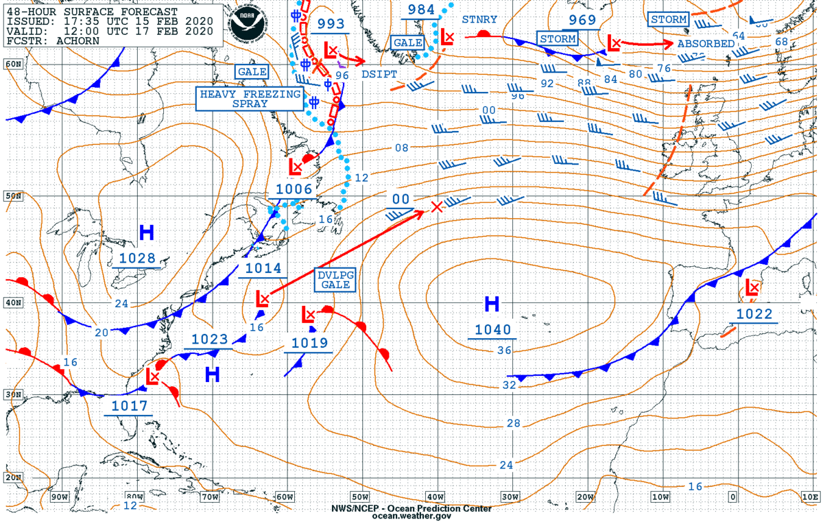 Finally, this is the forecast valid Monday, February 17 courtesy the Ocean Prediction Center. It shows a forecast central minimum pressure of 969 millibars which is much weaker than the central pressure Saturday. The higher that number (969mb), the weaker the winds (generally speaking). Nonetheless, this storm will continue to batter area coastlines with big waves and heavy bouts of rain.
This image above, courtesy the Ocean Prediction Center, shows the estimated wave heights across the Atlantic. Important note: These numbers are in meters! This equates to 50-foot waves.
Finally, this is the forecast valid Monday, February 17 courtesy the Ocean Prediction Center. It shows a forecast central minimum pressure of 969 millibars which is much weaker than the central pressure Saturday. The higher that number (969mb), the weaker the winds (generally speaking). Nonetheless, this storm will continue to batter area coastlines with big waves and heavy bouts of rain.All Weather News
More


Western Heat Continues With Some Relief
A large dome of hot high pressure remains acr
1 Jul 2025 11:00 PM

NHC Monitoring Front in the Southeast Ahead of 4th of July
SOUTHEAST - A frontal boundary moving through
1 Jul 2025 10:35 PM

Severe Storms For the East Coast Through Tuesday
A cold front is tapping into a moist air mass
1 Jul 2025 10:20 PM

Where Rain Could Dampen Holiday Travel Plans
AAA is expecting over 70 million travelers to
1 Jul 2025 4:35 PM

Severe Weather Threat Continues in the Midwest
It has been an active, severe season across t
30 Jun 2025 9:00 PM