Mid-Mississippi Valley Severe Threat Increasing Thursday
Top Stories
6 May 2021 4:00 PM
The severe weather threat for the Mid-South and Mid-Mississippi Valley has increased.
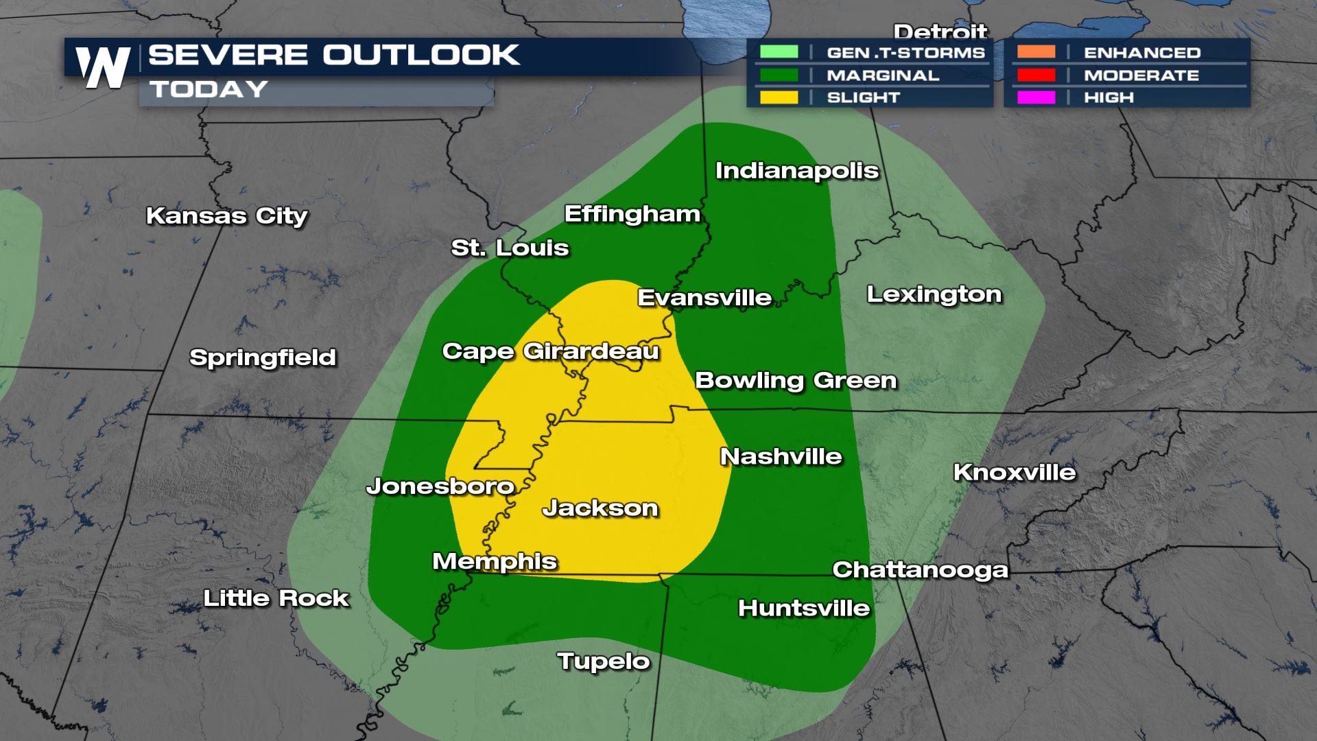
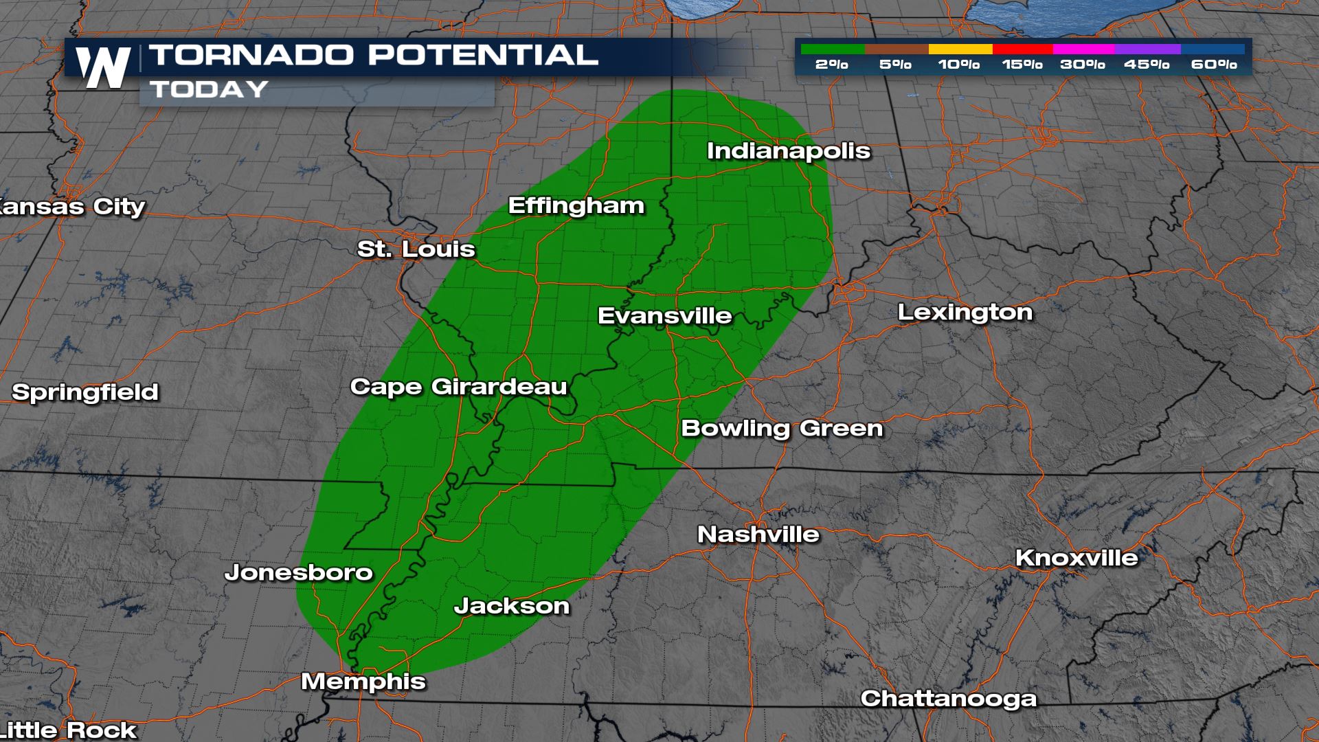
A Slight Risk (Level 2 out of 5) has been added for southern Illinois through western Tennessee and parts of the Ozarks. While scattered severe storms capable of gusty straight line winds of 60 mph and/or hail 1" or larger are the main threats, a brief tornado is possible as well. In the surrounding Marginal Risk areas (Level 1 out of 5) the potential is lower for severe storms, but an isolated severe storm can't be ruled out.
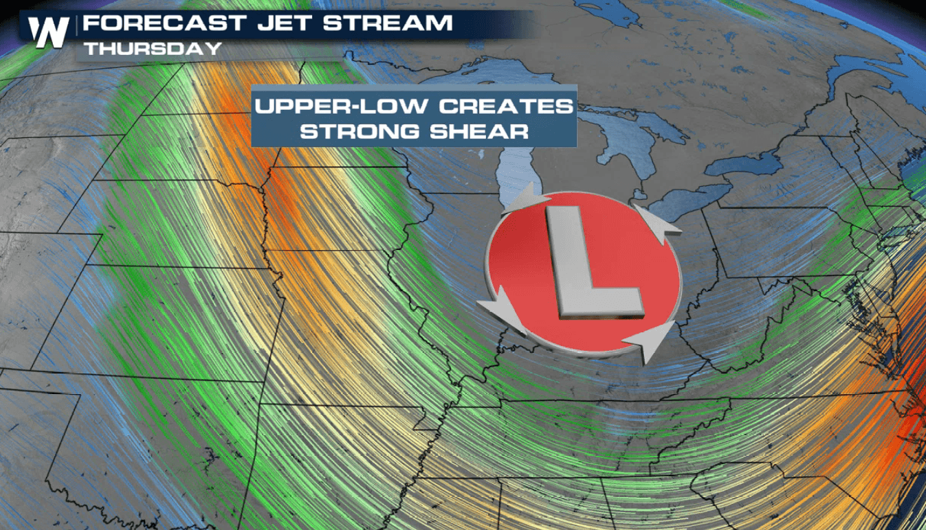
 This comes as a jet stream level low swings through the region and provides the lift and wind shear needed for thunderstorm development.
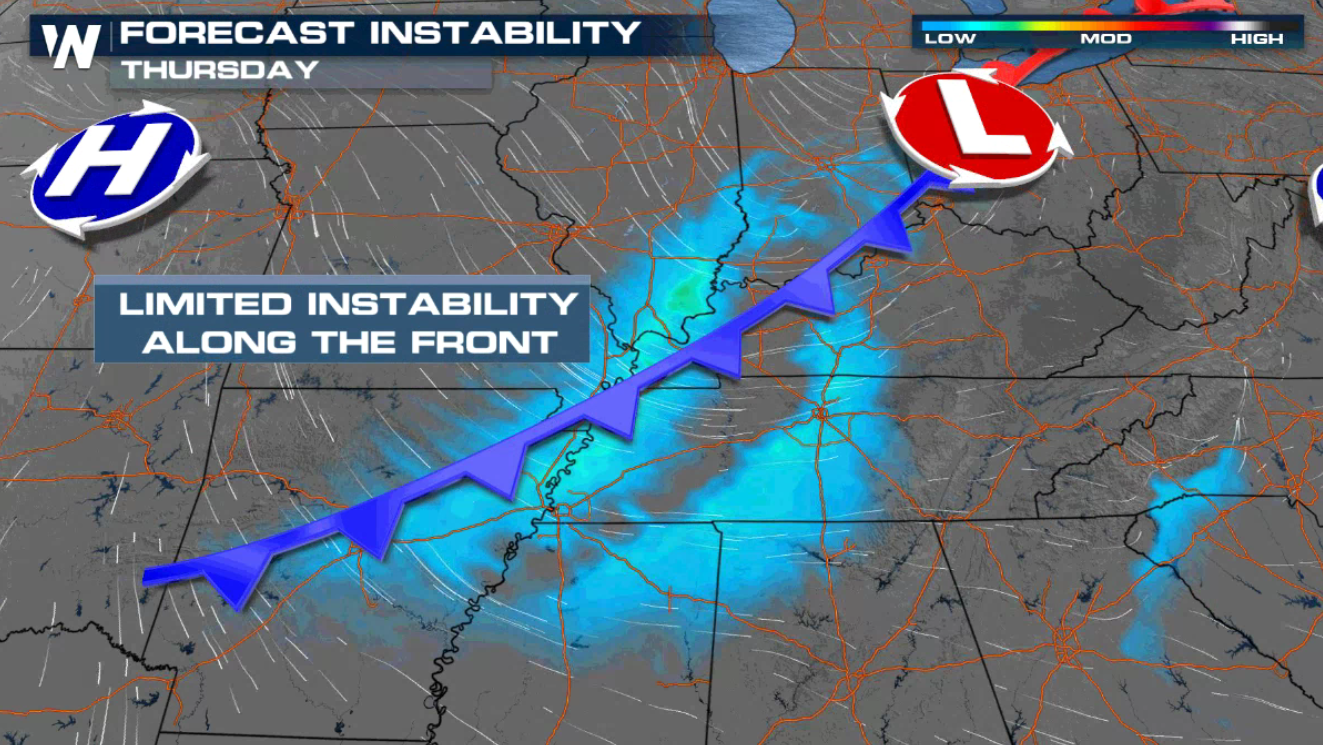
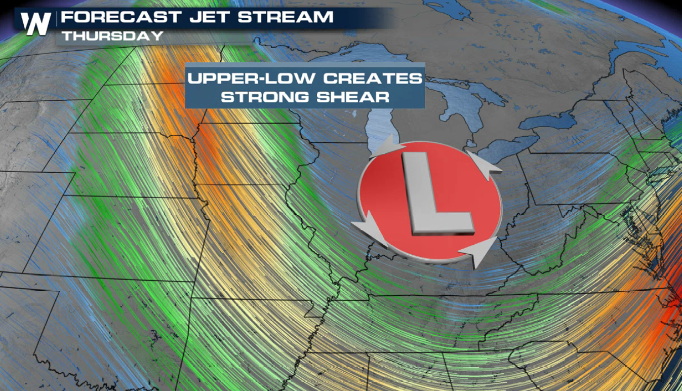 The upper low combines with limited energy along a cold front. While surface energy is on the lower side, there's enough energy due to returning moisture from the Gulf of Mexico and lift along the cold front to generate isolated to scattered severe storms.
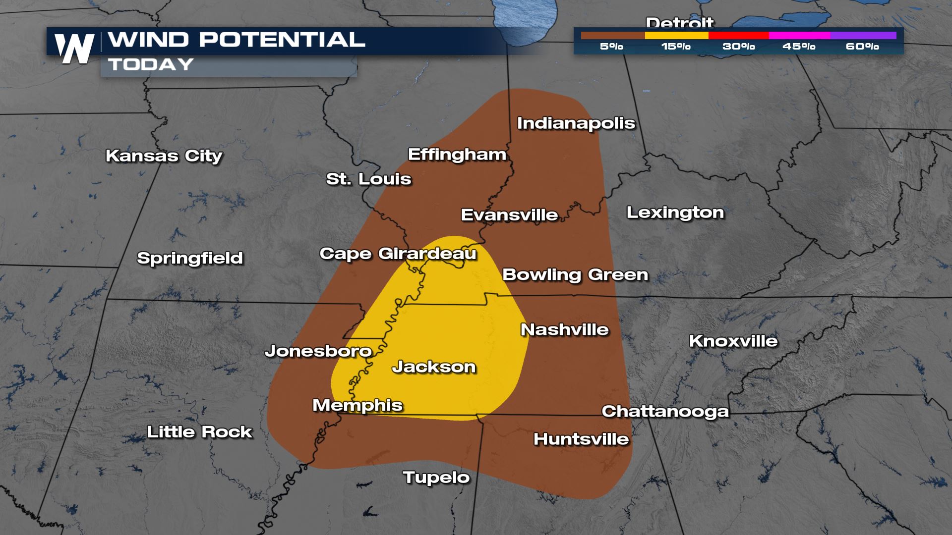
 Gusty winds of 60 mph or higher is the greatest threat through the risk area today (Thursday). Areas in yellow have the higher chance for gusty 60 mph winds as a line of thunderstorms moves through in the afternoon and early evening. This is mainly along and east of the Mississippi River from Cape Girardeau, Missouri to Memphis, TN and east almost to Nashville.
 A brief tornado can't be ruled out either, especially in any bowing segments that form within the line of storms. Any storms that form ahead of the cold front will also have the chance for rotation.
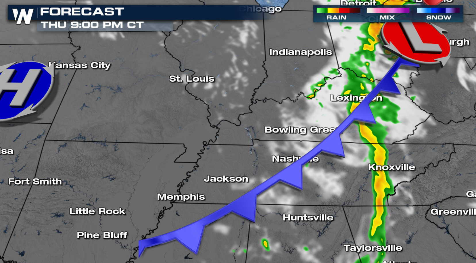
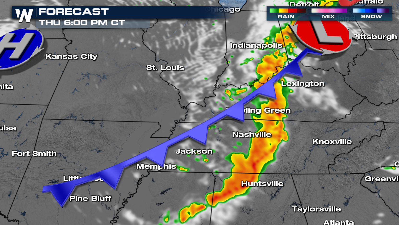 The line of storms will move through quickly in the late afternoon and evening. By late evening into the overnight hours, energy will be lessening and thunderstorm strength will decrease as well.
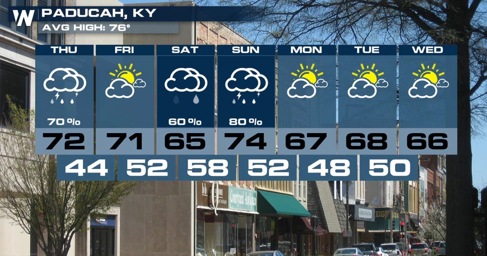
 Paducah, Kentucky is one of the spots included in the Slight Risk today (Thursday). Once this system clears out, an active pattern builds in to start the weekend with rain and thunderstorms in the forecast through mid-week next week.
 This is one of our top weather headlines. Stay tuned to WeatherNation for updates on this story, which will also be included in the Eastern Regional forecast at :10 past the hour, every hour!
This comes as a jet stream level low swings through the region and provides the lift and wind shear needed for thunderstorm development.
The upper low combines with limited energy along a cold front. While surface energy is on the lower side, there's enough energy due to returning moisture from the Gulf of Mexico and lift along the cold front to generate isolated to scattered severe storms.
Gusty winds of 60 mph or higher is the greatest threat through the risk area today (Thursday). Areas in yellow have the higher chance for gusty 60 mph winds as a line of thunderstorms moves through in the afternoon and early evening. This is mainly along and east of the Mississippi River from Cape Girardeau, Missouri to Memphis, TN and east almost to Nashville.
A brief tornado can't be ruled out either, especially in any bowing segments that form within the line of storms. Any storms that form ahead of the cold front will also have the chance for rotation.
Forecast
As energy increases along the cold front in the afternoon and the upper low passes overhead, thunderstorm coverage and intensity will increase. A line of storms with gusty winds and hail is expected from western Ohio through the Mid-South.
The line of storms will move through quickly in the late afternoon and evening. By late evening into the overnight hours, energy will be lessening and thunderstorm strength will decrease as well.
Paducah, Kentucky is one of the spots included in the Slight Risk today (Thursday). Once this system clears out, an active pattern builds in to start the weekend with rain and thunderstorms in the forecast through mid-week next week.
This is one of our top weather headlines. Stay tuned to WeatherNation for updates on this story, which will also be included in the Eastern Regional forecast at :10 past the hour, every hour!All Weather News
More


More Storms for the East Sunday and Monday
A low-pressure system crashing through the Mi
2 Aug 2026 2:20 AM

After Reaching Category 5, Genevieve Weakens in the Pacific
PacificGenevieve formed on last Friday south
2 Aug 2026 1:30 AM

Flooding, Severe Storms Target the Midwest Again
After an active week of storms across the nor
1 Aug 2026 1:40 AM

Flooding Risk Increases as Heavy Rain Targets the Tri-State Area
Tuesday, heavy rainfall moved across the Nort
30 Jul 2026 12:25 AM

Severe Weather: Energy From the Midwest Now in the Southeast
UPPER MIDWEST - Through Monday, dangerous tor
29 Jul 2026 10:30 PM