Heavy Snow In Southern Plains, Storms Near Gulf Coast
Special Stories
2 Dec 2020 1:00 PM
A large upper-level low pressure system will be diving south into the plains today. This storm could bring significant snow across the Plains and even some thunderstorms to the Mississippi Valley. Here is the latest forecast on this next storm system.
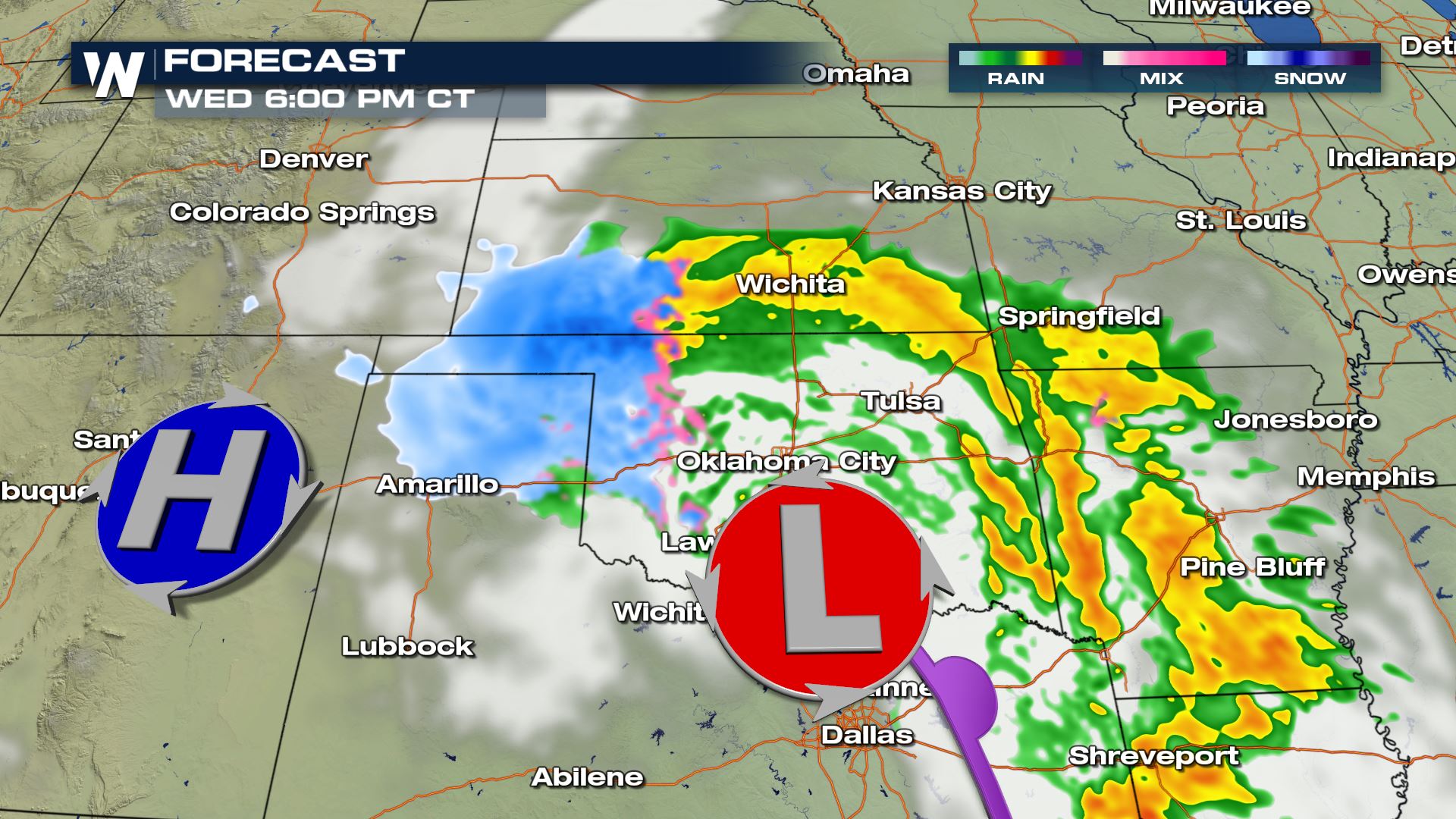
 As we head through today, Wednesday, our low pressure system in the southern US/Gulf Coast moves north and interacts with the ongoing energy off the Rocky Mountains.
By this evening, Gulf of Mexico moisture wraps around the low, and colder air from the wave in the north will bring more snow to the Central and Southern Plains.
As we head through today, Wednesday, our low pressure system in the southern US/Gulf Coast moves north and interacts with the ongoing energy off the Rocky Mountains.
By this evening, Gulf of Mexico moisture wraps around the low, and colder air from the wave in the north will bring more snow to the Central and Southern Plains.
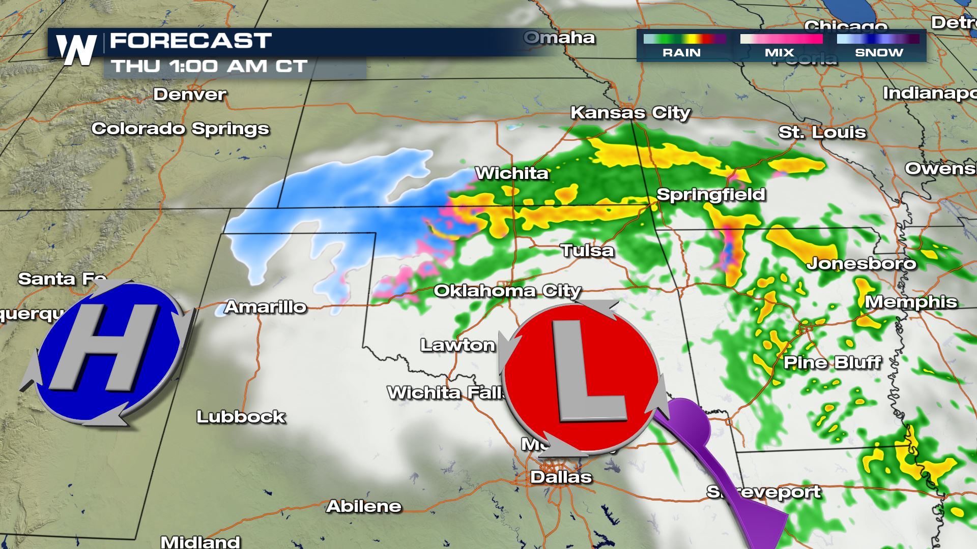
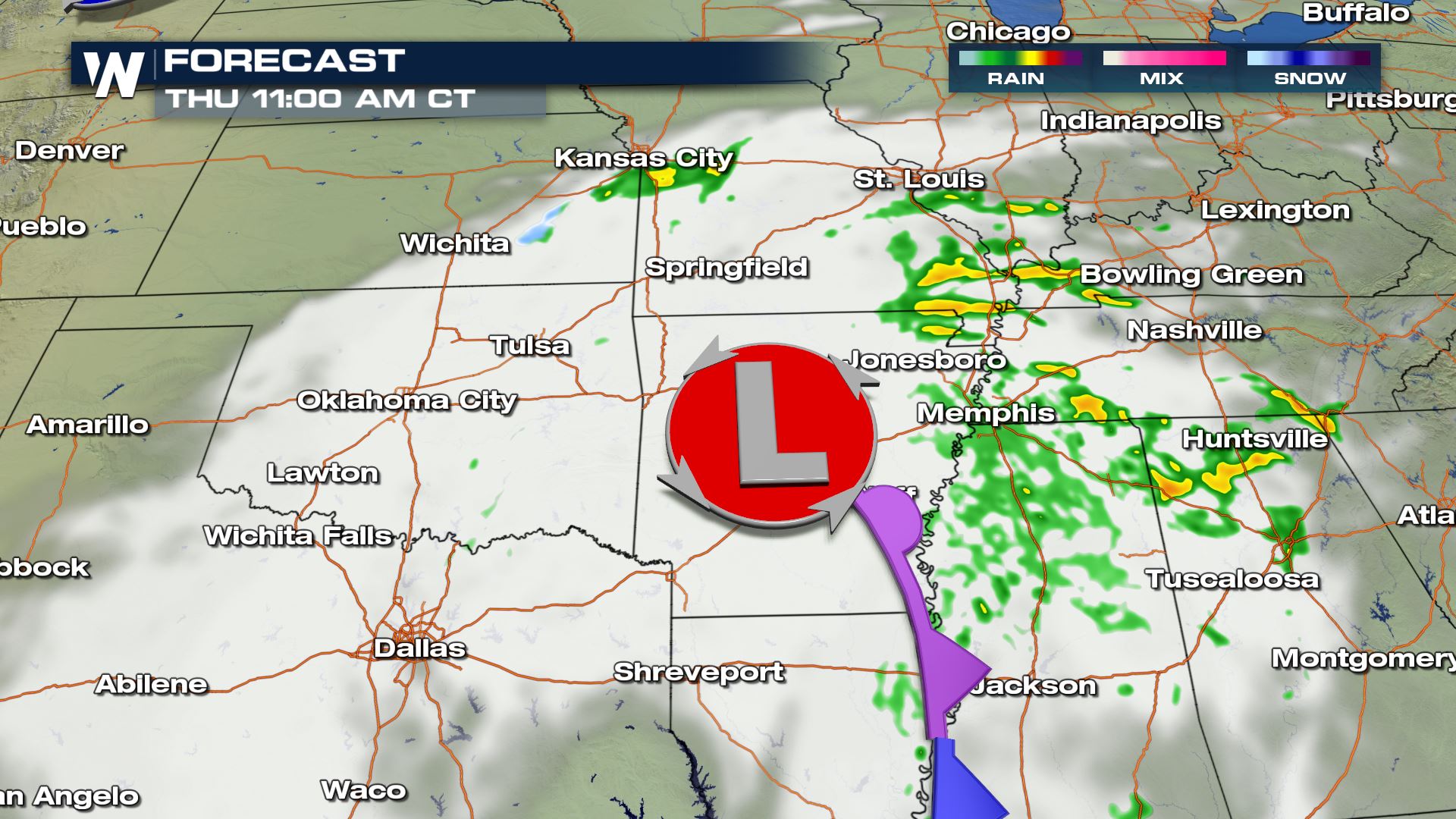
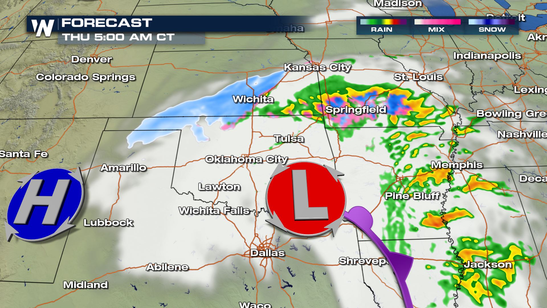 By Thursday morning, snow ends as it moves northeast.
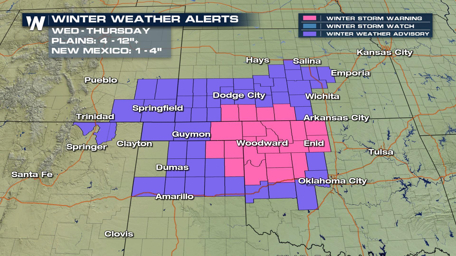
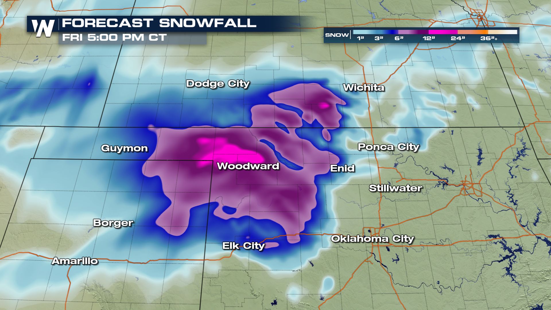
 With this snow in the forecast and some stronger winds expected to wrap around the low pressure system - remember winds are created when pressure gradients are tighter and change - winter weather alerts have been issued for Kansas and Oklahoma. Snowfall totals should between 4-7", isolated totals up to 1 foot, but with wind gusts up to 35 mph blowing snow may cause hazard to driving. These winter storm alerts are in effect for today through Thursday.

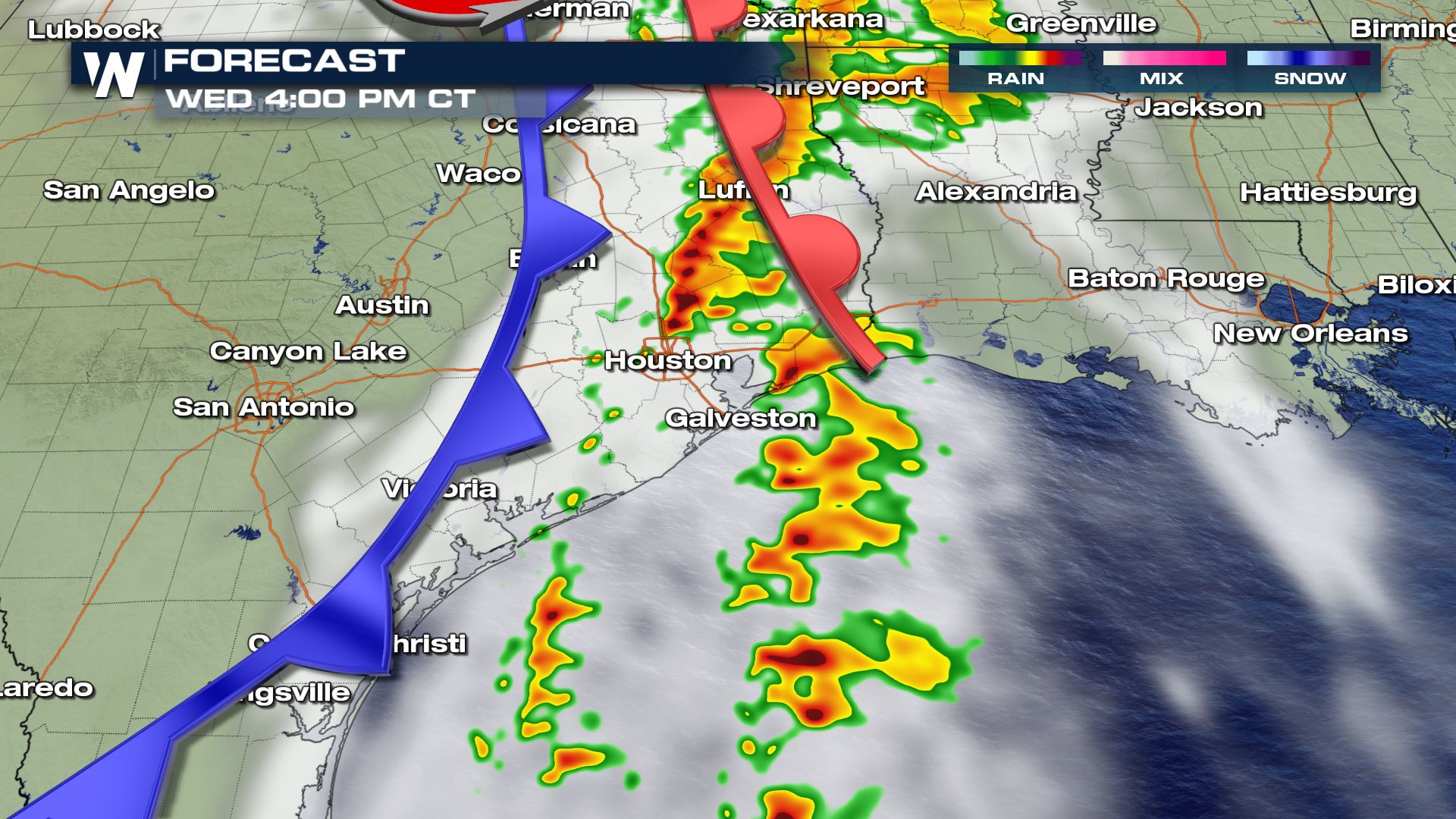
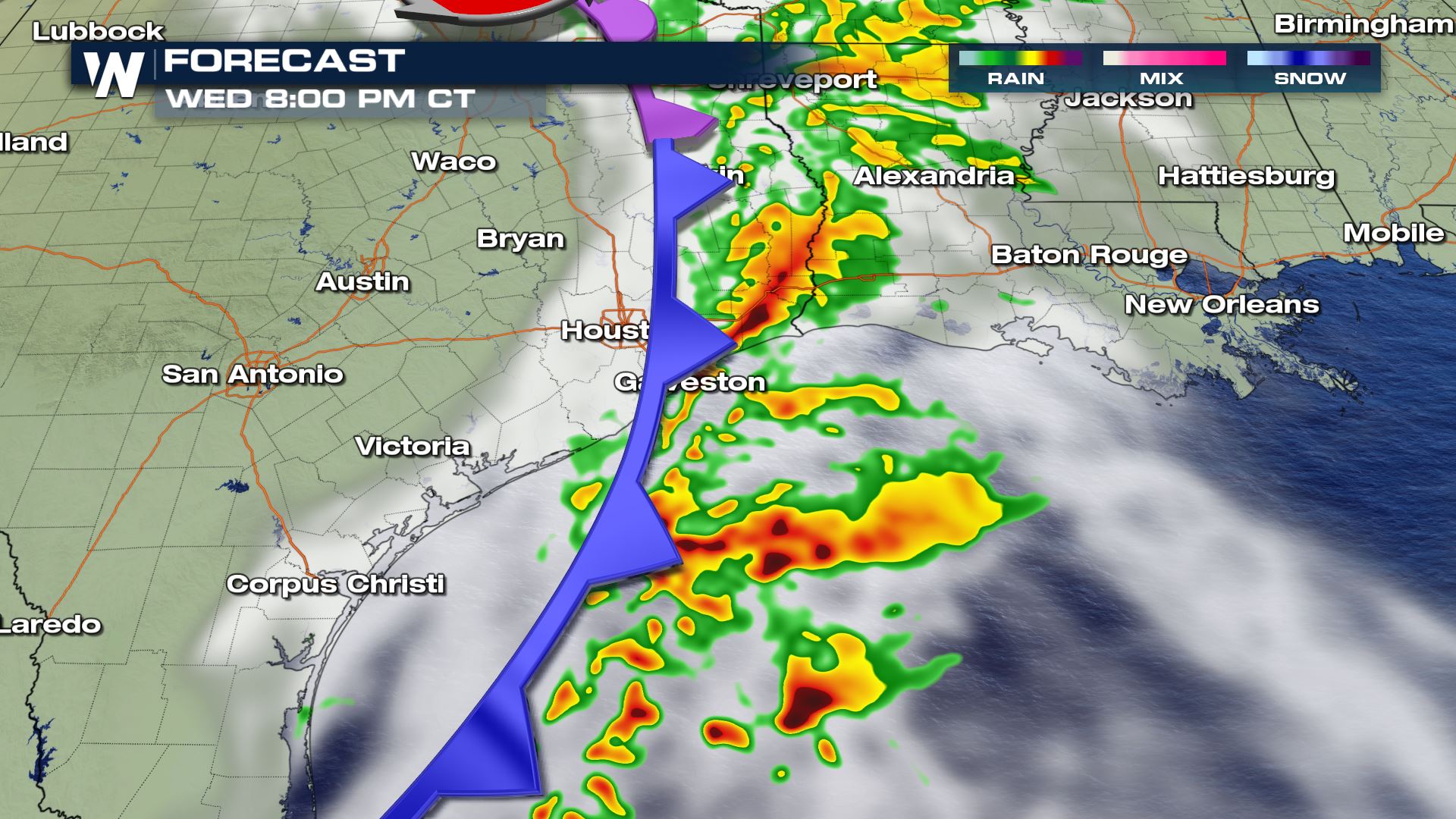
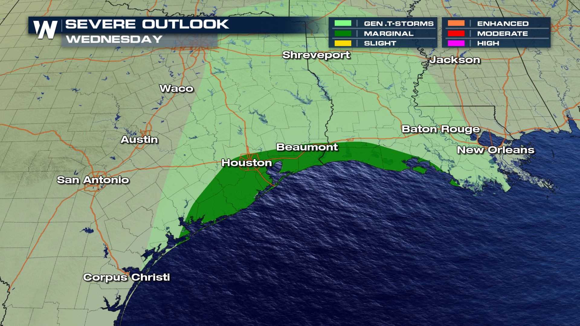
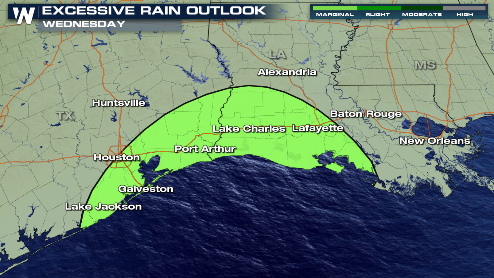
 Some of these storms along the warm front will have to be monitored they could get stronger at times. Right now, there is a marginal risk for severe storms from the Storm Prediction Center for Wednesday along the Gulf of Mexico coast.
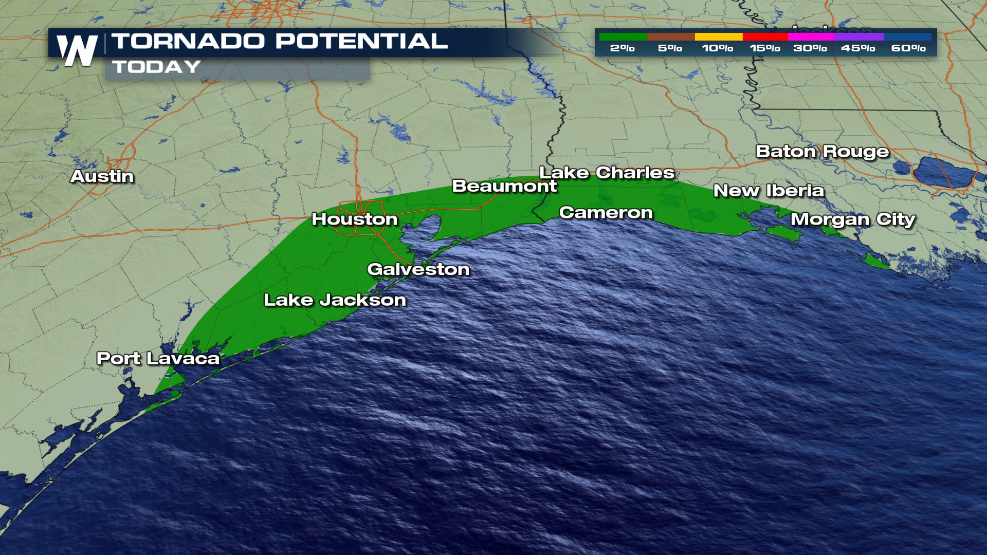 Isolated tornadoes and strong wind gusts are the main concern. Texas through Louisiana should watch for storms and heavy rain.
 Stay tuned to WeatherNation for more updates on this next system coming out of the west.
Snow Side
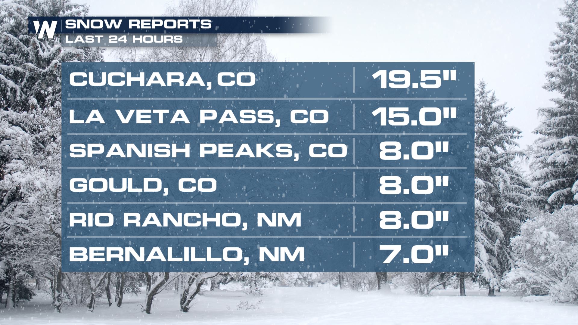
Snow has slowed down across the Rockies and is now moving into the Southern Plains. Colorado and New Mexico have seen some fairly high amounts, here are some of the totals:
As we head through today, Wednesday, our low pressure system in the southern US/Gulf Coast moves north and interacts with the ongoing energy off the Rocky Mountains.
By this evening, Gulf of Mexico moisture wraps around the low, and colder air from the wave in the north will bring more snow to the Central and Southern Plains.
By Thursday morning, snow ends as it moves northeast.
With this snow in the forecast and some stronger winds expected to wrap around the low pressure system - remember winds are created when pressure gradients are tighter and change - winter weather alerts have been issued for Kansas and Oklahoma. Snowfall totals should between 4-7", isolated totals up to 1 foot, but with wind gusts up to 35 mph blowing snow may cause hazard to driving. These winter storm alerts are in effect for today through Thursday.
Rain Side
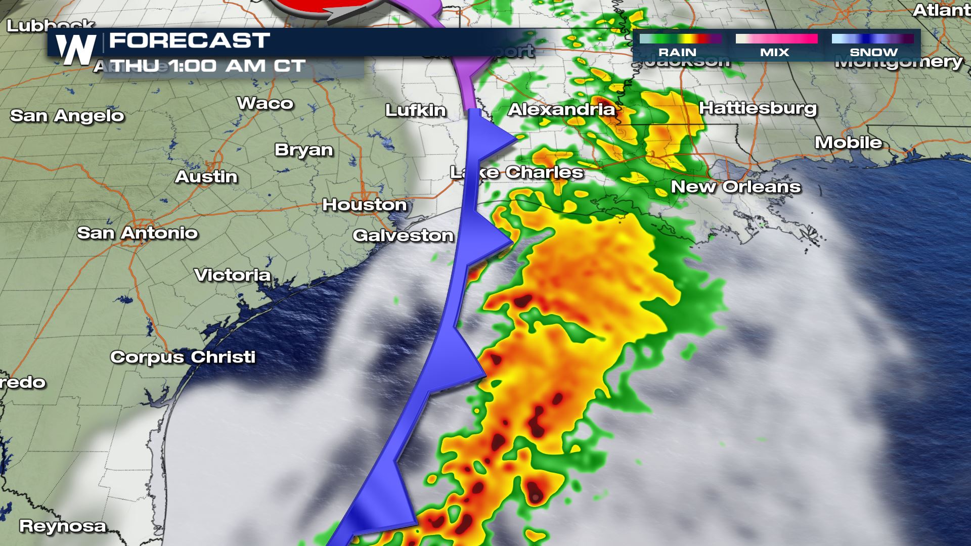
On the south side of this low pressure system, Gulf moisture works its way north and brings the potential for some heavy rain across the southern United States from Texas through Louisiana into Arkansas and Missouri. Storms form in the warm sector of this system and blossom along the cold front through late afternoon and evening.
Some of these storms along the warm front will have to be monitored they could get stronger at times. Right now, there is a marginal risk for severe storms from the Storm Prediction Center for Wednesday along the Gulf of Mexico coast.
Isolated tornadoes and strong wind gusts are the main concern. Texas through Louisiana should watch for storms and heavy rain.
Precipitation Forecast
Snowfall Accumulation
We are likely to see between 4-7" with areas along the state-line could see some higher accumulations, possibly 6-12", and blowing snow.
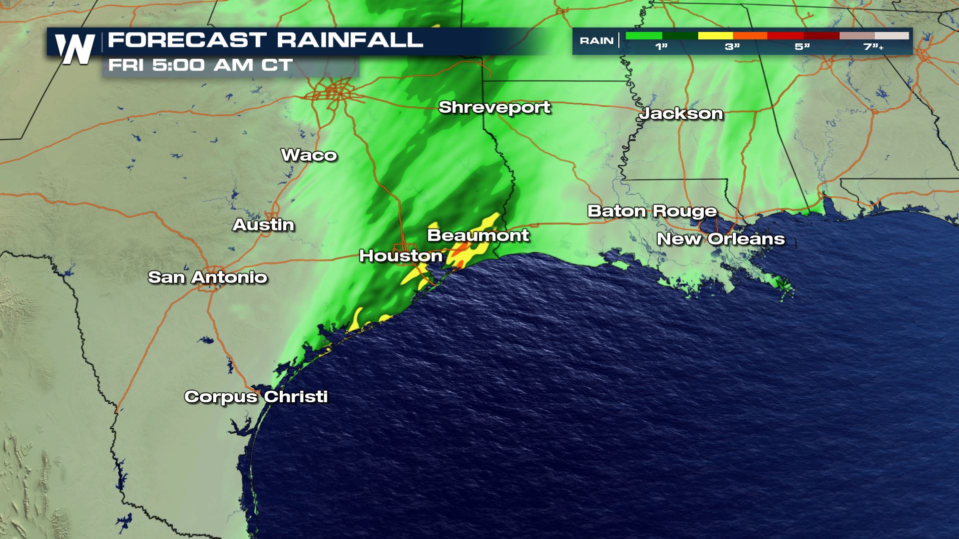
Rainfall Accumulation
We are expecting rain on the south side of this system to bring in a couple inches from Texas through Arkansas and Oklahoma. Here's an early look at what our models are showing:
Stay tuned to WeatherNation for more updates on this next system coming out of the west.All Weather News
More

More Storms for the East Through Monday
A low-pressure system that moved through the
3 Aug 2026 12:20 PM


After Reaching Category 5, Genevieve Weakens in the Pacific
PacificGenevieve formed last Friday south of
3 Aug 2026 12:30 AM

Flooding, Severe Storms Target the Midwest Again
After an active week of storms across the nor
1 Aug 2026 1:40 AM

Flooding Risk Increases as Heavy Rain Targets the Tri-State Area
Tuesday, heavy rainfall moved across the Nort
30 Jul 2026 12:25 AM