More Record Warmth in the Central US
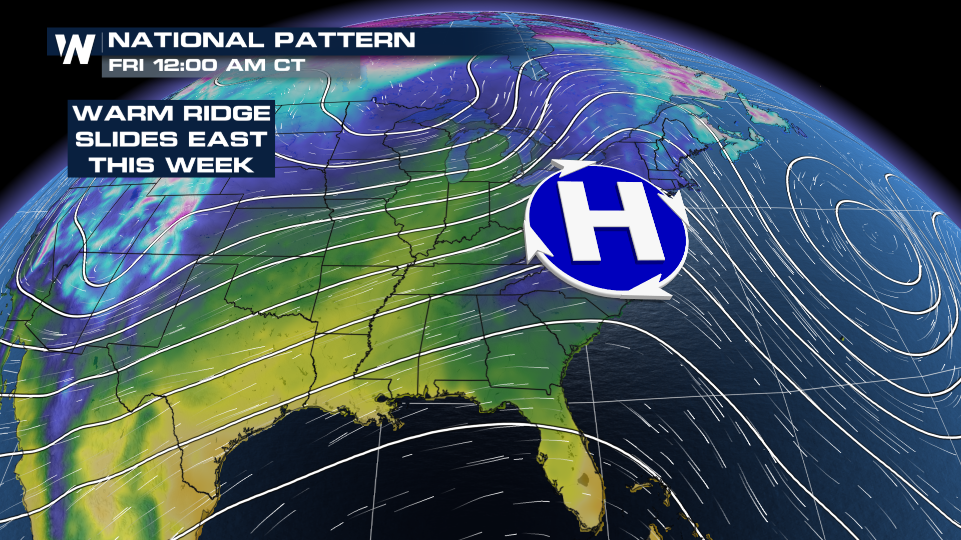
Record warmth has been sitting over the High Plains this week, as a ridge of high pressure has been dominating bringing the mild temps! Multiple records were broken in Michigan and Wisconsin today. (above) This high will continue to slide to the east, and the record warmth will follow it. This means cities like New York, Raleigh, and Washington can expect well above average temps in the coming days.
 This is not all that uncommon for an El Nino pattern, where the jet stream tends to favor a more southerly track, keeping the southwest and Gulf Coast wet (we've seen both this year) while mainly dry and mild conditions are the case for much of the northern 2/3 of the country.
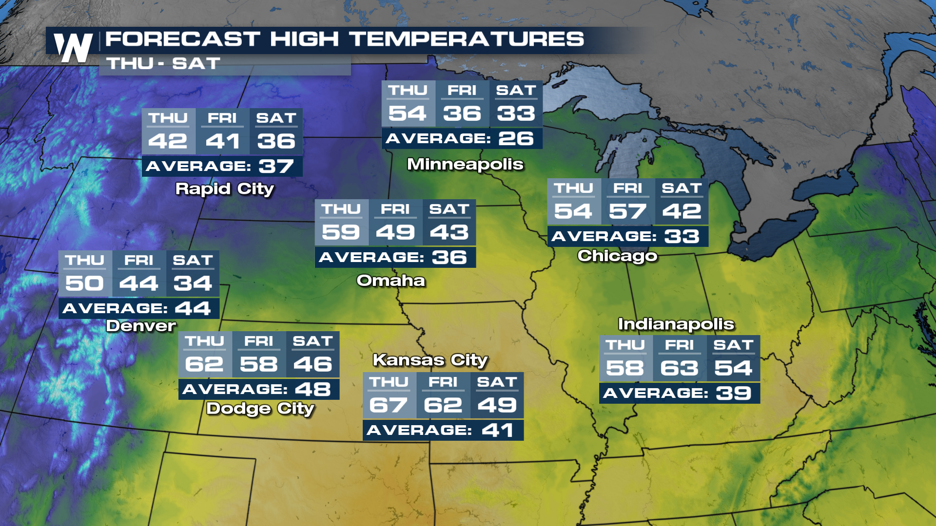
 We can see temps well above average in the plains tomorrow, but cooler air will work in, as the high moves out. Minneapolis will see a high of 54° tomorrow which will be over 20° above average! Once the high pressure slides east, cooler air will funnel in and by Friday and Saturday, temps will drop down to the mid to low 30s. Expect a slow decline in the temps in the next few days for this portion of the country.
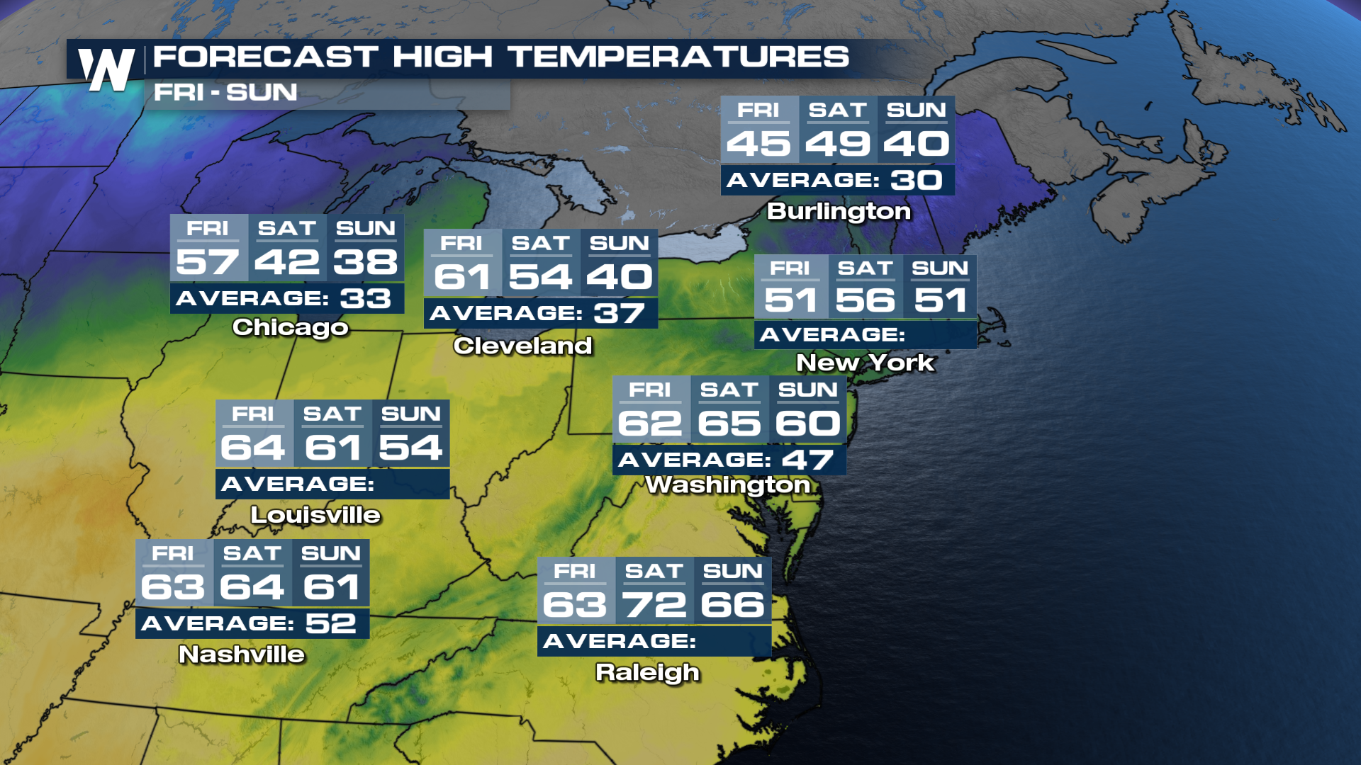
 Now as we head further east, by Friday cities from Cleveland to Raleigh will see temps 20°-25° above average. These temps have the potential to break records, and won't be feeling at all like February! As we look ahead, we do start to see a decline in temps on Sunday for cities like Cleveland, Louisville, and Washington as cooler air funnels its way in.
