Monday Severe Weather Update
Top Stories
8 Apr 2019 4:14 AM
The severe storm chances will be moving to the Southeast for the start of the work week. Here is the very latest.
 The severe weather will be confined to the East and Southeast with the highest risk in parts of Mississippi, Alabama and the Mid-Atlantic. Large hail, damaging winds and tornadoes will all be possible. Cities like Charlotte, Birmingham and Atlanta will need to be weather alert.
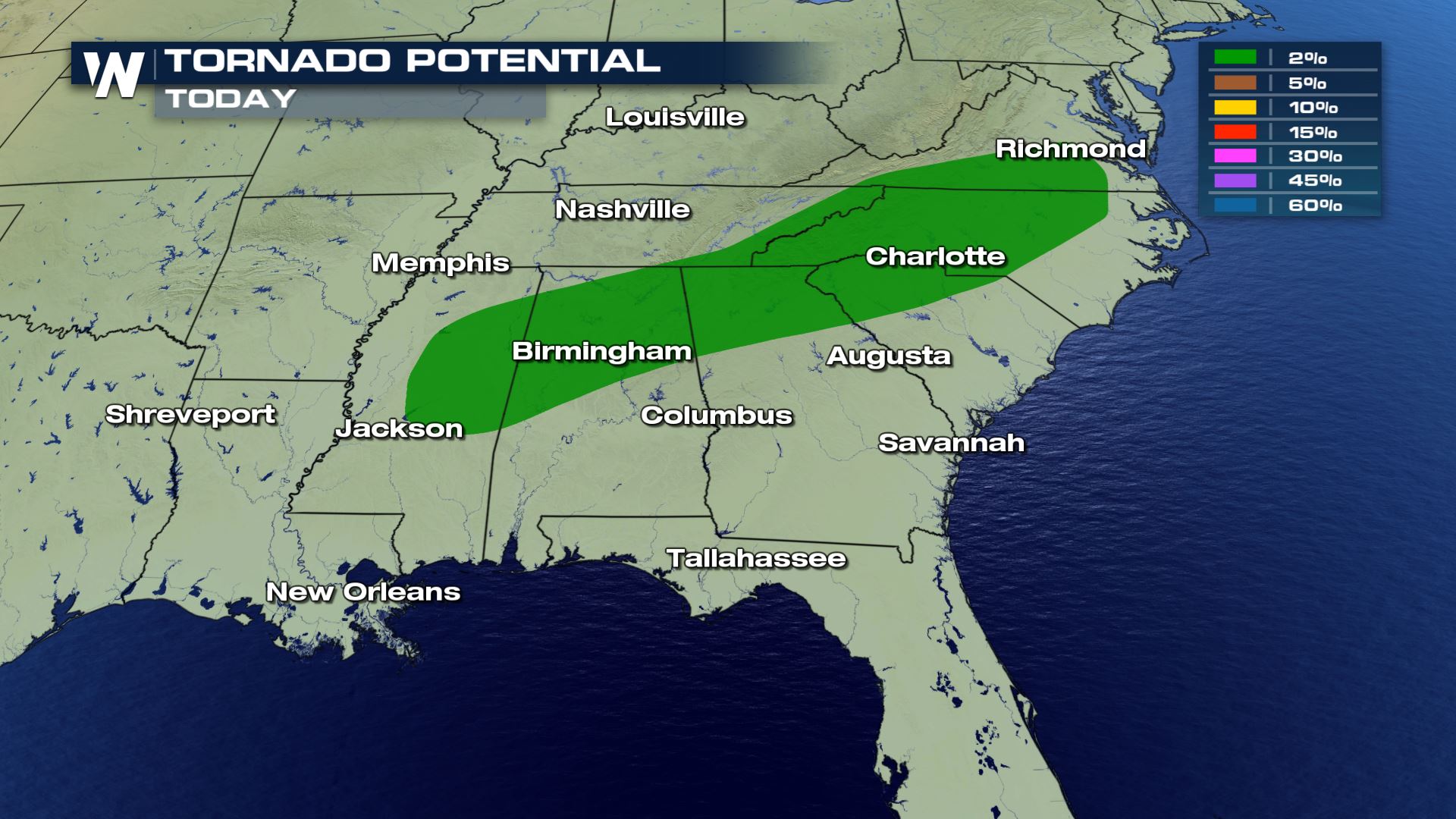
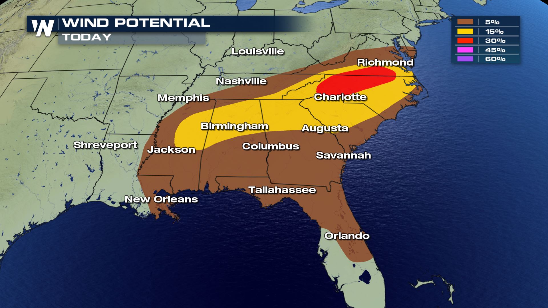
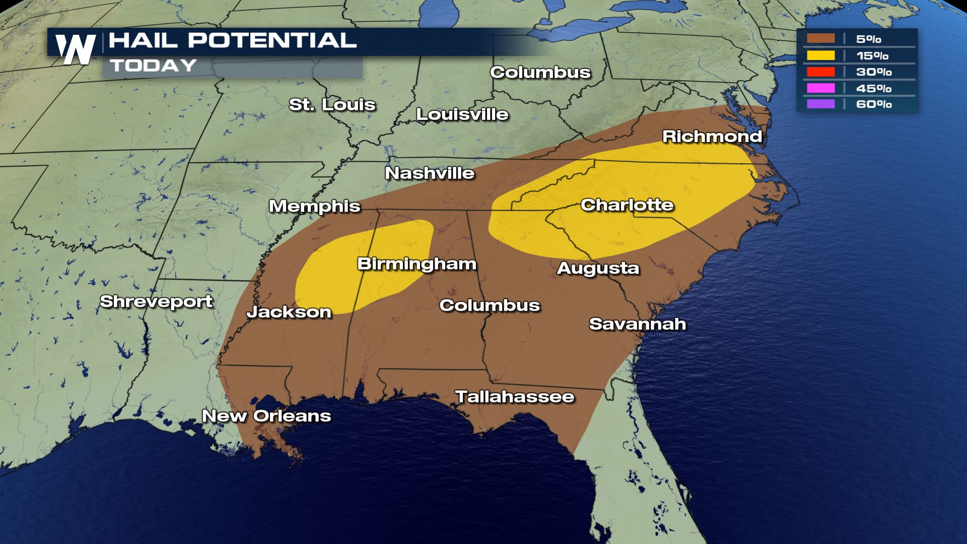 All modes of severe weather are in the forecast today. The other risk that we also want to mention is the frequent lightning.
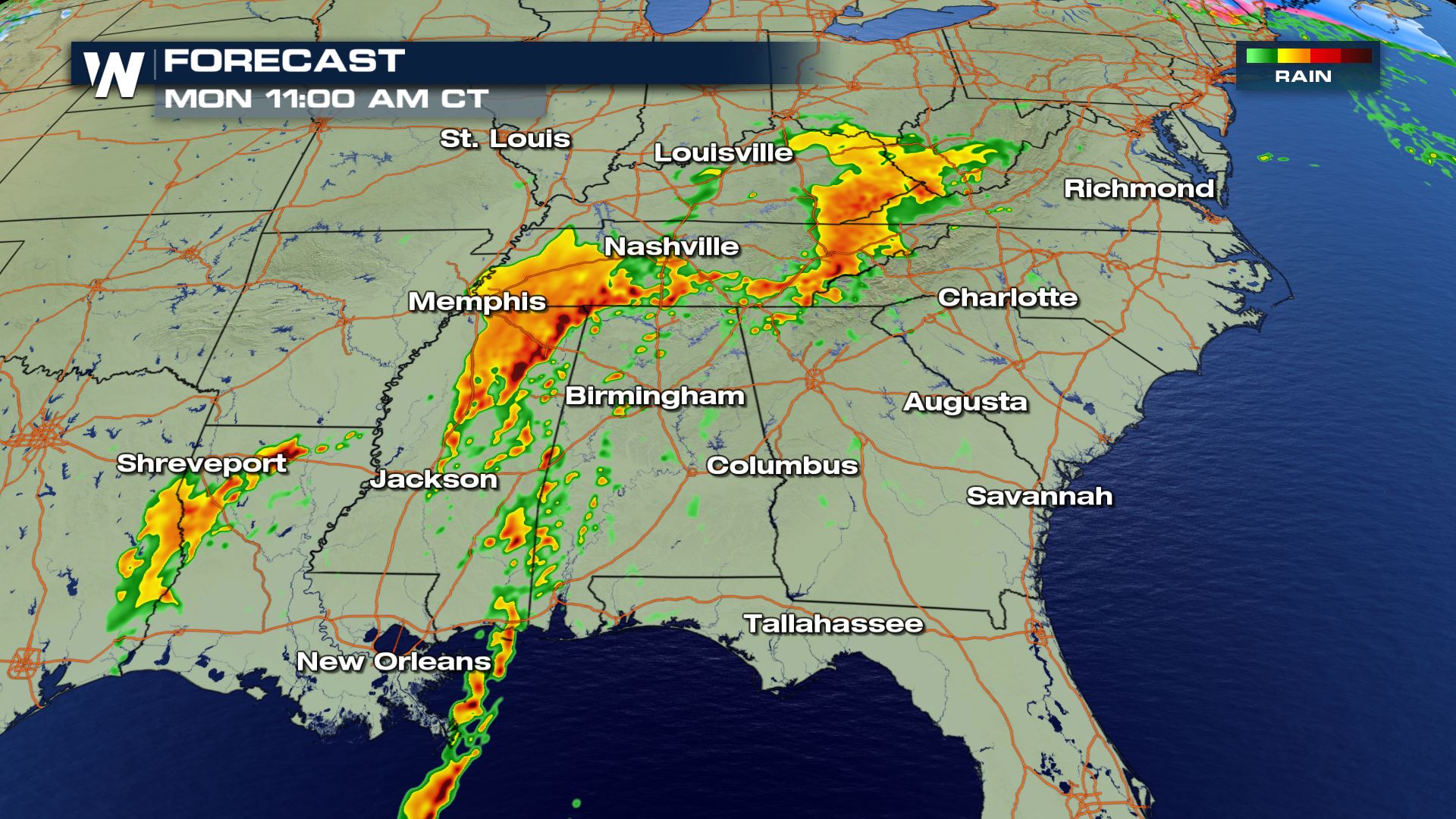

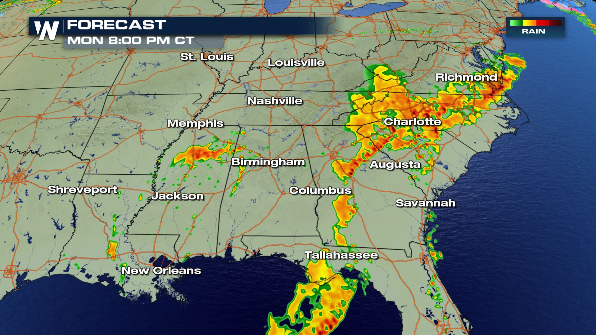
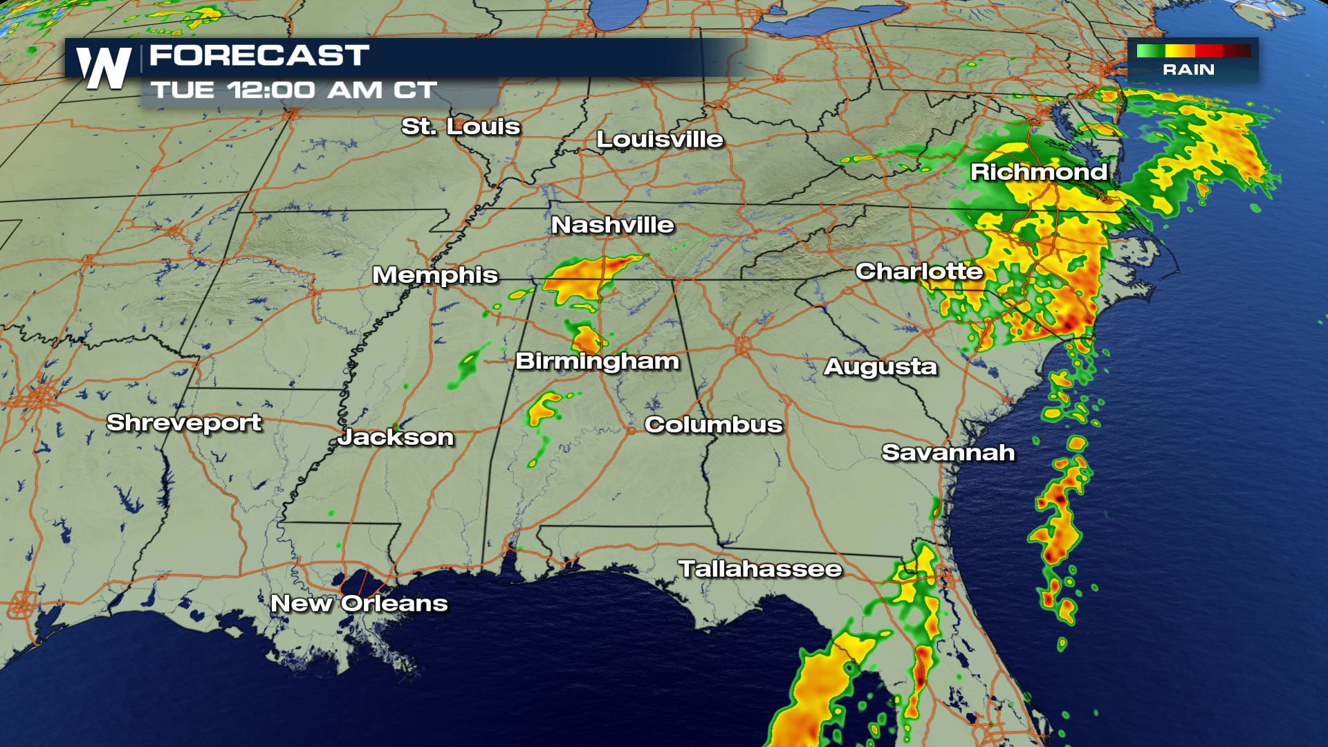 The timing for Monday's storms will be all morning and through the afternoon. This system is moving East so through the night the storms will be diminishing from West to East.
Keep checking with WeatherNation for more updates on Monday's severe weather chances.
The timing for Monday's storms will be all morning and through the afternoon. This system is moving East so through the night the storms will be diminishing from West to East.
Keep checking with WeatherNation for more updates on Monday's severe weather chances.
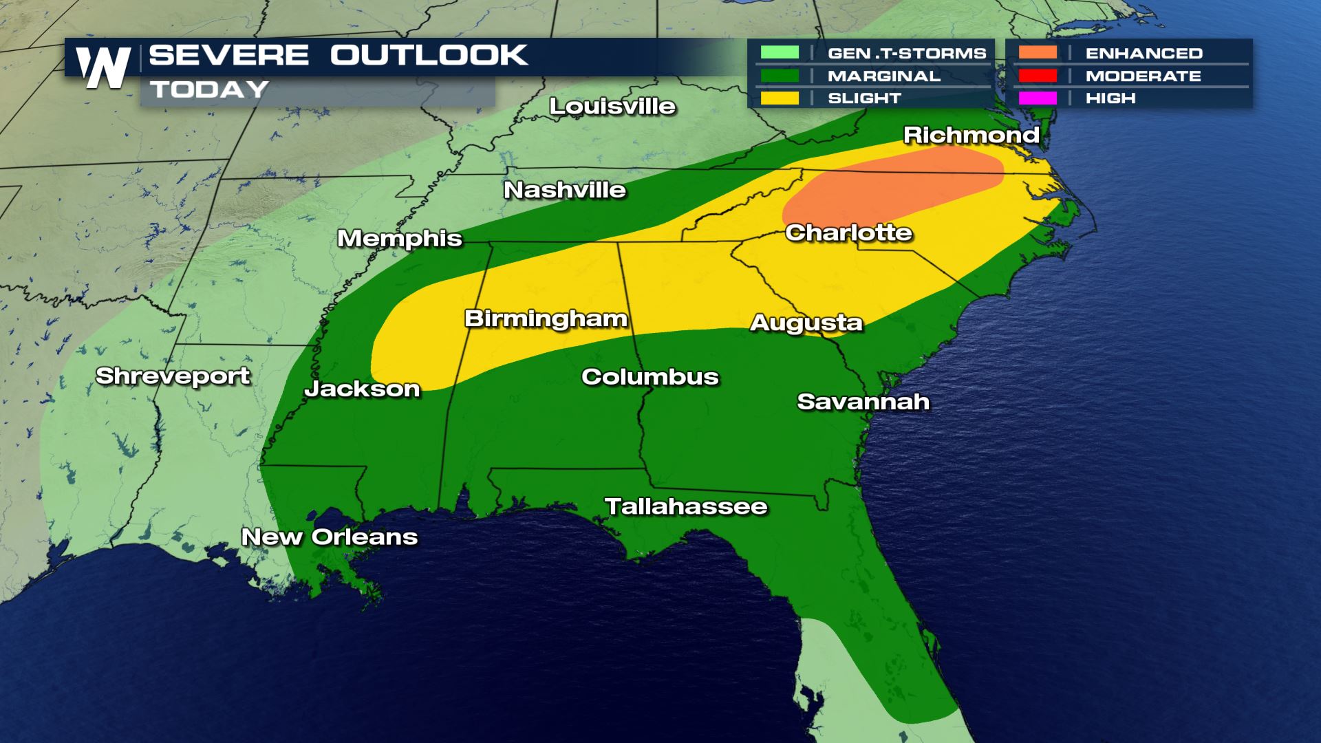
Severe Outlook
The severe weather will be confined to the East and Southeast with the highest risk in parts of Mississippi, Alabama and the Mid-Atlantic. Large hail, damaging winds and tornadoes will all be possible. Cities like Charlotte, Birmingham and Atlanta will need to be weather alert.
Severe Risks
All modes of severe weather are in the forecast today. The other risk that we also want to mention is the frequent lightning.
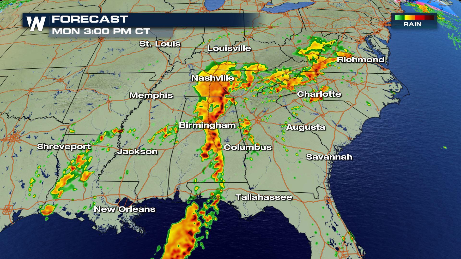
Forecast
The timing for Monday's storms will be all morning and through the afternoon. This system is moving East so through the night the storms will be diminishing from West to East.
Keep checking with WeatherNation for more updates on Monday's severe weather chances.All Weather News
More
Severe Storms For the East Coast Through Tuesday
A cold front moving through a moist airmass h
2 Jul 2025 1:00 AM


Western Heat Continues With Some Relief
A large dome of hot high pressure remains acr
1 Jul 2025 11:00 PM

NHC Monitoring Front in the Southeast Ahead of 4th of July
SOUTHEAST - A frontal boundary moving through
1 Jul 2025 10:35 PM

Where Rain Could Dampen Holiday Travel Plans
AAA is expecting over 70 million travelers to
1 Jul 2025 4:35 PM

Severe Weather Threat Continues in the Midwest
It has been an active, severe season across t
30 Jun 2025 9:00 PM