Monday Severe Weather Update
Top Stories
30 Sep 2019 10:32 AM
Isolated severe storms today anywhere from the Southern Plains to the Upper Mississippi Valley and the Great Lakes. Large hail, damaging winds and isolated tornadoes will all be possible. Here is the latest severe forecast for Monday.
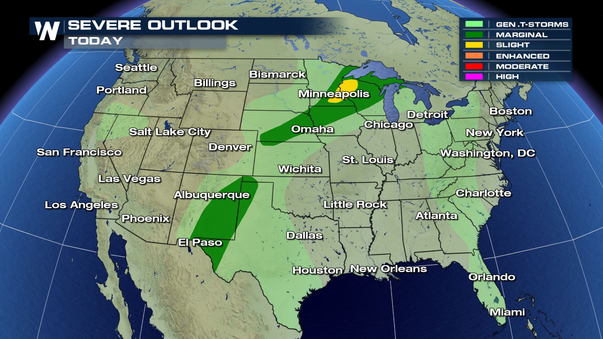 A good portion of the Central U.S. is under an isolated risk of severe storms this afternoon and evening. The severe risk across the Southern Plains will last into the early morning hours thanks to tropical moisture from Narda streaming into the U.S.
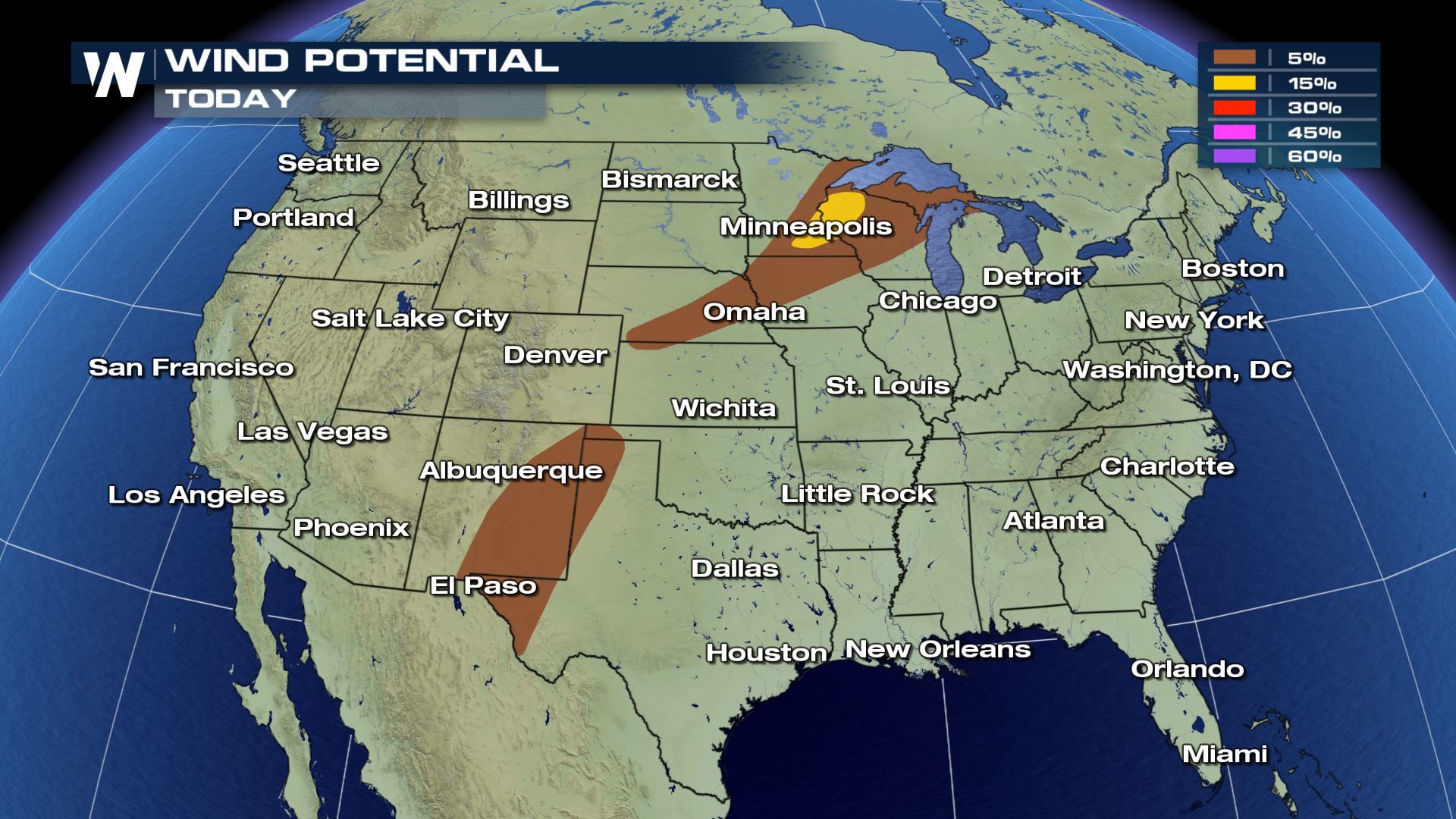
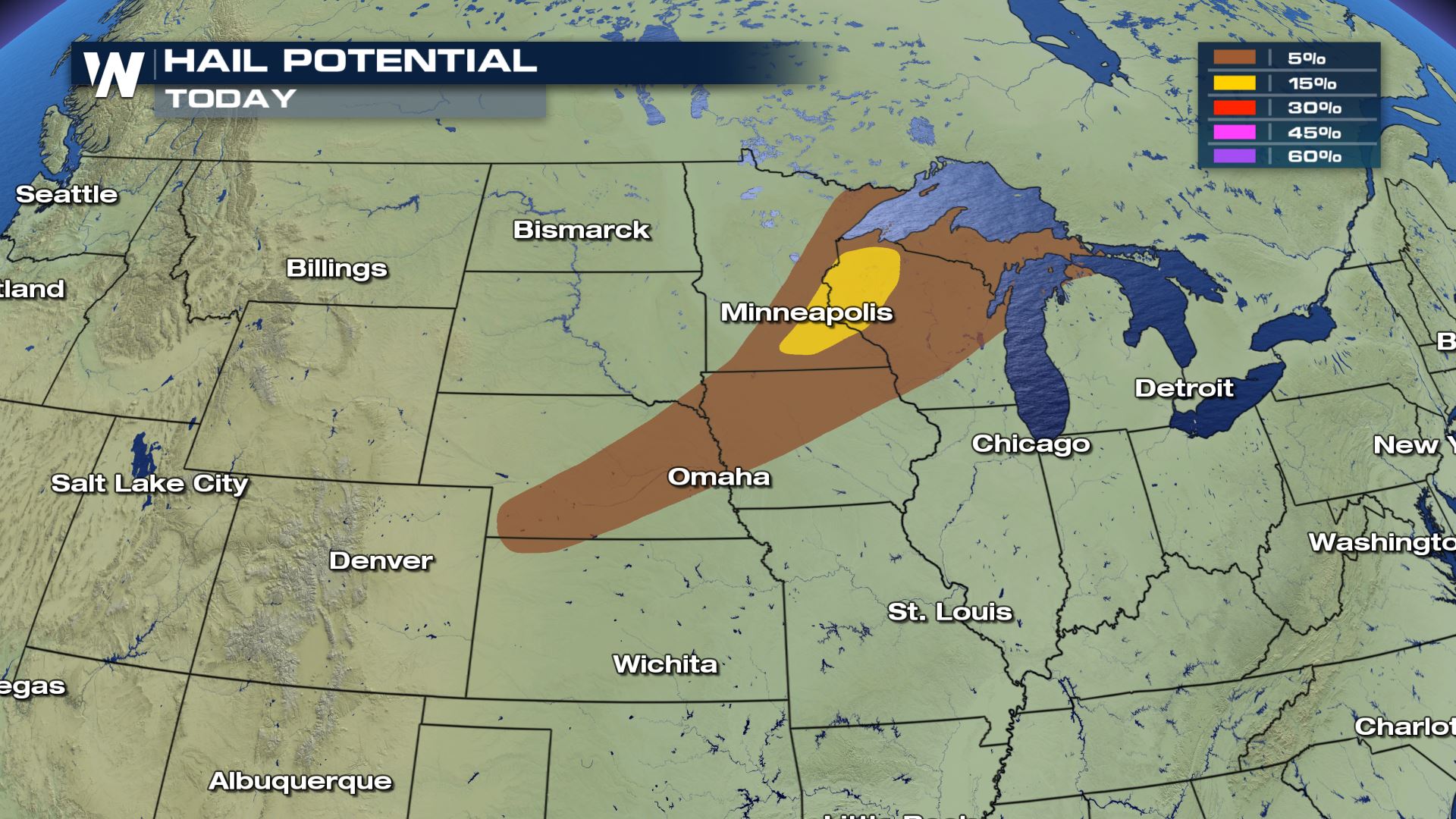
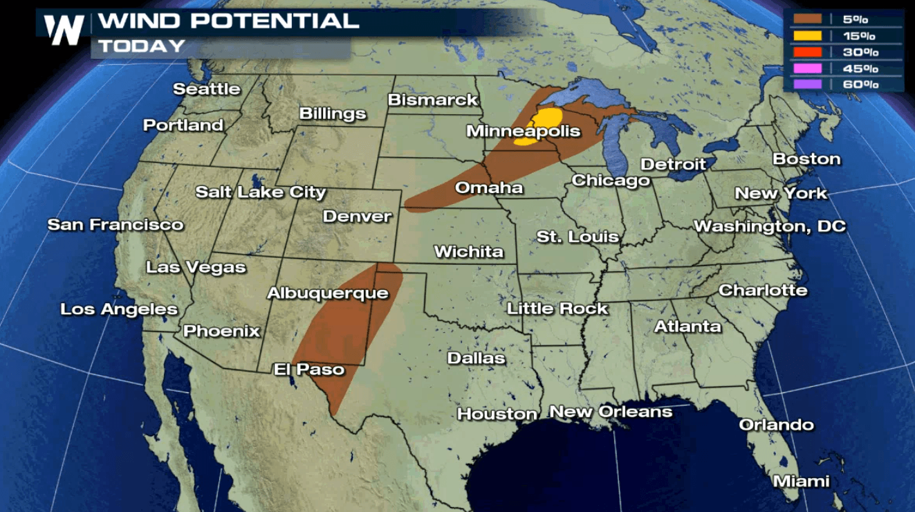
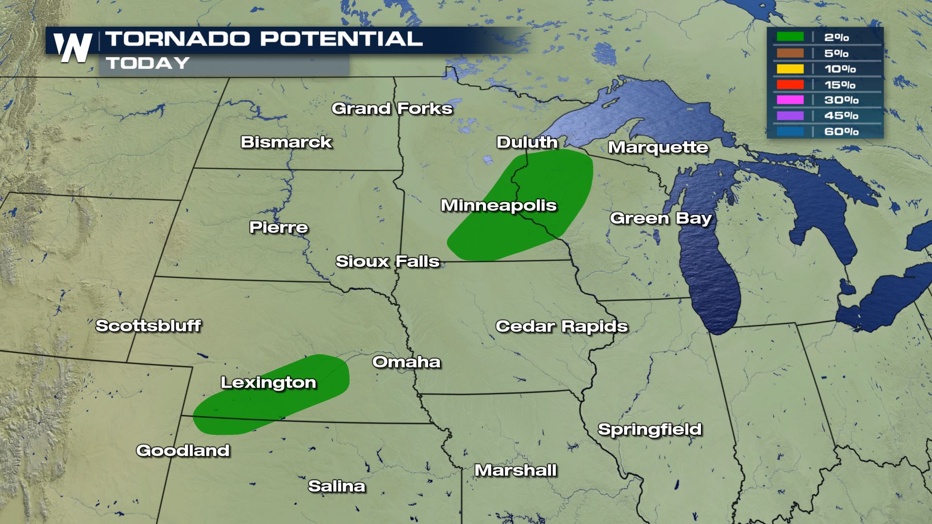 Large hail, strong winds and a few tornadoes will be possible with today's storms. The tornado risk will be highest over Nebraska and Kansas as well as Wisconsin. You will definitely want to be weather aware in these areas.
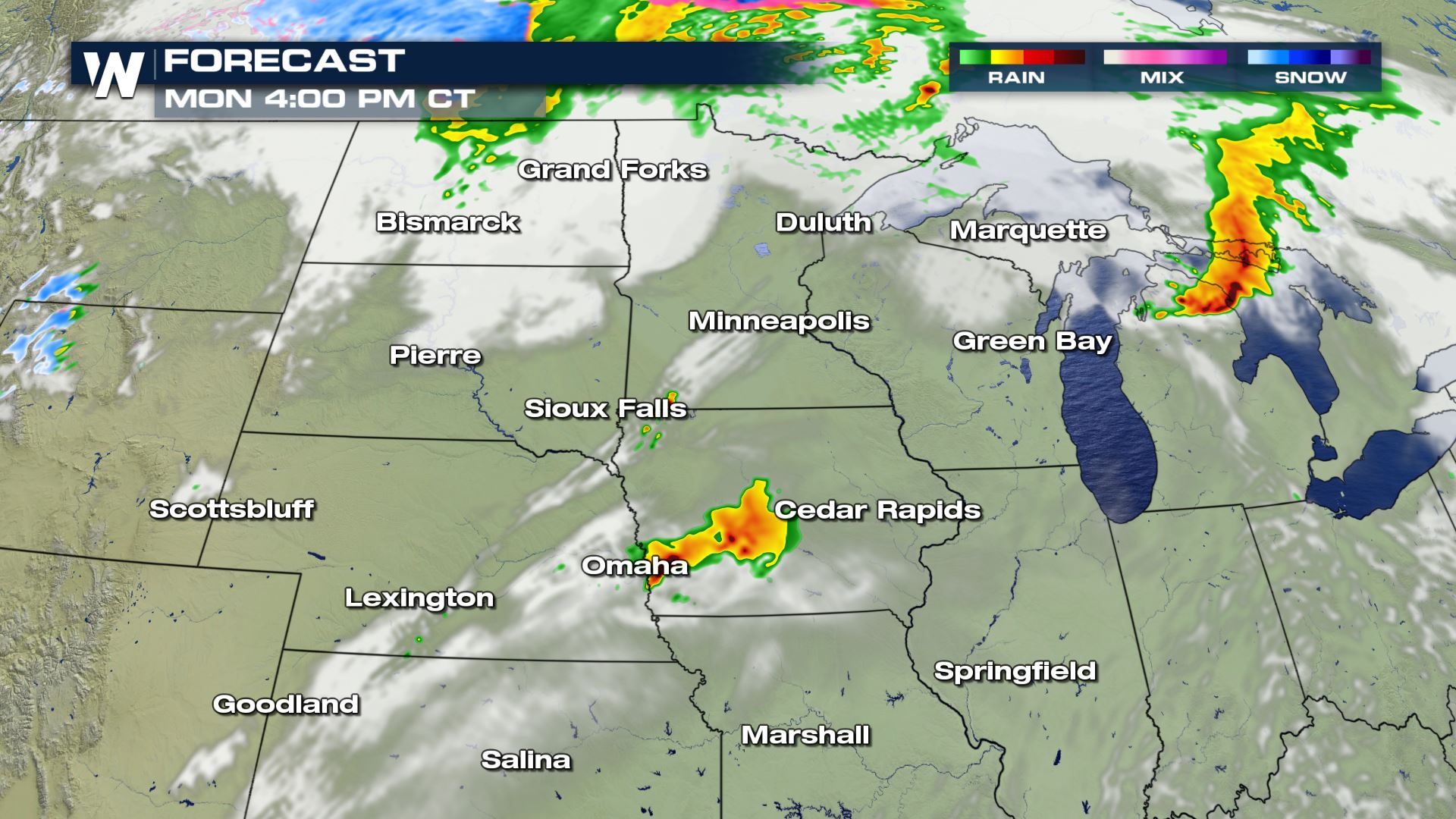
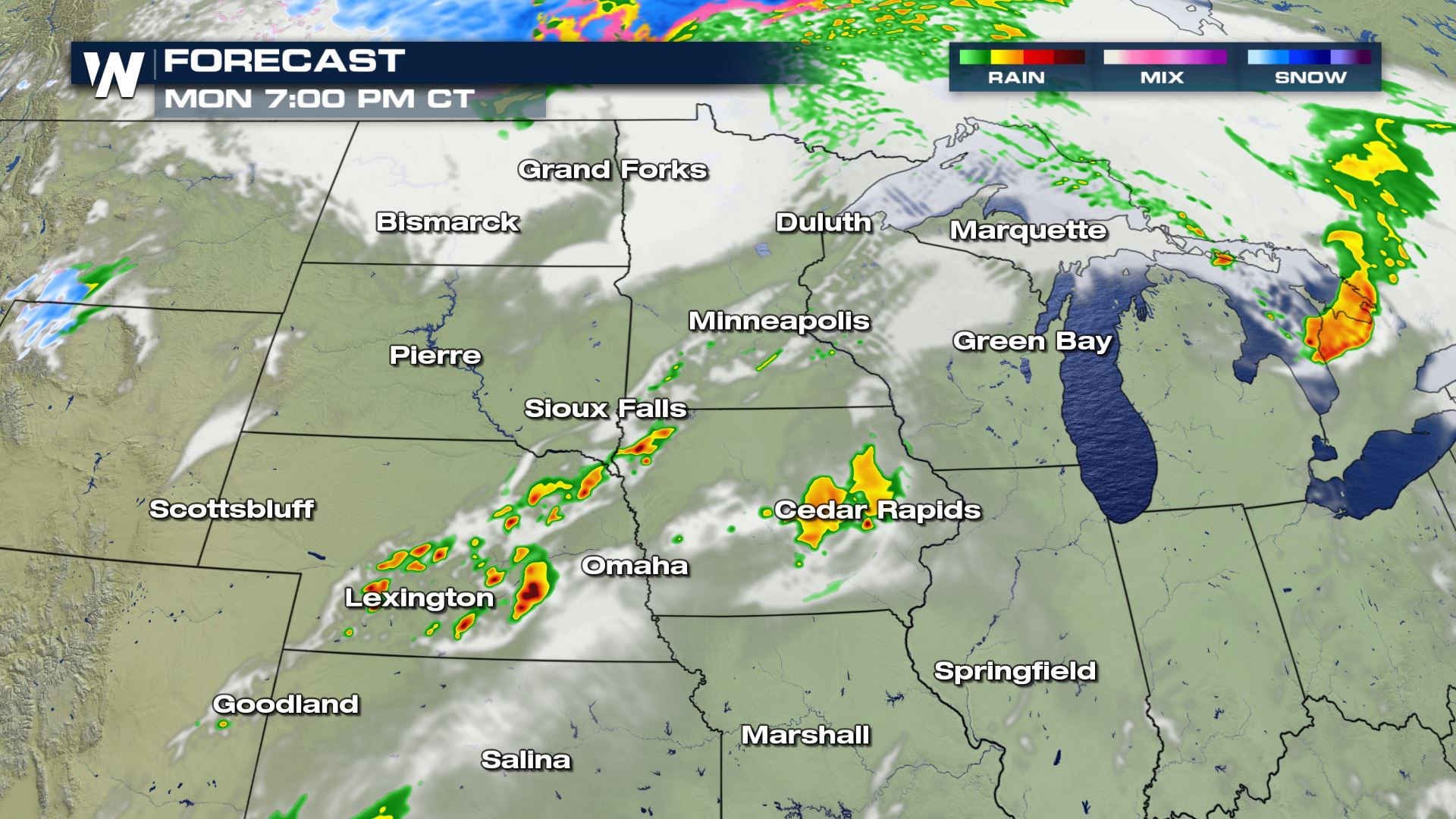
 Showers and storms will be possible all morning and all afternoon in these areas. That means both your morning and afternoon commutes could be on dangerous side, so be weather ready if any storms impact your area.
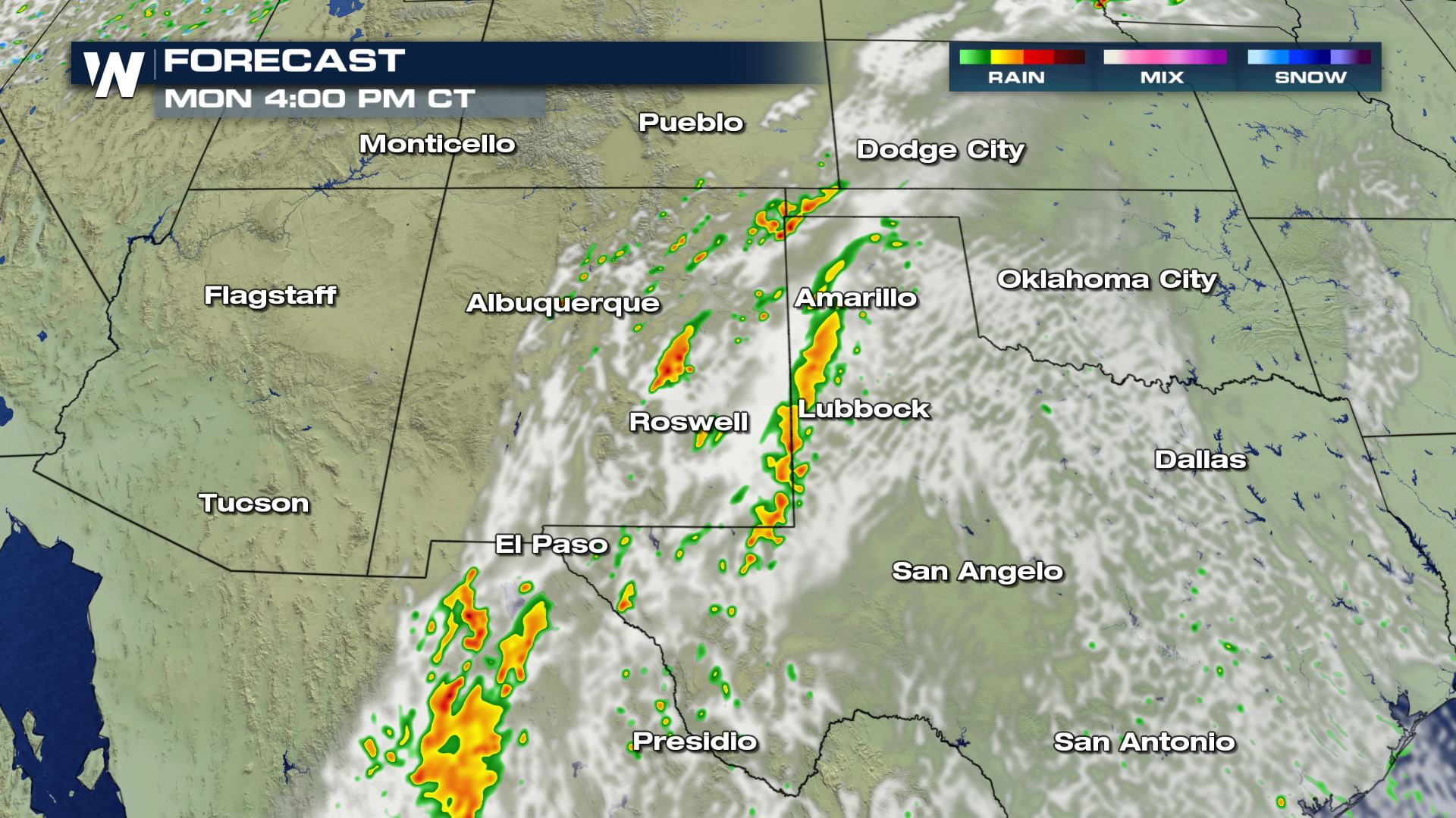
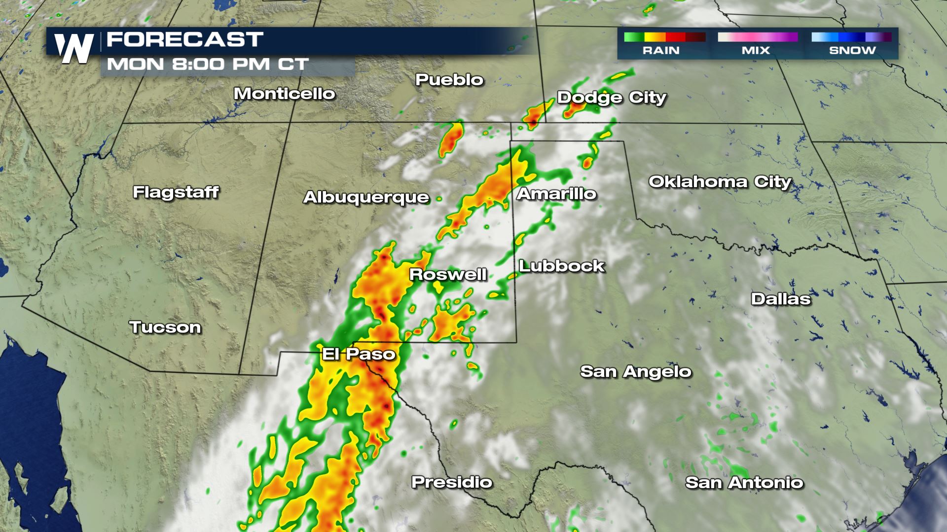
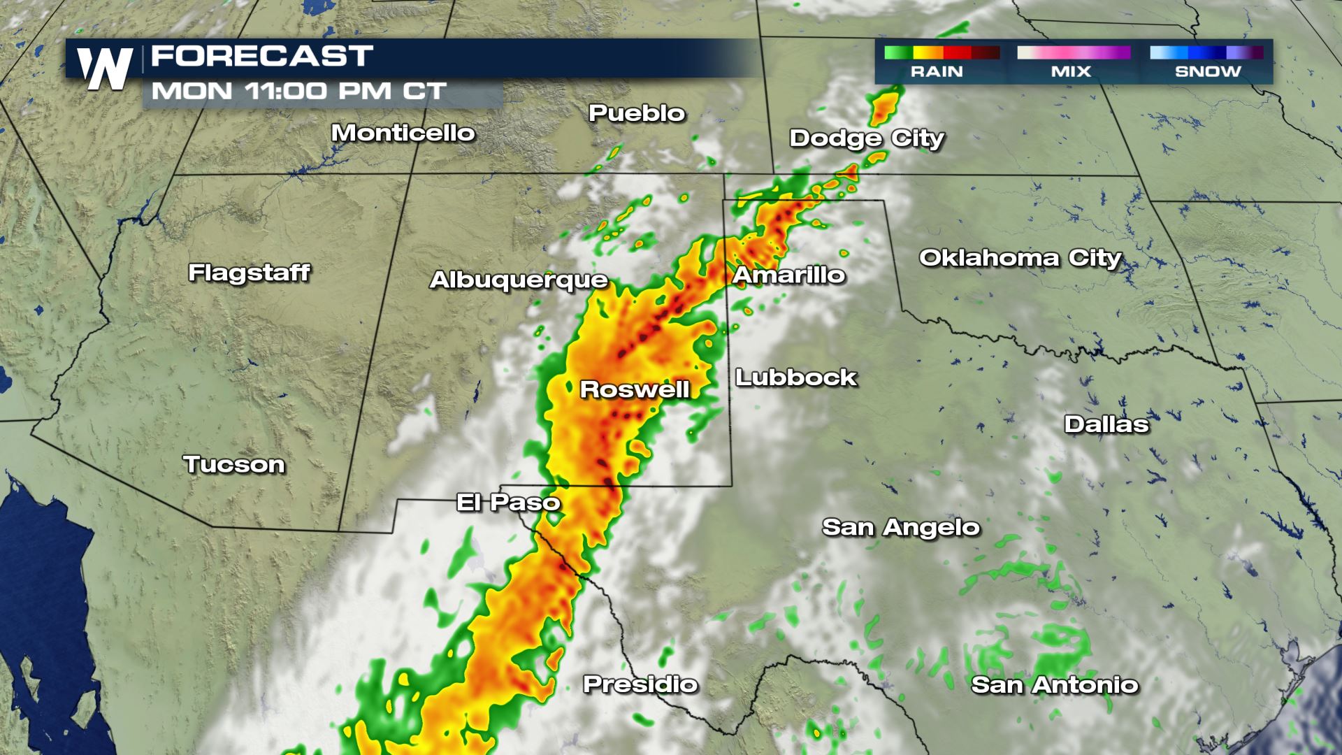
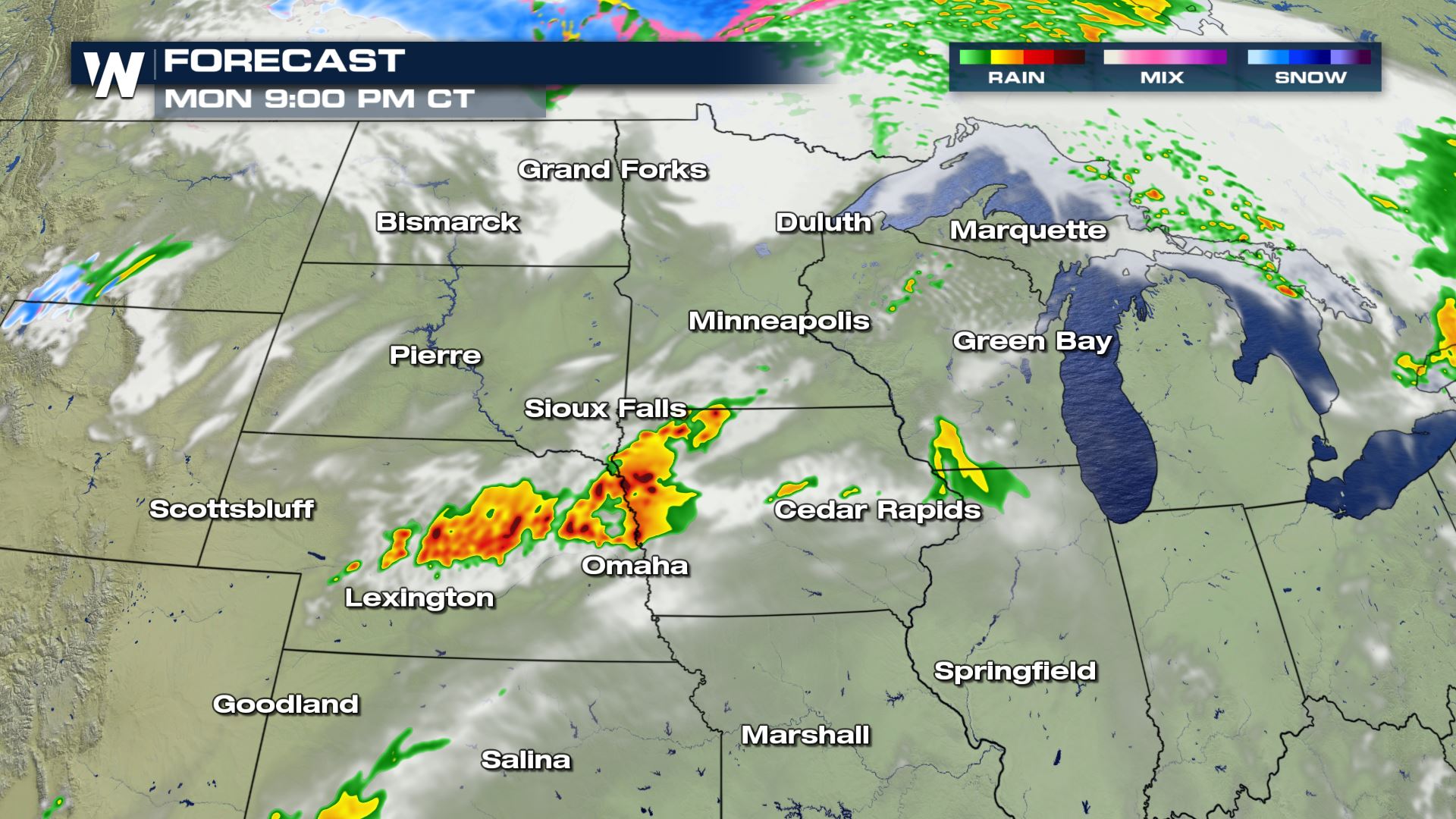
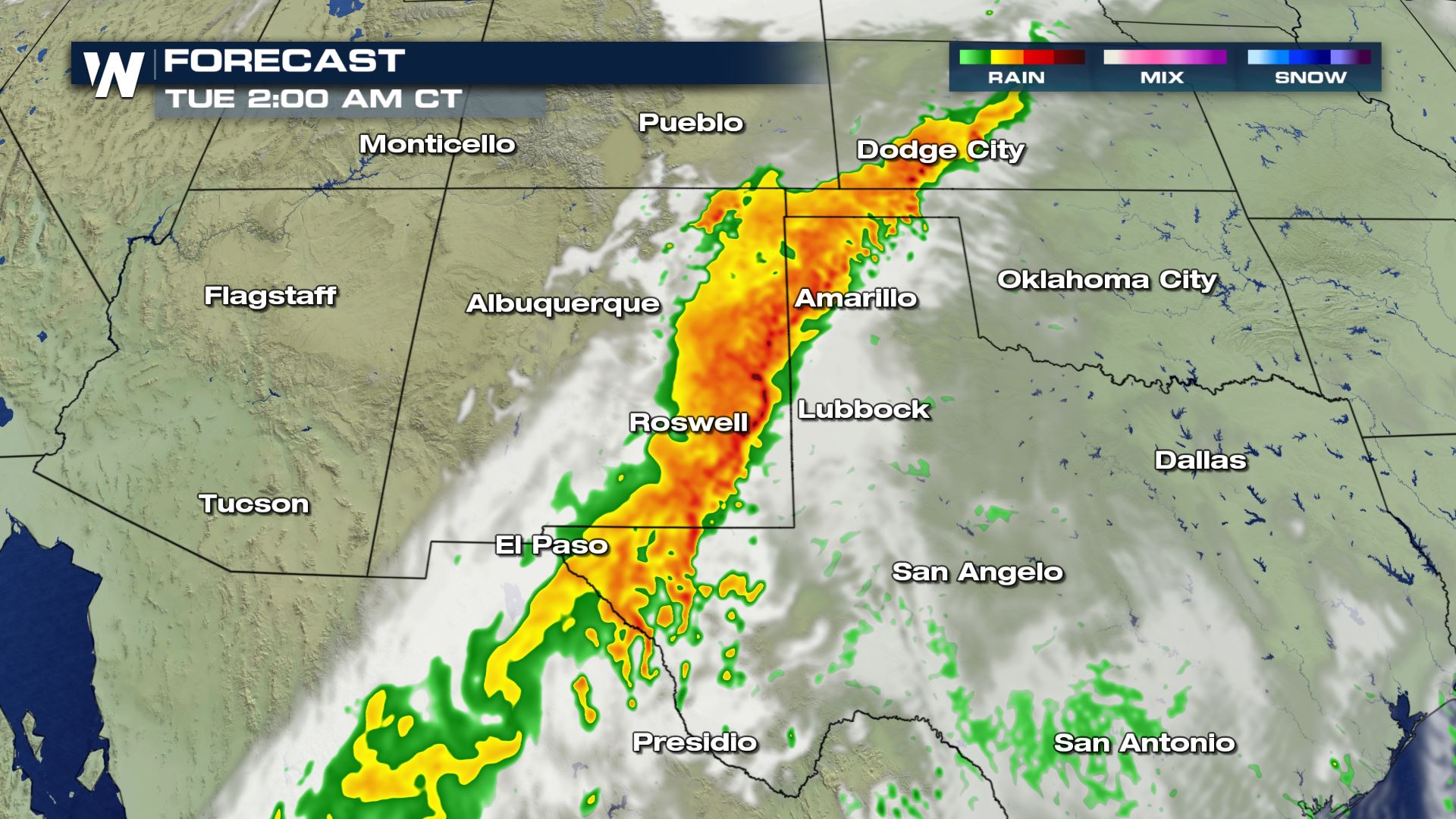 Look at the intense rainfall that is likely tonight and early Tuesday across New Mexico and West Texas. This is the tropical moisture impacting the southern United States. Flash flooding will be possible in these areas.
More updates are on the way all day on WeatherNation.
Look at the intense rainfall that is likely tonight and early Tuesday across New Mexico and West Texas. This is the tropical moisture impacting the southern United States. Flash flooding will be possible in these areas.
More updates are on the way all day on WeatherNation.
Severe Outlook
A good portion of the Central U.S. is under an isolated risk of severe storms this afternoon and evening. The severe risk across the Southern Plains will last into the early morning hours thanks to tropical moisture from Narda streaming into the U.S.
Severe Risks
Large hail, strong winds and a few tornadoes will be possible with today's storms. The tornado risk will be highest over Nebraska and Kansas as well as Wisconsin. You will definitely want to be weather aware in these areas.
Forecast
Upper Great Lakes
Showers and storms will be possible all morning and all afternoon in these areas. That means both your morning and afternoon commutes could be on dangerous side, so be weather ready if any storms impact your area.
Southern High Plains
Look at the intense rainfall that is likely tonight and early Tuesday across New Mexico and West Texas. This is the tropical moisture impacting the southern United States. Flash flooding will be possible in these areas.
More updates are on the way all day on WeatherNation.
All Weather News
More

More Storms for the East Through Monday
A low-pressure system that moved through the
3 Aug 2026 12:20 PM


After Reaching Category 5, Genevieve Weakens in the Pacific
PacificGenevieve formed last Friday south of
3 Aug 2026 12:30 AM

Flooding, Severe Storms Target the Midwest Again
After an active week of storms across the nor
1 Aug 2026 1:40 AM

Flooding Risk Increases as Heavy Rain Targets the Tri-State Area
Tuesday, heavy rainfall moved across the Nort
30 Jul 2026 12:25 AM