Rain, Ice for the Great Lakes Region

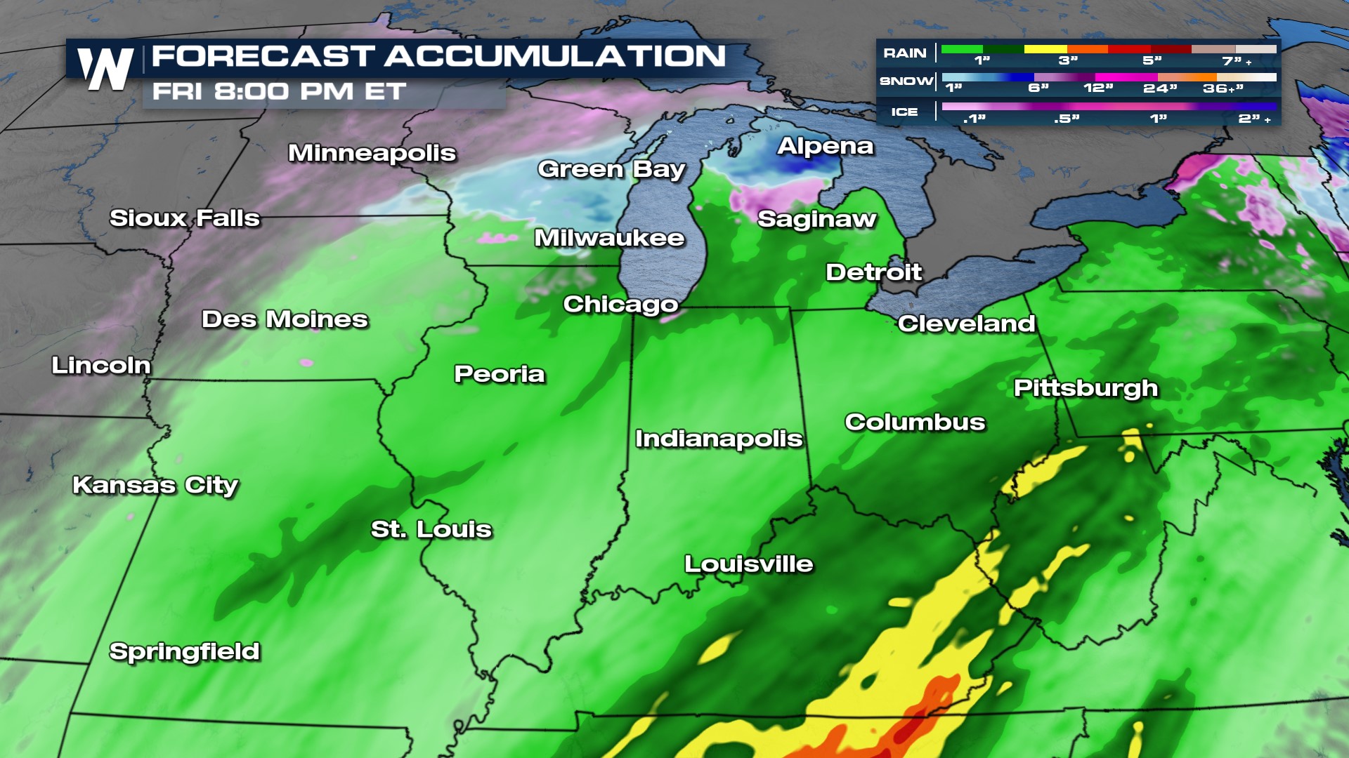
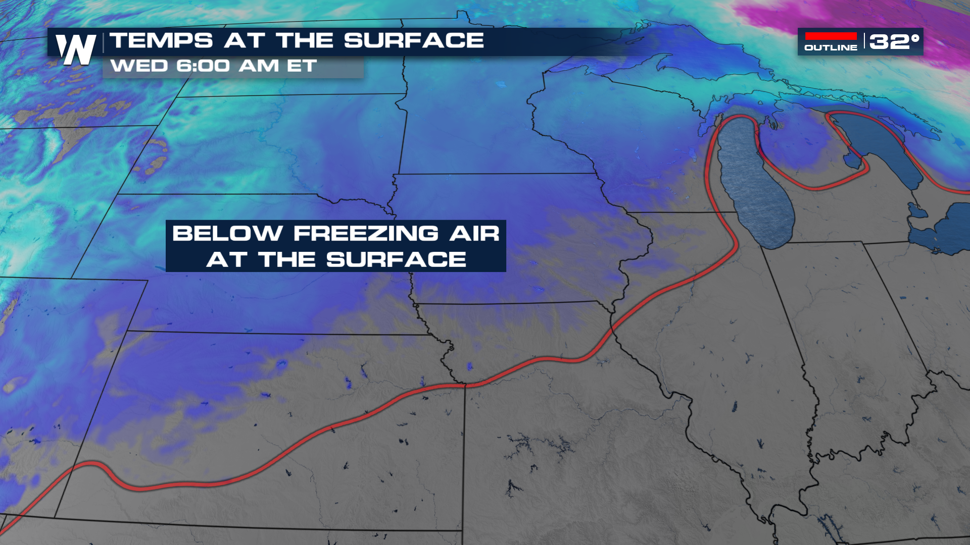
Over the next 24 hours we have two storm systems that will slide through the central portions of the country, bringing rain and ice to the Midwest and Great Lakes region. Both systems look to be warmer (in terms of atmospheric profile) compared to our last storm system, which means less ice compared to earlier in the week. System one is heavy rain through the first half of Wednesday while system two arrives Thursday with a bit more ice potential through the Great Lakes region Thursday afternoon and evening.
Additional ice accumulation will be in the range of 0.1" to 0.25" of ice. However, weather models are in much disagreement as to how much ice we are going to see. Below is the HRRR model and compared to the Baron model above showing much different outputs to the ice threat. Either way, it's never a bad idea to plan and prepare for rough weather conditions. It's better to be over-prepared, than under-prepared.
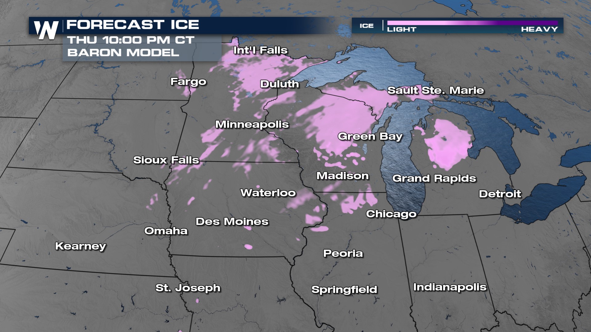 To get an ice event like this, you have to have a melting layer in the lower atmosphere. The precipitation will start as snow, melt through the warmer temps, and then re-freeze at the surface. This means travel can be impacted once again, so if you don't have to drive stay home.
 Where temperatures are cold enough in central and northern Michigan we will likely see snow with our second system Thursday into Friday. Accumulations could be upwards of 3" which will create localized travel impacts!