Parade of Rain Marches on in the Northwest
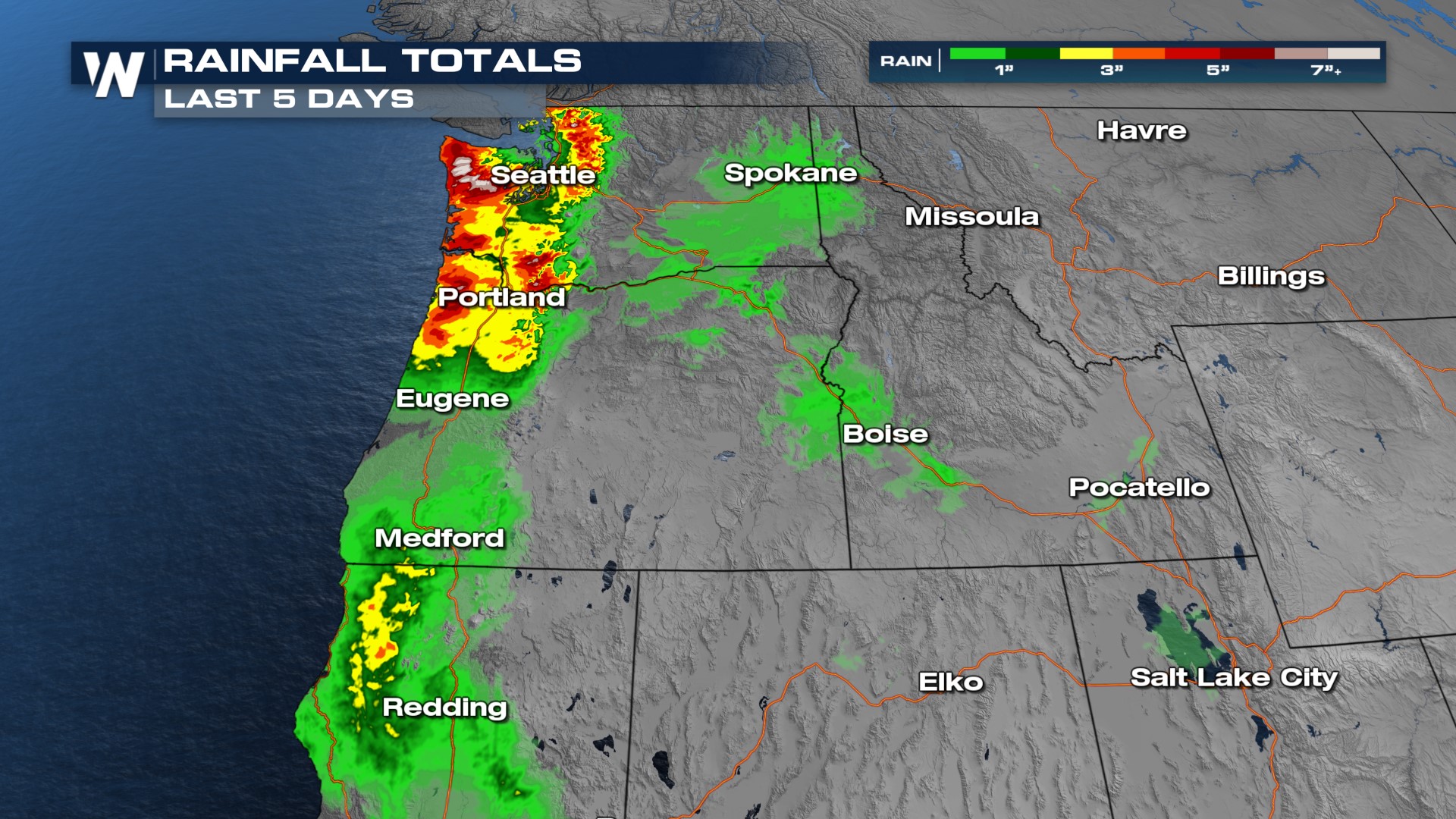
WET WEST - Over the last 5 days, areas along the West Coast have seen their fair share of rainfall. Yes, we're starting to feel like broken records here, but the rain is not over for us yet.

It's going to be a soggy start to the workweek as rounds of moisture are going to come onshore. Monday night is when the next heaviest batch of rainfall will aim for the west coast. This will stick around long enough to linger into Tuesday.
Our next push of moisture reaches into the coast late Tuesday night and into Wednesday morning. This push looks to have a bit more moisture attached to it as it is a bit of a stronger frontal system.
As far as rain totals go, we could see upwards of 2-4 more inches of rain in some spots. The highest totals look to be more likely along and towards the coastline.

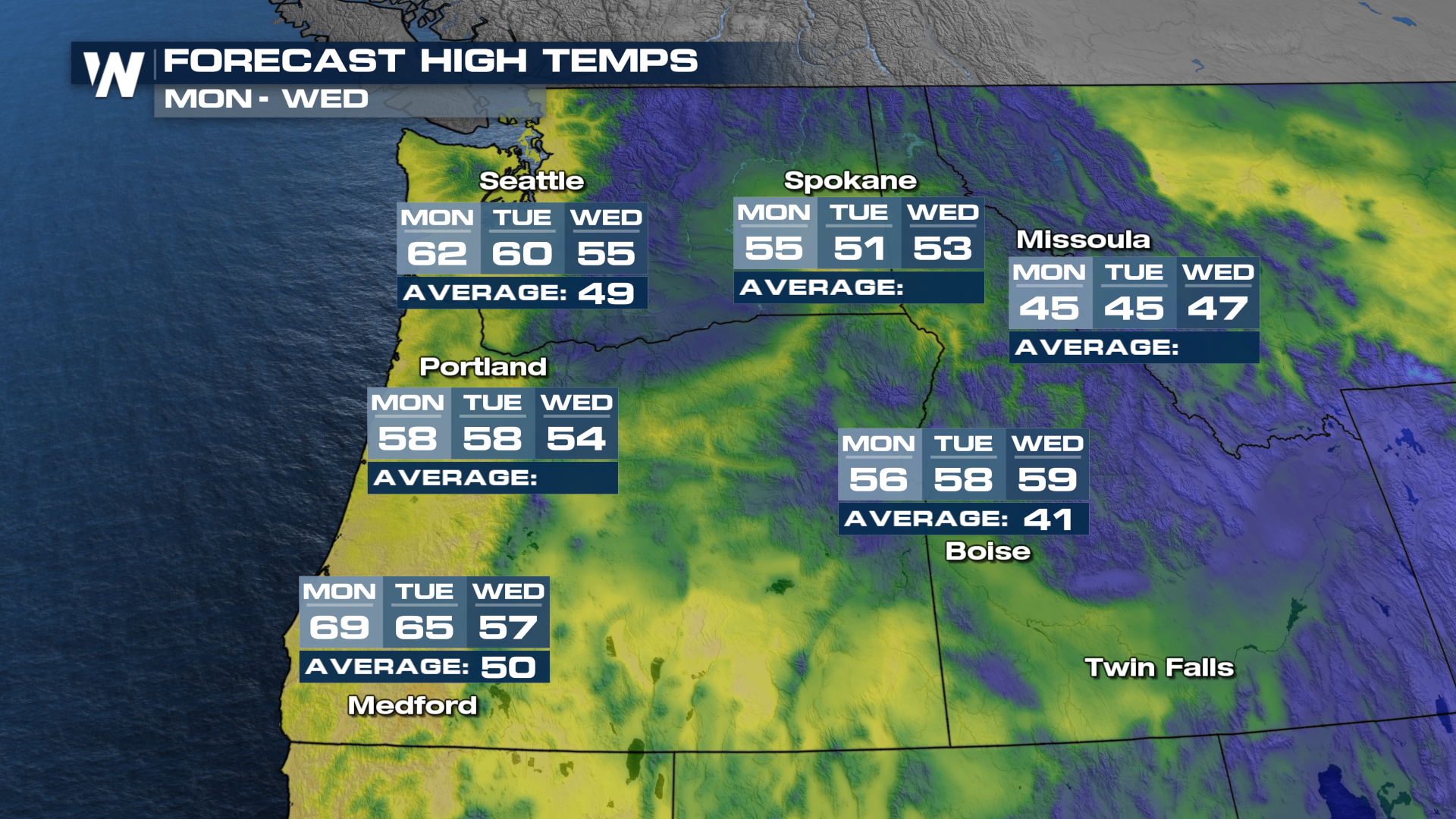
An interesting aspect of this system is that temperatures are and will be well above average over the next few days. This will move snow levels well up into the mountains with the initial surge of moisture. The second push will have cooler weather, bringing them back down Wednesday and Thursday.
