Pacific Northwest: Atmospheric River to Bring More Rain

Special Stories
25 Sep 2020 11:00 AM
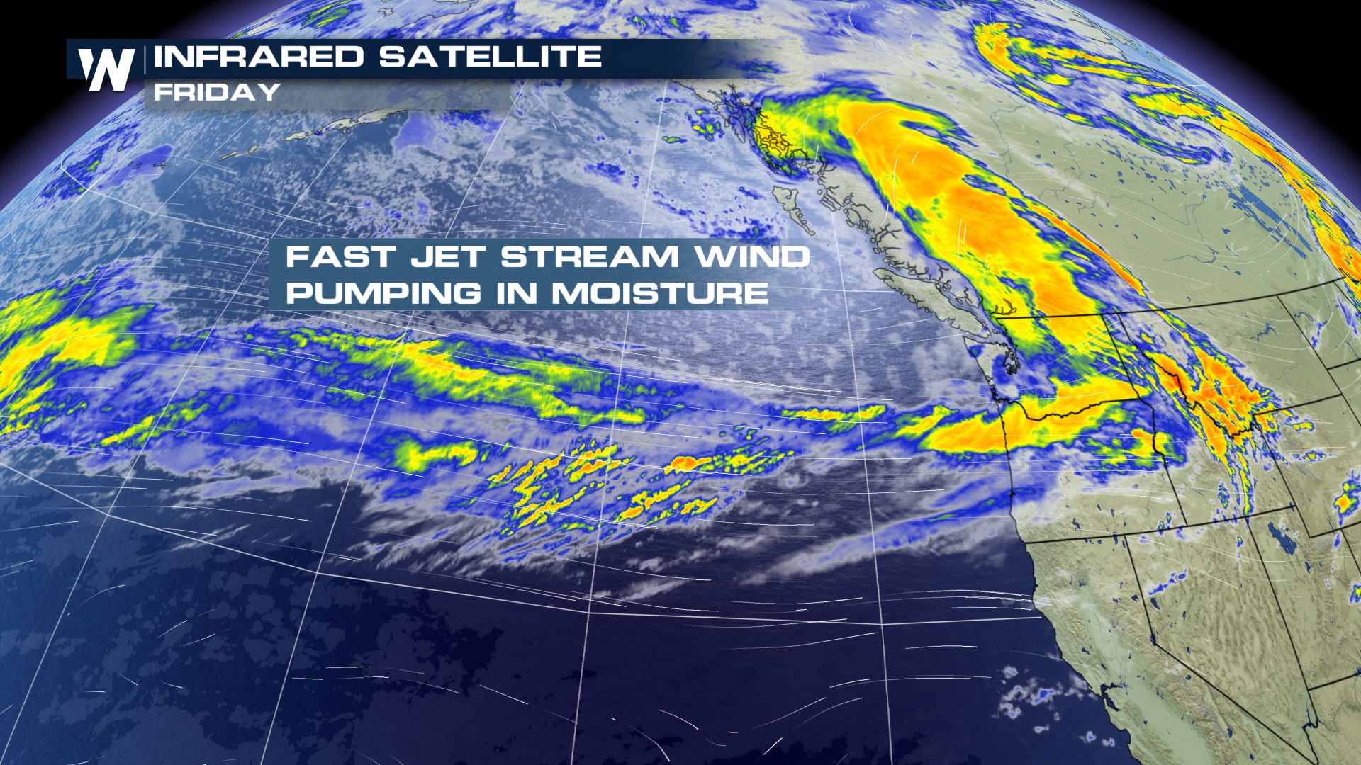
After smoke and wildfires in Washington and Oregon earlier this month, the Northwest finally got some relief earlier this week from an atmospheric river event which brought record breaking rainfall to Seattle Wednesday and Thursday. Additional chances for heavy rain are expected to continue on Friday as a strong trough digs into British Columbia.
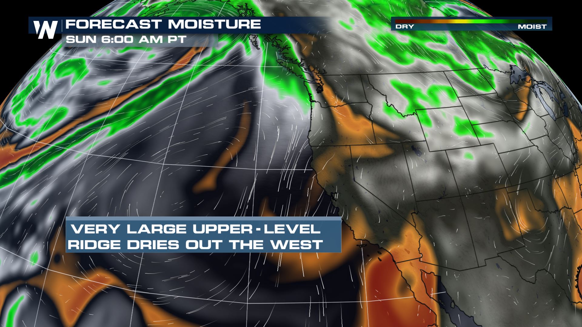
 Through the weekend, additional showers will be possible across the Northwest, though most of the moisture will be confined to areas along and west of the Cascades. A few scattered showers and snow flurries could push through the interior Saturday into Sunday morning. A large ridge is expected to build along the West Coast into early next week which will bring warm and dry conditions back to the region.
 As of Friday morning, three day rain totals had already surpassed 9 inches in Olympic National Park, while many mountain rain gauges had topped 3-4 inches.
[embed]https://twitter.com/NWSSeattle/status/1309510585462136832[/embed]
As of Friday morning, three day rain totals had already surpassed 9 inches in Olympic National Park, while many mountain rain gauges had topped 3-4 inches.
[embed]https://twitter.com/NWSSeattle/status/1309510585462136832[/embed]
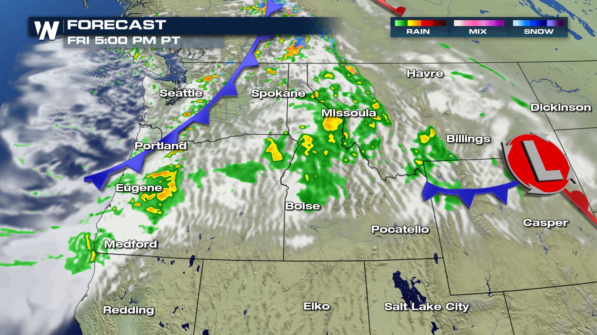
 The simulated radar images below depict when/where precipitation is expected to occur as the front moves inland Friday into Saturday. The heaviest and most widespread shower activity is expected through Friday afternoon, before the bulk of the rain moves east of the Cascades and becomes more scattered.
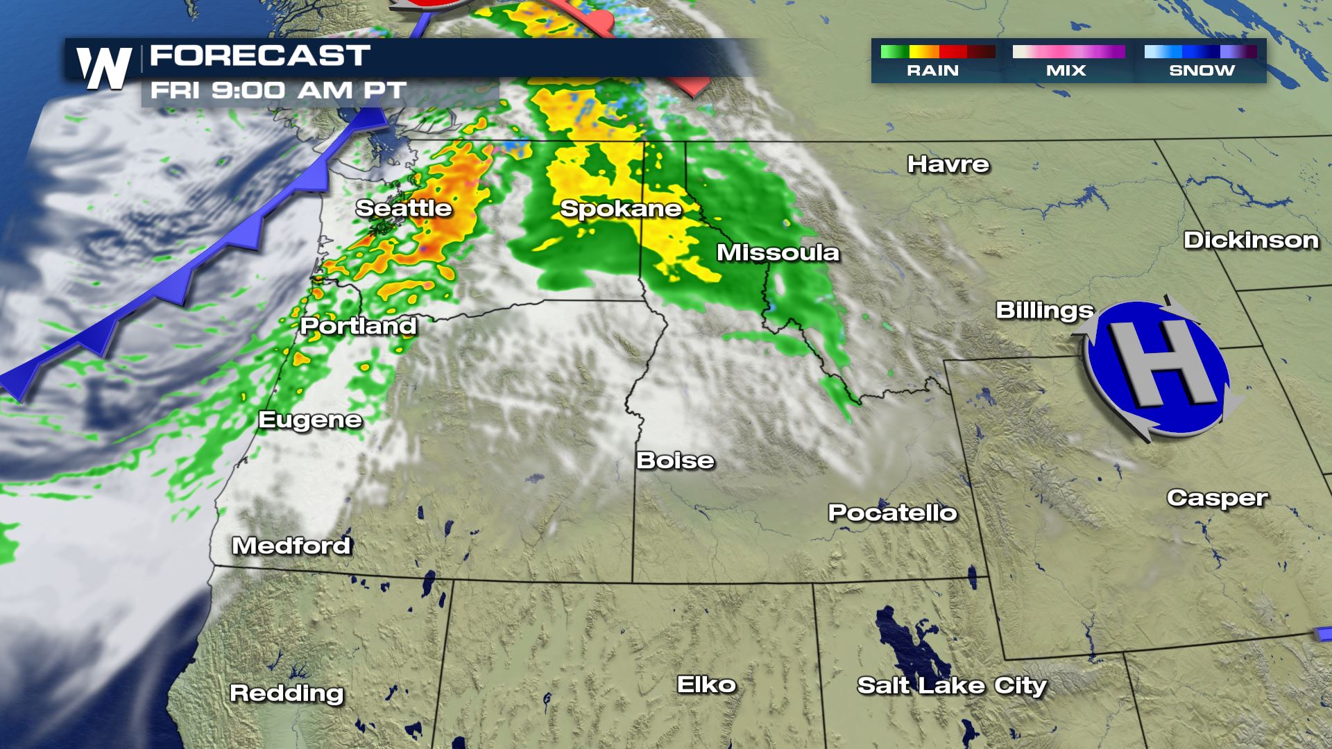
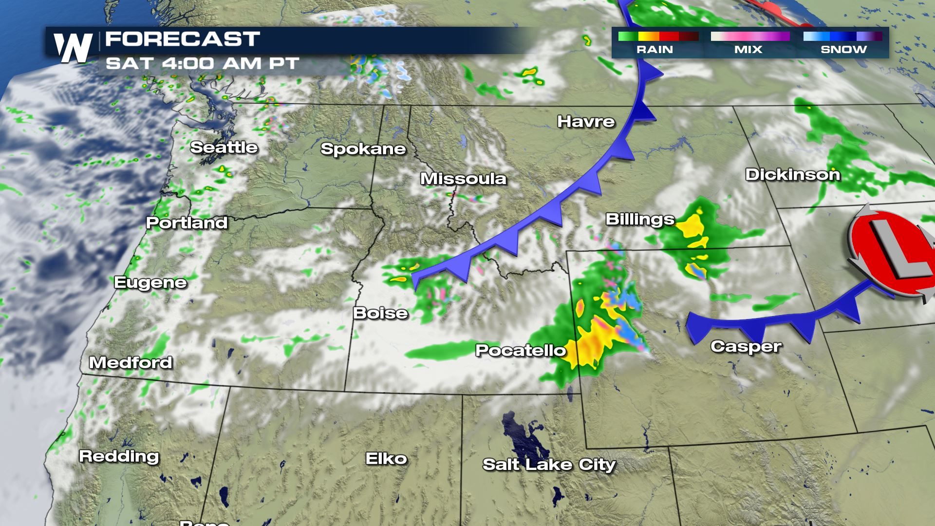 By Sunday morning, scattered showers are expected along and west of the Cascades while some heavier precipitation is still expected inland across Idaho, Montana, and Wyoming. Higher elevations could see snow into Saturday morning with another round possible in the Rockies of Montana and Wyoming Saturday night into Sunday.
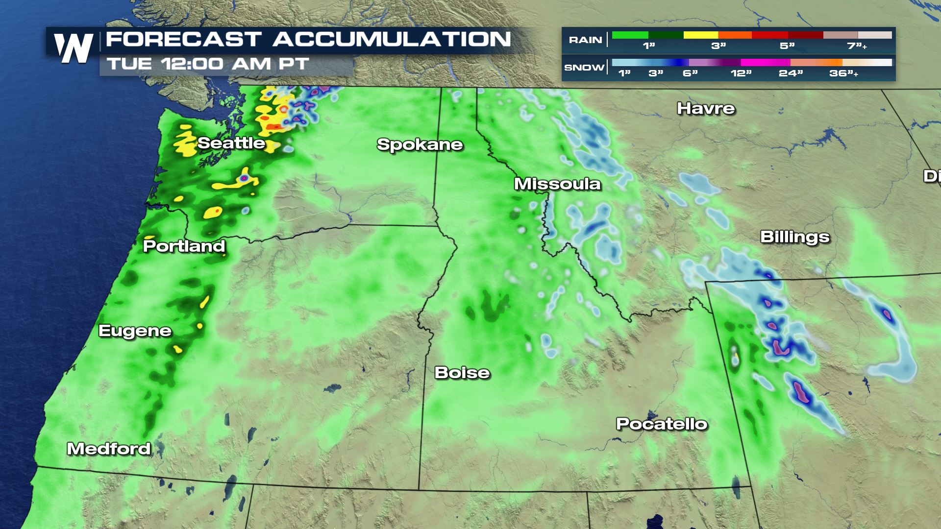
Additional rain totals through the weekend could still surpass 3-4 inches in some isolated areas while over half a foot of snow could accumulate on the high peaks of the Northern Cascades and in Wyoming's Northwestern Mountains.
By Sunday morning, scattered showers are expected along and west of the Cascades while some heavier precipitation is still expected inland across Idaho, Montana, and Wyoming. Higher elevations could see snow into Saturday morning with another round possible in the Rockies of Montana and Wyoming Saturday night into Sunday.
Additional rain totals through the weekend could still surpass 3-4 inches in some isolated areas while over half a foot of snow could accumulate on the high peaks of the Northern Cascades and in Wyoming's Northwestern Mountains.
 Remember if you encounter flooding in a vehicle, do not try to cross the water. Recent burn areas will be especially susceptible to flash flooding, mudslides, and debris flows.
Setup
Through the weekend, additional showers will be possible across the Northwest, though most of the moisture will be confined to areas along and west of the Cascades. A few scattered showers and snow flurries could push through the interior Saturday into Sunday morning. A large ridge is expected to build along the West Coast into early next week which will bring warm and dry conditions back to the region.
As of Friday morning, three day rain totals had already surpassed 9 inches in Olympic National Park, while many mountain rain gauges had topped 3-4 inches.
[embed]https://twitter.com/NWSSeattle/status/1309510585462136832[/embed]
Forecast
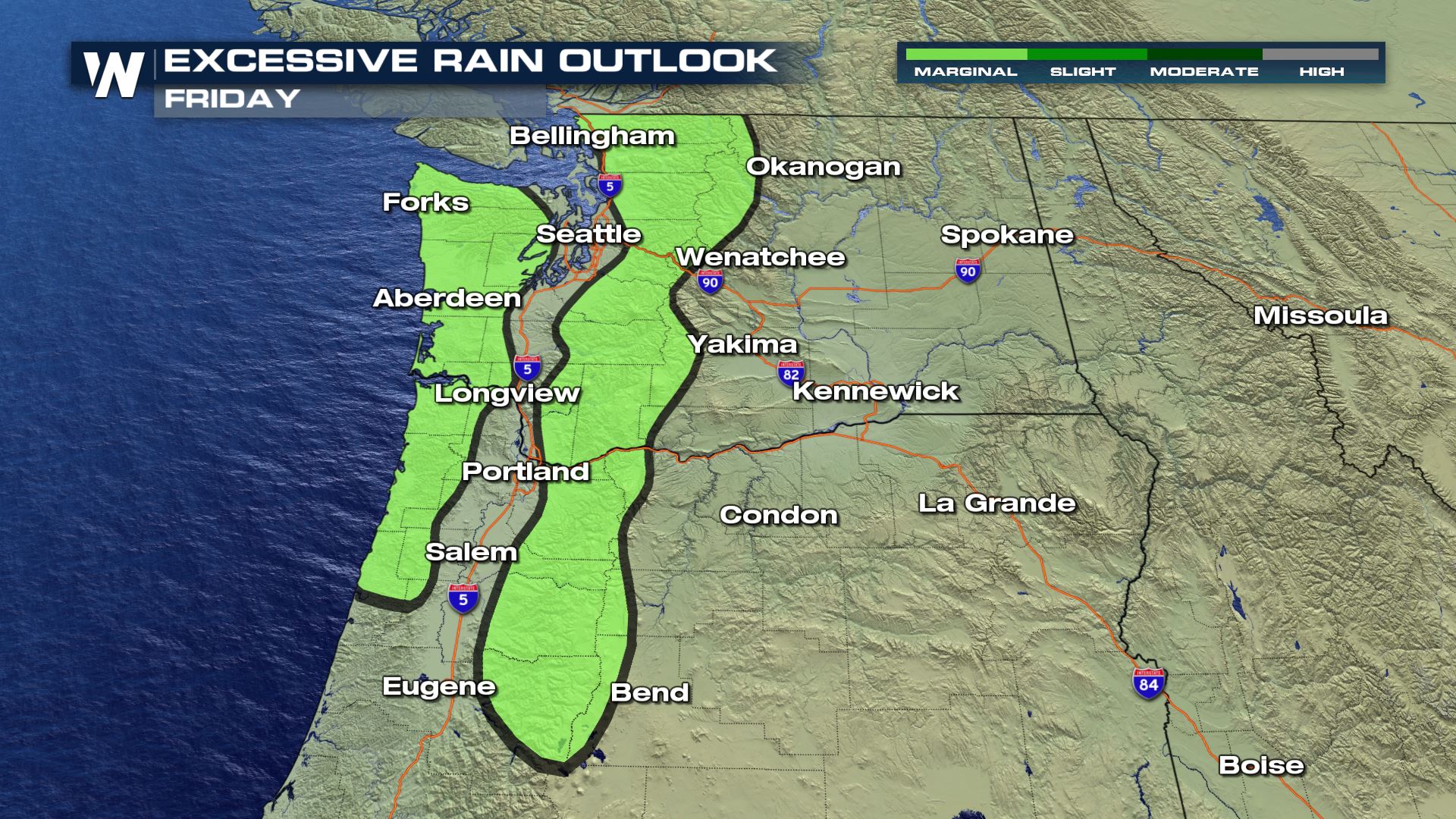
Enough rain could fall on Friday to trigger flash flooding, primarily over the higher terrain and near burn scars. The Weather Prediction Center has issued a marginal risk for flash flooding for the areas highlighted below. In addition, heavy surf and strong winds will lead to dangerous maritime conditions.
The simulated radar images below depict when/where precipitation is expected to occur as the front moves inland Friday into Saturday. The heaviest and most widespread shower activity is expected through Friday afternoon, before the bulk of the rain moves east of the Cascades and becomes more scattered.
By Sunday morning, scattered showers are expected along and west of the Cascades while some heavier precipitation is still expected inland across Idaho, Montana, and Wyoming. Higher elevations could see snow into Saturday morning with another round possible in the Rockies of Montana and Wyoming Saturday night into Sunday.
Additional rain totals through the weekend could still surpass 3-4 inches in some isolated areas while over half a foot of snow could accumulate on the high peaks of the Northern Cascades and in Wyoming's Northwestern Mountains.
Remember if you encounter flooding in a vehicle, do not try to cross the water. Recent burn areas will be especially susceptible to flash flooding, mudslides, and debris flows.All Weather News
More
Hurricane Center Monitoring Florida for Tropical Development
Residents and visitors to the Southeast will
30 Jun 2025 10:00 PM

Barry Makes Landfall, Watching Flossie Next
While the Eastern Pacific has made most of th
30 Jun 2025 9:40 PM

Severe Storms For the East Coast Through Tuesday
Frontal systems have been crossing the northe
30 Jun 2025 9:00 PM

Severe Weather Threat Continues in the Midwest
It has been an active, severe season across t
30 Jun 2025 9:00 PM


Where Rain Could Dampen Holiday Travel Plans
AAA is expecting over 70 million travelers to
30 Jun 2025 3:00 PM

Thunderstorms Possible in the Southeast Overnight
SOUTHEAST - Strong thunderstorms have develop
28 Jun 2025 2:40 AM