Severe Storms Wednesday, Plains to the Great Lakes
Top Stories
11 Sep 2019 5:11 AM
A shortwave of energy moving out of the Rockies will be the focus for severe storms today from the High Plains to the Great Lakes. Many states are under a severe weather risk for Wednesday and Thursday morning. A lot of the same areas that had severe storms on Tuesday will see more of the same for Wednesday. Here is the latest forecast.
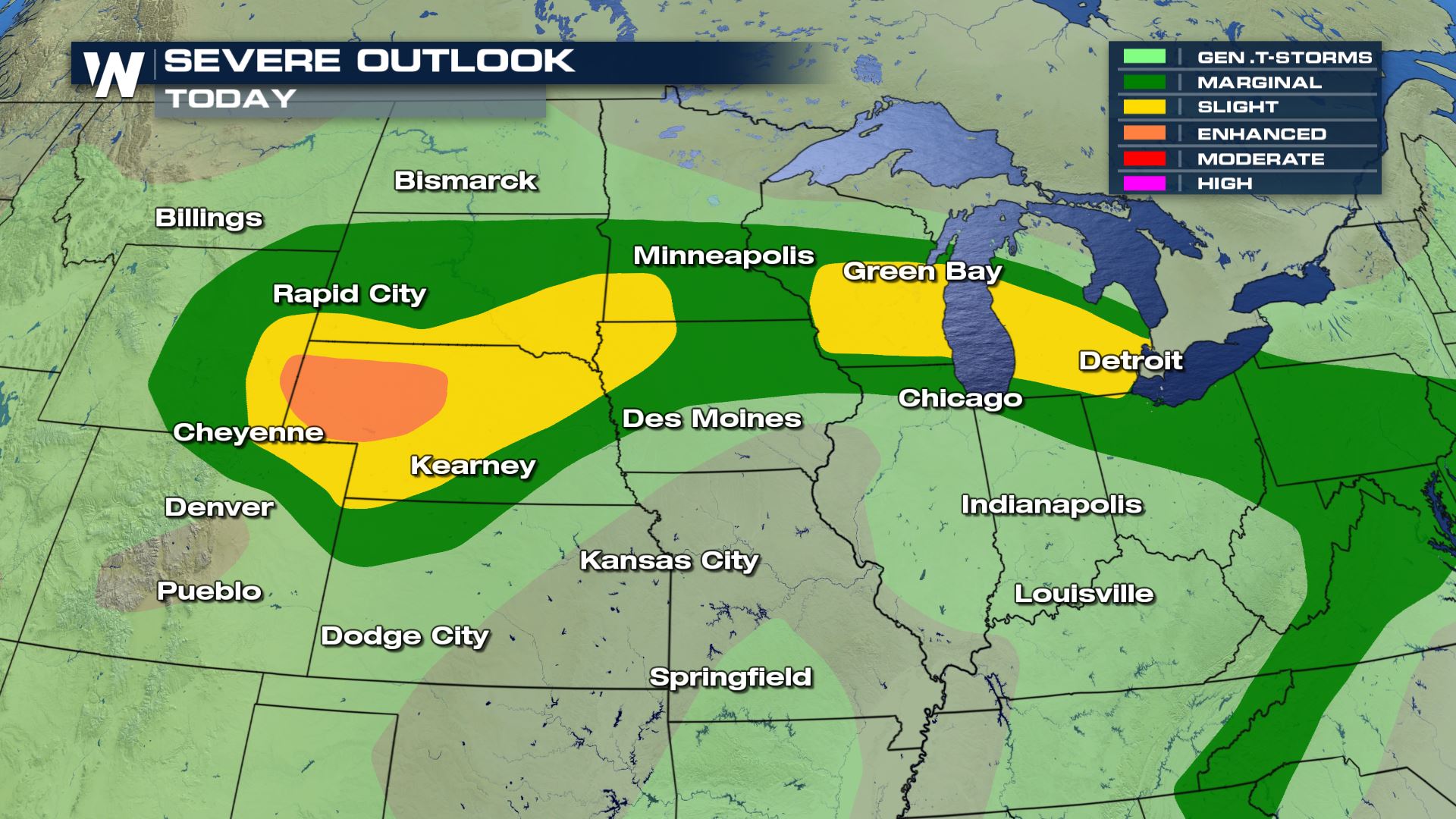 Severe storms will be possible anywhere from Wyoming and Colorado into the Great Lakes. All these areas will need to be weather aware for this afternoon and evening.
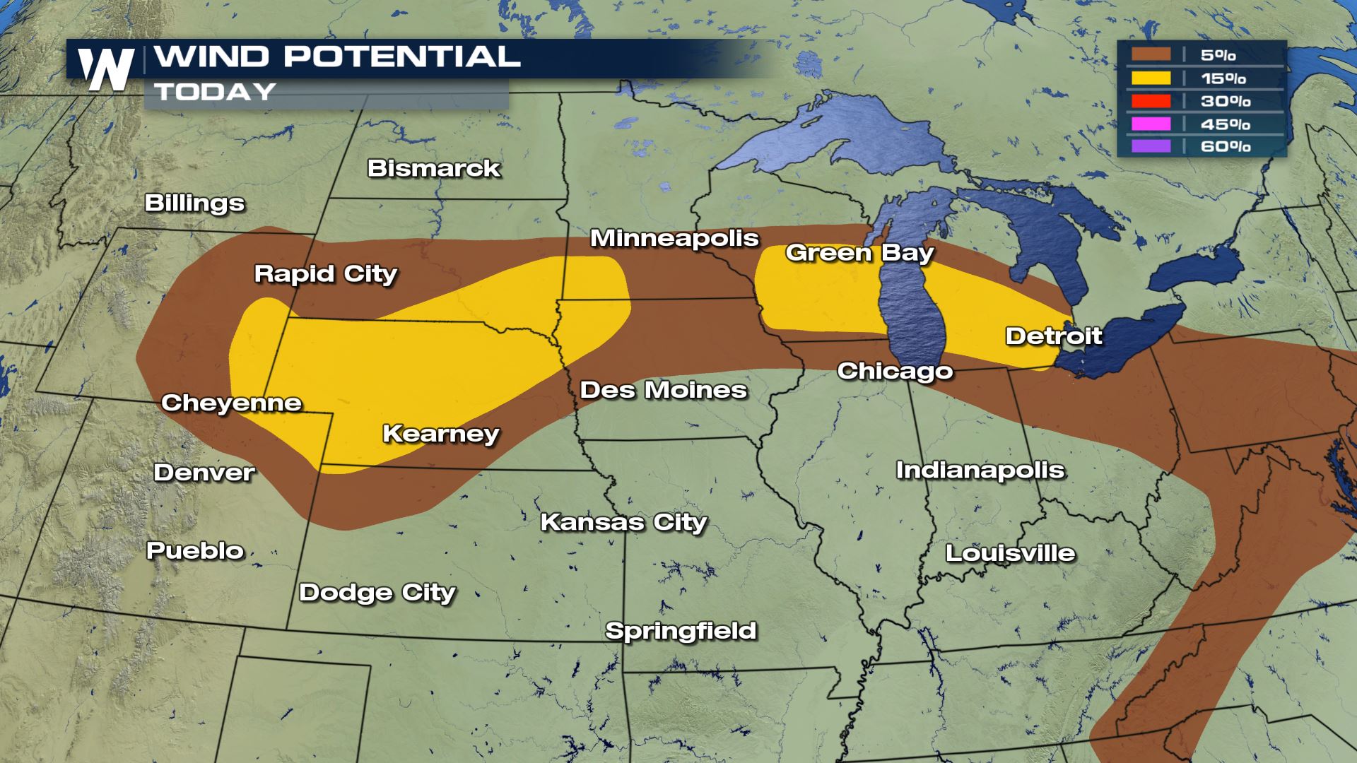
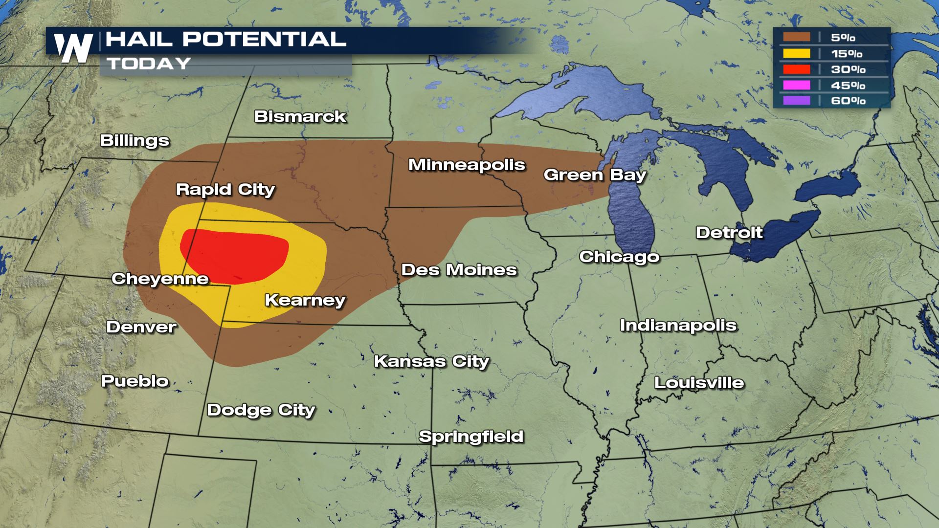
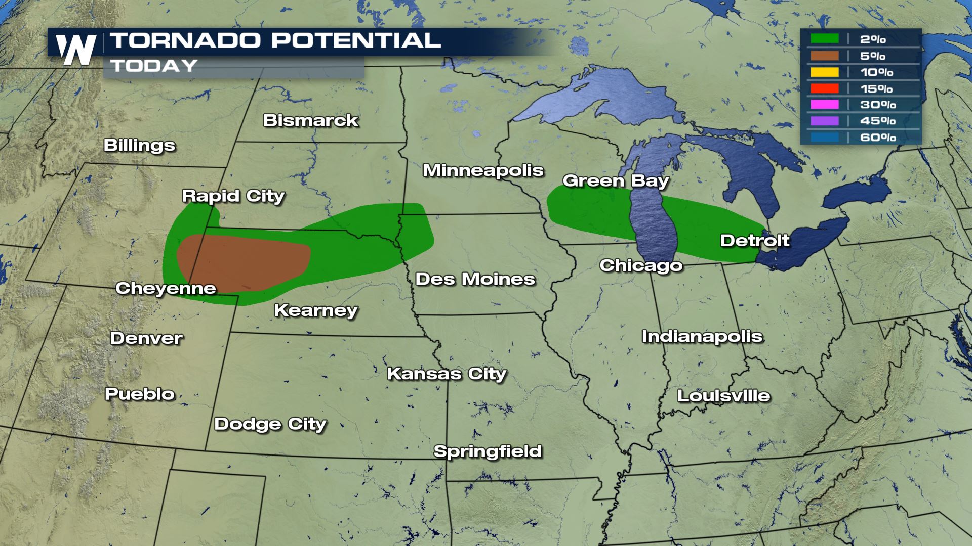 All modes of severe weather will be possible today including hail over 2" in diameter, winds greater than 70 mph and a few strong tornadoes. After what happened in Sioux Falls, South Dakota on Tuesday night, you want to be prepared for night time severe storms.
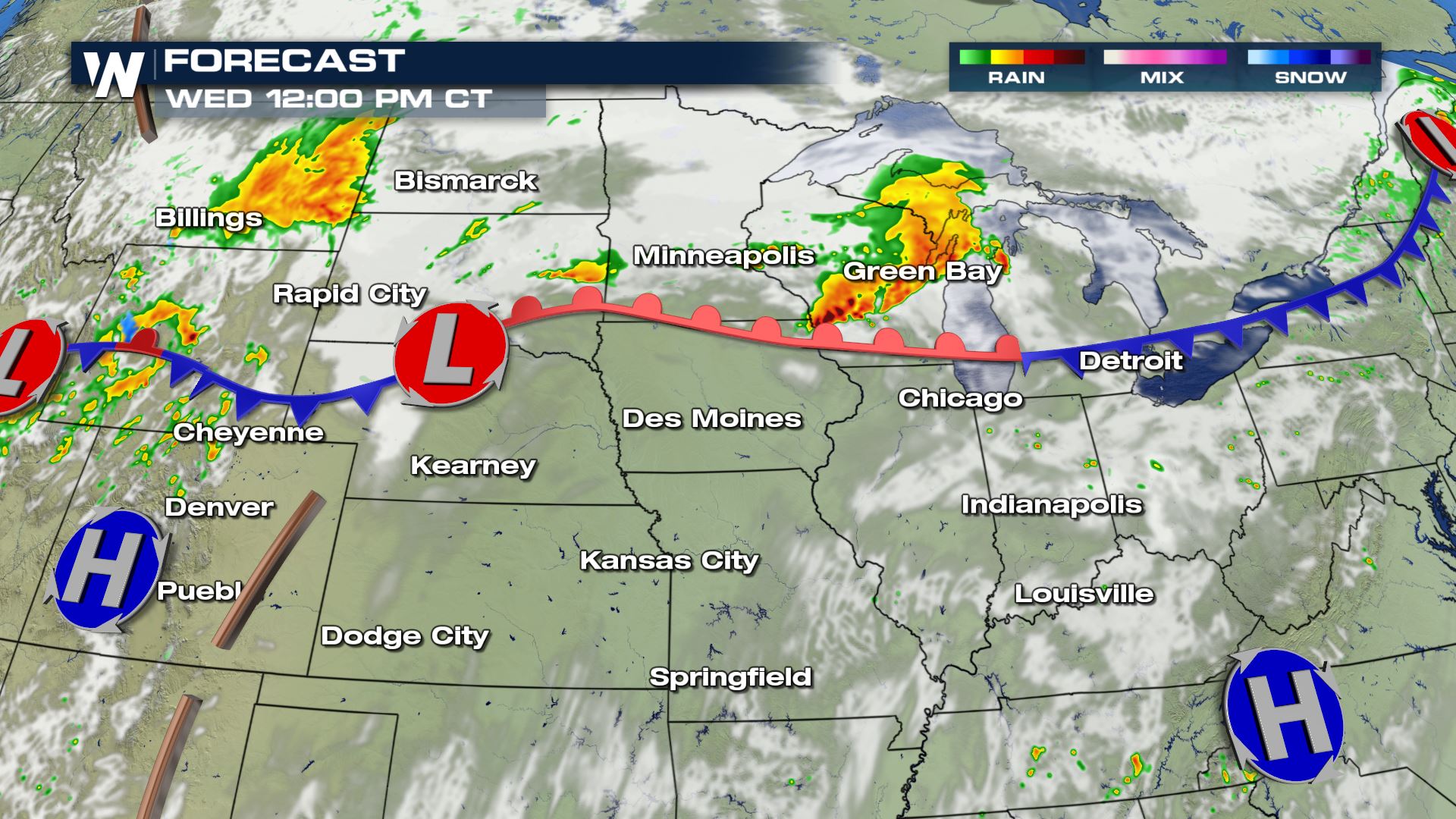
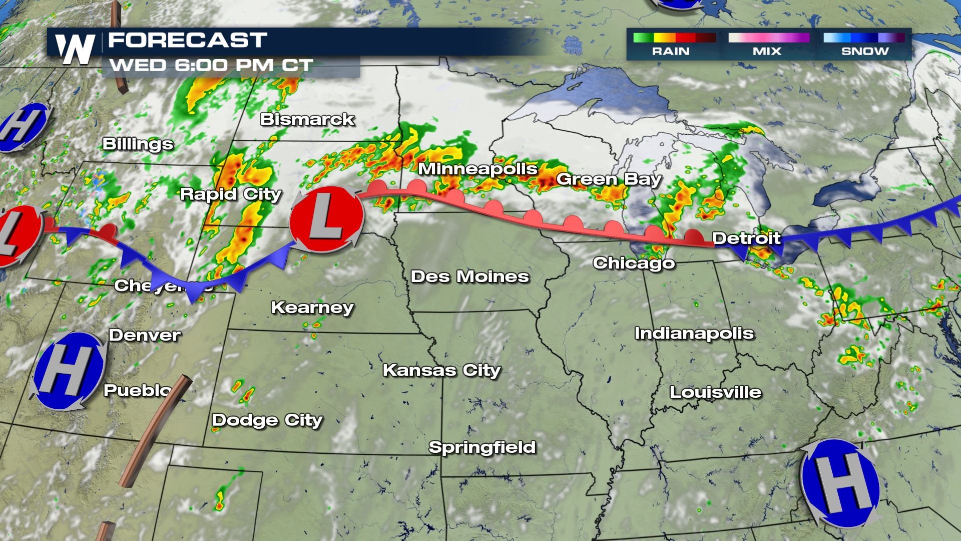
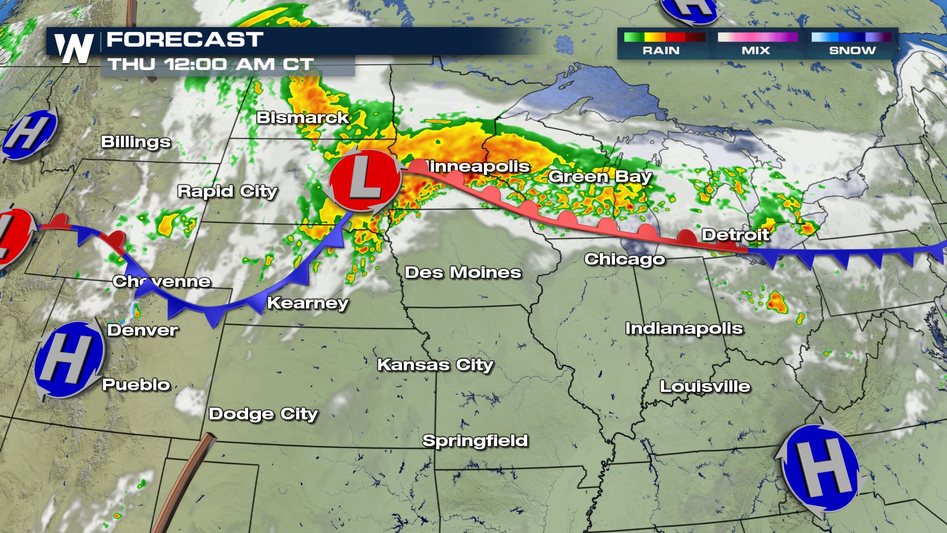 The timing for today's storms will be all afternoon and all evening. This is a situation where severe storms could be happening well past midnight also. You want to have a way to get alerts while you're sleeping.
Keep checking with WeatherNation for the latest updates.
The timing for today's storms will be all afternoon and all evening. This is a situation where severe storms could be happening well past midnight also. You want to have a way to get alerts while you're sleeping.
Keep checking with WeatherNation for the latest updates.
Severe Outlook
Severe storms will be possible anywhere from Wyoming and Colorado into the Great Lakes. All these areas will need to be weather aware for this afternoon and evening.
Severe Risks
All modes of severe weather will be possible today including hail over 2" in diameter, winds greater than 70 mph and a few strong tornadoes. After what happened in Sioux Falls, South Dakota on Tuesday night, you want to be prepared for night time severe storms.
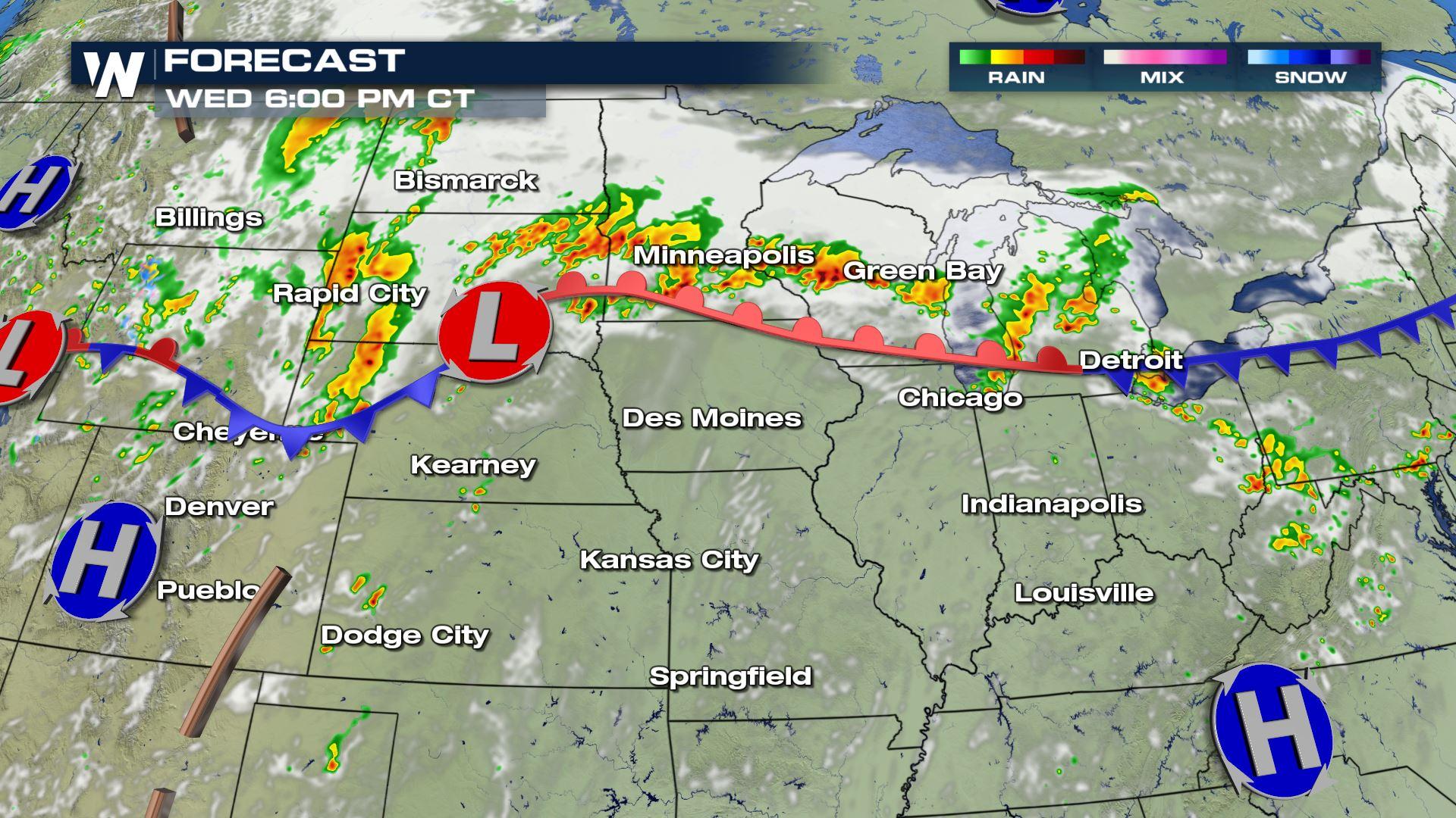
Forecast
The timing for today's storms will be all afternoon and all evening. This is a situation where severe storms could be happening well past midnight also. You want to have a way to get alerts while you're sleeping.
Keep checking with WeatherNation for the latest updates.
All Weather News
More
Tropics: Fausto Heads to Hawaii; Genevieve Will Become a Major Hurricane
Atlantic BasinBertha has dissipated after mov
25 Jul 2026 7:25 PM


Severe Storms Target the Midwest This Weekend
Extreme heat will be a big story this week ac
25 Jul 2026 7:10 PM

Heat Wave Grips Central, Western U.S.
Are you over the summer heat yet? SouthwestEx
25 Jul 2026 5:20 PM

Southeast Flood Risk Lingers Near Stalled Front
A stalled boundary over the Southeast will ke
25 Jul 2026 10:55 AM

Another Round of Storms Targets the Northeast
Tuesday brought severe weather again across p
23 Jul 2026 1:15 AM

Another Round of Severe Weather for the Upper Midwest and Great Lakes
The upper-level low train continues to keep t
21 Jul 2026 1:45 AM