Muggy and Stormy in the South

Top Stories
5 Jul 2026 8:40 PM
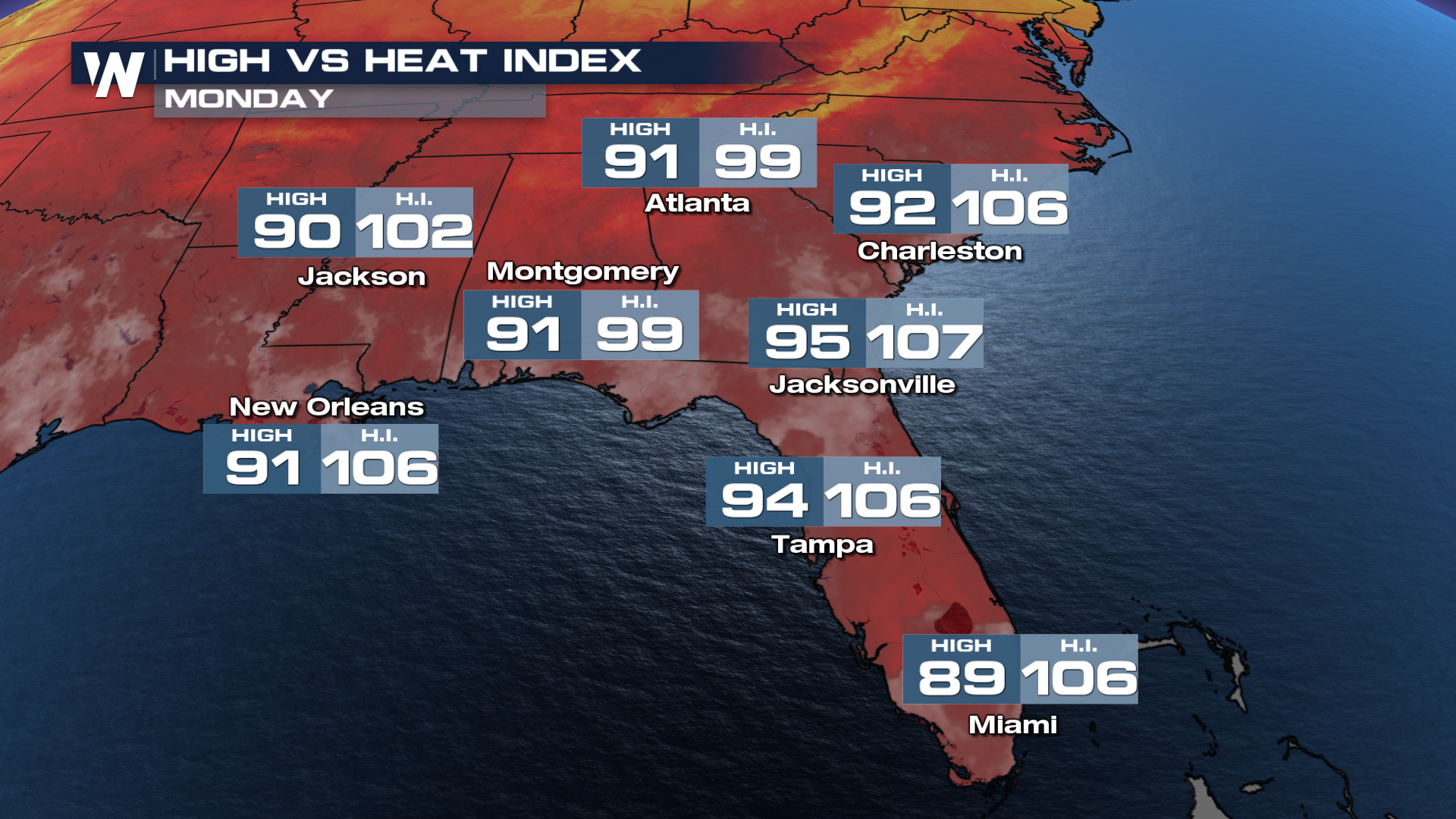
SOUTHEAST - It's been muggy and stormy in the southeast and as we wrap up the holiday-long weekend, that trend will continue. Forecast highs and heat index values through Monday will likely reach the triple digits all across the southeast. Cities like Charleston, SC, will be feeling like 110 through Monday.
 This heat and humidity will also help to drive diurnal thunderstorms (storms that are driven by daytime heating). There is a marginal risk across the southeast for severe weather through Monday morning but as we head into the day on Monday thunderstorms will continue to pop through the southeastern U.S.
All Weather News
More

Severe Storms Target the Midwest to the Northeast This Week
Extreme heat will be a big story this week ac
27 Jul 2026 1:50 AM


Tropics: Fausto Heads to Hawaii; Genevieve Rapidly Intensifying
Atlantic BasinBertha has dissipated after mov
27 Jul 2026 1:40 AM

Southeast Flood Risk Lingers Near Stalled Front
A stalled boundary over the Southeast will ke
25 Jul 2026 10:55 AM

Another Round of Storms Targets the Northeast
Tuesday brought severe weather again across p
23 Jul 2026 1:15 AM

Another Round of Severe Weather for the Upper Midwest and Great Lakes
The upper-level low train continues to keep t
21 Jul 2026 1:45 AM