Snowstorm Moves into the Midwest, Great Lakes

The powerful system responsible for blizzard conditions from Colorado to Iowa is now moving east, bringing heavy snow into the Midwest and Great Lakes today. Yesterday there was a large pileup on I-40 in New Mexico following those nasty conditions. Winds were clocked over 60 mph in the panhandle of Texas, leading to whiteout conditions on Monday. Now, dangerous road conditions are the focus in Iowa, Missouri, Illinois and Wisconsin.
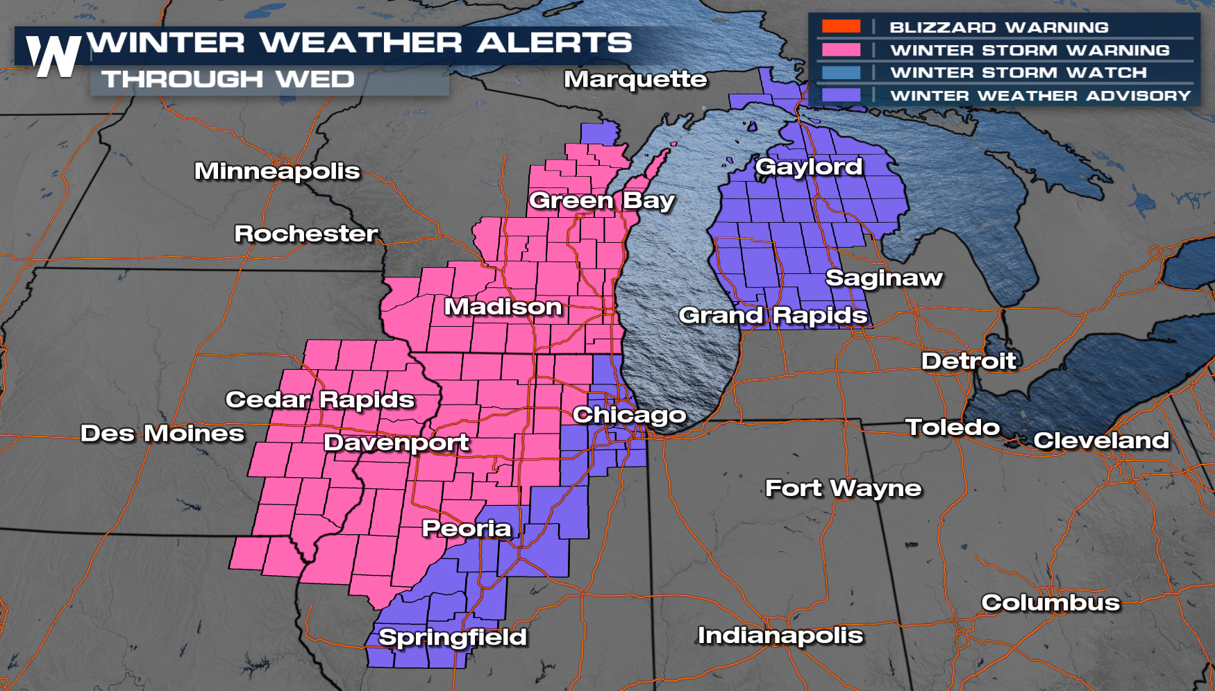
For the overnight hours, winter weather alerts remain in place from Iowa to Michigan into Wednesday. The highest amounts of snow will continue to likely fall around the Great Lakes. An additional 2"- 4" of snow will be possible!
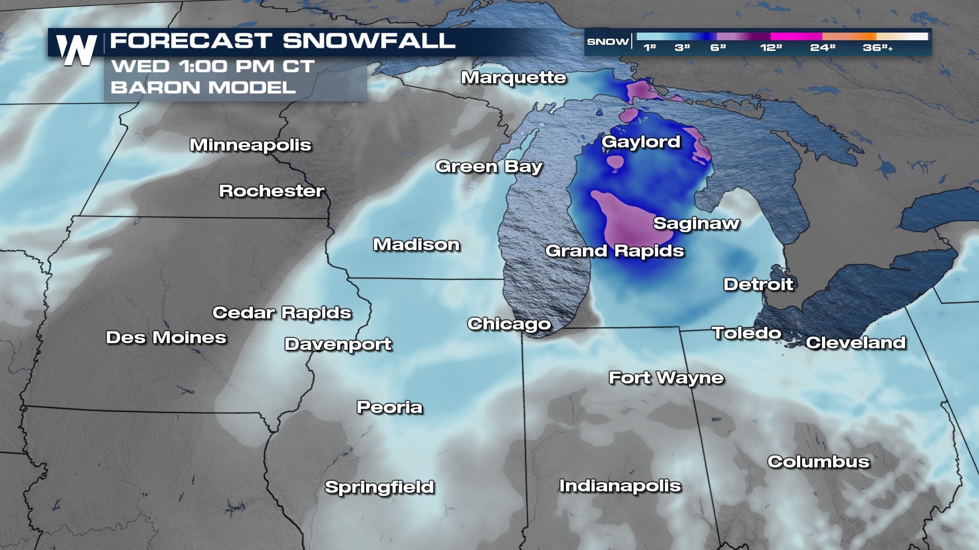 We will see light snow for the Ohio Valley but the big-time totals and low visibility will be into central Michigan with upwards of 8" possible. A few lingering snow showers and lake effect showers are possible on the backside of the system through Wednesday morning. As we look ahead more snow will follow an area of low pressure bringing another batch of snow for some including Kansas, Iowa and the Great Lakes.


