NASA & NOAA to Launch Weather Satellite Thursday
Special Stories
10 Nov 2022 1:00 AM
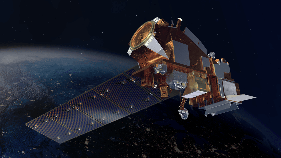
ABOVE - Photo credit: NASA. Joint Polar Satellite System-2 (JPSS-2)
NASA is set to launch the Joint Polar Satellite System-2 (JPSS-2) into orbit on on Thursday, November 10th at 1:25 am PST/4:25 EST from Vandenberg Space Force Base in California on an Atlas V 401 rocket! This is a slight delay from the original launch date of November 1st. https://twitter.com/NASA_LSP/status/1588275044534190080 JPSS-2 is the third satellite in a polar satellite series and partnership between NASA and the National Oceanic and Atmospheric Administration (NOAA). Polar satellites focus on the entire earth, moving from North to South Pole and seeing the same spot on Earth 2x/day - once during the day, the second at night. This is opposed to geostationary satellites that spin at the same rate of the Earth, centered over the equator at 22,000 feet and focus on the same area all the time. JPSS-2 will work to improve weather forecasts by providing information from above for meteorologists & scientists better predict the future. JPSS-2 will cross the equator 14 times per day, taking measurements from the Earth from the North Pole to South Pole. This means JPSS-2 will send back two full images of the Earth twice per day. According to NASA some of the instruments included are:At launch, JPSS-2 weighs 5,567 pounds and has four highly sophisticated instruments to measure weather and climate conditions on Earth:
- The Advanced Technology Microwave Sounder (ATMS) sees through clouds like an X-ray and can view the structure of the atmosphere underneath those clouds and inside of storms.
- The Visible Infrared Imaging Radiometer Suite (VIIRS) measures in the infrared and visible part of the spectrum and can image hurricanes, floods, dust storms, cloud patterns, ocean color, and help locate and map wildfires.
- The Cross-track Infrared Sounder (CrIS) works together with ATMS to take detailed measurements of the atmospheric conditions needed to generate extreme weather forecasts days in advance.
- The Ozone Mapping and Profiler Suite (OMPS) consists of sensors to track the concentration of ozone in the atmosphere and measure sulfur dioxide and other aerosols emitted from volcanoes and particulates from wildfires.
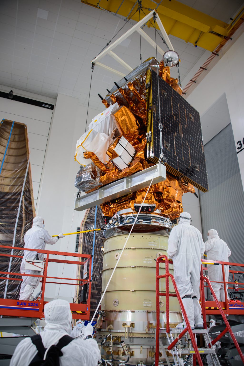
Photo credit: USSF 30th Spacewing/Aaron Taubman via NASA Crane lowers the National Oceanic and Atmospheric Administration’s (NOAA) Joint Polar Satellite System-2 (JPSS-2) onto the Low-Earth Orbit Flight Test of an Inflatable Decelerator (LOFTID) payload
In addition to the NOAA satellite, there is a secondary piece of equipment going up in the Launch on Tuesday. The Low-Earth Orbit Flight Test of an Inflatable Decelerator, or LOFTID, is a test of an inflatable heat shield during reentry. The goal of the LOFTID mission is to prepare for future missions to Mars or Venus. The LOFTID will be deployed just before the JPSS-2 reaches the polar orbit.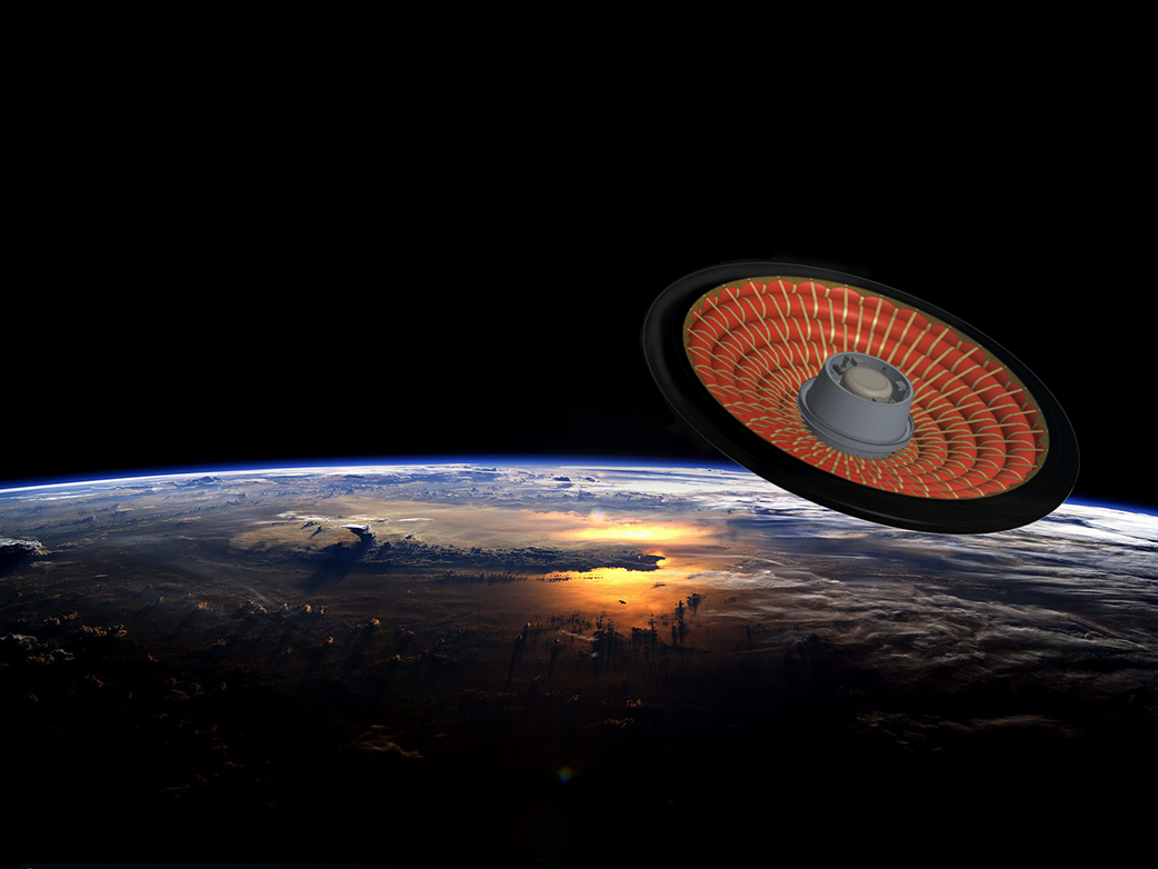
Photo credit: NASA Low-Earth Orbit Flight Test of an Inflatable Decelerator (LOFTID)
The launch is set for 5:25 am EDT/2:25 am PDT on Tuesday. Live coverage from NASA can be accessed here.All Weather News
More
More Storms for the East Through Monday
A low-pressure system that moved through the
2 Aug 2026 10:40 PM

Wildfire Outbreak in the Pacific Northwest
SPOKANE, WA - On Saturday, August 1st, the Ol
2 Aug 2026 10:35 PM


After Reaching Category 5, Genevieve Weakens in the Pacific
PacificGenevieve formed on last Friday south
2 Aug 2026 6:25 PM

Flooding, Severe Storms Target the Midwest Again
After an active week of storms across the nor
1 Aug 2026 1:40 AM

Flooding Risk Increases as Heavy Rain Targets the Tri-State Area
Tuesday, heavy rainfall moved across the Nort
30 Jul 2026 12:25 AM

Severe Weather: Energy From the Midwest Now in the Southeast
UPPER MIDWEST - Through Monday, dangerous tor
29 Jul 2026 10:30 PM