National Snow Coverage Down to Lowest Level since November
Top Stories
30 Mar 2020 11:59 AM
It's a sure sign of spring.
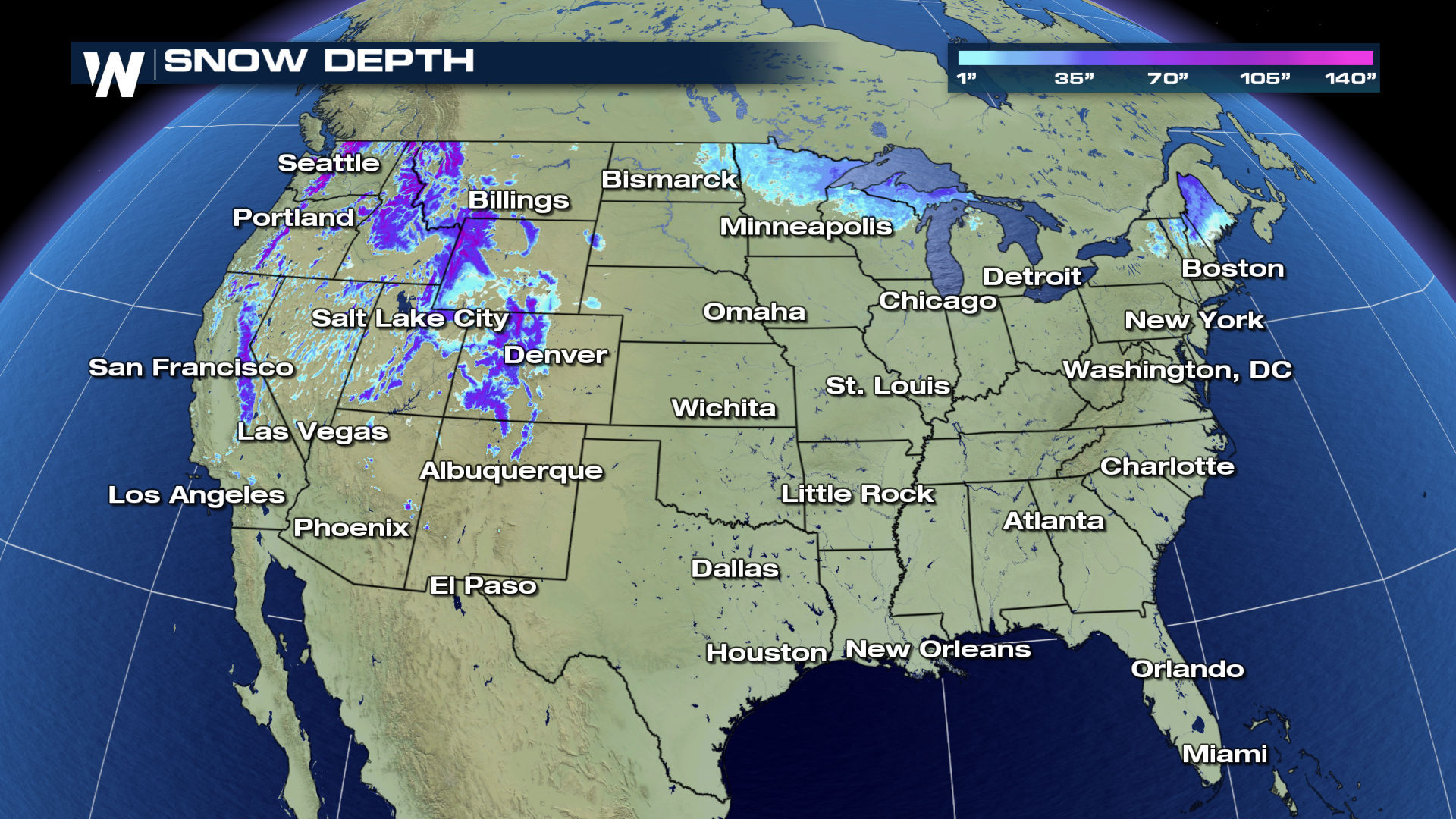
National snow coverage figures are down considerably from earlier this month, and they're down to the lowest levels since late November.
According to official data from the National Operational Hydrologic Remote Sensing Center (NOHRSC), 13.5 percent of the lower 48 states were covered in snow, as of Monday.
The biggest snow gap areas were in the Midwest and Northeast, where hardly any snow was on the ground as of Monday's update. Only a few patchy areas of snow were visible in northern Minnesota, Wisconsin and Michigan in the Midwest, and only the higher terrain of northern New England and New York had it in the Northeast.
 While averages aren't available, the 13.5 percent figure is lower than 2019 (23 percent) levels and it's also lower than those from three of the past four years.
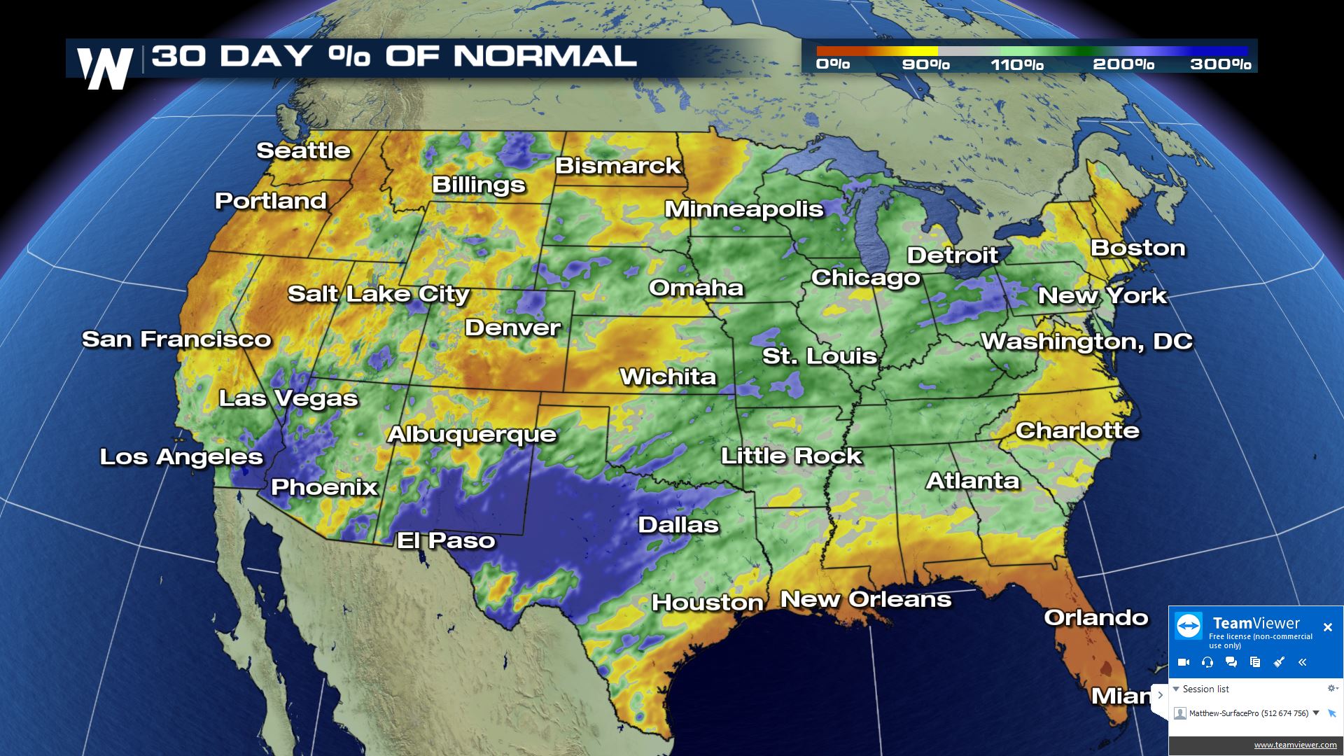
There's little doubt this rapid snow melt has been buoyed by balmy temperatures of late. Most of the eastern third of the United States is running above average temperature-wise so far this month, which has likely helped reduce overall snow levels there. In the Northeast, a generally drier 30-day pattern is probably helping to suppress snow levels across the Northeast.
 While a bit of snow could be in the offing for some this week, there's little to suggest that there will be any sort of big boost to overall nationwide snowpack levels over the next few weeks. Both the shorter- and longer-term outlooks trend mild across the eastern two-thirds of the country, the part that is lagging the most in terms of its snowpack.
Stay with WeatherNation for the latest.
 While averages aren't available, the 13.5 percent figure is lower than 2019 (23 percent) levels and it's also lower than those from three of the past four years.
There's little doubt this rapid snow melt has been buoyed by balmy temperatures of late. Most of the eastern third of the United States is running above average temperature-wise so far this month, which has likely helped reduce overall snow levels there. In the Northeast, a generally drier 30-day pattern is probably helping to suppress snow levels across the Northeast.
 While a bit of snow could be in the offing for some this week, there's little to suggest that there will be any sort of big boost to overall nationwide snowpack levels over the next few weeks. Both the shorter- and longer-term outlooks trend mild across the eastern two-thirds of the country, the part that is lagging the most in terms of its snowpack.
Stay with WeatherNation for the latest.
While a bit of snow could be in the offing for some this week, there's little to suggest that there will be any sort of big boost to overall nationwide snowpack levels over the next few weeks. Both the shorter- and longer-term outlooks trend mild across the eastern two-thirds of the country, the part that is lagging the most in terms of its snowpack.
Stay with WeatherNation for the latest.All Weather News
More