Nation's Next Big Winter Storm
Top Stories
10 Feb 2018 4:52 PM
Nation's Next Big Winter Storm
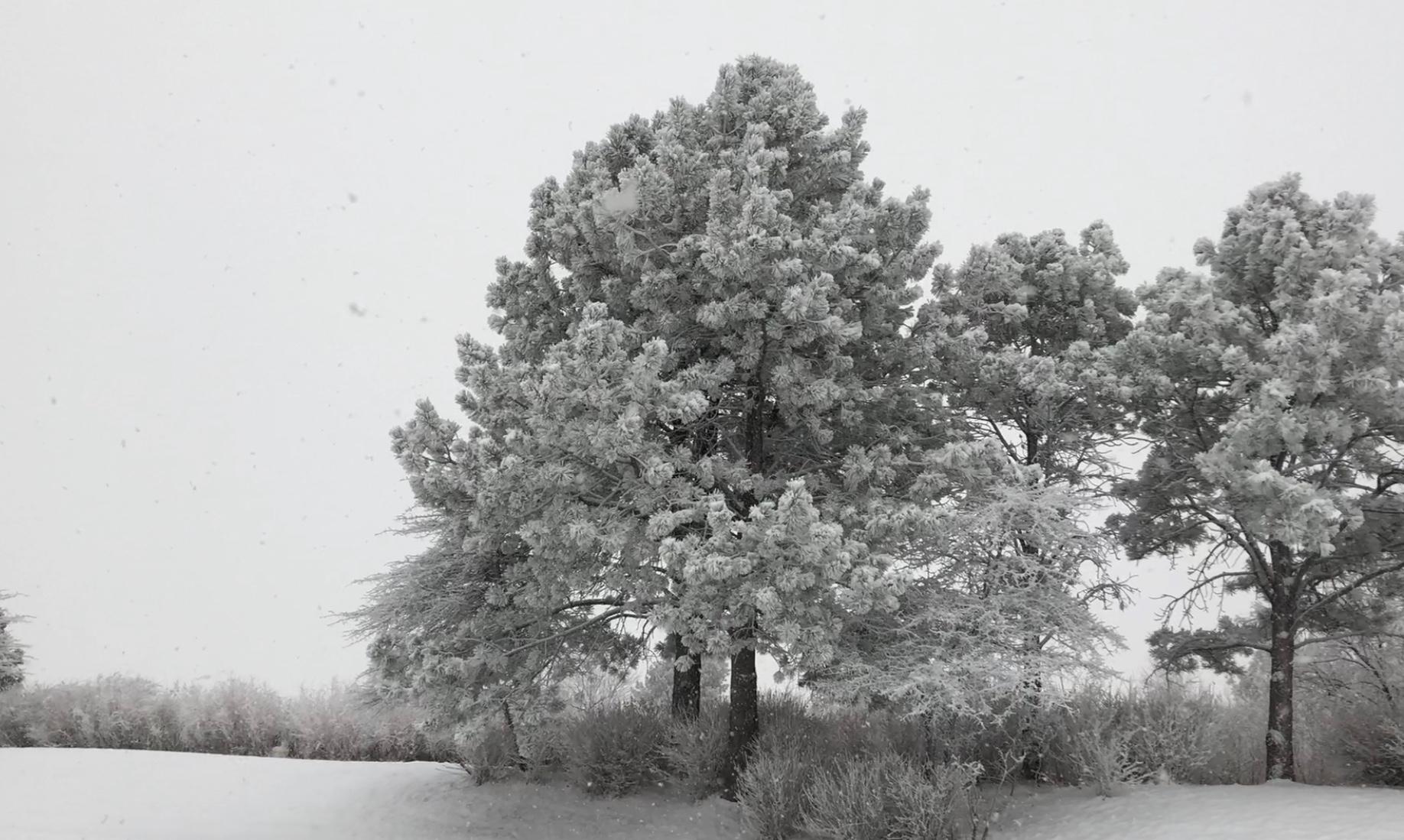
Denver, CO is a city that one usually associates with snow during the winter season. However, this year, the Mile High City has only seen 13.2" of the white gold since September. Although Denver saw another healthy dose of snowfall Saturday, with some spots getting as much as 8.0" of snow, this powerful system continues to tack to the east.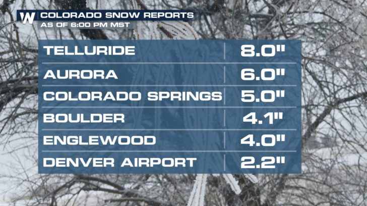 https://twitter.com/WeatherNation/status/962451160027185152
As this system tracks further to the east, we will see everything from snow to ice to a chance of severe weather in the southeast. Travel on Monday, through parts of I-70 and I-80 in Kansas, Missouri, and Nebraska could be hazardous. While northern states will see snow, a line of ice stretching from Texas through New England could develop through Monday afternoon.
https://twitter.com/WeatherNation/status/962451160027185152
As this system tracks further to the east, we will see everything from snow to ice to a chance of severe weather in the southeast. Travel on Monday, through parts of I-70 and I-80 in Kansas, Missouri, and Nebraska could be hazardous. While northern states will see snow, a line of ice stretching from Texas through New England could develop through Monday afternoon.
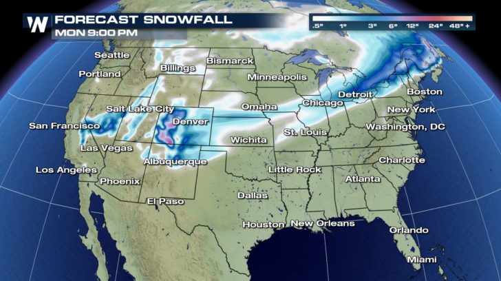 Snowfall Forecast through Monday Evening
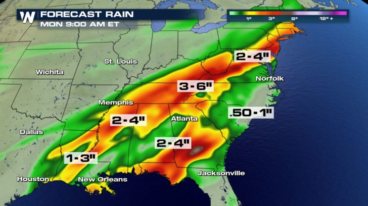 Rain Forecast through Monday Morning
Think you can predict snowfall amounts?
While winter weather moves into parts of the Midwest through New England, flooding rain is possible through the southeast with some localized areas seeing nearly six inches of rain. Along with the flooding threat, the threat for severe weather returns Sunday and Monday.
Rain Forecast through Monday Morning
Think you can predict snowfall amounts?
While winter weather moves into parts of the Midwest through New England, flooding rain is possible through the southeast with some localized areas seeing nearly six inches of rain. Along with the flooding threat, the threat for severe weather returns Sunday and Monday.
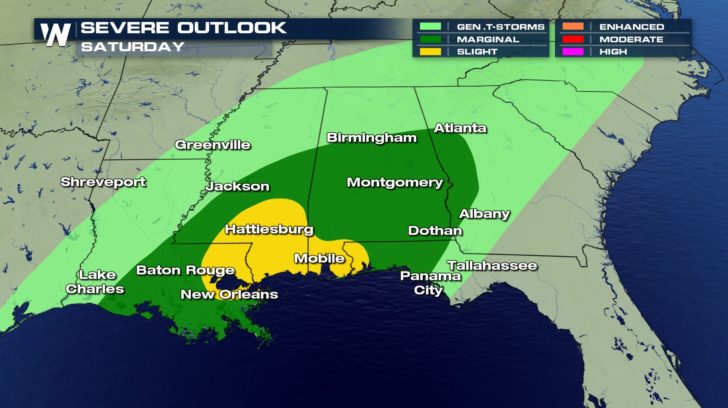 Severe Outlook Saturday
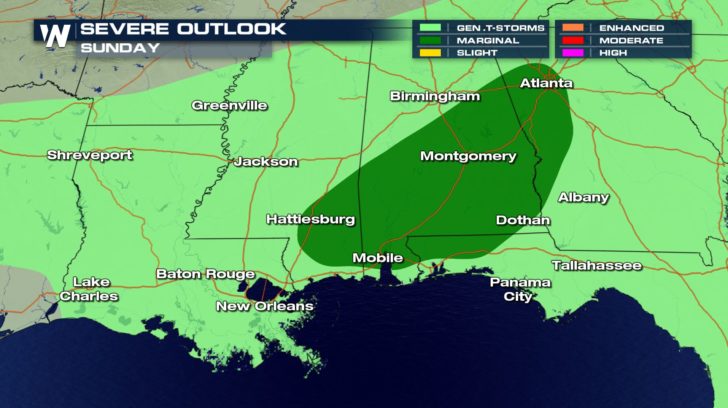 Severe Outlook Sunday
Detailed Severe Weather Outlook
As Sunday and Monday come to an end, the chance of snow returns to the Rocky Mountain West for your Tuesday.
For WeatherNation - Josh Cozart
Severe Outlook Sunday
Detailed Severe Weather Outlook
As Sunday and Monday come to an end, the chance of snow returns to the Rocky Mountain West for your Tuesday.
For WeatherNation - Josh CozartAll Weather News
More
Hurricane Flossie Now A Major Hurricane
Hurricane FlossieThe National Hurricane Cente
2 Jul 2025 3:00 AM

NHC Monitoring Front in the Southeast Ahead of 4th of July
SOUTHEAST - A frontal boundary moving through
2 Jul 2025 3:00 AM

Where Rain Could Dampen Holiday Travel Plans
AAA is expecting over 70 million travelers to
2 Jul 2025 2:35 AM


Western Heat Continues With Some Relief
A large dome of hot, high pressure remains ac
2 Jul 2025 2:00 AM

Severe Storms For the East Coast Through Tuesday
A cold front moving through a moist airmass h
2 Jul 2025 1:00 AM

Severe Weather Threat Continues in the Midwest
It has been an active, severe season across t
30 Jun 2025 9:00 PM