More Heavy Snow in Northern Tier of the Country

Special Stories
22 Oct 2020 9:00 AM
A powerful upper low and cold front is bringing very heavy snow to parts of the northern U.S. Winter weather alerts remain in effect for the threat of heavy snow and hazardous travel from the Great Lakes to the Northwest. Several inches have already fallen from Minnesota to Montana.
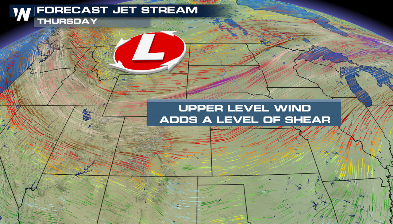 A strong upper-level jet stream diving south out of Canada, along with a cold front at the surface, will act together to bring another blast of cold air and snow to the northern U.S. Right now, the ingredients are lining up to produce heavy snow throughout Montana, northern Wyoming, parts of North Dakota, South Dakota and northern Minnesota.
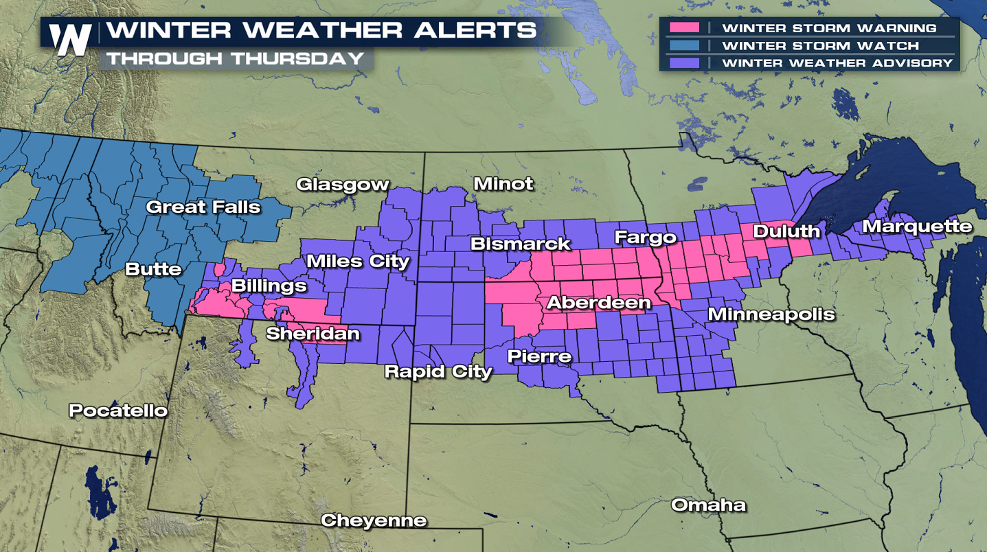 Winter weather alerts have been issued across parts of the northern U.S. Travel conditions will be hazardous and roads will be slick. The strong winds associated with this storm could also bring blowing and drifting snow.
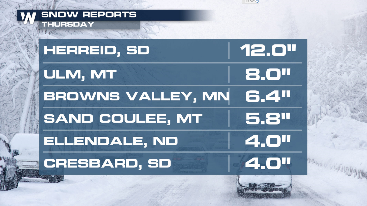
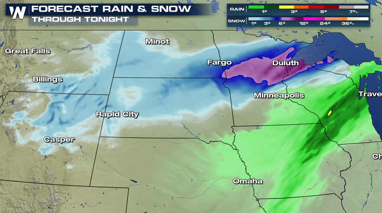 Widespread 4-6" of snow is expected with some totals higher than 12" in localized areas. The mountains could easily accumulate 1 to 2 feet of snow along with other higher terrain areas.
 This wave of snow will add to preexisting snow that already fell from previous Alberta clipper systems. The greatest new snow accumulation is expected across central North Dakota and into northwest Minnesota.
Keep checking with WeatherNation for all the latest snow updates.
This wave of snow will add to preexisting snow that already fell from previous Alberta clipper systems. The greatest new snow accumulation is expected across central North Dakota and into northwest Minnesota.
Keep checking with WeatherNation for all the latest snow updates.
Upper-Level Pattern
A strong upper-level jet stream diving south out of Canada, along with a cold front at the surface, will act together to bring another blast of cold air and snow to the northern U.S. Right now, the ingredients are lining up to produce heavy snow throughout Montana, northern Wyoming, parts of North Dakota, South Dakota and northern Minnesota.
Alerts
Winter weather alerts have been issued across parts of the northern U.S. Travel conditions will be hazardous and roads will be slick. The strong winds associated with this storm could also bring blowing and drifting snow.
Widespread 4-6" of snow is expected with some totals higher than 12" in localized areas. The mountains could easily accumulate 1 to 2 feet of snow along with other higher terrain areas.
Forecast
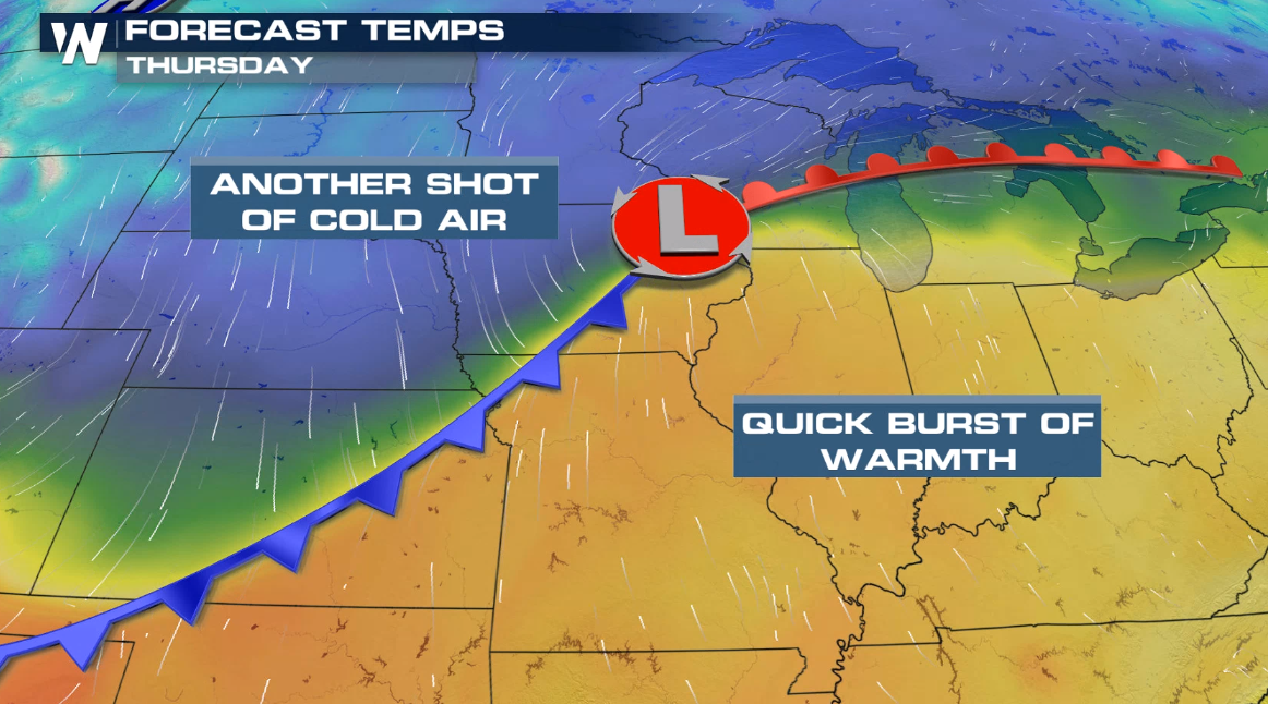
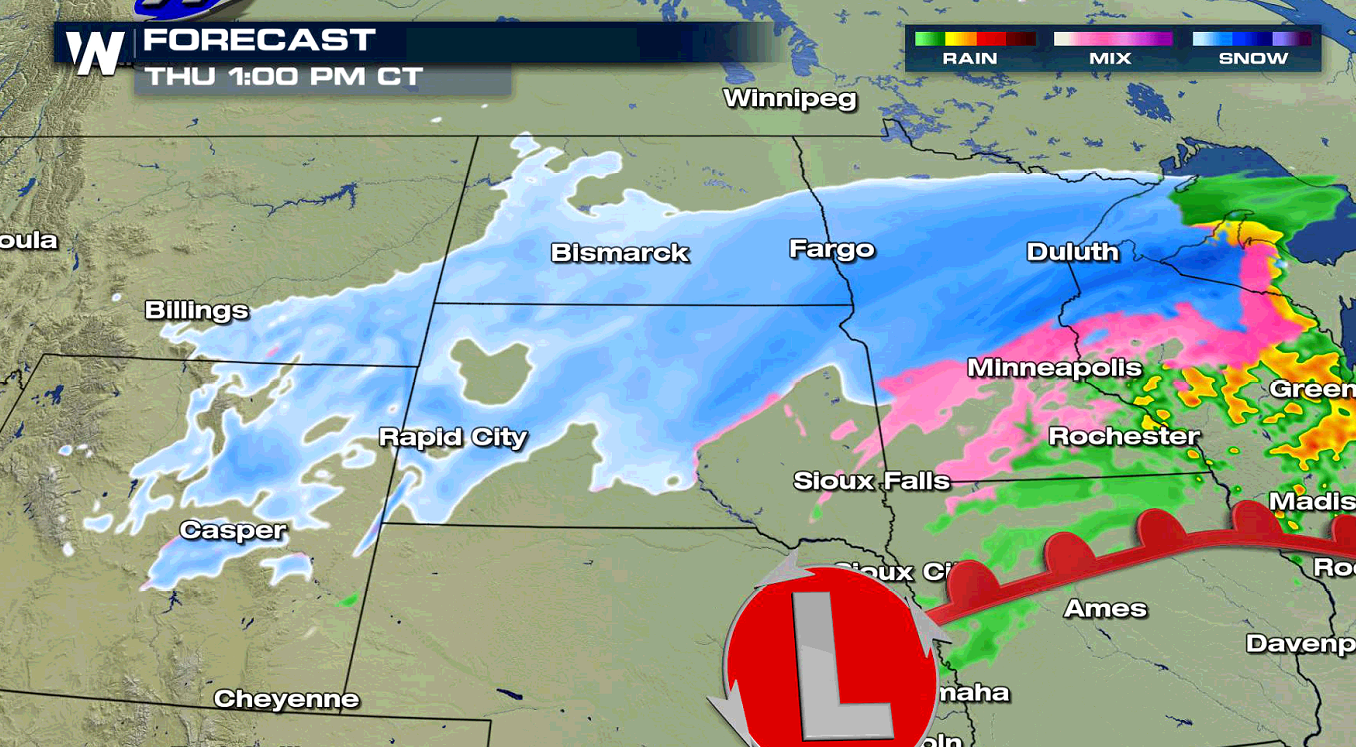
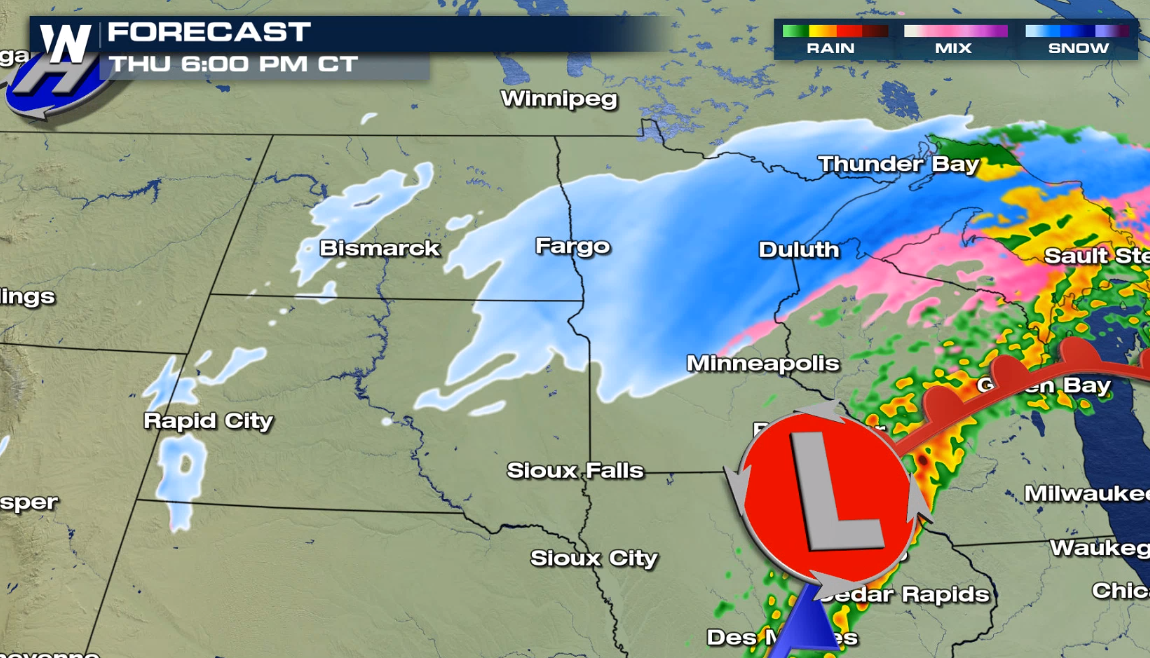
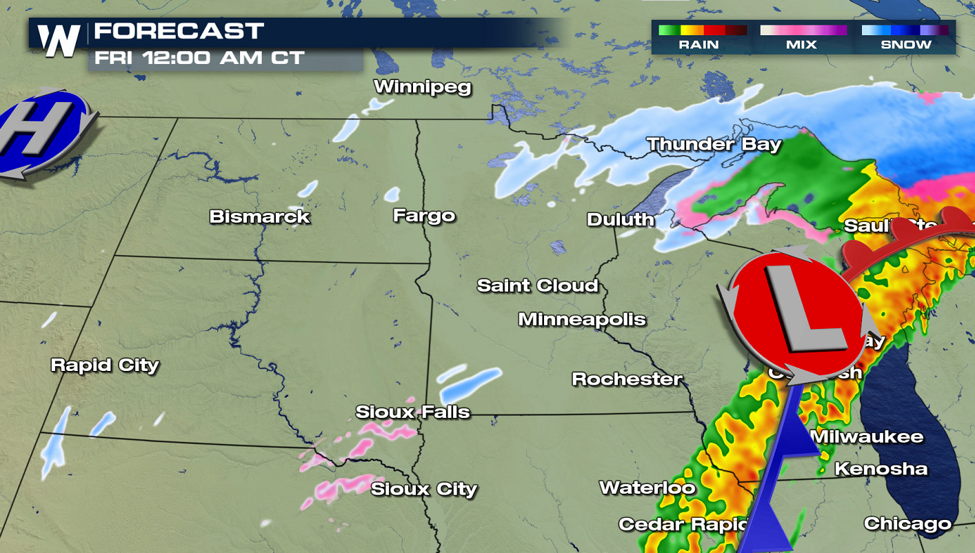
Although snow will be ongoing at times throughout the day in parts of Montana and Wyoming, the snow is expected to increase throughout the day (Thursday) into early Friday morning. By Friday midday, most of the snow will then be in Canada.
This wave of snow will add to preexisting snow that already fell from previous Alberta clipper systems. The greatest new snow accumulation is expected across central North Dakota and into northwest Minnesota.
Keep checking with WeatherNation for all the latest snow updates.All Weather News
More
Wildfire Outbreak in the Pacific Northwest
SPOKANE, WA - On Saturday, August 1st, the Ol
2 Aug 2026 7:20 PM

More Storms for the East Through Monday
A low-pressure system that moved through the
2 Aug 2026 7:20 PM


After Reaching Category 5, Genevieve Weakens in the Pacific
PacificGenevieve formed on last Friday south
2 Aug 2026 6:25 PM

Flooding, Severe Storms Target the Midwest Again
After an active week of storms across the nor
1 Aug 2026 1:40 AM

Flooding Risk Increases as Heavy Rain Targets the Tri-State Area
Tuesday, heavy rainfall moved across the Nort
30 Jul 2026 12:25 AM

Severe Weather: Energy From the Midwest Now in the Southeast
UPPER MIDWEST - Through Monday, dangerous tor
29 Jul 2026 10:30 PM