Great Lakes Storms, High Plains Winds, and Cooler Air

GREAT LAKES - A large trough has been moving over the northern U.S. since early this week, bringing along with it gusty winds, scattered showers, and cooler temperatures.
As the upper-level trough and surface front move over the Great Lakes, they'll continue to usher in cooler air above warmer sea surface temperatures. The contrast between the two can enhance lake-effect showers. It's not quite cold enough for lake-effect snow with this system. These off-and-on showers, which have been dragging over the Great Lakes, will begin to wind down as we head into the weekend.
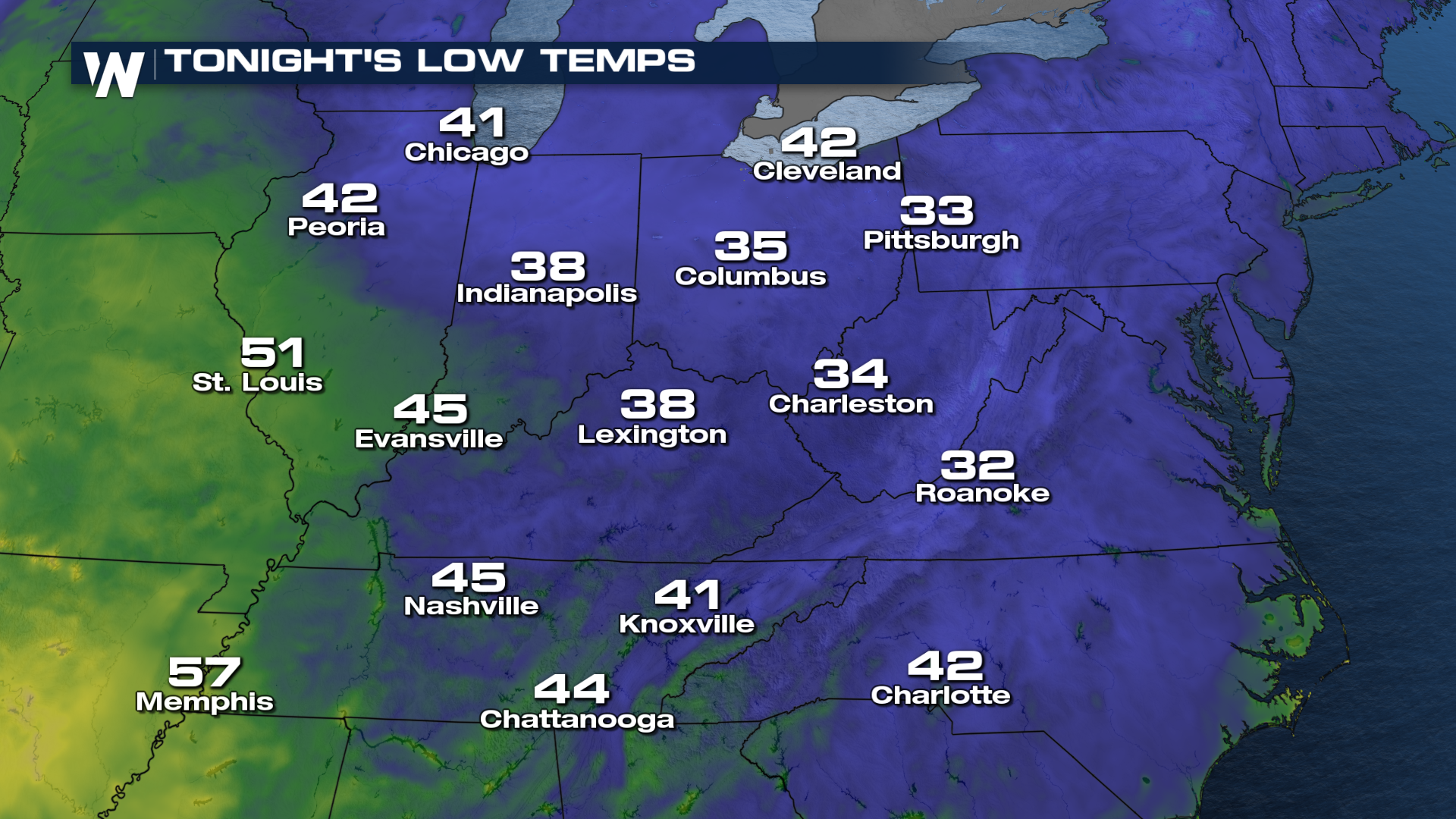
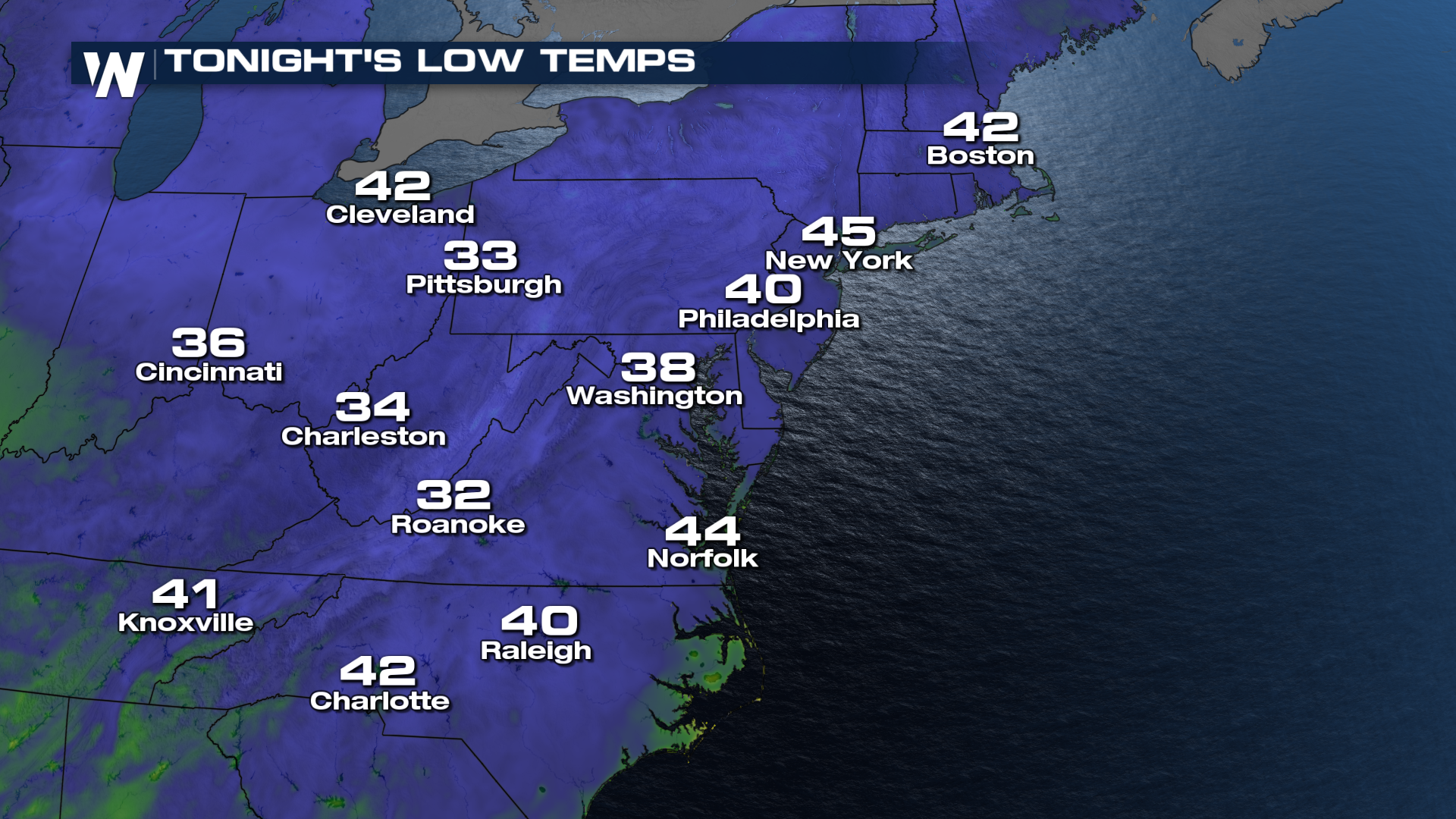
With cold temperatures also being ushered in, temperatures tonight will drop into the 30s and 40s from the Great Lakes down to the Carolinas.
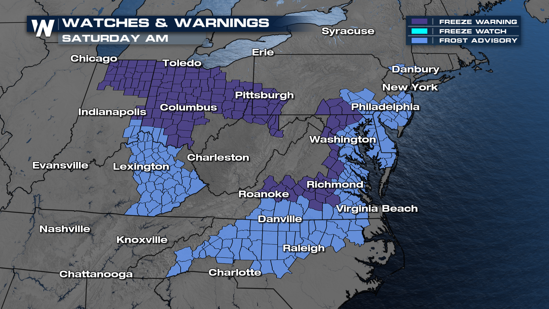
As a result, Frost Advisories and Freeze Warnings have been issued again for Saturday morning.
For more details on what the forecast looks like once this low moves out, be sure to join us LIVE on WeatherNation, which streams 24/7.


