Spring Snow in California Bolsters Snowpack
Snow is falling again on the West Coast thanks to yet another area of low pressure that keeps winter kicking into Friday. Several peaks in the Cascades and the Sierra Nevada could see over a foot of snow, with isolated totals over 2' by Friday. This snowfall will be beneficial ahead of the Spring melt.
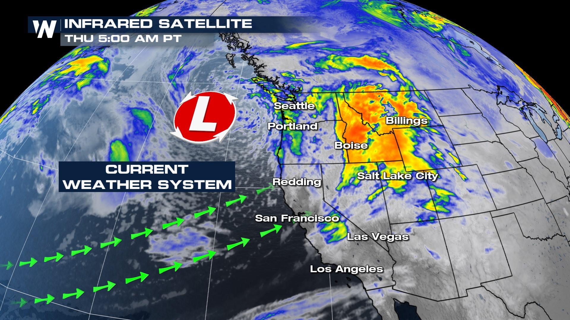
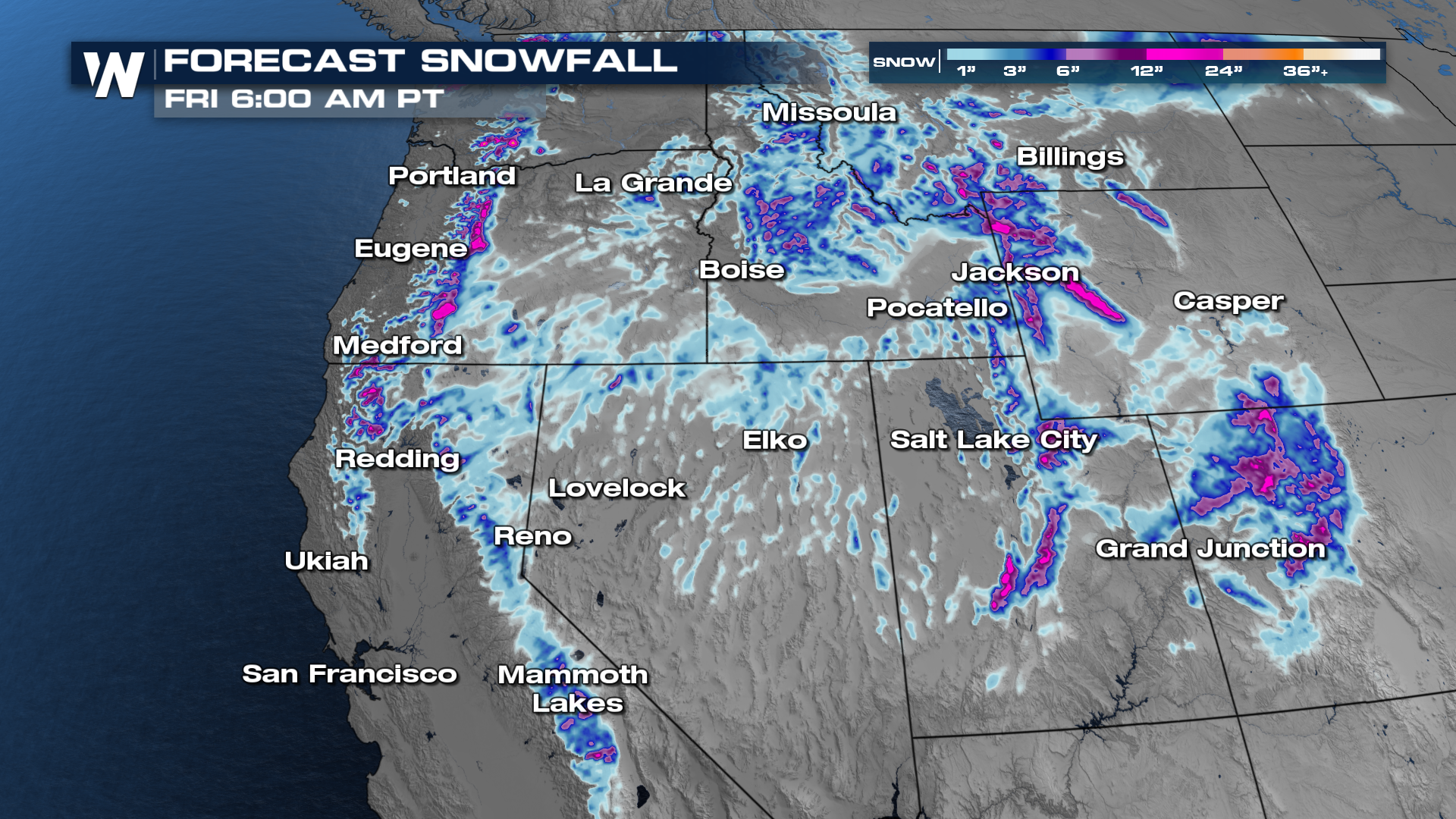 Rain and snow continue as a weak low moves onshore today. The activity on Thursday and Friday morning will be more concentrated in the Pacific Northwest and northern Rockies, rather than the central Sierra. Lingering snow showers are possible through Thursday night in California, as an area of low pressure will bring another round of moisture for the weekend.
Moderate to heavy rainfall will be another large component of this frontal boundary moving through. The foothills and the coastline have the highest chance of seeing 2-4"+ of rain as this system pushes eastward. Rainfall will continue through tonight, with a brief break ahead of our next storm system this weekend.


