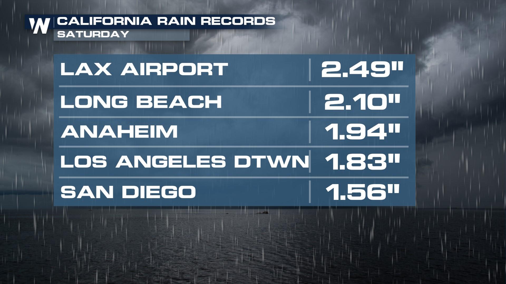
More Rainfall Records Fall out West
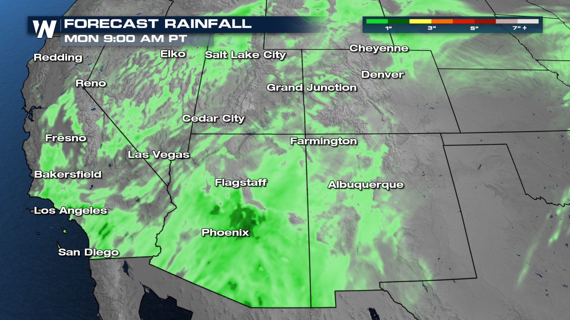
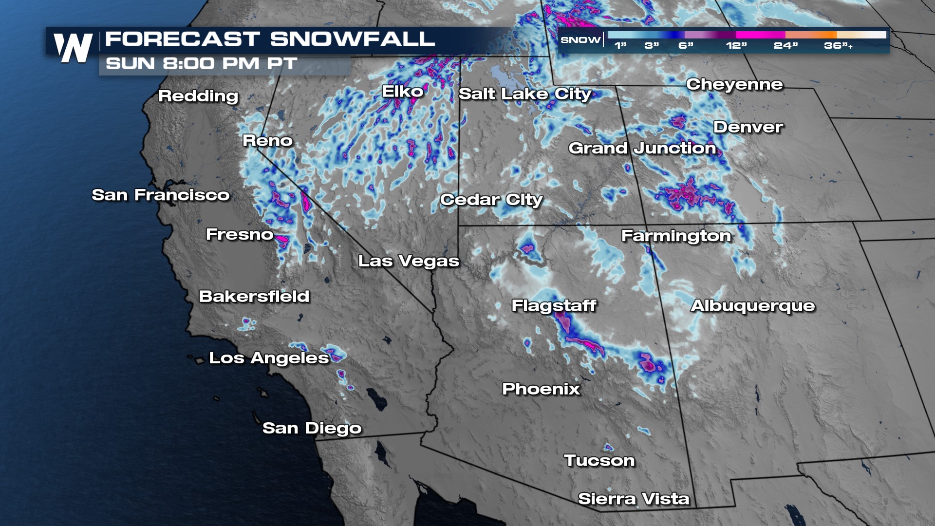
Pockets of rain showers and isolated thunderstorms will continue into Sunday across parts of California and Nevada, as well as the Four Corners. The higher elevations will see heavy snowfall, with the potential for snow during the day as temperatures stay cold enough. Snow will fall in the San Gabriel and San Bernardino Mountains outside Los Angeles. Rain and snow start to taper by Sunday night before energy slides into the Four Corners with rain and snow expected.
Flooding
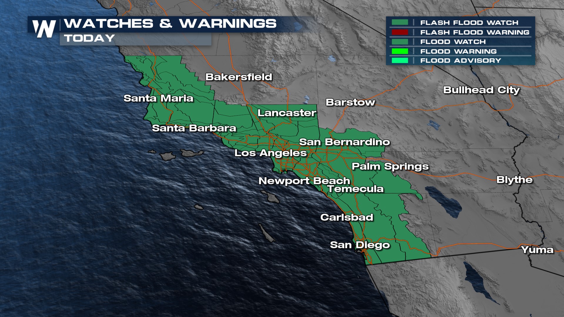
Our primary threat will be heavy rain and subsequent flash flooding. This will be possible in southern California cities including San Diego and Los Angeles. Flooding will be likely, especially where poor drainage could lead to mudslides, debris flows, and ponding of water on the roadway.
 Flood Watches are in effect for Southern California through Sunday. Never drive through flooded roads. Remember, "Turn Around, Don't Drown."
 Snow
Snow
Heavy snow is likely in the highest peaks, where upwards of another foot of snow will be possible on the mountain summits. Traveling on I-80 and HWY 50 could be quite challenging. Interstates 40 and 70 could also be difficult across the Four Corners. Still, this late Spring snow is a good thing because it contributes to reservoir levels and spring ski potential.
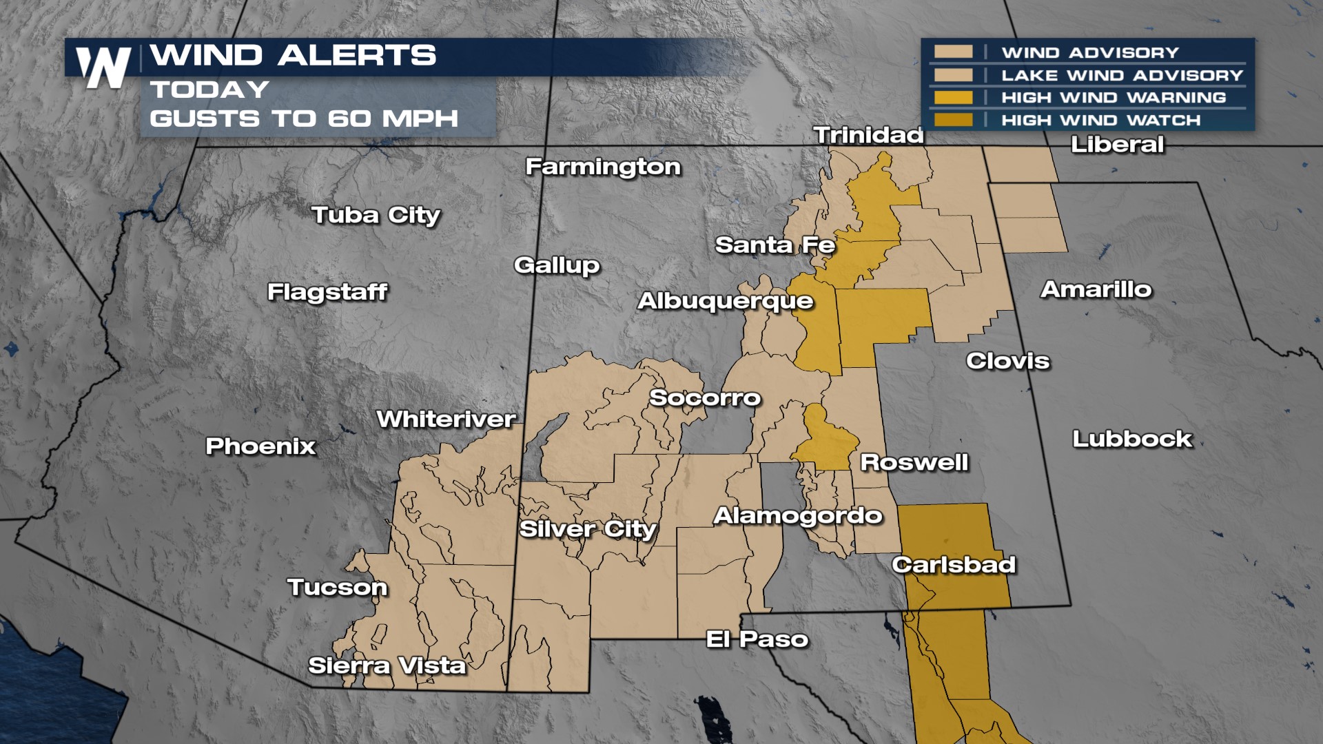
Wind
The incoming system will be quite windy too, resulting in widespread wind alerts through Arizona and New Mexico. Watch out for areas of blowing dust on the Plains and snow in the highest elevations.
 Stay with WeatherNation for the latest on the weekend West Coast system.


