NOAA & NASA Investigation Completed into GOES-17 Satellite Malfunctions
Special Stories
7 Aug 2019 1:35 AM
During the instrument check-out phase after GOES-17’s March 1, 2018 launch, engineers discovered the ABI’s infrared detectors could not maintain the required temperatures in certain orbital conditions.
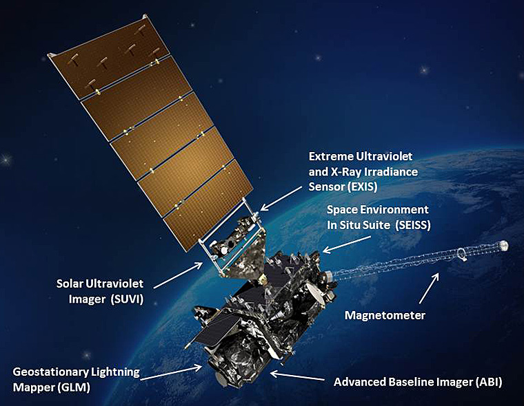
 [GOES-R satellite showing instruments with Earth in the background. Credits: NASA]
The board, which NOAA and NASA appointed, concluded that the blockage restricted the flow of coolant in the pipes, causing the ABI electronics to overheat, reducing the sensitivity of its infrared sensors.
Engineers were able to mitigate the issue through operational changes to the instrument and mission operations, including the use of Artificial Intelligence techniques, to restore most of the ABI’s functionality. The GOES-17 ABI is now projected to deliver more than 97 percent of the data it was designed to provide.
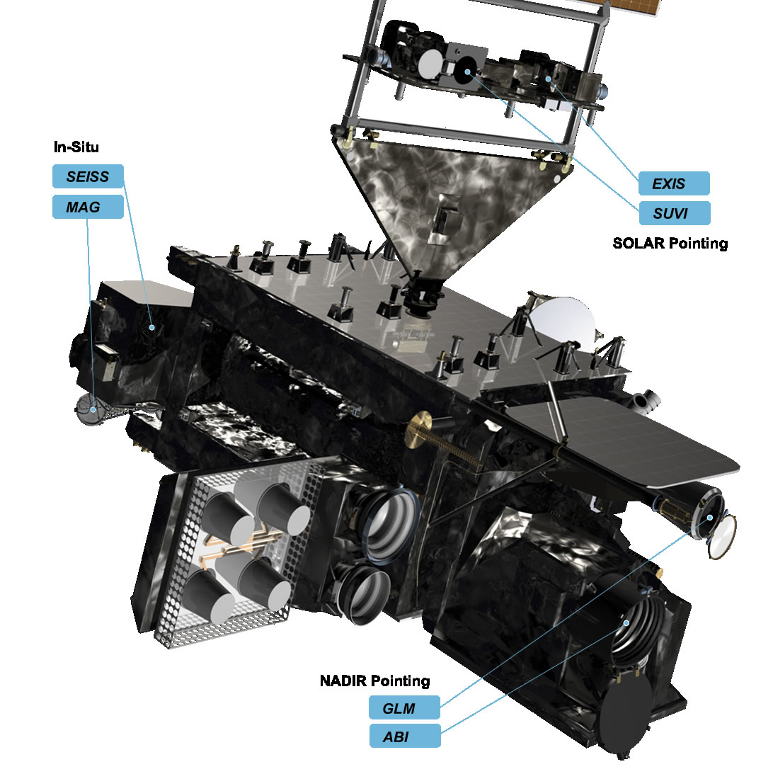
 [Close-up of GOES-R instruments]
Today, GOES-17 is providing faster, more accurate, and more detailed observations used by NOAA National Weather Service forecasters to predict Pacific storm systems, severe storms, fog, wildfires and other environmental dangers. Also, GOES-17 monitors tropical cyclones in the Pacific Ocean.
The Mishap Investigation Board Summary Report is available online.
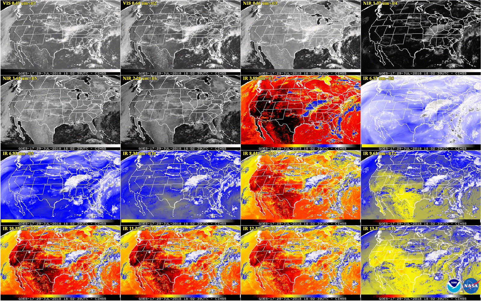
 [This 16-panel image shows a snapshot of the continental U.S. and surrounding oceans from each of the Advanced Baseline Imager channels on July 29, 2018. This imagery was captured between the instrument’s “cool” and “warm” season, when all 16 channels are available 24 hours per day. During the instrument’s “warm” seasons, varied data outages are expected for 9 of the channels during nighttime hours. The ABI’s increased channels provide three times more spectral information than the previous GOES imager. Credit: NOAA/NASA]
Edited for WeatherNation by Meteorologist Mace Michaels
All Weather News
More