New, Next-Generation NOAA Polar-Orbiting Satellite is Now Operational
Special Stories
30 May 2018 9:39 AM
(NOAA) -- Weather forecasters officially have a new tool in their arsenal, as the first satellite in NOAA’s new Joint Polar Satellite System has passed rigorous testing and is now operational.
Launched last November as JPSS-1 and renamed NOAA-20 once it reached orbit, the satellite features the latest and best technology NOAA has ever flown in a polar orbit to capture more precise observations of the world’s atmosphere, land and waters. Data from the satellite’s advanced instrumentswill help improve the accuracy of 3-to-7 day forecasts.
“Improved weather forecasts can save lives, protect property and provide businesses and communities valuable additional time to prepare in advance of dangerous weather events,” said Secretary of Commerce Wilbur Ross.
NOAA-20 provides NOAA’s National Weather Service with global data for numerical weather prediction models used to develop timely and accurate U.S. weather forecasts. In addition, high-resolution imagery from the satellite’s Visible Infrared Imaging Radiometer Suite, known as VIIRS, will enable the satellite to detect fog, sea-ice formation and breaking in the Arctic, volcanic eruptions and wildfires in their very early stages. This advanced modeling and imagery information, shared with international and governmental partners, will help businesses, the emergency preparedness and response communities and individuals make the best decisions possible in the face of weather-related hazards.
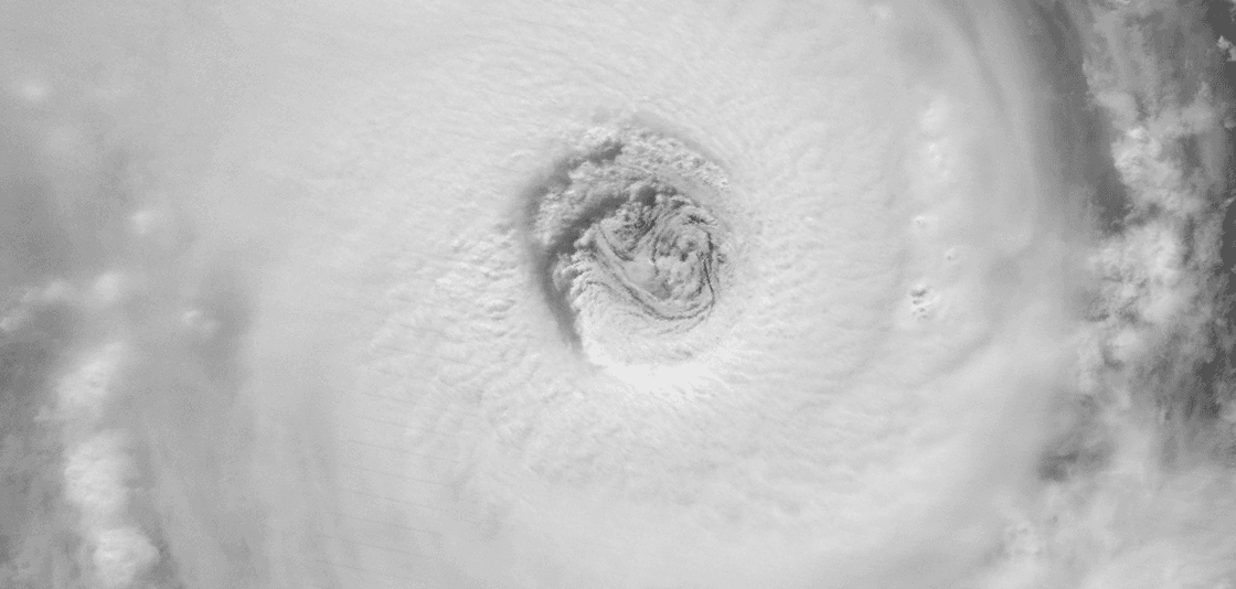
 NOAA-20 caught this image of the fourth Nor'easter to batter the East Coast during the past winter on March 21. (NOAA)
NOAA-20 joins Suomi NPP – the NOAA-NASA demonstration satellite launched in 2011 – giving the U.S. the benefit of two sophisticated spacecraft in nearly the same orbit. Each circles the Earth in a polar orbit 14 times a day, collecting global observations that form the basis for U.S. weather prediction.
“NOAA-20 is especially beneficial for tracking developing storms in the Arctic, Alaska and Antarctica. Forecasts for these remote regions are critical for the U.S. fishing, energy, transportation and recreation industries, which operate in some of the harshest conditions on the planet,” said Neil Jacobs, Ph.D., assistant secretary of commerce for environmental observation and prediction.
JPSS-2, the second in the series, is scheduled to be launched in 2021, followed by JPSS-3 in 2026 and JPSS-4 in 2031. JPSS satellites are designed to operate for seven years, with the potential for several more years. The JPSS mission will deliver its critical data and information for at least the next two decades to support a Weather-Ready Nation.
All Weather News
More
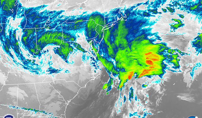
East Gears Up for Stormy, Wet Weekend
A low pressure system crashing through the Mi
1 Aug 2026 9:15 PM


Flooding, Severe Storms Target the Midwest Again
After an active week of storms across the nor
1 Aug 2026 1:40 AM

After Reaching Category 5, Genevieve Weakens in the Pacific
PacificFausto is now a post-tropical cyclone.
31 Jul 2026 1:30 AM

Flooding Risk Increases as Heavy Rain Targets the Tri-State Area
Tuesday, heavy rainfall moved across the Nort
30 Jul 2026 12:25 AM

Severe Weather: Energy From the Midwest Now in the Southeast
UPPER MIDWEST - Through Monday, dangerous tor
29 Jul 2026 10:30 PM