Hot Weather Powers More Storms in the Northeast

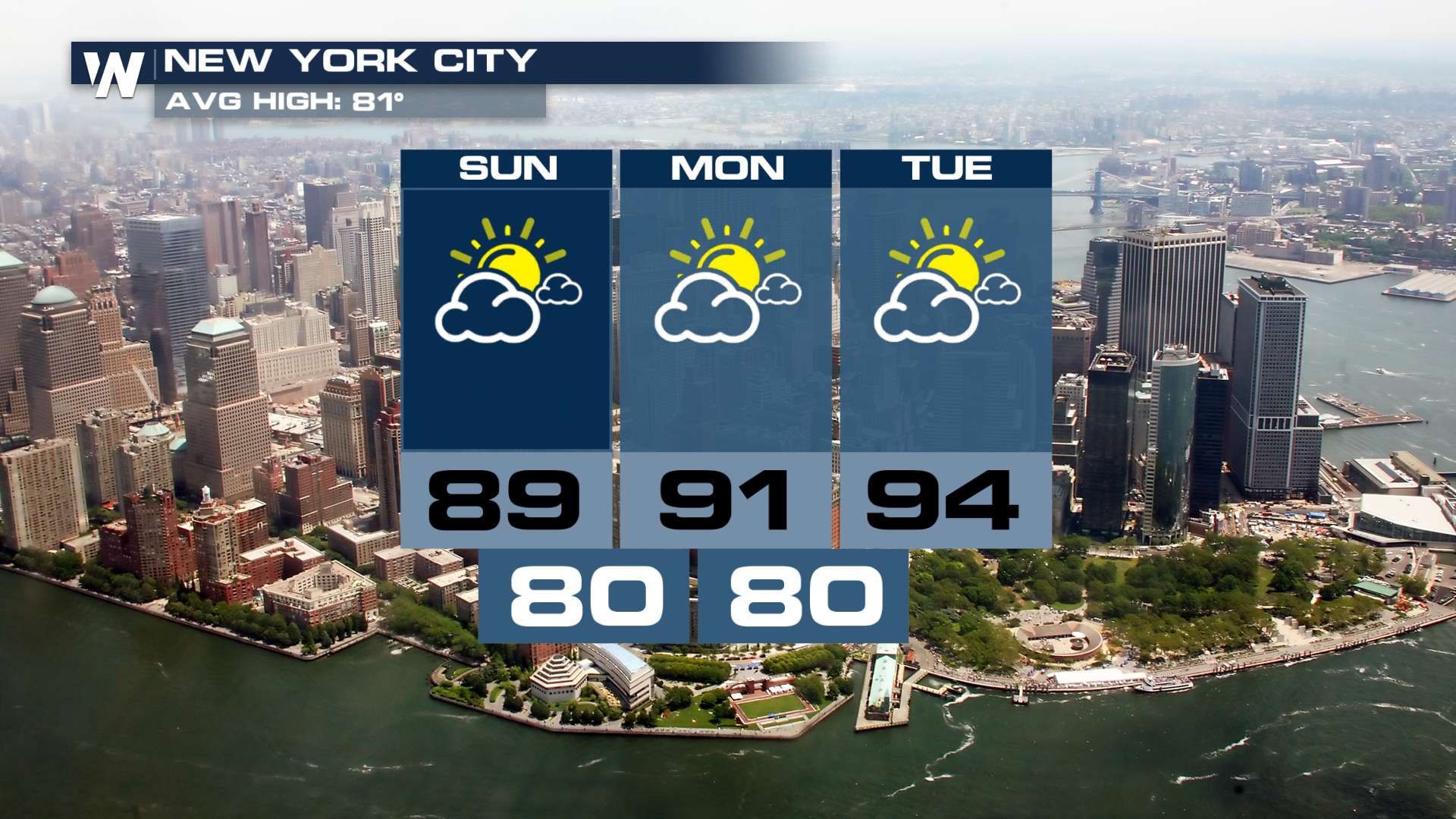
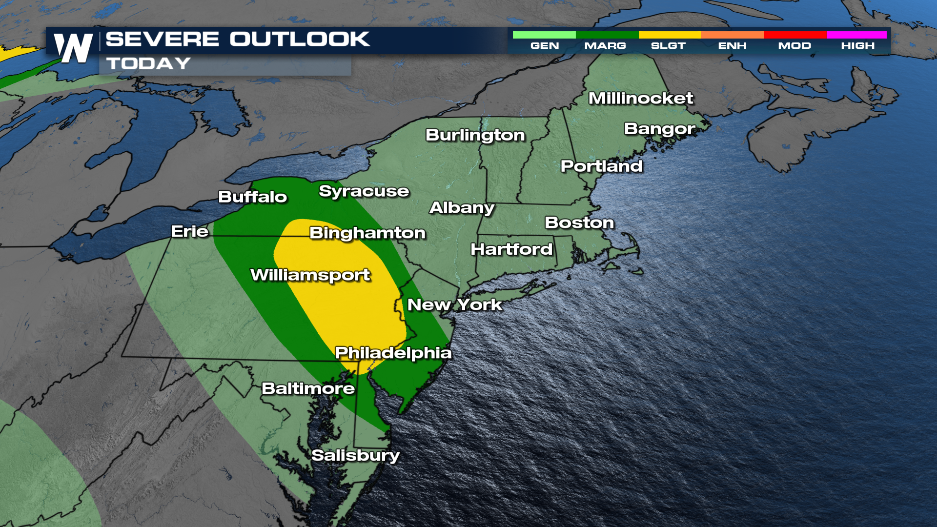
Record highs are likely across the Northeast starting today and lasting through at least Wednesday. Over 200 locations could tie or break records during this stretch! That heat is helping fire another batch of storms over the next few days. Wind and hail are the major impacts expected with the storms today, however a few tornado warnings were issued early Sunday AM.
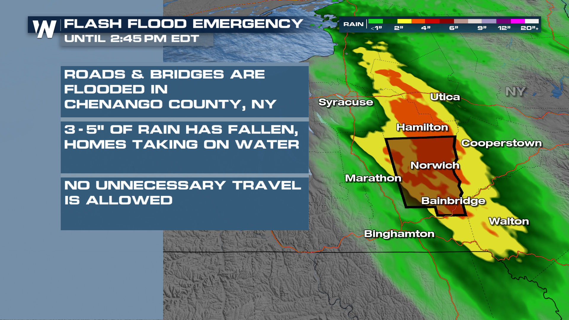
 A Flash Flood Emergency was issued for Chenango County in New York for significant rainfall and dangerous flooding. Water was reported to be approaching homes in the area.
 A strong high-pressure system will begin building today and strengthen through the week, sending temperatures soaring. With a little more rain in the forecast Sunday, the Weather Prediction Center upgraded this area's expectation of excessive rainfall.
Monday and Tuesday a front will scoot closer to the area, keeping the threat of severe weather around. Damaging winds look to be the most likely threat, especially Tuesday with the front. If it's not a little stormy, it's going to be really steamy. Highs in the mid to upper 90's will be easy to come by towards Tuesday.