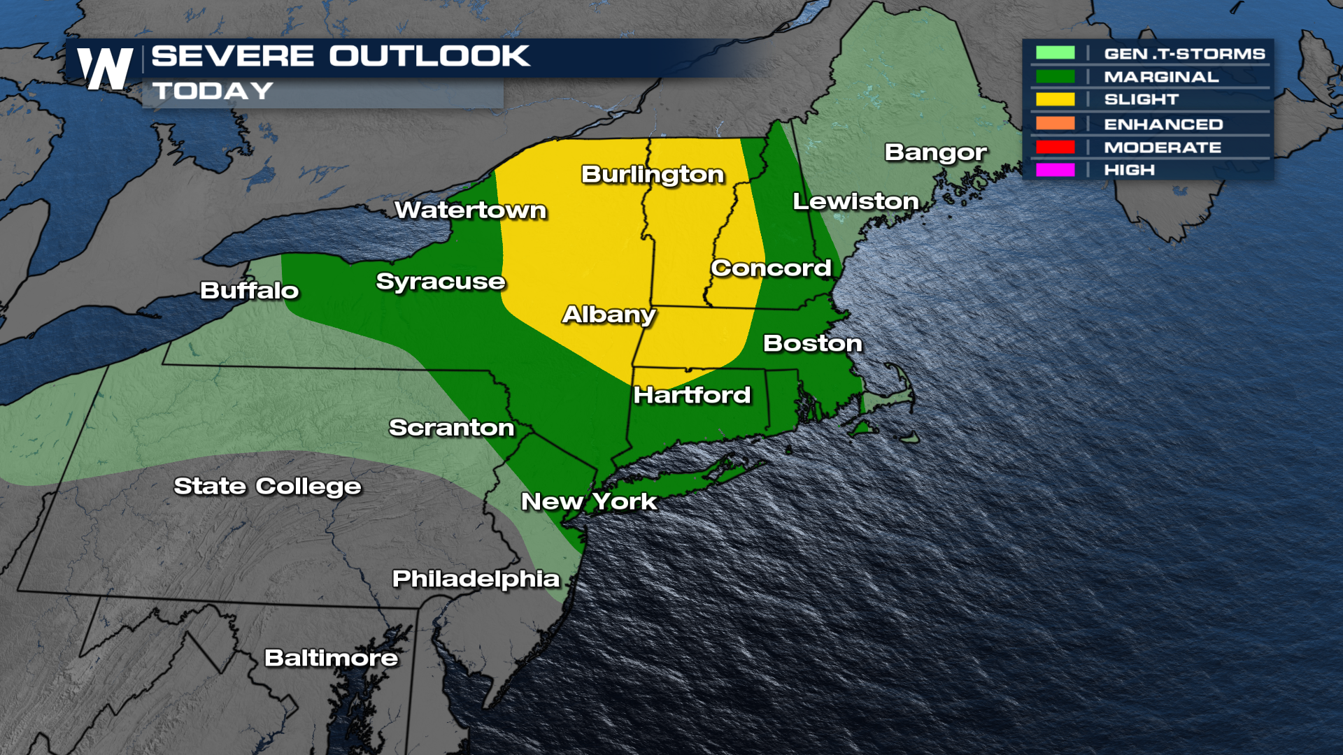
Northeast Severe Weather Risk Saturday

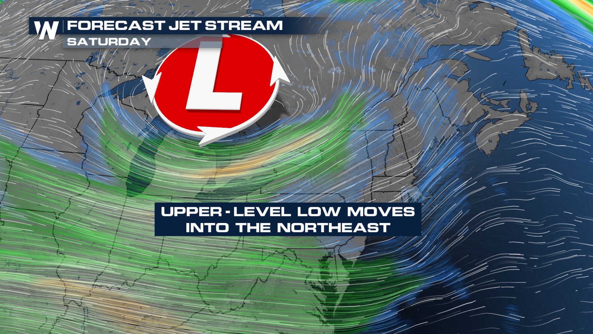
A progressive shortwave trough will be moving eastward across the Great Lakes region Saturday. As temperatures cool aloft and strong daytime heating continues, there will be enough energy to create favorable conditions for severe weather.
Thunderstorms are already forming across New York and are expected to intensify as they move into a more unstable atmosphere by mid-afternoon. These storms have the potential to develop into supercells, with locally damaging winds being the primary threat. The strongest storms may also produce hail and possibly even a tornado or two. A severe thunderstorm watch has already been issued for the state of New York, Vermont, and New Hampshire.
The Storm Prediction Center has issued a Slight Risk for severe thunderstorms across the Northeast on Saturday. Strong wind, damaging hail, and tornadoes are possible. The severe weather risk is expected to peak in the afternoon as storm intensify and move into unstable conditions.
 Timing
At the surface a warm front will move into the Northeast first with isolated showers and thunderstorms on Saturday. Watch for morning and midday rain/thunderstorms. Additional strong to severe thunderstorms might develop in the afternoon as the associated cold front moves into the region. These storms ahead of the cold front will be the strongest.
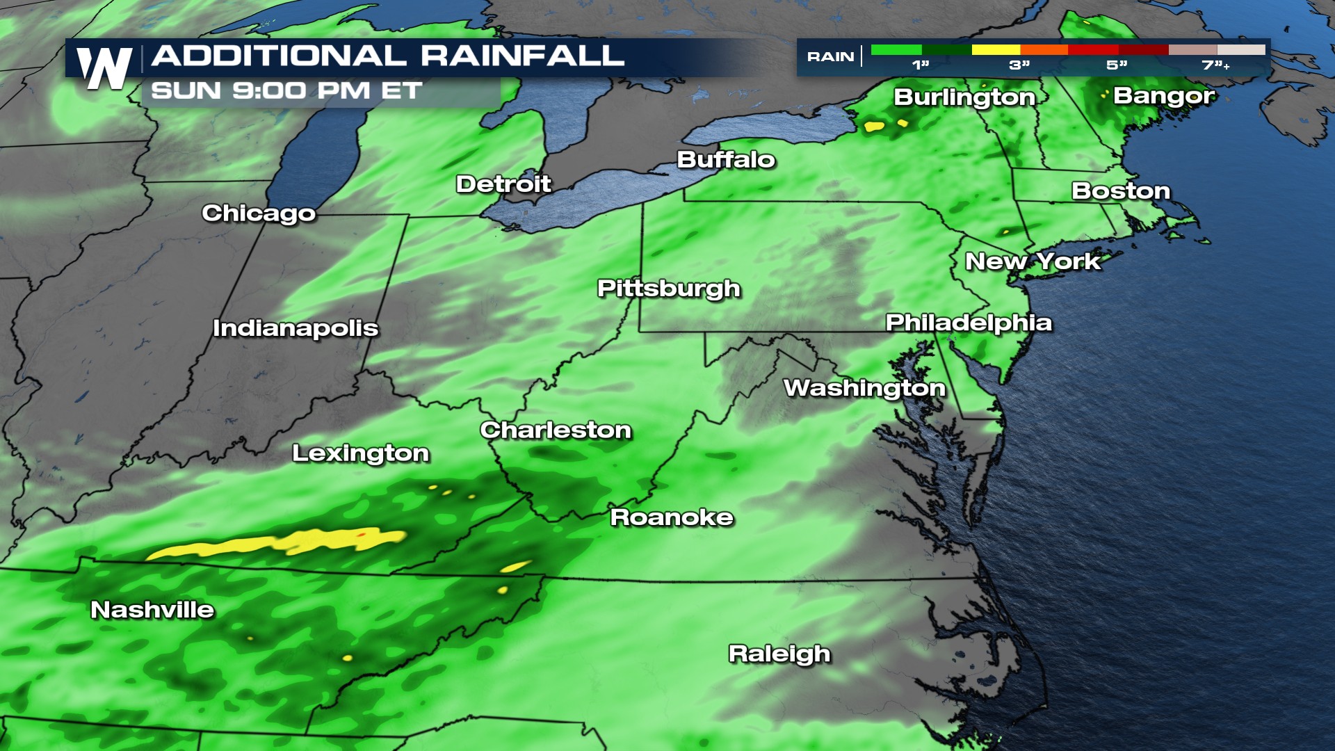
Rain Forecast
Expect pockets of 1-2 inches of rainfall accumulation.
 Stay with WeatherNation for the latest.


