Northern Plains Severe Threat

ABOVE - A new severe thunderstorm watch has been issued for portions of North Dakota and Minnesota through midnight tonight. Threats include scattered large hail up to 2" in diameter and damaging wind gusts up to 70 mph possible.
Overnight
The Storm Prediction Center has issued a SLIGHT (level 2 out of 5) risk for severe thunderstorms overnight across the Northern Plains with the expectation of late afternoon supercells capable of large hail and damaging wind gusts.

Wednesday
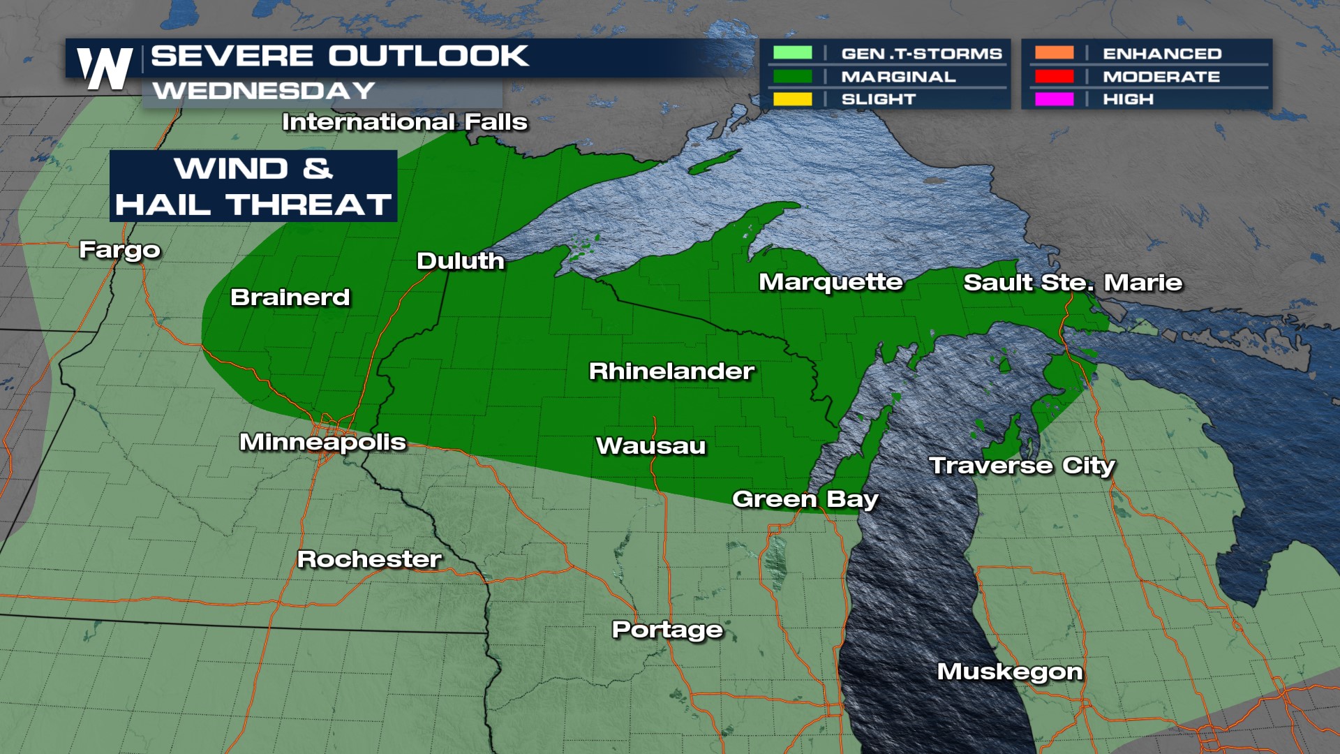
This system shifts a little to the east on Wednesday and to accompany the threat of severe thunderstorms, the SPC has issued a MARGINAL (level 1 out of 5) risk for severe thunderstorms. Cities included are Duluth, Green Bay, and Marquette along the Upper Midwest and Upper Great Lakes. Our main hazards will be isolated hail and where stronger heating occurs stronger wind gusts.
Timing
As we heat things up throughout the day the atmosphere becomes more buoyant. Our incoming cold front runs into this bouncy air and storms start to build up. As mentioned above, organized thunderstorms are likely later with hail and wind hazards. Our forecast models have storms happening a little bit earlier in the day and slowing down as the front passes into the evening.
Temperatures
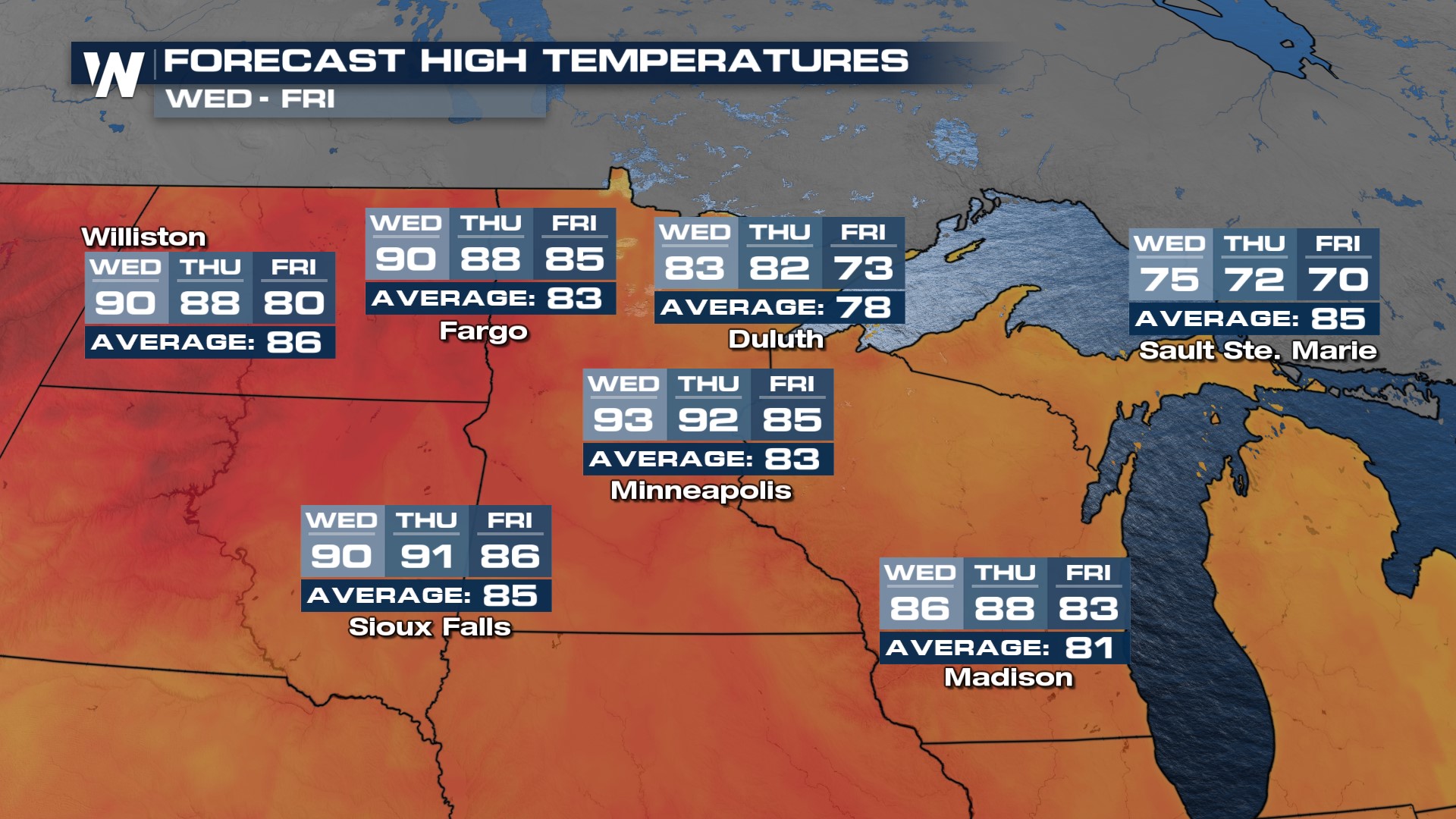
With this incoming surface cold front, and upper-level low, temperatures are expected to cool a bit across the north-central U.S.
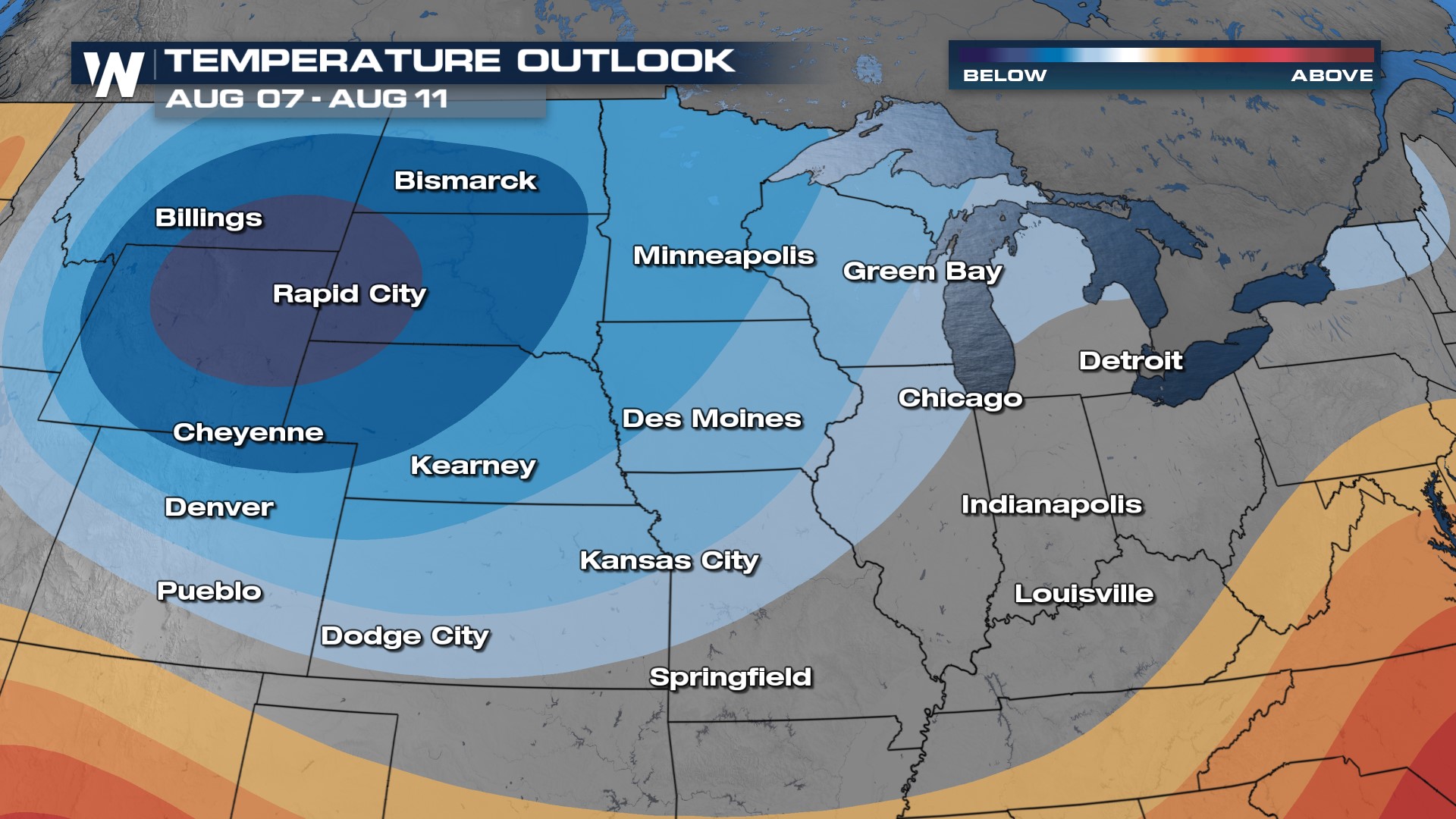
 The Climate Prediction Center even has long-range outlooks favorable for below-average temperatures.
 For more on this top weather headline be sure to join us on WeatherNation!


