November to Start Cool for Many in the Central U.S.
Special Stories
30 Oct 2018 8:16 PM
A series of strong cold fronts will keep much of the central United States colder-than-average as we begin the new month. Alongside the time change as we set the clocks back an hour this weekend, it's sure to make that part of the country feel more winter-like!
Every day, the Climate Prediction Center [a sector of NOAA] releases a 6-10 day temperature and precipitation outlook as well as an outlook for the 8-14 day time frame. Here's what it looks like for early November:
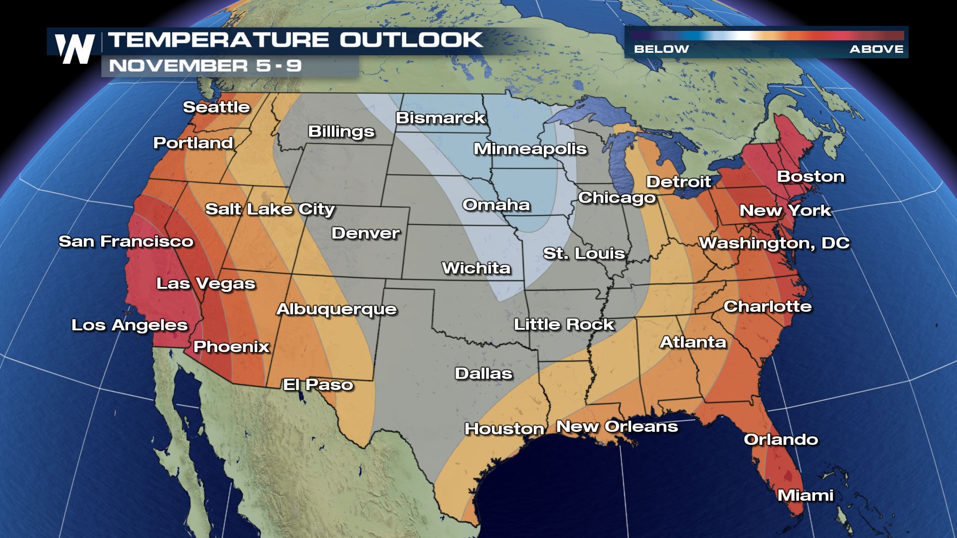 The temperature outlook between November 5 and 9 where blue shows a higher-than-average chance of cooler temperatures and oranges show a higher-than-average chance of warmer temperatures.
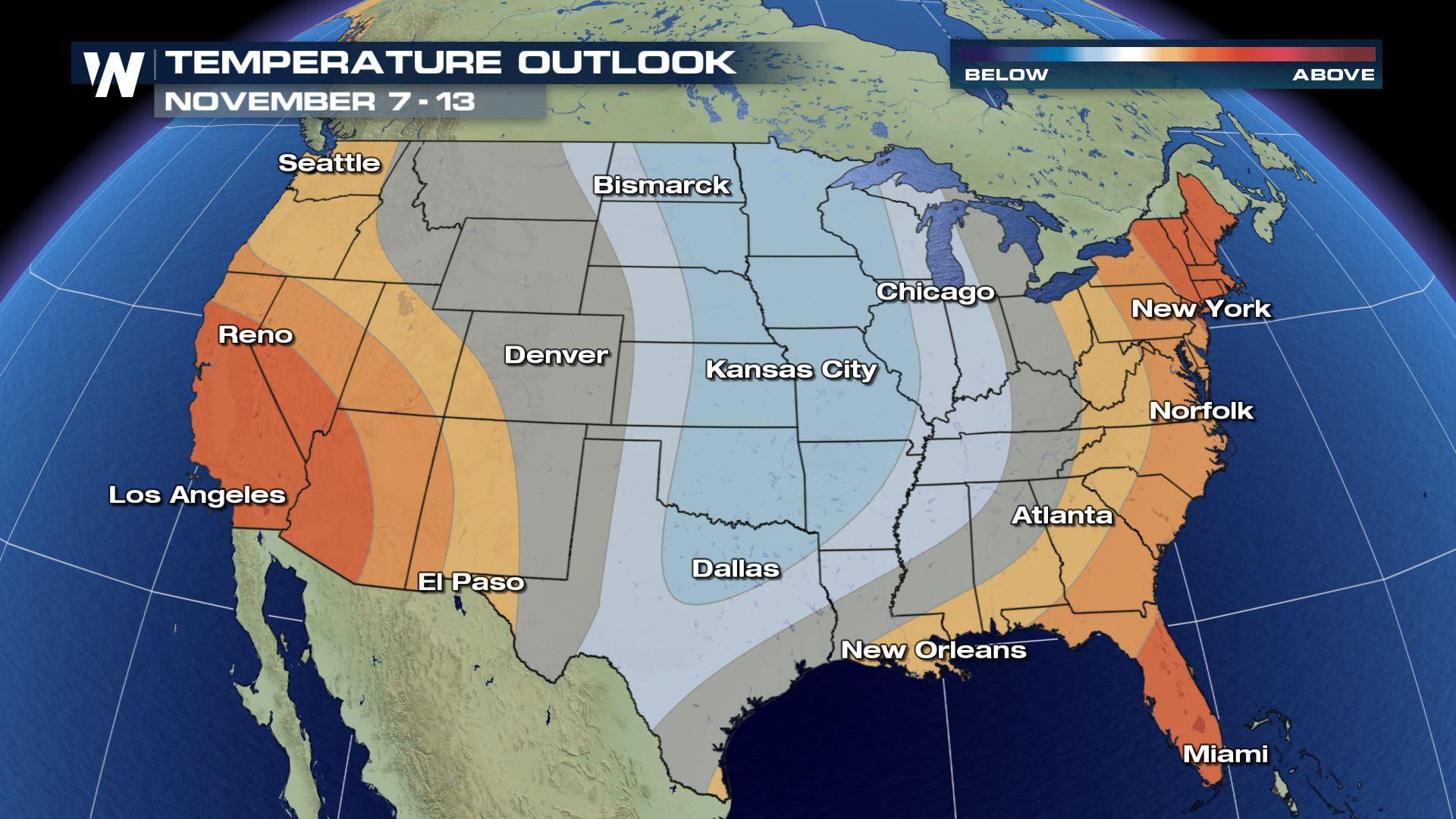
 The temperature outlook between November 7 and 13 where blue shows a higher-than-average chance of cooler temperatures and oranges show a higher-than-average chance of warmer temperatures.
Meanwhile, the precipitation outlook favors one side of the country for wetter-than-average conditions to begin November:
The temperature outlook between November 7 and 13 where blue shows a higher-than-average chance of cooler temperatures and oranges show a higher-than-average chance of warmer temperatures.
Meanwhile, the precipitation outlook favors one side of the country for wetter-than-average conditions to begin November:
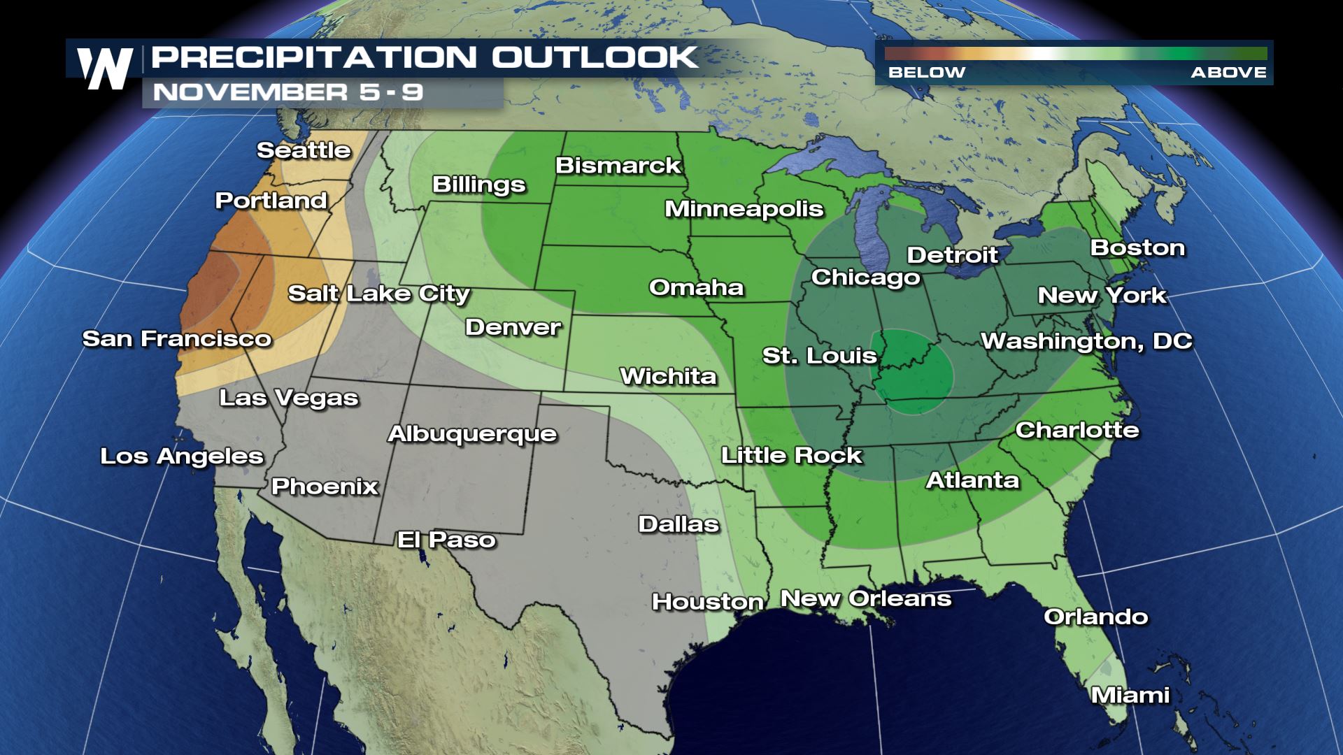 The precipitation outlook between November 5 and 9 where green shows a higher-than-average chance of wetter conditions and brown shows a higher-than-average chance of drier conditions.
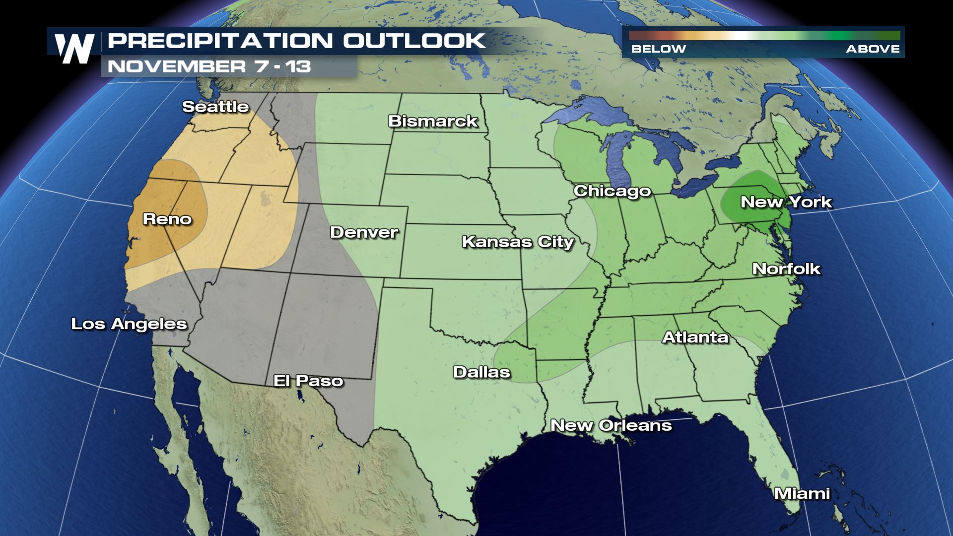 The precipitation outlook between November 7 and 13 where green shows a higher-than-average chance of wetter conditions and brown shows a higher-than-average chance of drier conditions.
What will the impacts be? With a colder plunge through the central U.S. the jet stream will get pushed north from the Gulf of Mexico. This will allow for some heavy rain storms and (if it's cold enough) snow storms for some. Make sure you get your home and vehicle 'winterized' and ready for the season ahead. The Climate Prediction Center updates these maps daily, so you can check them out to see if there are any changes here: www.cpc.noaa.gov
For WeatherNation, Meteorologist Steve Glazier
The precipitation outlook between November 7 and 13 where green shows a higher-than-average chance of wetter conditions and brown shows a higher-than-average chance of drier conditions.
What will the impacts be? With a colder plunge through the central U.S. the jet stream will get pushed north from the Gulf of Mexico. This will allow for some heavy rain storms and (if it's cold enough) snow storms for some. Make sure you get your home and vehicle 'winterized' and ready for the season ahead. The Climate Prediction Center updates these maps daily, so you can check them out to see if there are any changes here: www.cpc.noaa.gov
For WeatherNation, Meteorologist Steve Glazier
The temperature outlook between November 5 and 9 where blue shows a higher-than-average chance of cooler temperatures and oranges show a higher-than-average chance of warmer temperatures.
The temperature outlook between November 7 and 13 where blue shows a higher-than-average chance of cooler temperatures and oranges show a higher-than-average chance of warmer temperatures.
Meanwhile, the precipitation outlook favors one side of the country for wetter-than-average conditions to begin November:
The precipitation outlook between November 5 and 9 where green shows a higher-than-average chance of wetter conditions and brown shows a higher-than-average chance of drier conditions.
The precipitation outlook between November 7 and 13 where green shows a higher-than-average chance of wetter conditions and brown shows a higher-than-average chance of drier conditions.
What will the impacts be? With a colder plunge through the central U.S. the jet stream will get pushed north from the Gulf of Mexico. This will allow for some heavy rain storms and (if it's cold enough) snow storms for some. Make sure you get your home and vehicle 'winterized' and ready for the season ahead. The Climate Prediction Center updates these maps daily, so you can check them out to see if there are any changes here: www.cpc.noaa.gov
For WeatherNation, Meteorologist Steve GlazierAll Weather News
More
Wildfire Outbreak in the Pacific Northwest
Conditions have been incredibly dry out west.
2 Aug 2026 1:30 PM

After Reaching Category 5, Genevieve Weakens in the Pacific
PacificGenevieve formed on last Friday south
2 Aug 2026 1:25 PM

More Storms for the East Sunday and Monday
A low-pressure system crashing through the Mi
2 Aug 2026 1:25 PM


Flooding, Severe Storms Target the Midwest Again
After an active week of storms across the nor
1 Aug 2026 1:40 AM

Flooding Risk Increases as Heavy Rain Targets the Tri-State Area
Tuesday, heavy rainfall moved across the Nort
30 Jul 2026 12:25 AM

Severe Weather: Energy From the Midwest Now in the Southeast
UPPER MIDWEST - Through Monday, dangerous tor
29 Jul 2026 10:30 PM