Preliminary EF-1 Tornado Rating for Pauls Valley, OK Storm
Top Stories
28 Apr 2021 3:56 PM
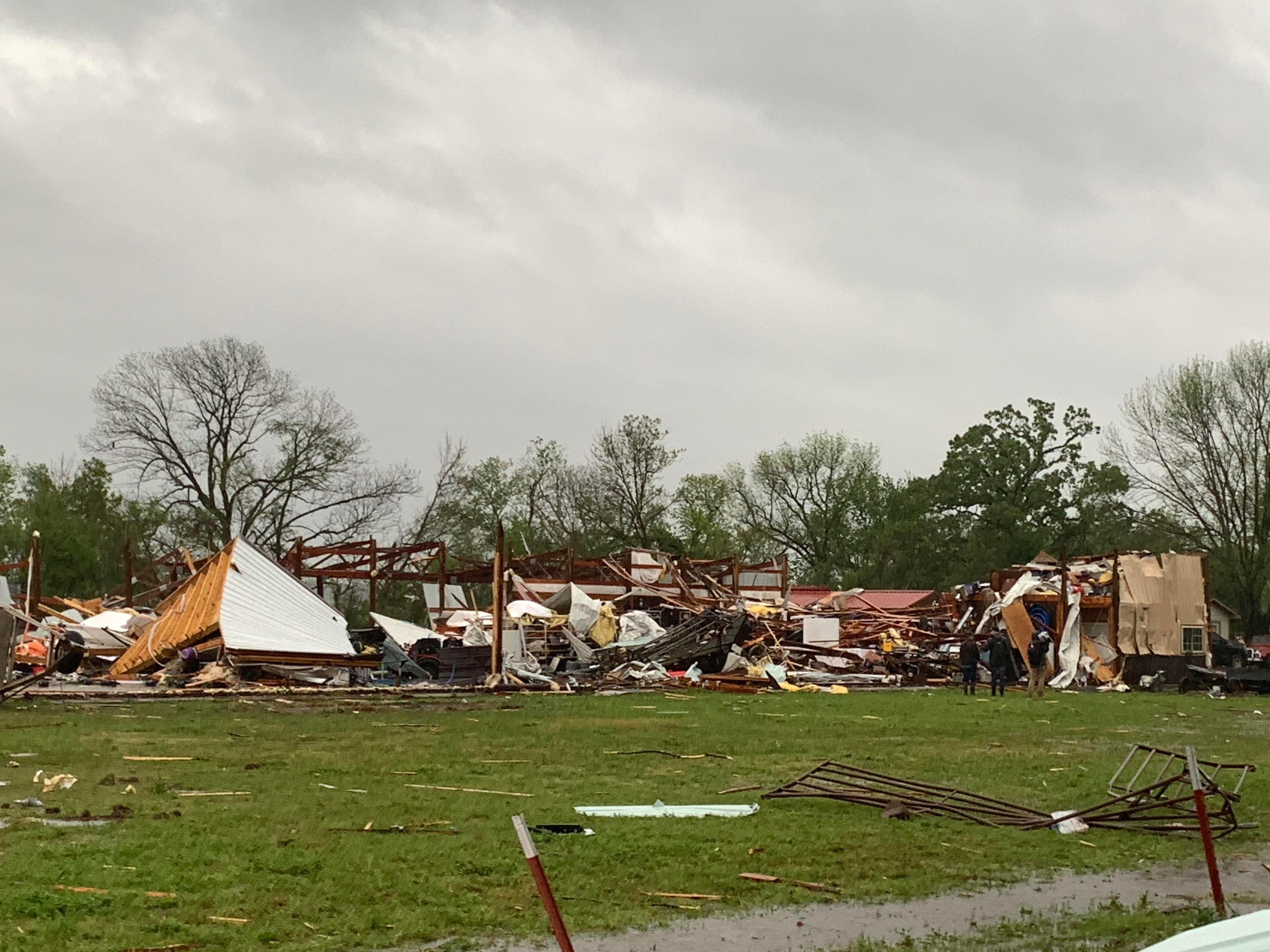
Wednesday's morning scene in Pauls Valley, Oklahoma was not only wet and dreary but also damaged after a tornado hit the town, possibly producing winds up to 100 miles per hour.
https://twitter.com/WeatherNation/status/1387429124067766272
The National Weather Service office in Norman, Oklahoma sent meteorologists south on Interstate 35 to the town of Pauls Valley (and general area) to conduct a storm survey Wednesday. This is a common task after storm damage occurs, as meteorologists analyze the damage from ground level, sometimes taking in aerial views too, and compare it to radar data to come to a conclusion. In this case, meteorologists at NWS Norman released a preliminary estimate that this was a tornado of EF-1 intensity.
https://twitter.com/NWSNorman/status/1387490199547043841
The meteorologists could not finish their storm survey Wednesday because of constant rain and muddy roads in the area. It made travel very difficult to access all of the damage path As a result, more information will be gathered and released in the coming days.
The tornado rating is EF, short for Enhanced Fujita, and ranges on a scale from 0 being weakest to 5 being strongest. An EF-1 tornado's winds range from 86 to 110 miles per hour.
Pauls Valley is in Garvin County, Oklahoma. It sits south of Oklahoma City along Interstate 35. The town's population is around 6,000 people. The tornado was one of about a dozen observed tornadoes across Oklahoma, Texas, and Colorado on Tuesday.
All Weather News
More


More Storms for the East Through Monday
A low-pressure system that moved through the
3 Aug 2026 1:50 AM

After Reaching Category 5, Genevieve Weakens in the Pacific
PacificGenevieve formed last Friday south of
3 Aug 2026 12:30 AM

Flooding, Severe Storms Target the Midwest Again
After an active week of storms across the nor
1 Aug 2026 1:40 AM

Flooding Risk Increases as Heavy Rain Targets the Tri-State Area
Tuesday, heavy rainfall moved across the Nort
30 Jul 2026 12:25 AM

Severe Weather: Energy From the Midwest Now in the Southeast
UPPER MIDWEST - Through Monday, dangerous tor
29 Jul 2026 10:30 PM