55 Million People Under Frost/Freeze Alerts

Top Stories
2 Apr 2021 12:30 PM
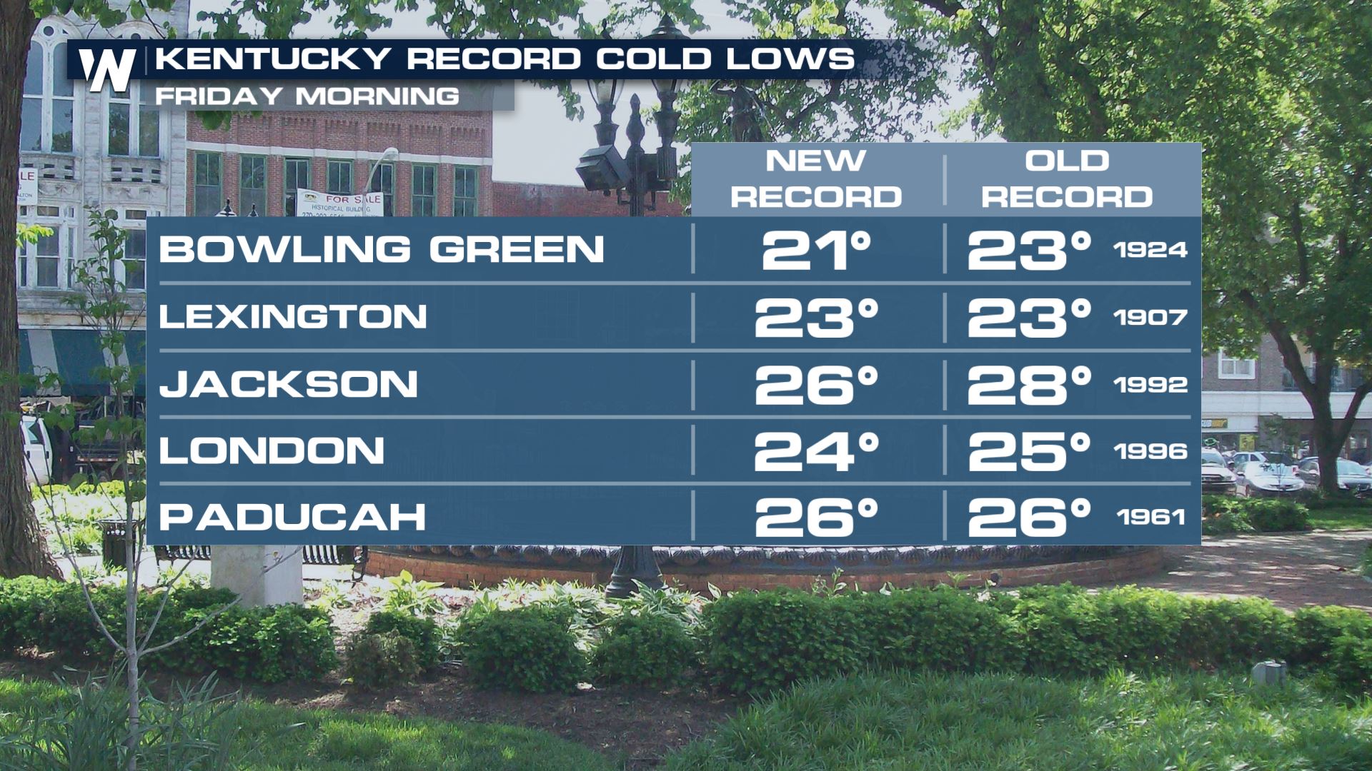
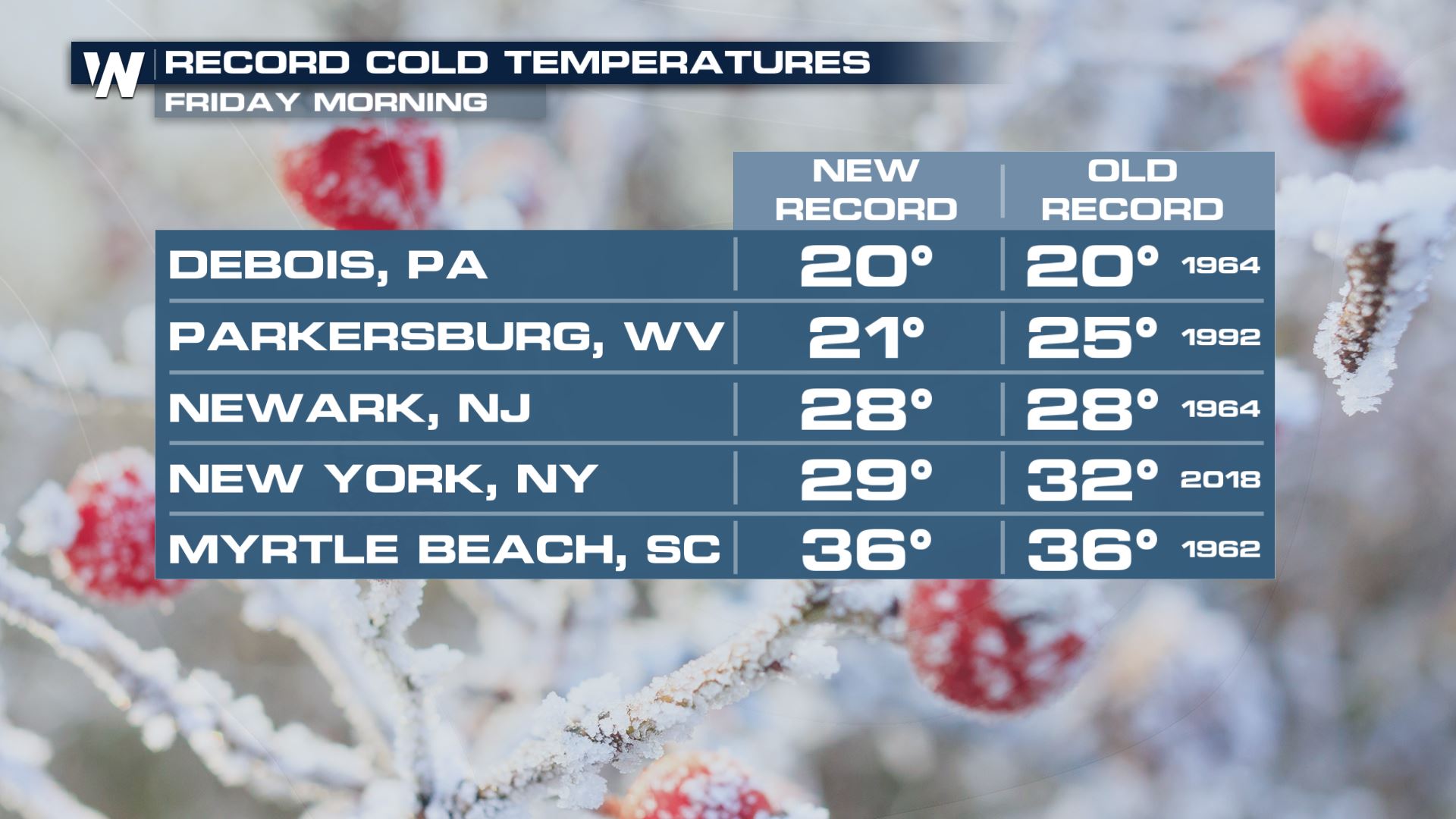
More than 55 million folks are finding themselves under frost or freeze alerts from this morning into Saturday morning as April is starting out with below average temperatures in the eastern third of the nation. Record low morning temps were broken in Kentucky in many cities on Friday morning, with new record low temperatures stretching all the way into the northeast!
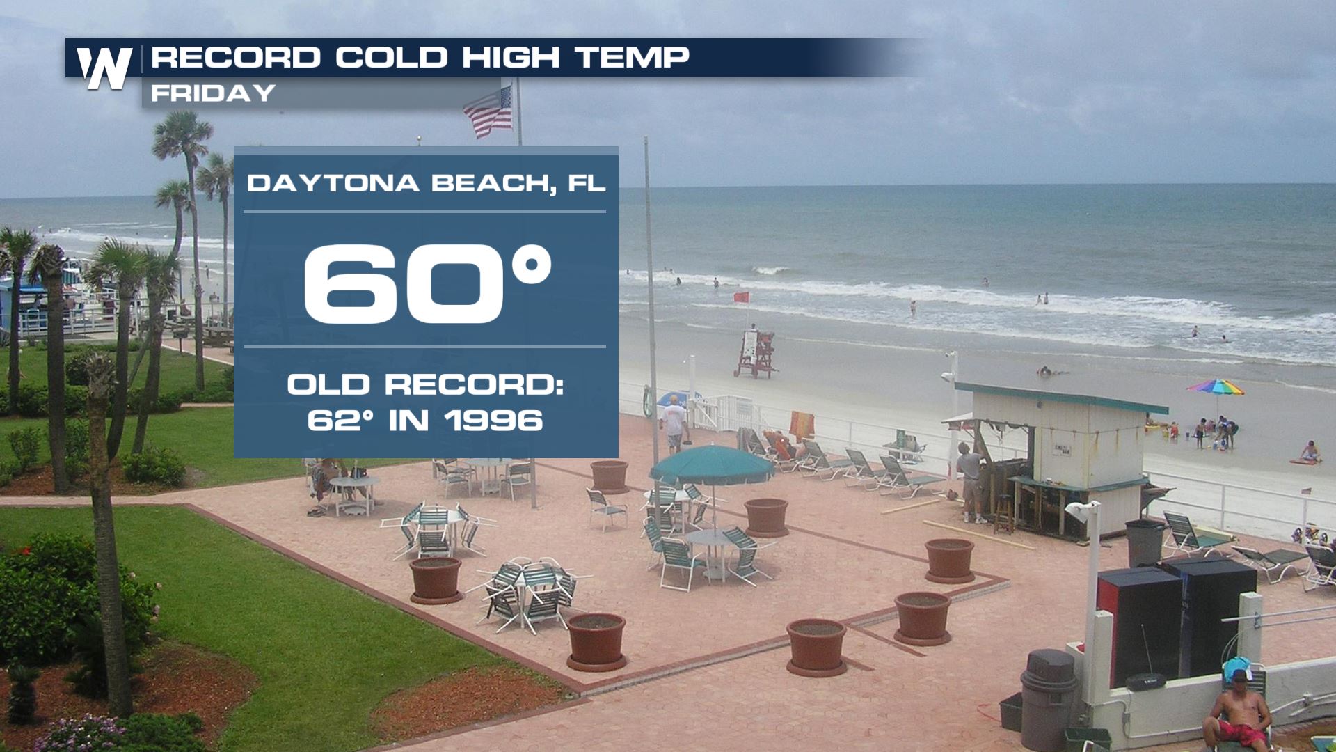
 A record cold high temperature was also set in Daytona, FL on Friday!
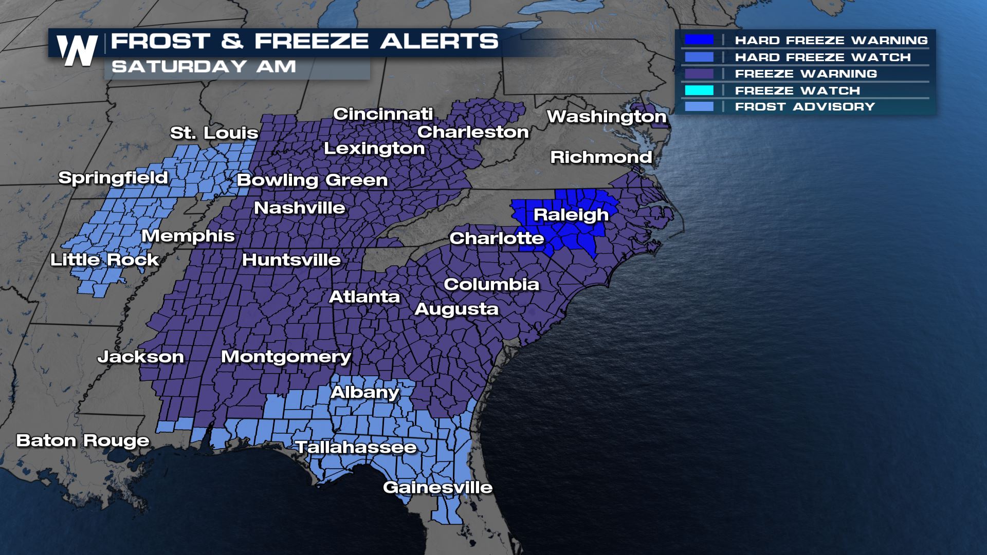 The frost and freeze alerts extend all the way to Lake Pontchartrain, Mobile Bay, the Gulf coast states and the Atlantic Ocean! When frost and freeze alerts are issued, it means unprotected plans can be harmed and/or killed outside.
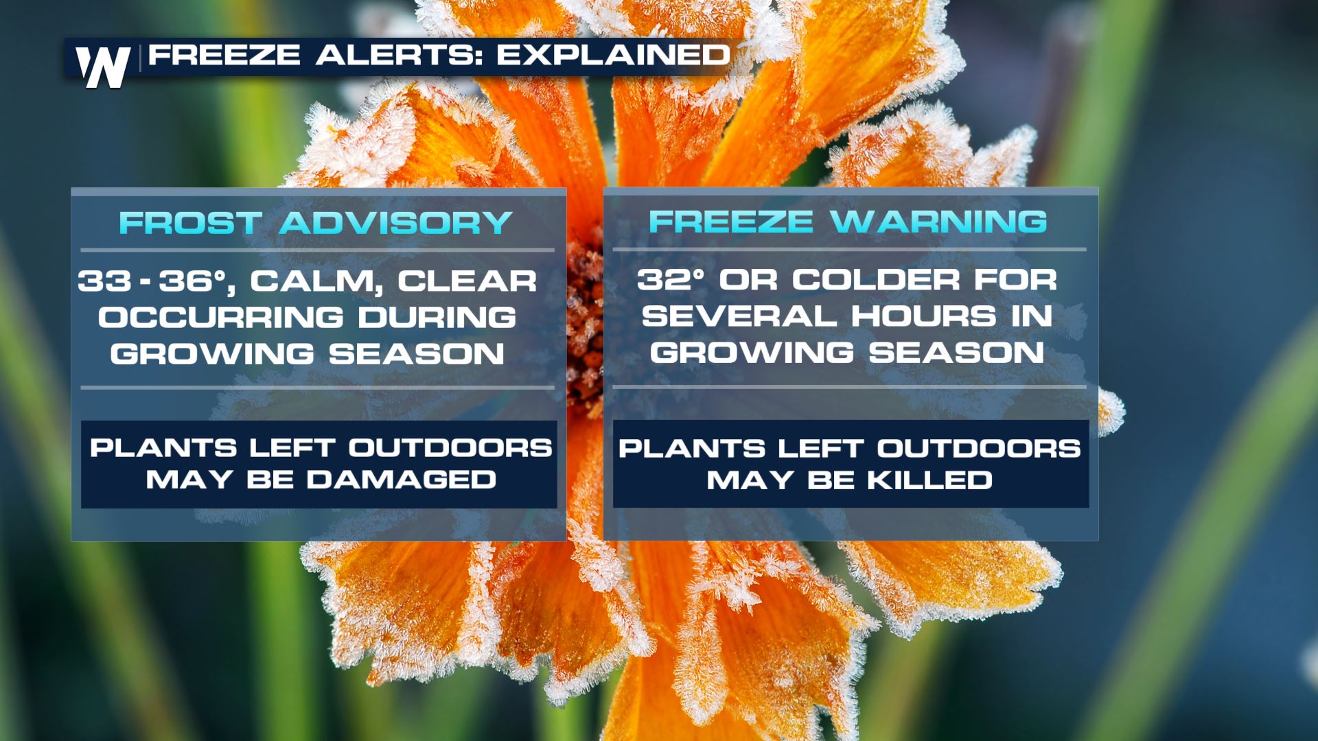 To avoid damaged or dead vegetation, bring potted plants inside or cover plants up if you can't bring them inside.
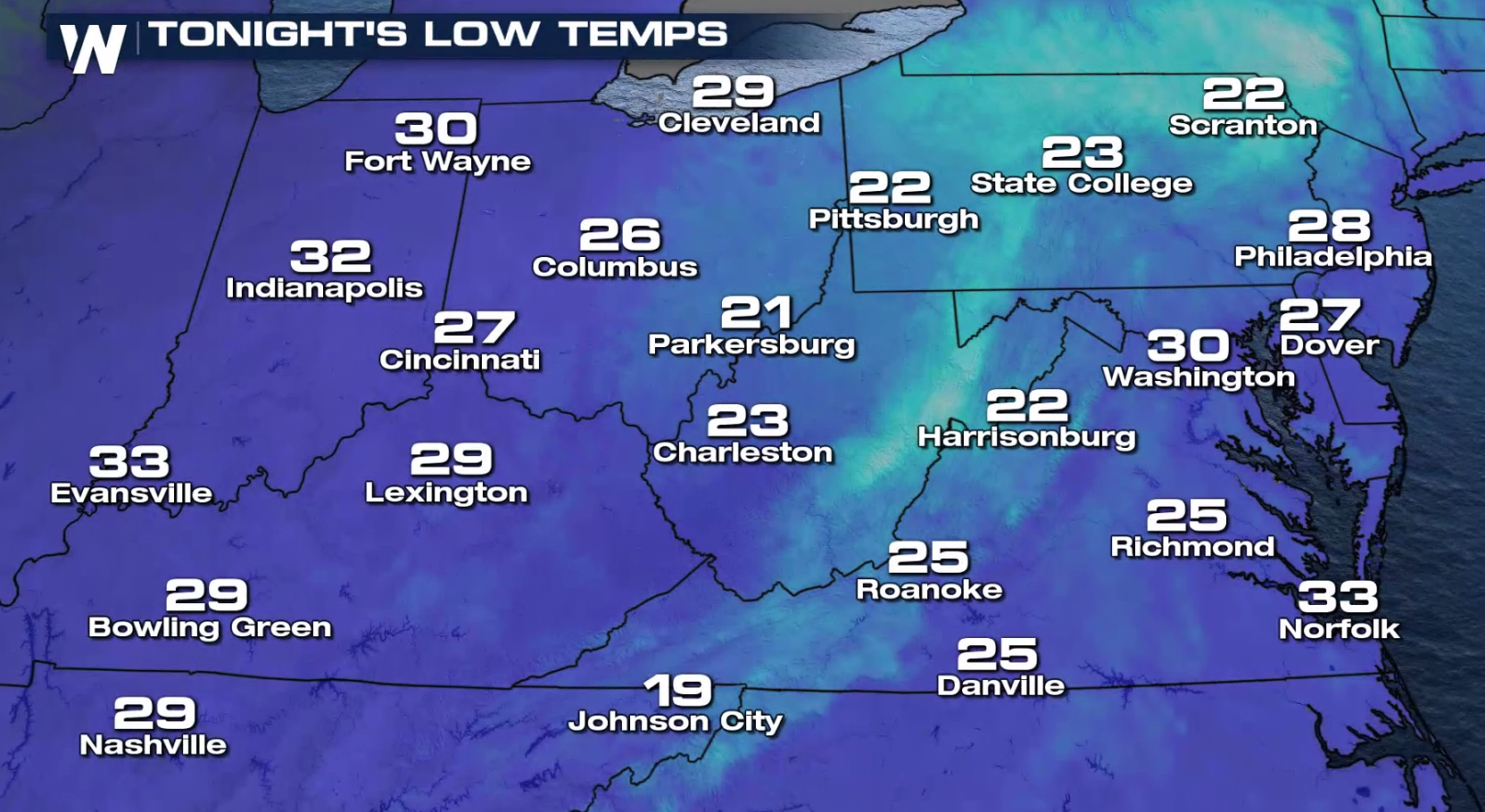
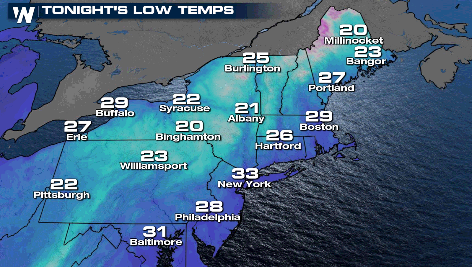
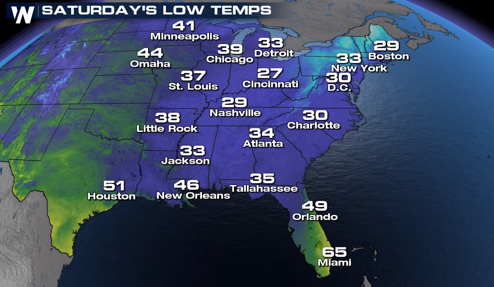 Here's a look at forecast low temperatures by Saturday morning, it'll still be another chilly start to the day, however temperatures will begin slowly climbing.
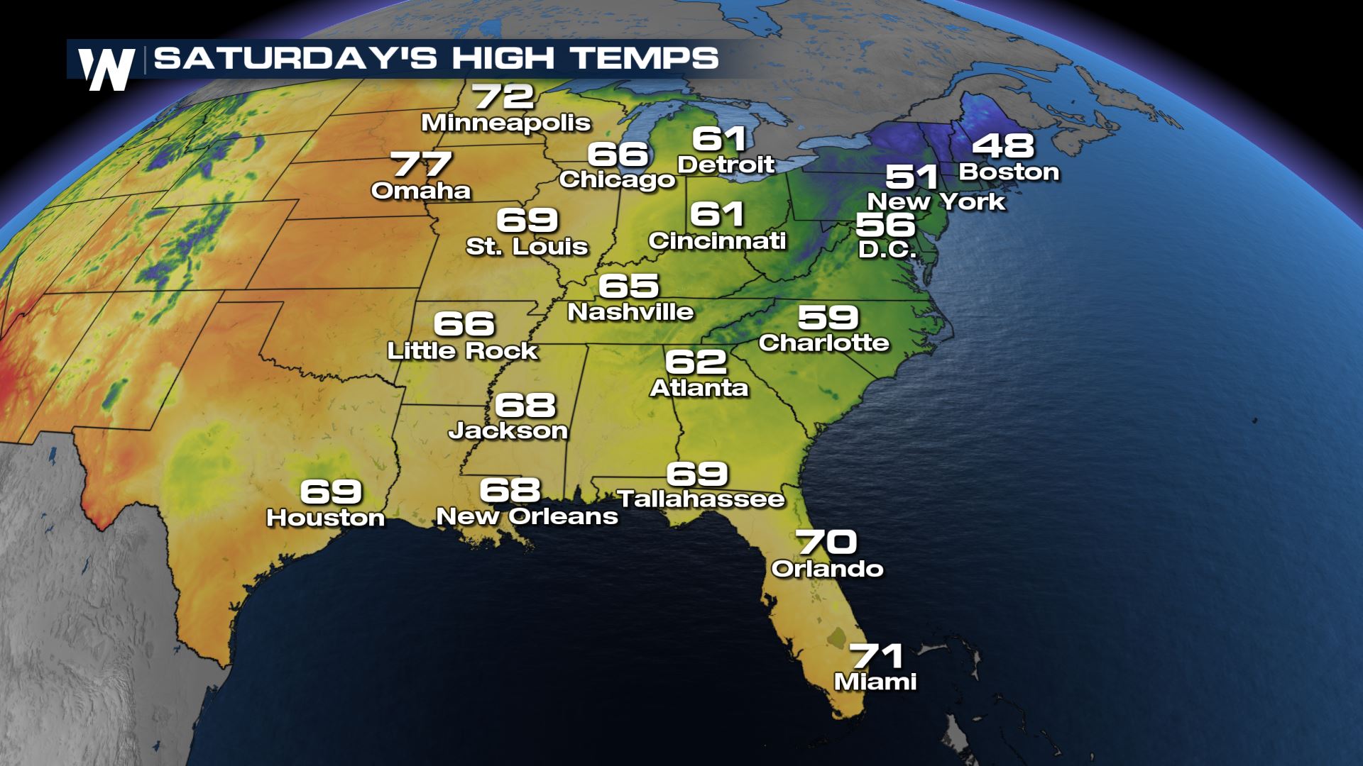
 The temperature trend shows a gradual warming on Sunday as the cold air slowly retreats.

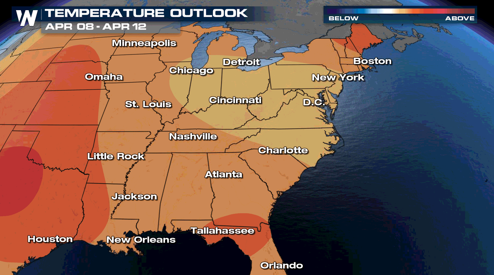
 In the extended forecast, the second week of April continues to show favorable chances for above-average temperatures for the eastern U.S.
 This cold snap will be short lived as above average temperatures are in the forecast for next week. Keep it tuned to WeatherNation for all the latest updates.
A record cold high temperature was also set in Daytona, FL on Friday!
Alerts
The frost and freeze alerts extend all the way to Lake Pontchartrain, Mobile Bay, the Gulf coast states and the Atlantic Ocean! When frost and freeze alerts are issued, it means unprotected plans can be harmed and/or killed outside.
To avoid damaged or dead vegetation, bring potted plants inside or cover plants up if you can't bring them inside.
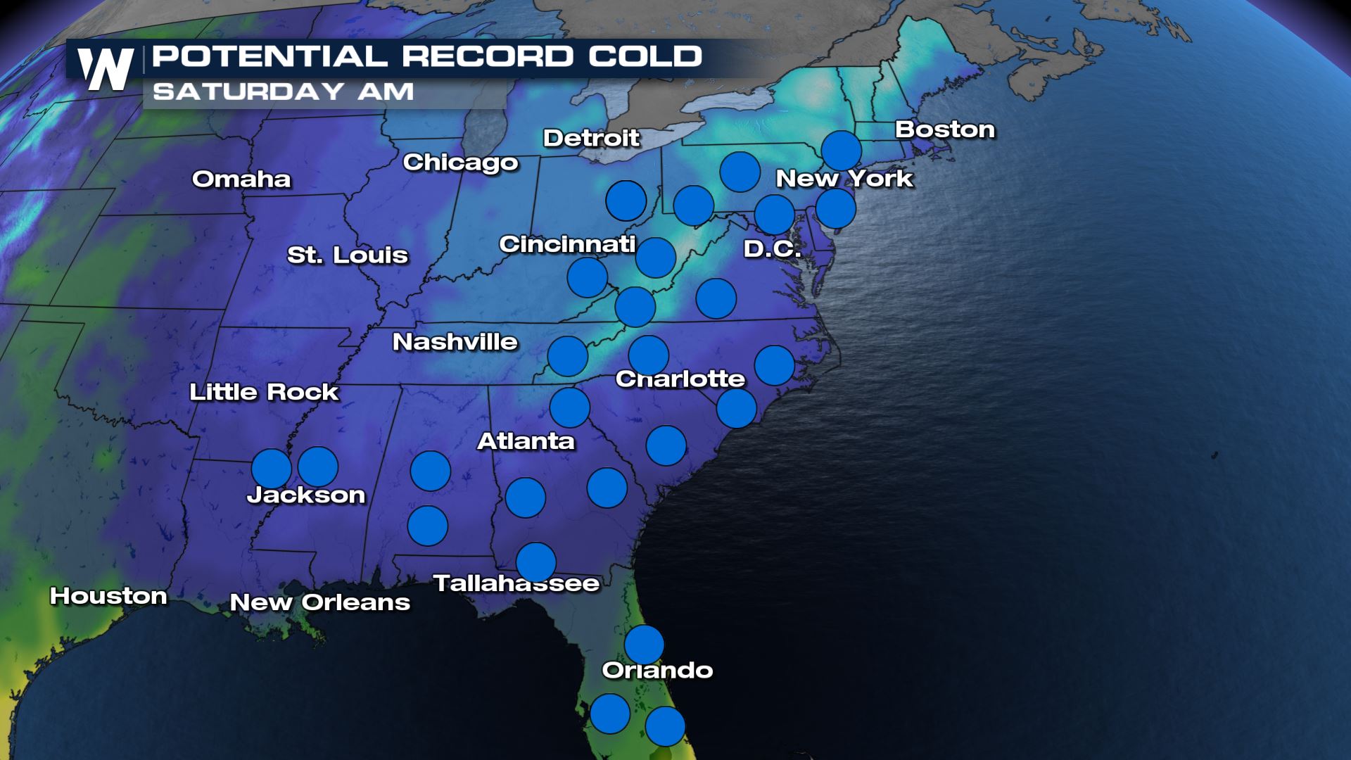
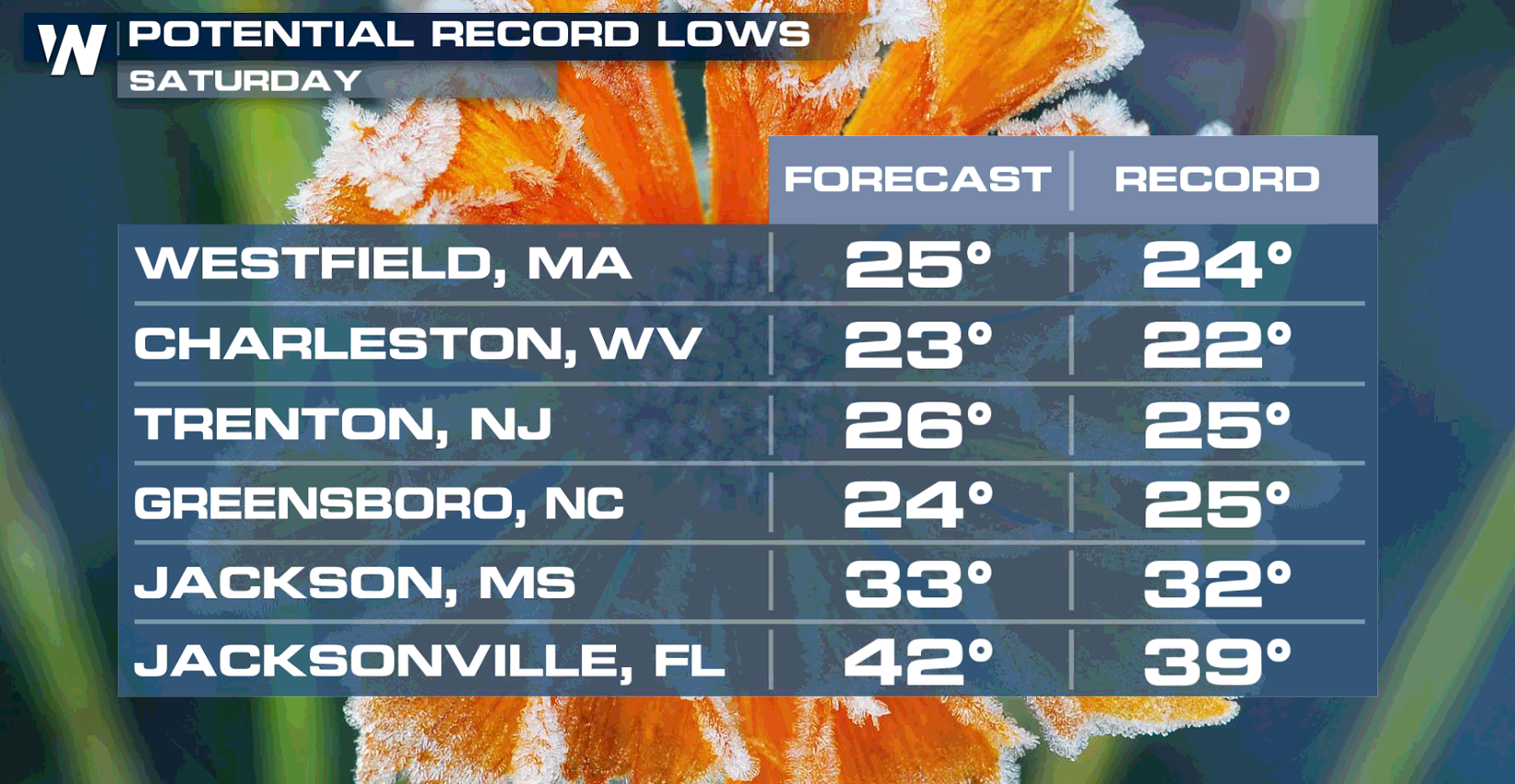
Record Low Potential
Another day of record low temperatures will be possible into Saturday across the eastern United States.
Forecast Lows
Here's a look at forecast low temperatures by Saturday morning, it'll still be another chilly start to the day, however temperatures will begin slowly climbing.
The temperature trend shows a gradual warming on Sunday as the cold air slowly retreats.
In the extended forecast, the second week of April continues to show favorable chances for above-average temperatures for the eastern U.S.
This cold snap will be short lived as above average temperatures are in the forecast for next week. Keep it tuned to WeatherNation for all the latest updates.All Weather News
More
Severe Storm Threat Returns to the Midwest
After several tornadoes ripped through the Mi
31 Jul 2026 2:20 AM


After Reaching Category 5, Genevieve Weakens in the Pacific
PacificFausto is now a post-tropical cyclone.
31 Jul 2026 1:30 AM

Flooding Risk Increases as Heavy Rain Targets the Tri-State Area
Tuesday, heavy rainfall moved across the Nort
30 Jul 2026 12:25 AM

Severe Weather: Energy From the Midwest Now in the Southeast
UPPER MIDWEST - Through Monday, dangerous tor
29 Jul 2026 10:30 PM

Southeast Flood Risk Lingers Near Stalled Front
A stalled boundary over the Southeast will ke
25 Jul 2026 10:55 AM