Rain and Mountain Snow for the Northwest
Top Stories
18 Sep 2021 3:55 PM
Multiple rounds of energy moving through the Pacific northwest brings the first chance for heavy rain and mountain snow of the fall season. While snow will be confined to high mountain peaks, the rainfall will be extremely beneficial for the drought-stricken Pacific northwest.
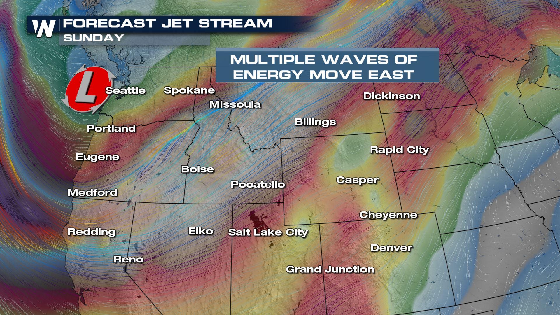
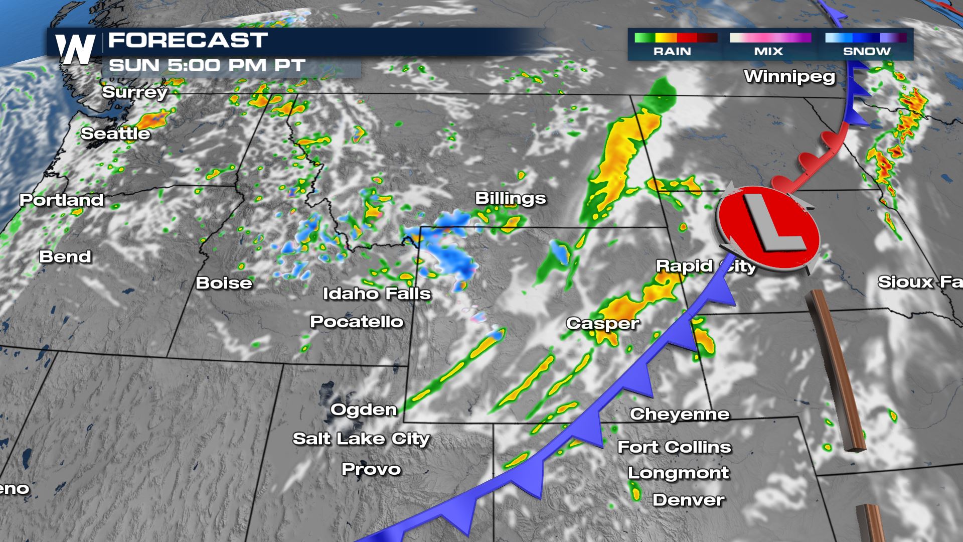
 Heavy rain will continue across the northern Rockies into Saturday night, keeping temperatures cooler and the pattern generally unsettled. Energy from an upper low behind the cold front will bring additional rounds of rain and thunderstorms to round out the weekend along with some high mountain peak snow.
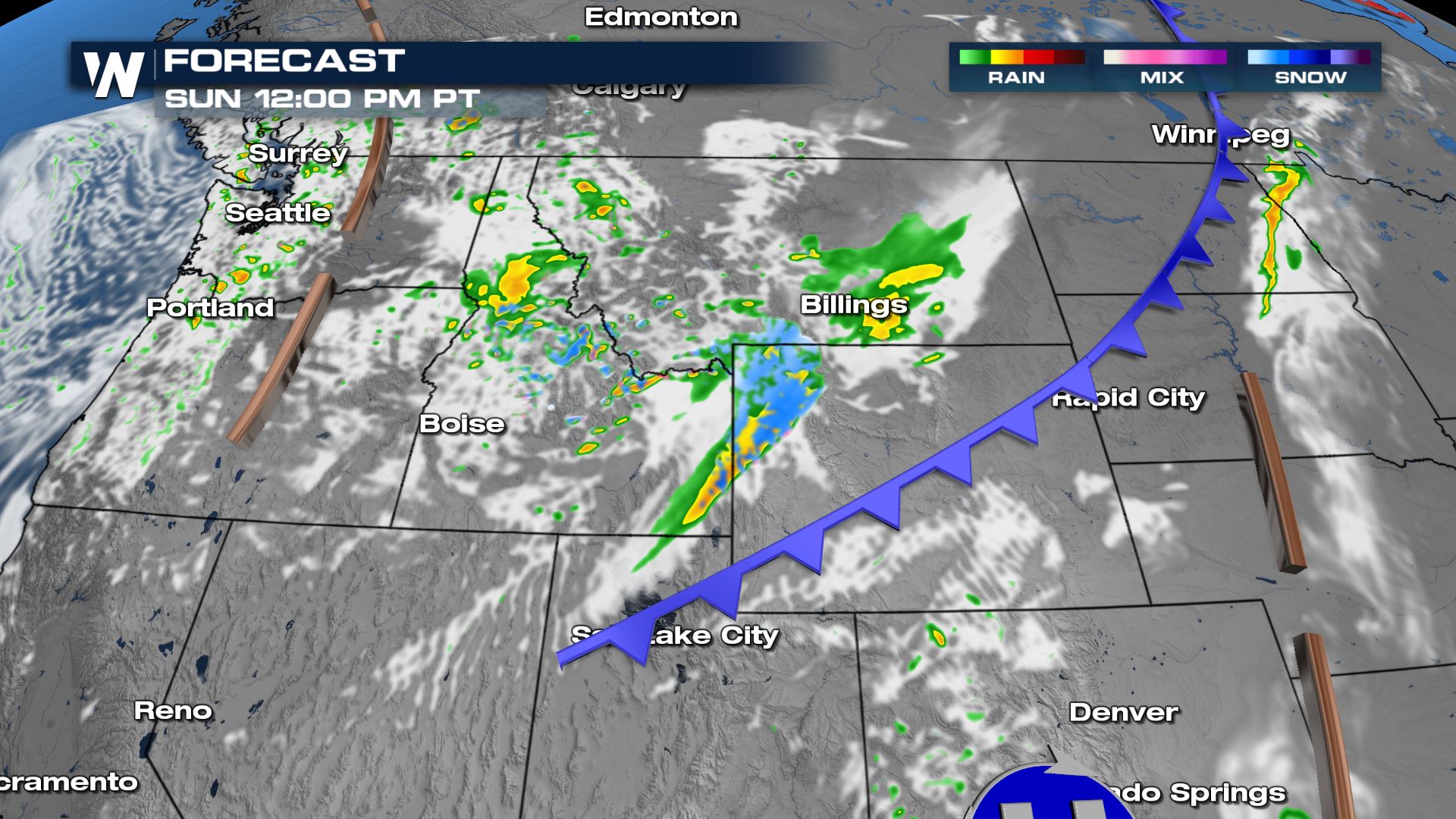
 More rounds of mountain snow is possible Sunday as cold air behind the front plus energy in the upper levels moves over high elevation areas. This is not totally out of the ordinary, as the average first measurable snowfall in the Salmon Mountains and Bitterroots is in September.
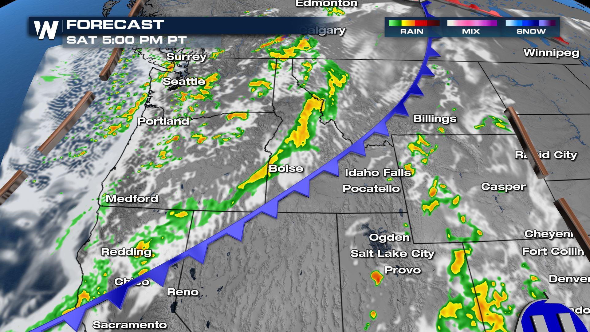
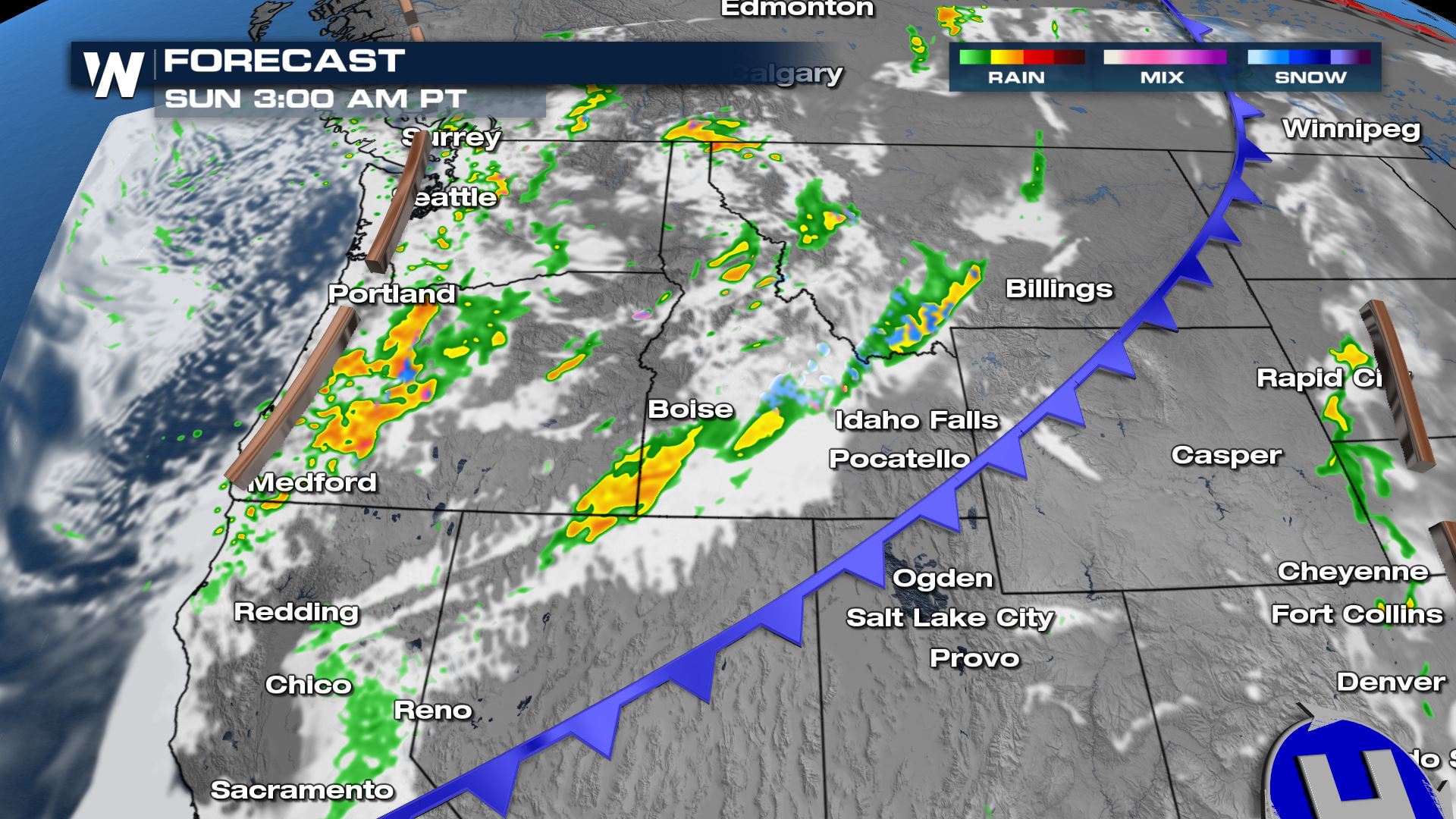
 As the frontal boundary moves inland we will see rain and snow showers continue, especially over higher peaks. They will be more scattered but could still put down heavy amounts of precipitation at times.
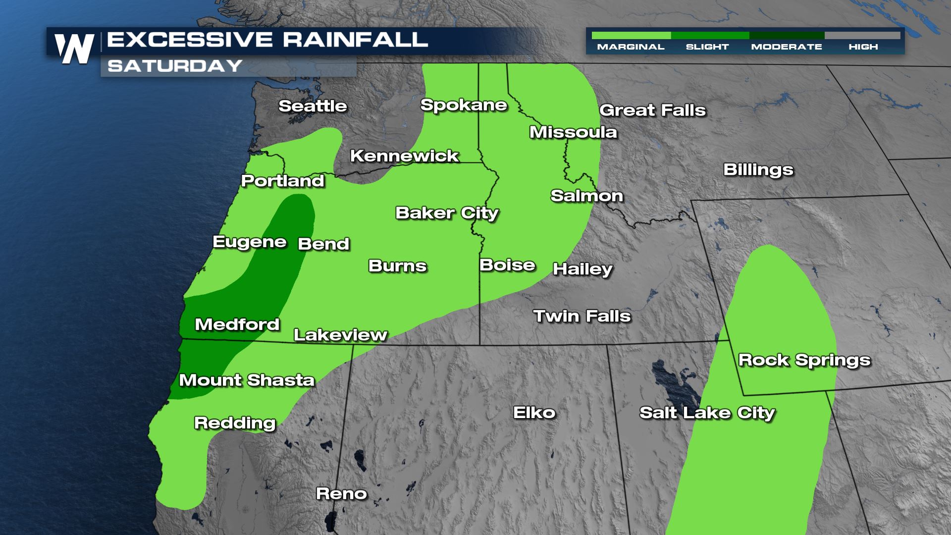
 Excessive rainfall outlooks have been issued again today for the flood risk. Darker green areas indicate higher potential for flooding. Watch out near recent area burn scars for heavy rain to cause mudslides and debris flows.
 For more on this first fall front, tune in to the western regional forecast :50 past the hour.
Forecast
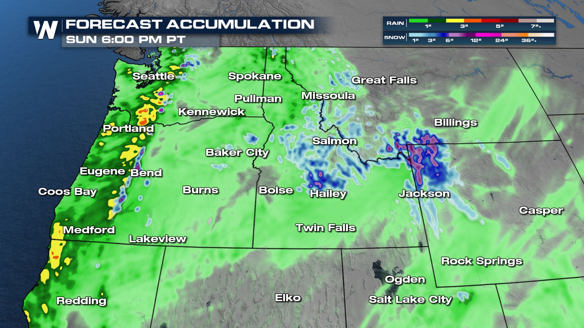
As the cold front moves inland rain will increase east of the I-5 corridor and into interior areas of Washington, Oregon and Idaho. This moisture will be extremely beneficial for fire fighters battling large blazes across these states. It should also help to dissipate smoke in the region.
Heavy rain will continue across the northern Rockies into Saturday night, keeping temperatures cooler and the pattern generally unsettled. Energy from an upper low behind the cold front will bring additional rounds of rain and thunderstorms to round out the weekend along with some high mountain peak snow.
More rounds of mountain snow is possible Sunday as cold air behind the front plus energy in the upper levels moves over high elevation areas. This is not totally out of the ordinary, as the average first measurable snowfall in the Salmon Mountains and Bitterroots is in September.
As the frontal boundary moves inland we will see rain and snow showers continue, especially over higher peaks. They will be more scattered but could still put down heavy amounts of precipitation at times.
Rainfall Forecast
There will be areas of locally heavy rain, with up to 5" possible along the immediate coastline. Farther inland, we could see up to 3" of rain in heavier pockets. This will certainly help the ongoing drought in the west. Snow on high mountain peaks could accumulate to 3-6" in spots!
Excessive rainfall outlooks have been issued again today for the flood risk. Darker green areas indicate higher potential for flooding. Watch out near recent area burn scars for heavy rain to cause mudslides and debris flows.
For more on this first fall front, tune in to the western regional forecast :50 past the hour.All Weather News
More
Wildfire Outbreak in the Pacific Northwest
SPOKANE, WA - On Saturday, August 1st, the Ol
3 Aug 2026 1:55 AM

More Storms for the East Through Monday
A low-pressure system that moved through the
3 Aug 2026 1:50 AM


After Reaching Category 5, Genevieve Weakens in the Pacific
PacificGenevieve formed last Friday south of
3 Aug 2026 12:30 AM

Flooding, Severe Storms Target the Midwest Again
After an active week of storms across the nor
1 Aug 2026 1:40 AM

Flooding Risk Increases as Heavy Rain Targets the Tri-State Area
Tuesday, heavy rainfall moved across the Nort
30 Jul 2026 12:25 AM

Severe Weather: Energy From the Midwest Now in the Southeast
UPPER MIDWEST - Through Monday, dangerous tor
29 Jul 2026 10:30 PM