Rain and Snow Return to the Southwest

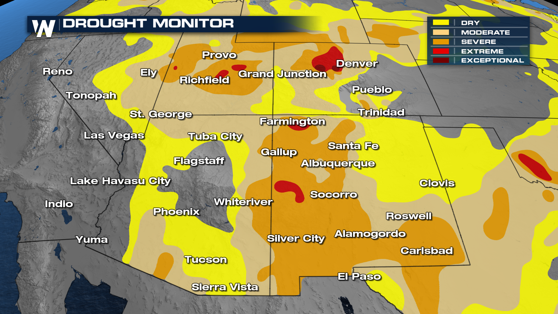
For much of this winter season, the Southwestern United States has been under the influence of a large, blocking ridge of high pressure. This ridge has sent storms well to the north, keeping the southwest dry and warm. While a few soaking systems helped push drought conditions out of California, the Four Corners have been seeing drought conditions worsen with snow pack rivaling the worst on record (snow pack records date back about 40 years).
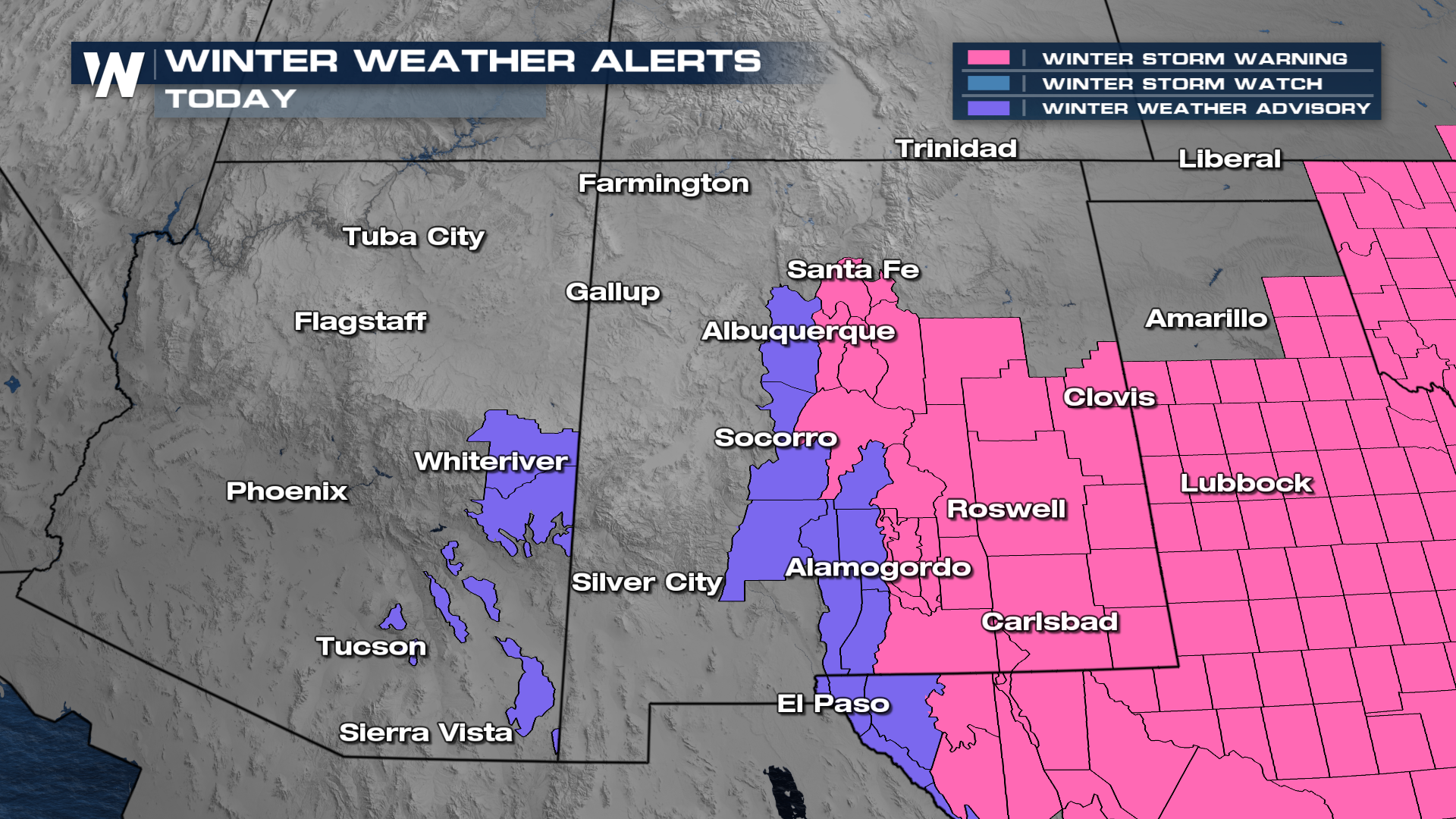
 A wet storm system has moved in from the Pacific bringing heavy rain and snow back to these parched locations. Winter weather alerts remain in place for portions of New Mexico and Arizona lasting through Sunday morning.
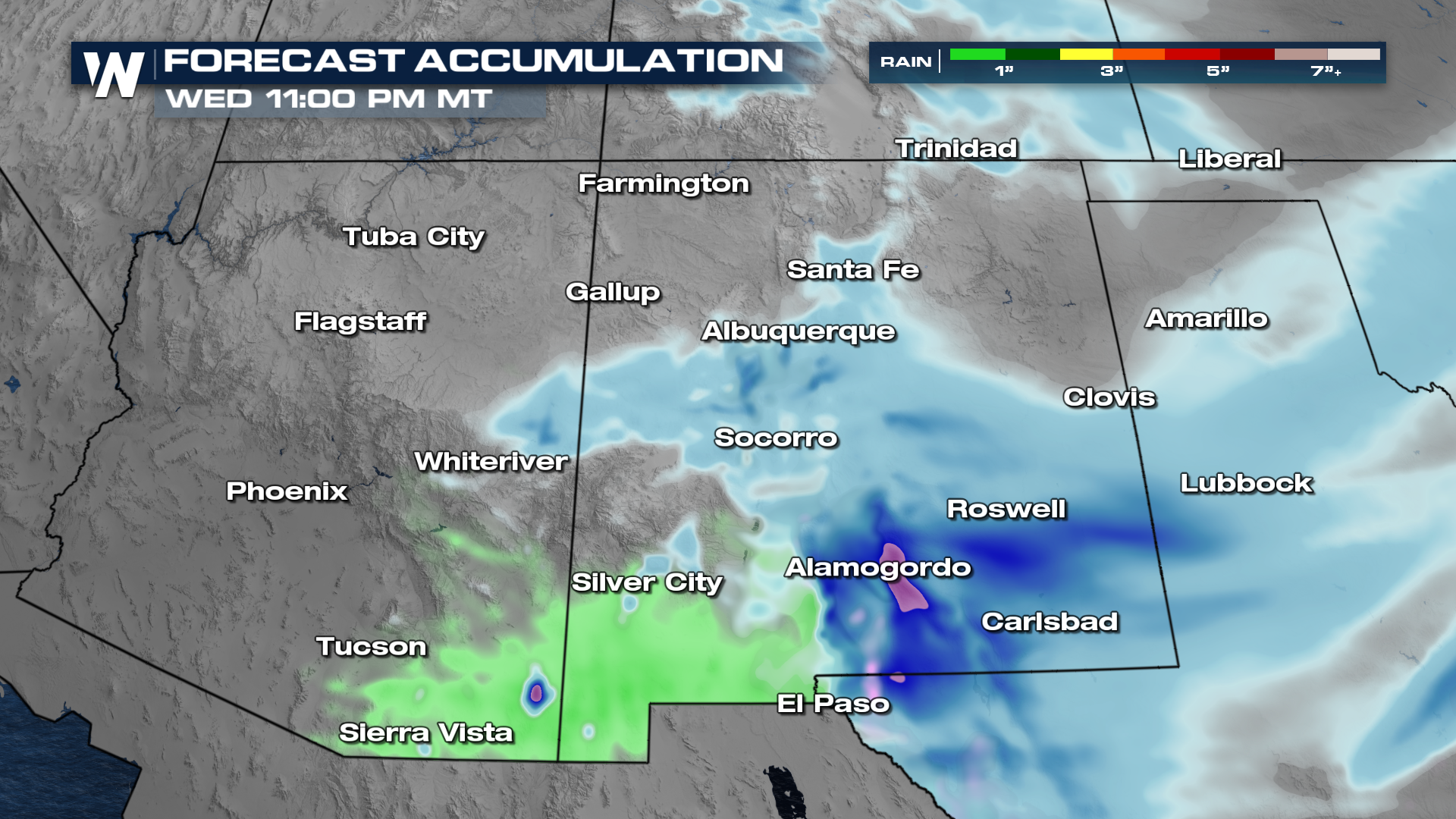
The worst of this low is definitely behind us by Sunday morning rainfall-wise. What's left is some residual snowfall that'll bring some decent totals across New Mexico throughout the day.
Some totals will still measure close to 6" in some areas like near Alamogordo, New Mexico. Rainfall totals still may reach half an inch in some spots in southern Arizona and New Mexico. However, most of this precipitation should be on it's way out by Sunday afternoon.
Get the latest forecast for the Western U.S. anytime with the WeatherNation app by pulling up the regional forecast section, or tuning in to WeatherNationTV at :50 past the hour.


