Rain and Storm Chances Continue Along the Gulf Coast
Special Stories
10 Feb 2021 6:00 AM
A long, stalled out front continues to bring heavy rain and thunderstorm chances to the Gulf Coast States through the next several days. Pockets of torrential rain are likely along with a few stronger thunderstorms, but the overall severe weather threat is low.
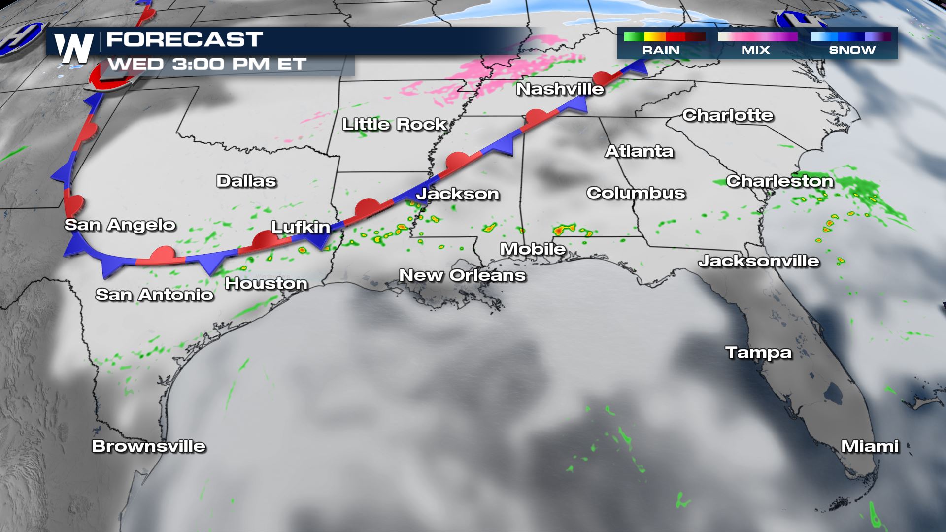
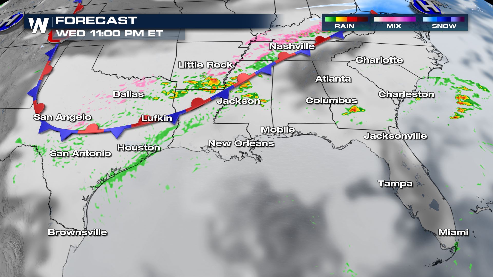
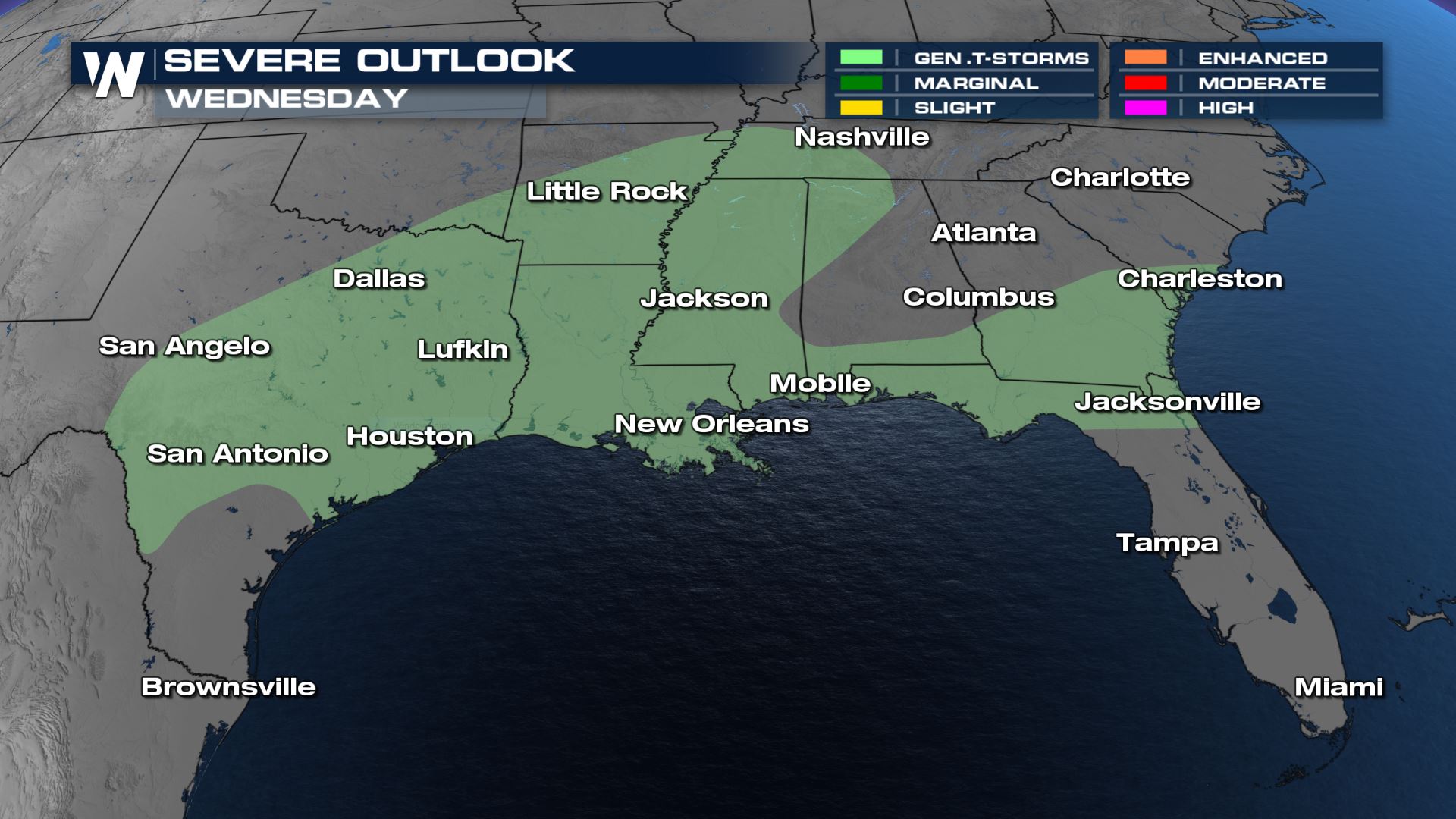
On Wednesday afternoon, storms will be widely scattered as the front weakens and becomes more diffuse. Most of these will start along the I-10 corridor and drift to the north throughout the late afternoon and evening. Heavy rain will be possible at times.
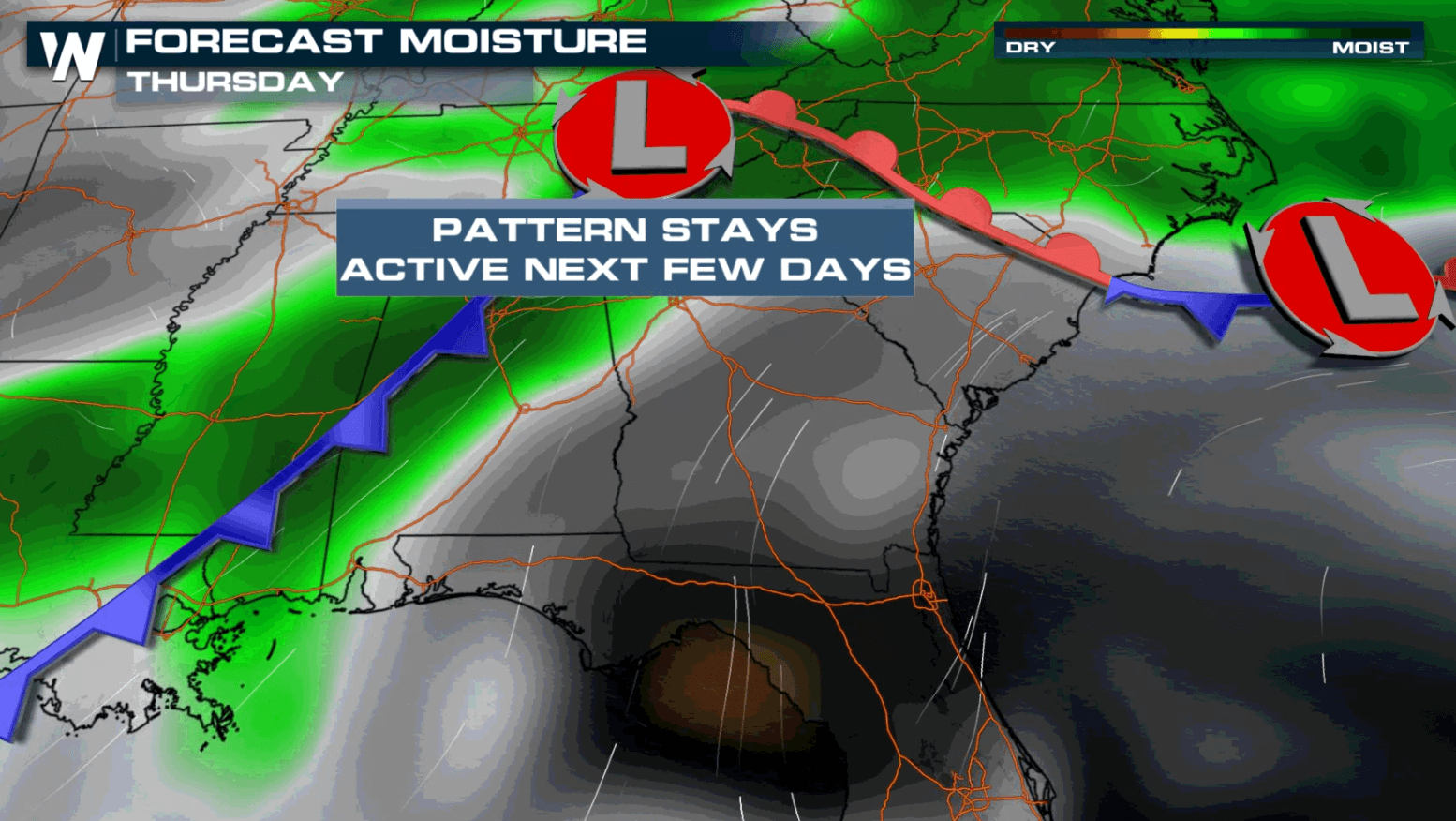
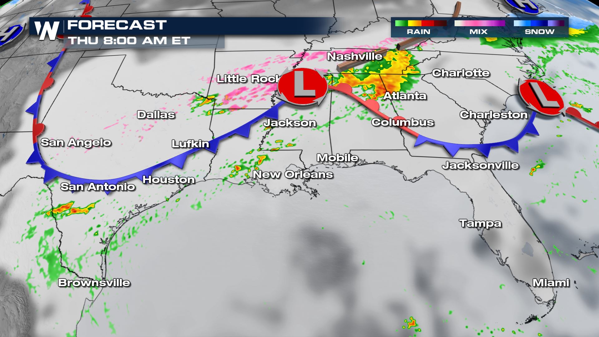
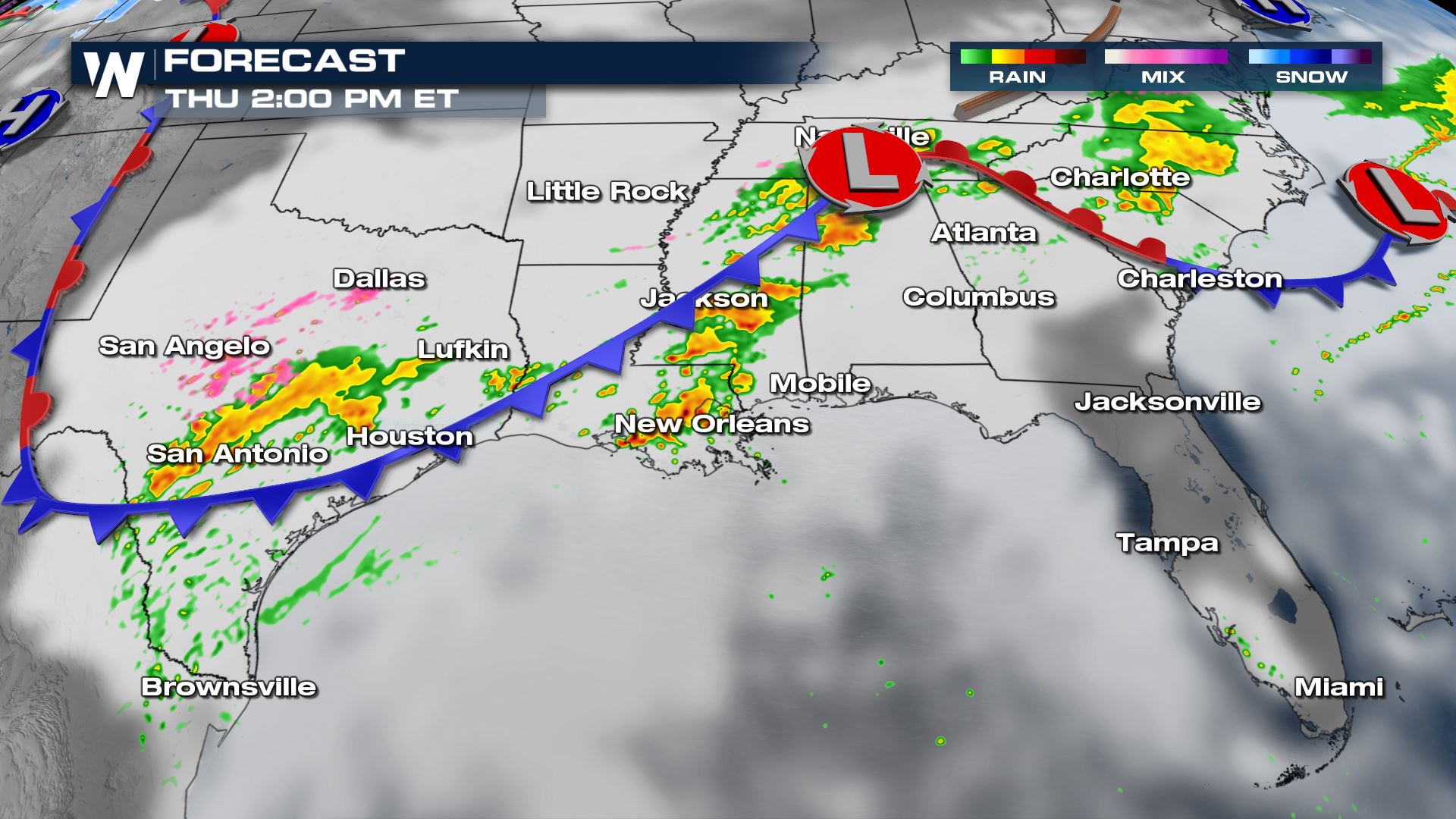
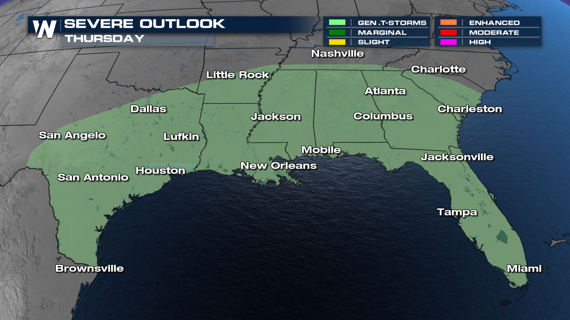
 By Thursday morning a low pressure center will form in north Mississippi, with heavy rain likely north of the warm front in Alabama, Georgia and Tennessee. A broken line of rain and thunderstorms will also form along the cold front. This will provide a focus for some stronger thunderstorms to form especially in the afternoon.
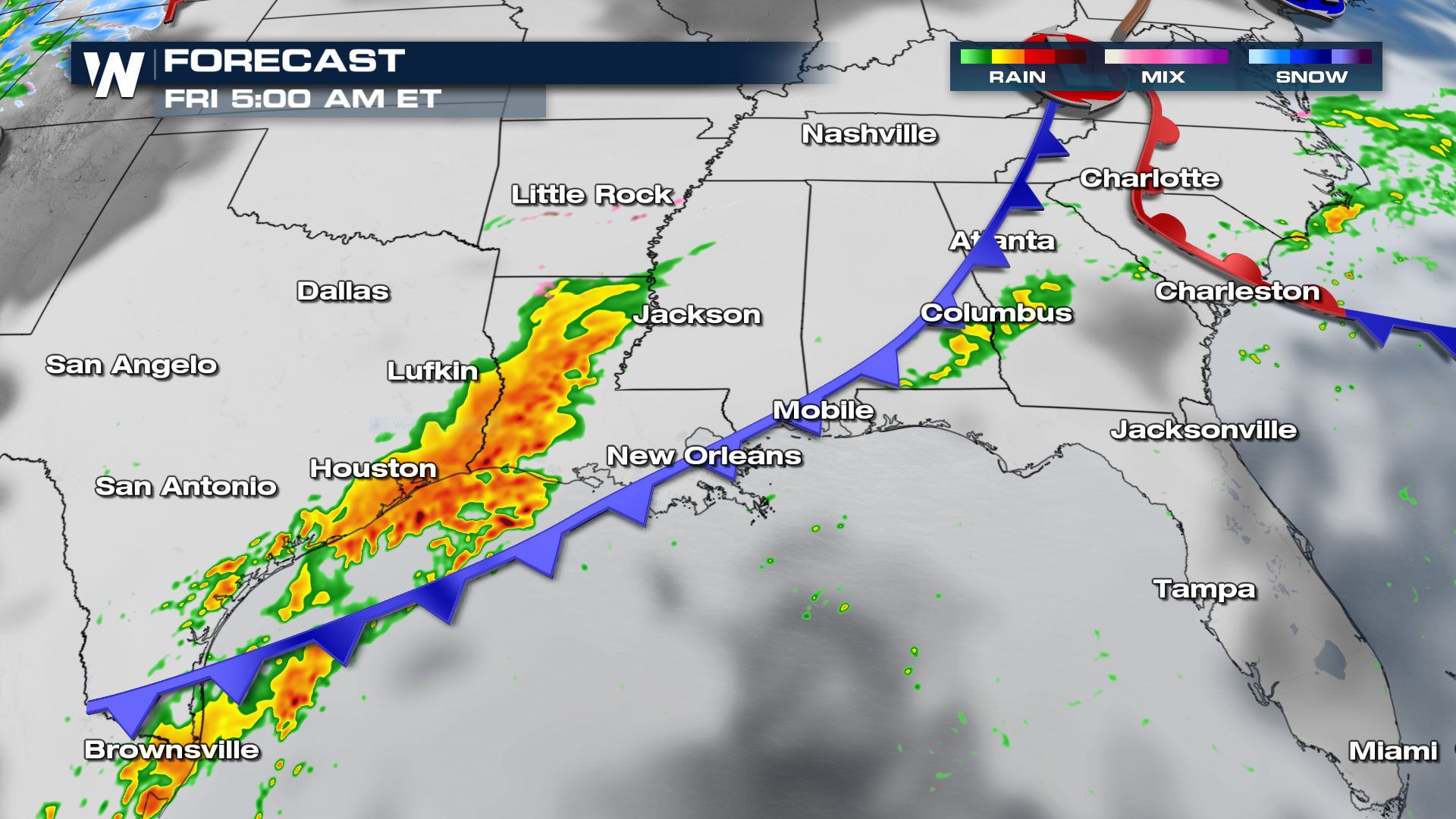
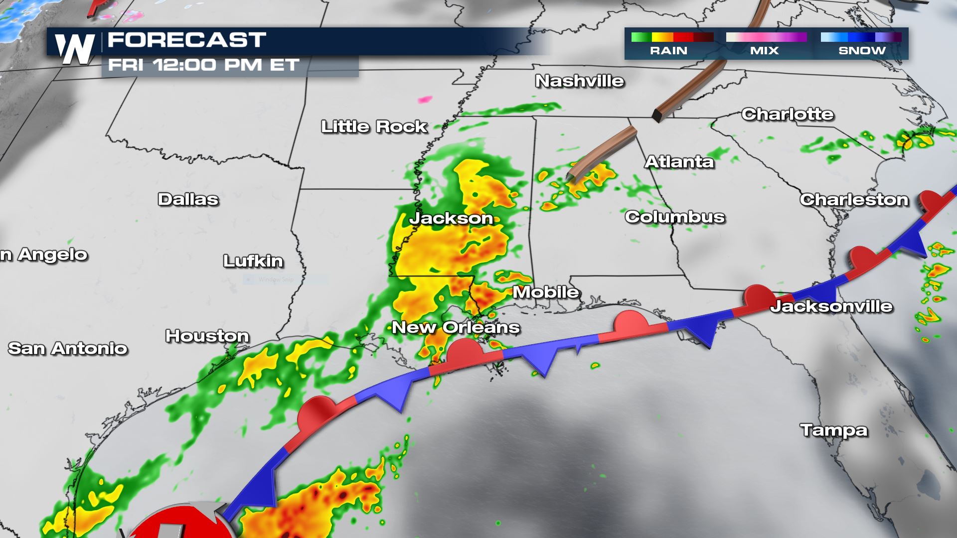
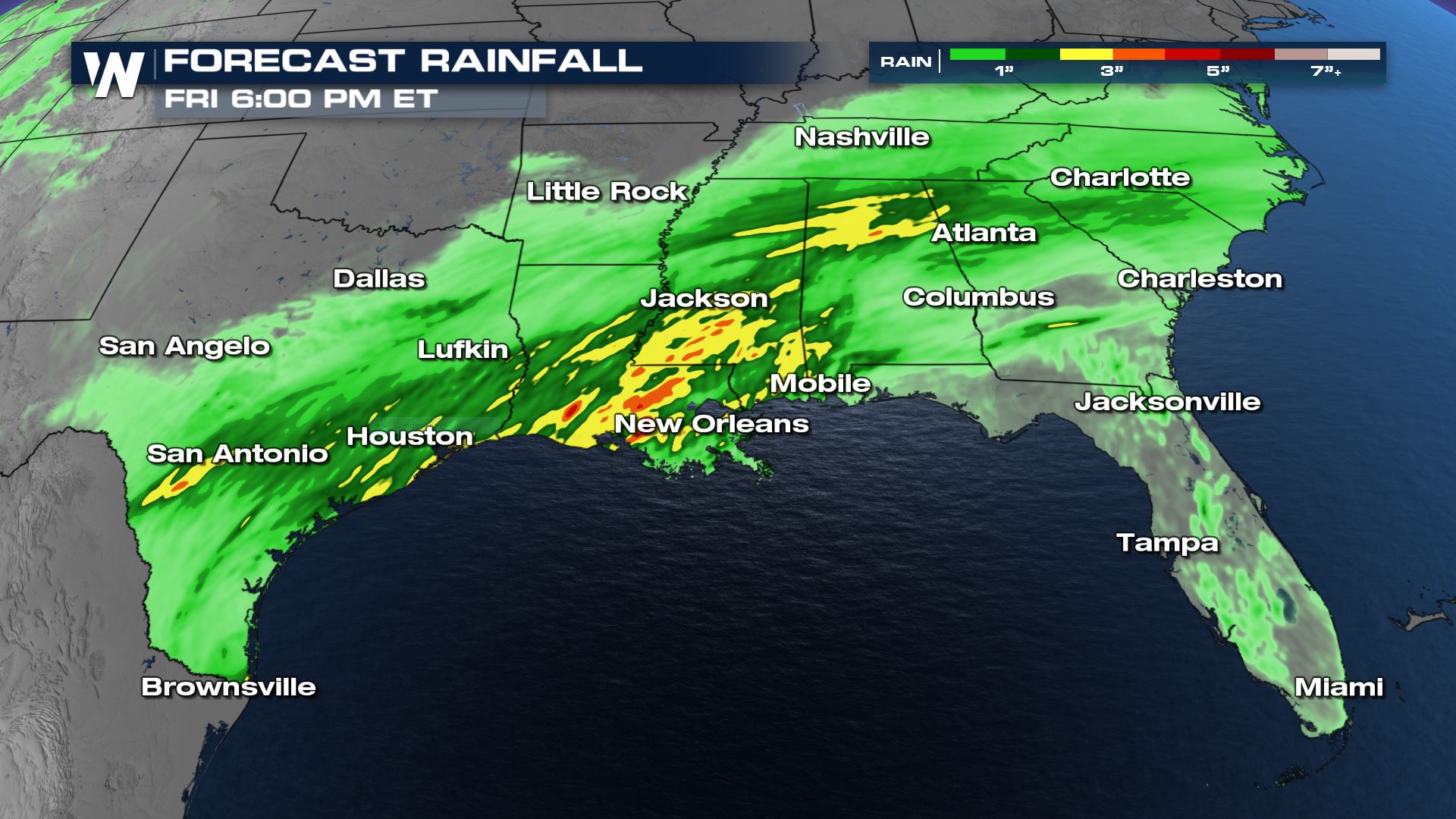
 By Friday the front will be creeping toward the coast, but a secondary area of heavy rain and thunderstorms will form in east Texas and Louisiana due to upper level moisture coming up from the Pacific.
 As mentioned above, we are not really looking at an organized severe weather event but some thunderstorms may be strong. This is most likely where there is a big clash between the air masses. We're talking a 30° temperature gradient ahead and in front of the boundary. Gusty winds in excess of 40 mph will be the biggest hazard with any strong storm.
 For the latest information on the rain side of this event be sure to tune into WeatherNation, we're streaming 24/7.
By Thursday morning a low pressure center will form in north Mississippi, with heavy rain likely north of the warm front in Alabama, Georgia and Tennessee. A broken line of rain and thunderstorms will also form along the cold front. This will provide a focus for some stronger thunderstorms to form especially in the afternoon.
By Friday the front will be creeping toward the coast, but a secondary area of heavy rain and thunderstorms will form in east Texas and Louisiana due to upper level moisture coming up from the Pacific.
As mentioned above, we are not really looking at an organized severe weather event but some thunderstorms may be strong. This is most likely where there is a big clash between the air masses. We're talking a 30° temperature gradient ahead and in front of the boundary. Gusty winds in excess of 40 mph will be the biggest hazard with any strong storm.
Forecast Accumulation
Rainfall accumulations will be highest along the stalled out front where rain may train over the same spots for a longer duration of time. Our in-house forecast model is looking at isolated totals of 3" to 4" through Friday with widespread 1-2" rain totals. There could be isolated flooding concerns in areas that tend to flood easily.
For the latest information on the rain side of this event be sure to tune into WeatherNation, we're streaming 24/7.All Weather News
More
Wildfire Outbreak in the Pacific Northwest
SPOKANE, WA - On Saturday, August 1st, the Ol
3 Aug 2026 1:55 AM

More Storms for the East Through Monday
A low-pressure system that moved through the
3 Aug 2026 1:50 AM


After Reaching Category 5, Genevieve Weakens in the Pacific
PacificGenevieve formed last Friday south of
3 Aug 2026 12:30 AM

Flooding, Severe Storms Target the Midwest Again
After an active week of storms across the nor
1 Aug 2026 1:40 AM

Flooding Risk Increases as Heavy Rain Targets the Tri-State Area
Tuesday, heavy rainfall moved across the Nort
30 Jul 2026 12:25 AM

Severe Weather: Energy From the Midwest Now in the Southeast
UPPER MIDWEST - Through Monday, dangerous tor
29 Jul 2026 10:30 PM