Rain Finally Makes a Return to the Northwest

Top Stories
1 Feb 2026 11:00 AM
More precipitation is in the forecast across the Pacific Northwest. Conditions have not been as active to start the weekend, but another cold front is on the way for early Sunday morning. The highest totals look to target the Olympic Peninsula again and into the foothills of the Cascades. A few inches of rain will be possible over the next several days, along with snow in the higher elevations. Localized totals may end up measuring up to a foot in the northern Cascades.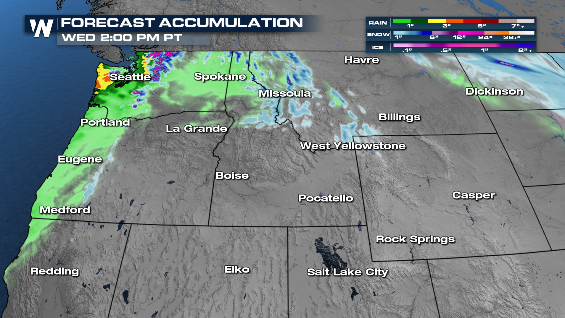
Over the next few days, the forecast calls for waves of moisture off and on, producing rain and snow showers.
More details on your Western Regional Forecast can be found :50 past the hour, every hour, on WeatherNation.
All Weather News
More

Severe Storms, Flash Flooding Overnight In Midwest
WHAT TO EXPECTIt was a very active day across
22 Jun 2026 1:50 AM


Summer Solstice Kicks Off Father's Day Sunday
Fathers across the country will have to share
21 Jun 2026 5:20 PM

Flood Risk Continues This Weekend for the Gulf Coast States
Numerous flash flood warnings were issued as
21 Jun 2026 1:15 PM

Dry T-Storms & Fire Danger in the West
A weak low-pressure system moving through the
20 Jun 2026 1:40 PM

Tornadoes Tear Through The Midwest, Isolated Severe Storms in the South
EARLIER THIS WEEKMONTROSE, IL - A dangerous t
20 Jun 2026 1:30 AM