Rain, Snow and Ice for the Northeast Monday
Top Stories
22 Feb 2021 1:30 PM
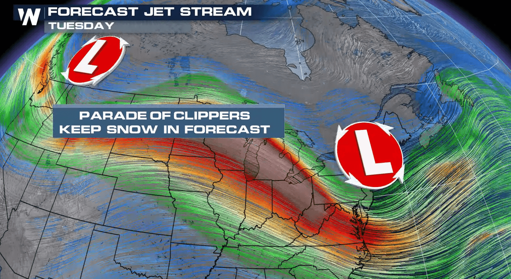
An energetic trough will move through the Northeast today (Monday) and bring chances for heavy snow, ice and rain. A fast moving trough will be the focus for the precipitation. This is the same energy that is brought snowy weather to areas of the Northern Plains and Upper Midwest this weekend.
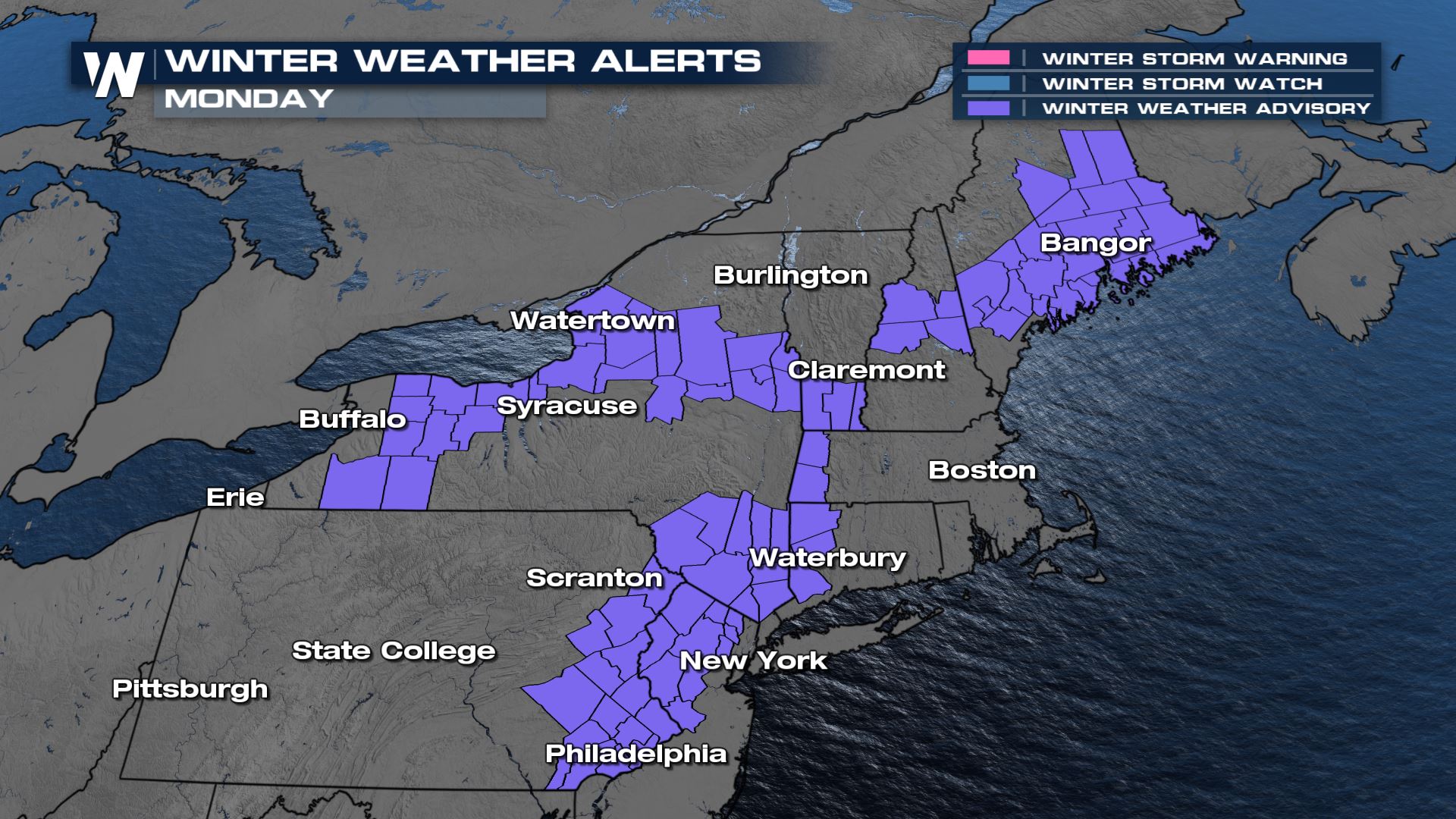 Winter weather advisories have been issued from Virginia to Vermont and also eastern Maine. Snowfall totals up to 6" are possible.
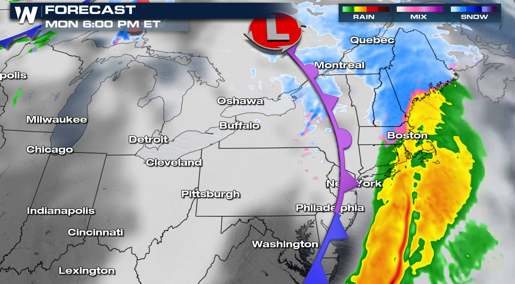 Snow and rain will move through New England in the evening. A secondary wave aloft brush through right on the tail end of this system, and produce a little more snow to be possibly enhanced with a bit of lake effect too. As the system moves to the east, precipitation will come to an end overnight into early Tuesday.
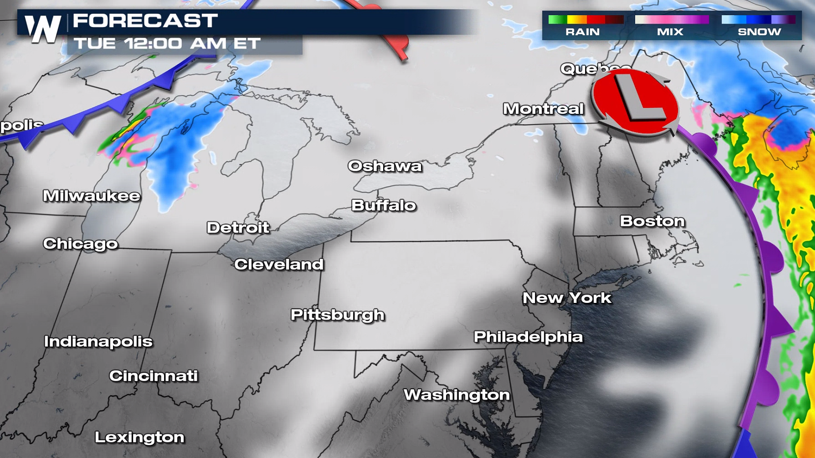
 More updates are on the way all day on WeatherNation.
Winter weather advisories have been issued from Virginia to Vermont and also eastern Maine. Snowfall totals up to 6" are possible.
Forecast
Snow will push through the region from the morning into the afternoon. There will be some warmer temperatures trying to mix in with this set-up, which may lead to some ice and regular rain mixing in with the snow.
Snow and rain will move through New England in the evening. A secondary wave aloft brush through right on the tail end of this system, and produce a little more snow to be possibly enhanced with a bit of lake effect too. As the system moves to the east, precipitation will come to an end overnight into early Tuesday.
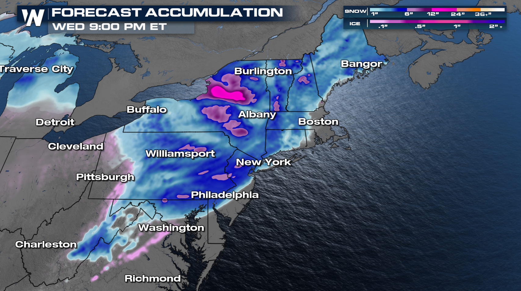
Accumulation Forecast
Snowfall accumulation will be heaviest in New York State, especially where lake enhanced snow could bump up totals around Watertown, NY. 3" to 6" will be common in the alerts areas with 1" to 3" possible across a large portion of the Northeast.
More updates are on the way all day on WeatherNation.All Weather News
More
Tropics: Fausto Heads to Hawaii; Genevieve Has Formed and Could Become a Major Hurricane
Atlantic BasinBertha has dissipated after mov
24 Jul 2026 10:40 PM

Very Hot Temperatures For the Western and Central United States
Are you over the summer heat yet? Well, more
24 Jul 2026 10:10 PM

Severe Chances Return for the Midwest
The upcoming stretch of hot temperatures will
24 Jul 2026 8:10 PM

Southeast Flood Risk Lingers Near Stalled Front
A stalled boundary over the Carolinas will ke
24 Jul 2026 8:00 PM

Hot & Smoky w/ a Chance of Lightning
Conditions have been really dry out west. We'
24 Jul 2026 11:15 AM

Another Round of Storms Targets the Northeast
Tuesday brought severe weather again across p
23 Jul 2026 1:15 AM

Another Round of Severe Weather for the Upper Midwest and Great Lakes
The upper-level low train continues to keep t
21 Jul 2026 1:45 AM