Record Snowfall Sinking Boats in Alaska

Most of the lower 48 has been missing out on a lot of Winter. Areas along the West Coast and Great Lakes have had an active Winter, but other than them, many along or east of the Rockies have been quiet so far. Not Alaska.
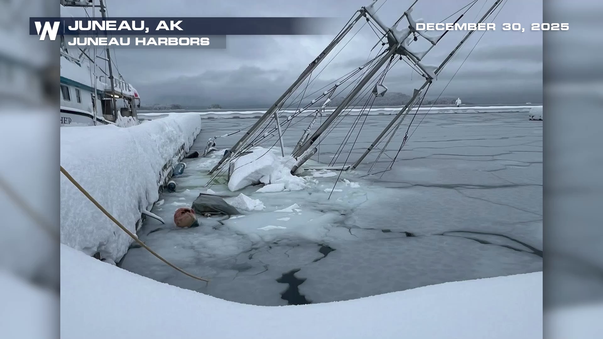
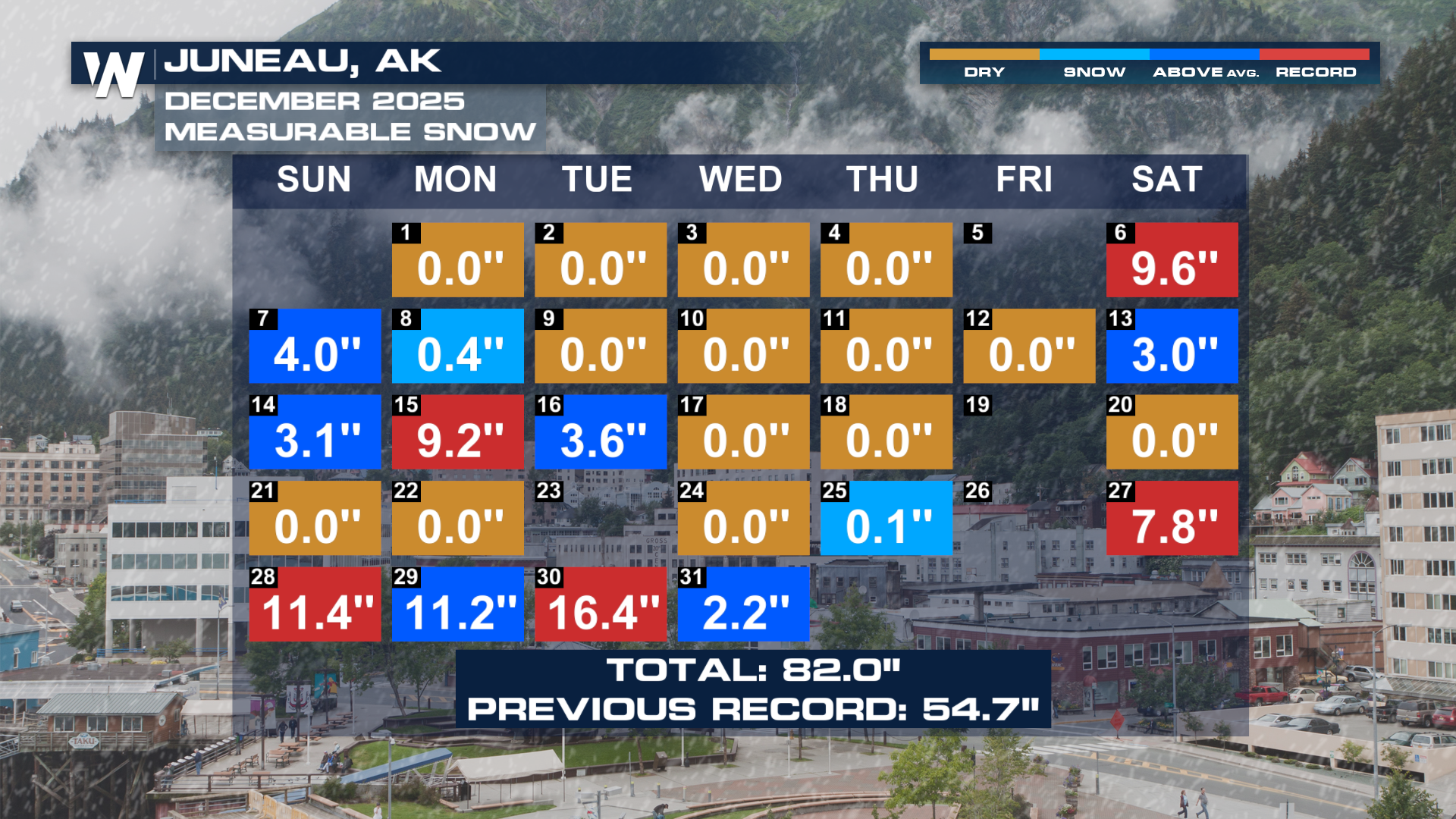
Heavy snowfall towards the end of 2025 was enough to sink boats around Juneau. By the end of the month, the airport in Juneau had measured more snow than any December prior, and it wasn't even close! Over 80 inches of snow fell throughout the month, with multiple daily records sprinkled in.
We spoke with the National Weather Service office in Juneau, Alaska to learn more about this historic snowfall.
UPDATE: January 11th, 2026
Since 2026 has rolled around, it has only kept snowing. Areas from Anchorage to Haines have picked up close to 20 more inches of snow. Not to mention it's been coming in with limited visibility with some blizzard conditions. Another system moving in threatens to bring warmer temperatures along with additional precipitation.
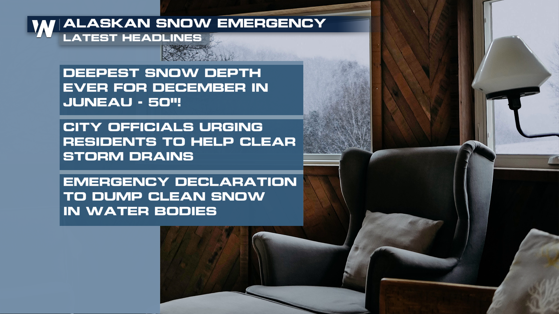 Residents have been asked to clear any clogged storm drain nearby, with officials giving the okay to dump "clean" snow into nearby bodies of water. The weight of the snow has caved in roofs in addition to sinking boats in local harbors.
WHY ARE WARM TEMPERATURES BAD
You would think a nice thawing out would help ease problems in Alaska but it could actually cause more harm. If temperatures warm enough to end the week, rain falling on top of snow will help rapidly melt the pack. Then, everything is running off, not just the rain. This could lead to significant flooding in the area.


