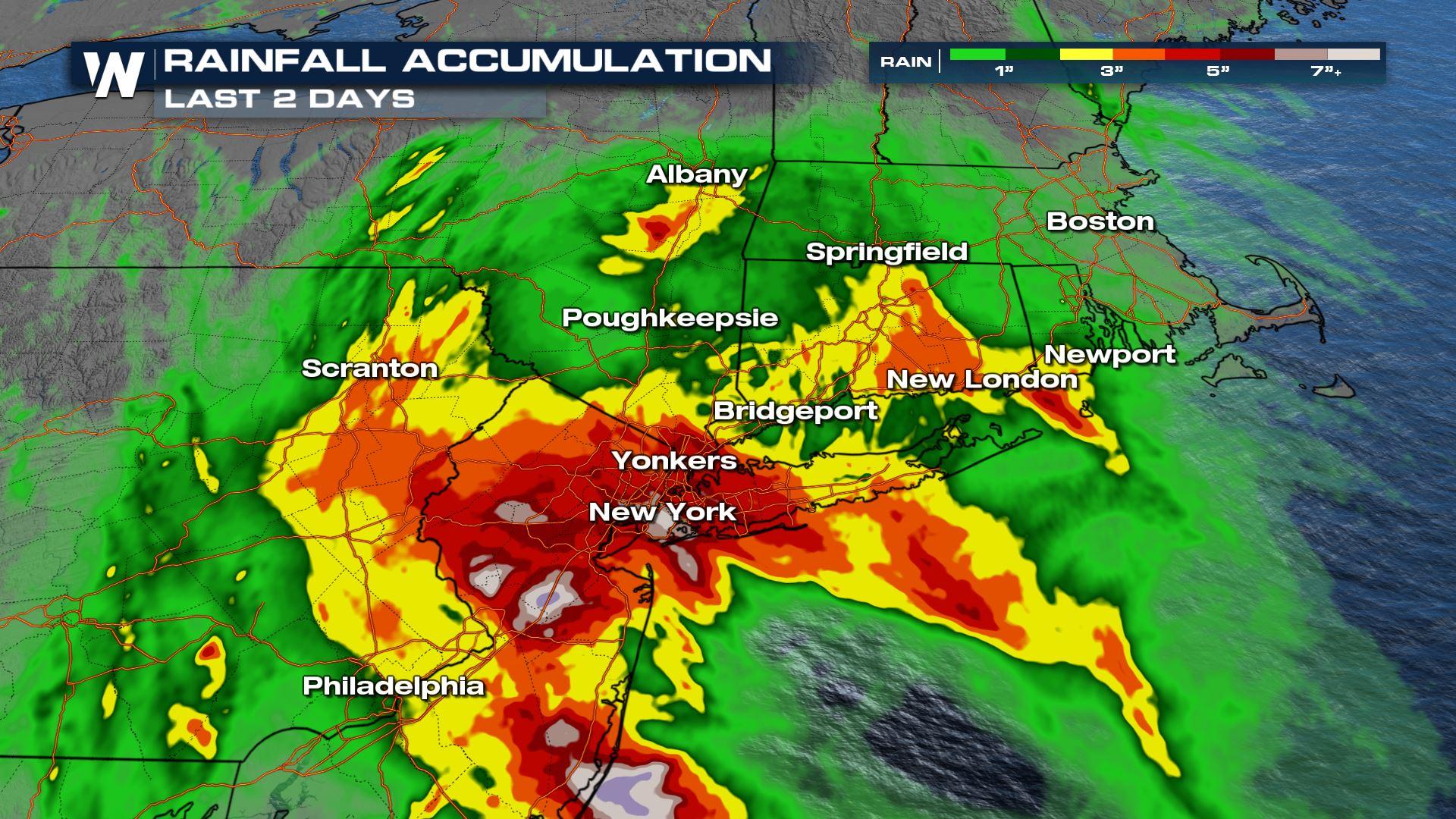
Remnants of Henri Bring Heavy Rain to the Northeast
Top Stories
23 Aug 2021 6:50 PM
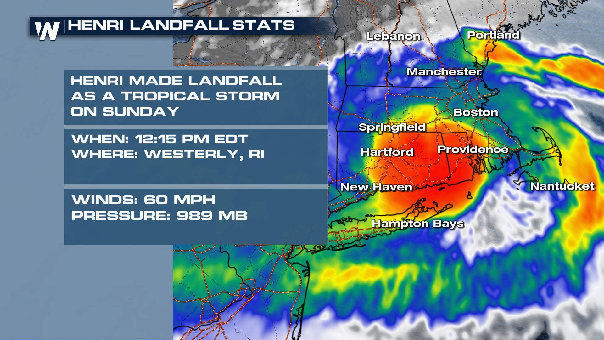
Henri makes landfall as a Tropical Storm on Sunday, August 22, 2021 at 12:15 PM EDT in Westerly, Rhode Island. Winds were sustained at 60 mph and pressure of 989 mb.
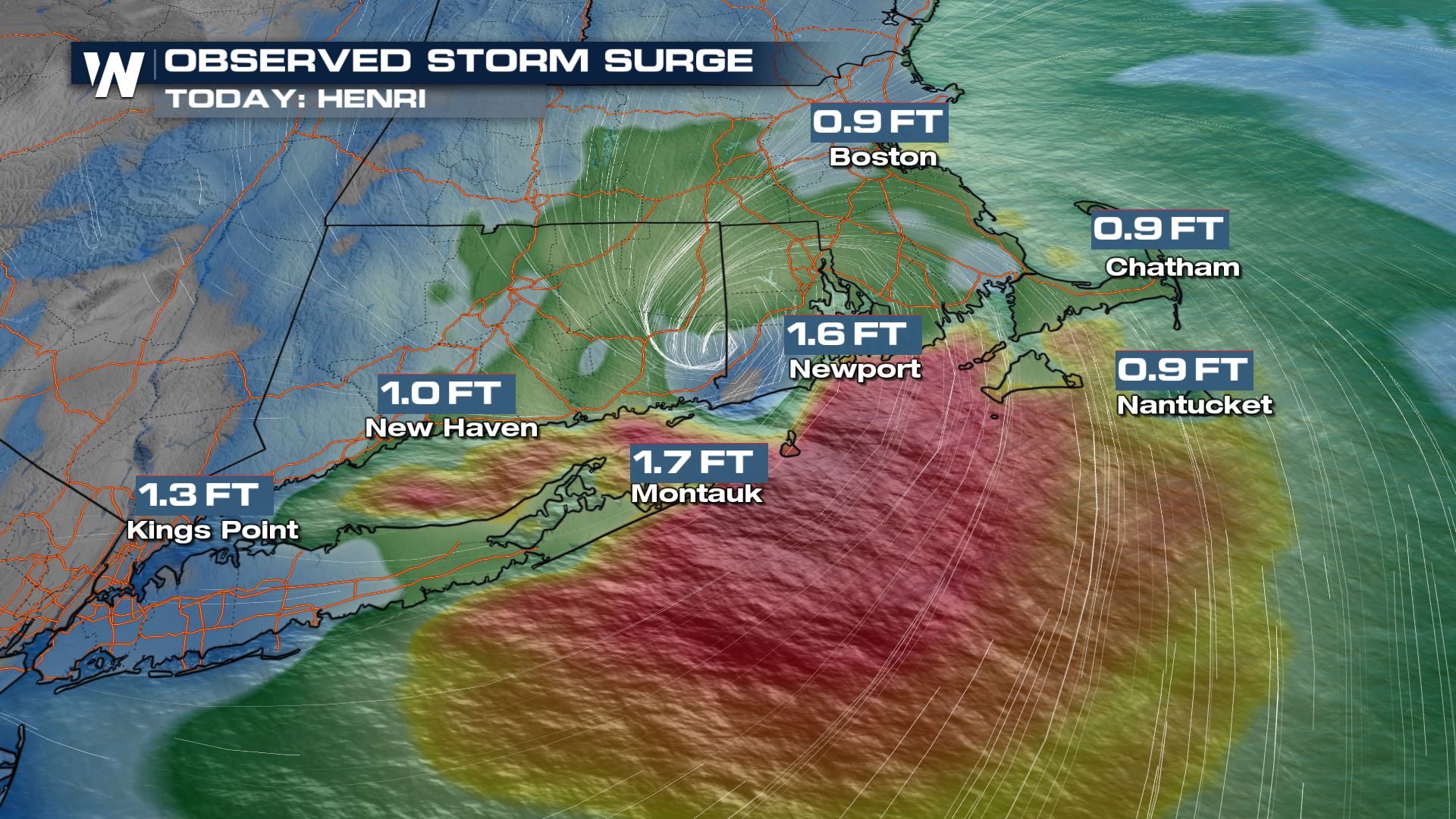
 Henri has weakened, but the remnants will continue to impact New England and the northeast through early Tuesday. Here is a look at some of the surge that southern New England has already seen:
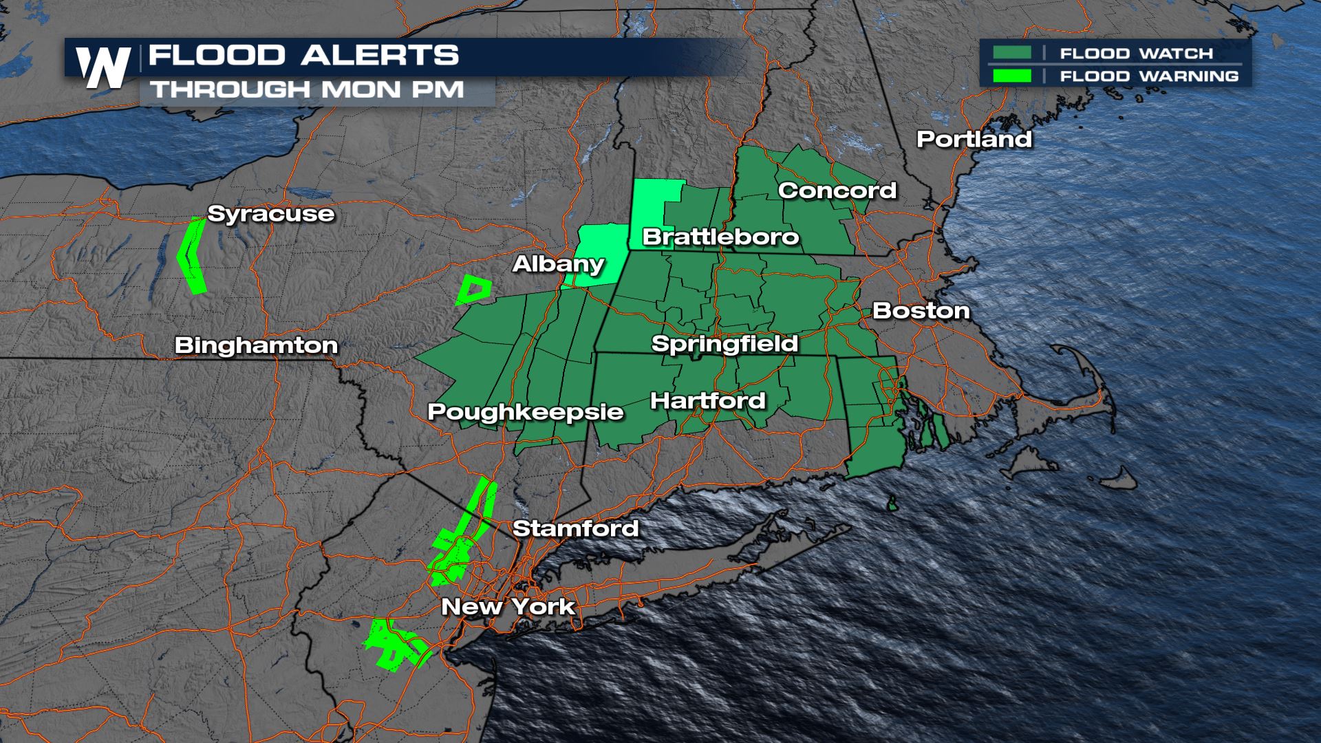
 Because of the expected heavy rain and already saturated soils, flood alerts are in place through Tuesday morning.
 Stay with WeatherNation for all the latest on the Tropics!
Henri has weakened, but the remnants will continue to impact New England and the northeast through early Tuesday. Here is a look at some of the surge that southern New England has already seen:
Flooding Concern
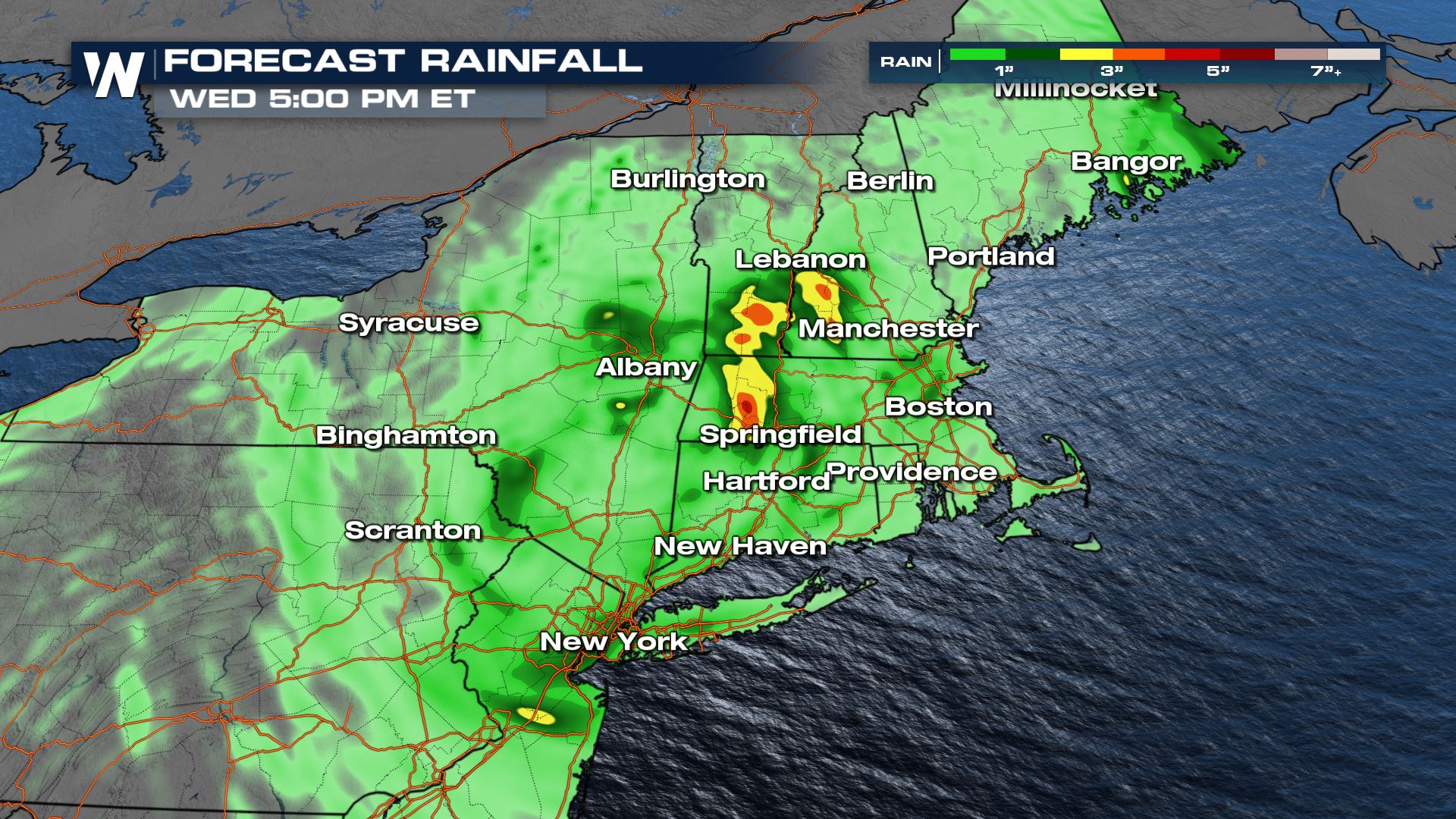
Heavy rain looks likely to continue across southern New England, with pockets of additional rain of 1-2". This comes right after the heavy rain of Fred earlier last week, meaning any additional rainfall will lead to the rapid rise of water.
Because of the expected heavy rain and already saturated soils, flood alerts are in place through Tuesday morning.
Stay with WeatherNation for all the latest on the Tropics!All Weather News
More


Tropics: Fausto Heads towards Hawaii; Genevieve a Major Hurricane
PacificTropical Depression Fausto continues t
29 Jul 2026 10:15 AM

Flooding Risk Increases as Heavy Rain Targets the Tri-State Area
New England - Along with the threat of severe
29 Jul 2026 10:10 AM


Southeast Flood Risk Lingers Near Stalled Front
A stalled boundary over the Southeast will ke
25 Jul 2026 10:55 AM

Another Round of Storms Targets the Northeast
Tuesday brought severe weather again across p
23 Jul 2026 1:15 AM