Rocky Mountain Snow... In June...
Special Stories
8 Jun 2020 6:23 AM
Seriously. An unseasonably cool blast of air behind a potent cold front that brought severe storms to the high plains, also brought snowfall accumulation to the northern Rockies.
https://www.facebook.com/WeatherNation/videos/278372096647095/
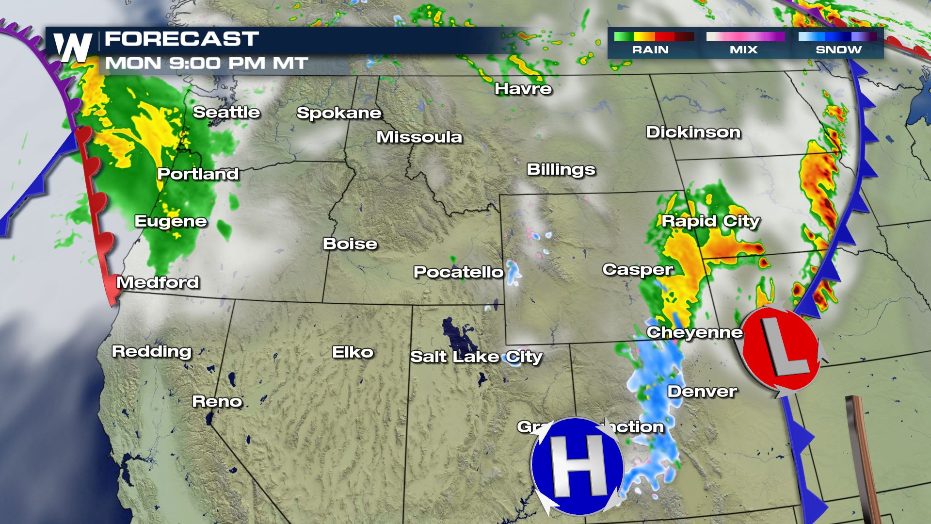
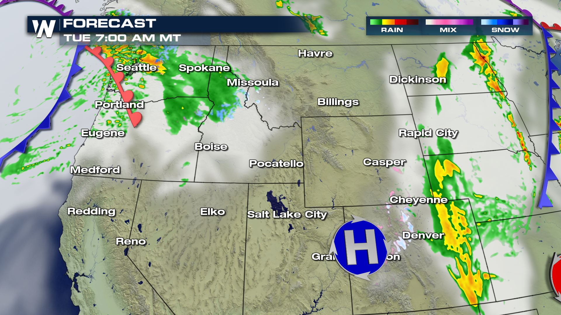
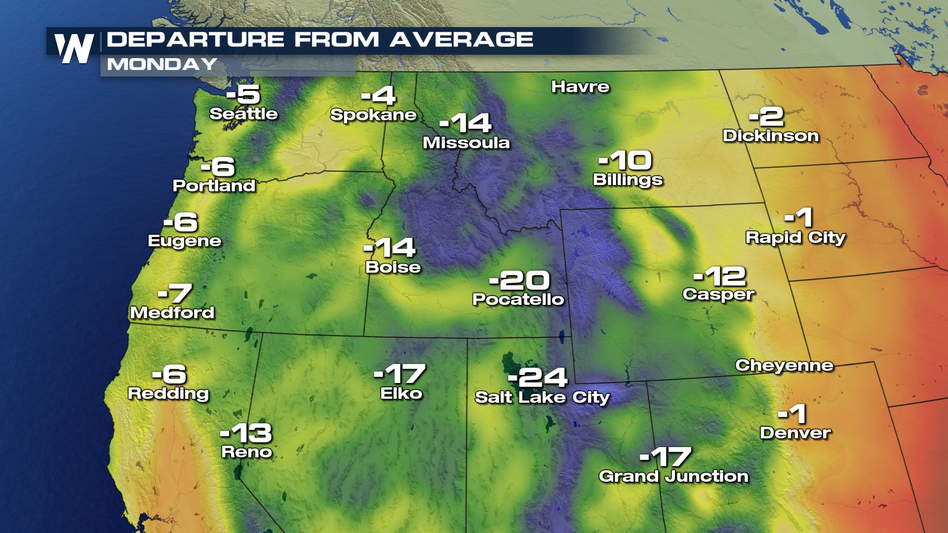
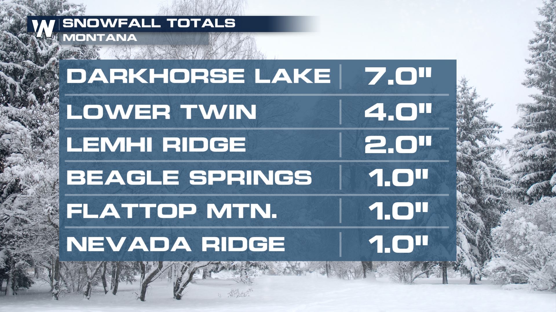 An upper level trough digging into the Pacific Northwest has helped dropped temperatures as much as 20 degrees below average. A surface trough diving south through the Rockies will move from Idaho and Montana to Wyoming and Colorado. Mountain snow will accumulate as temperatures drop overnight. Another quick wave from the Pacific Coast will bring additional rain and high elevation snow to the Cascades into Tuesday.
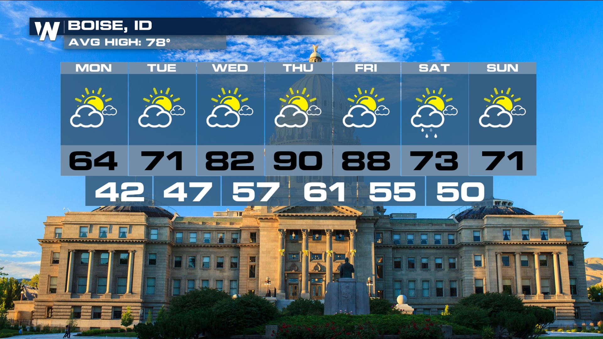
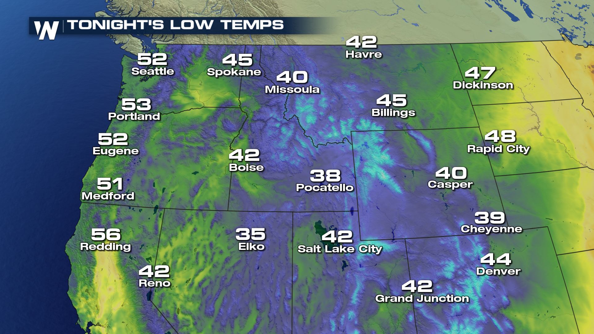 After the cool trough moves out, ridging will build back into the West by midweek. Temperatures will warm as much as 20-30 degrees by Thursday.
 An upper level trough digging into the Pacific Northwest has helped dropped temperatures as much as 20 degrees below average. A surface trough diving south through the Rockies will move from Idaho and Montana to Wyoming and Colorado. Mountain snow will accumulate as temperatures drop overnight. Another quick wave from the Pacific Coast will bring additional rain and high elevation snow to the Cascades into Tuesday.


 After the cool trough moves out, ridging will build back into the West by midweek. Temperatures will warm as much as 20-30 degrees by Thursday.

All Weather News
More