Severe Chances for Eastern North Carolina Sunday

Special Stories
1 Nov 2020 7:16 AM
A deepening trough pushing into the Mid-Atlantic will help to provide a chance for severe weather today in the Tar Heel State. Here is the very latest severe forecast.
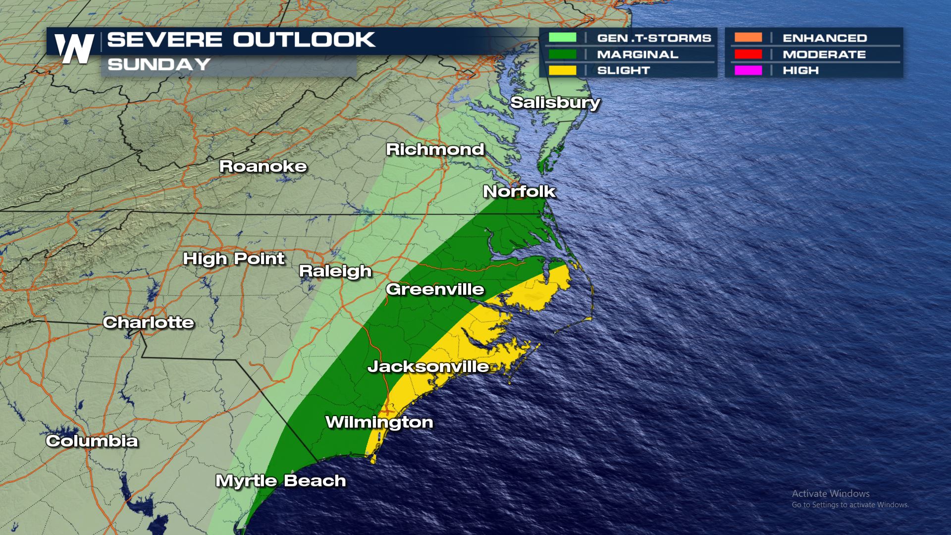 A marginal to slight risk has been issued for eastern North Carolina today, including cities like Wilmington and Jacksonville.
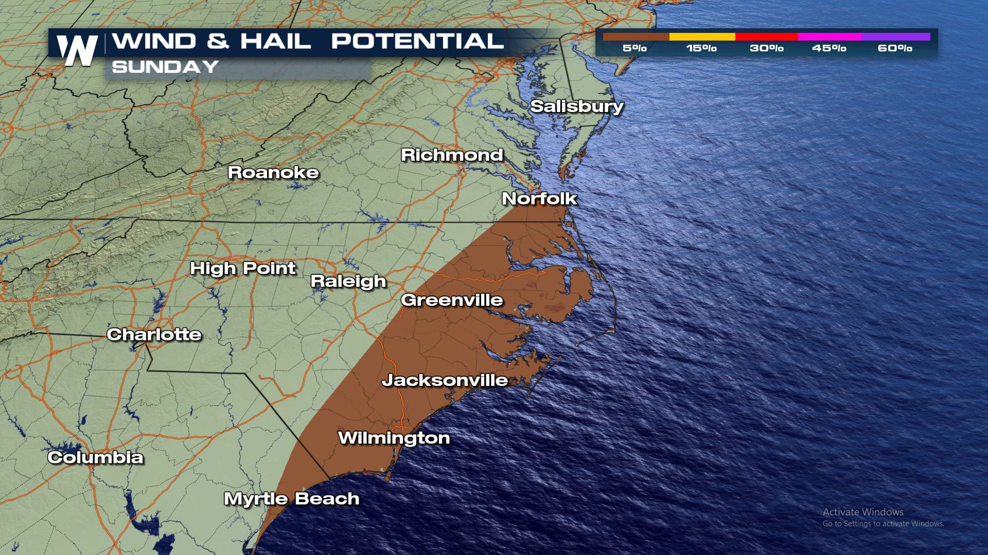
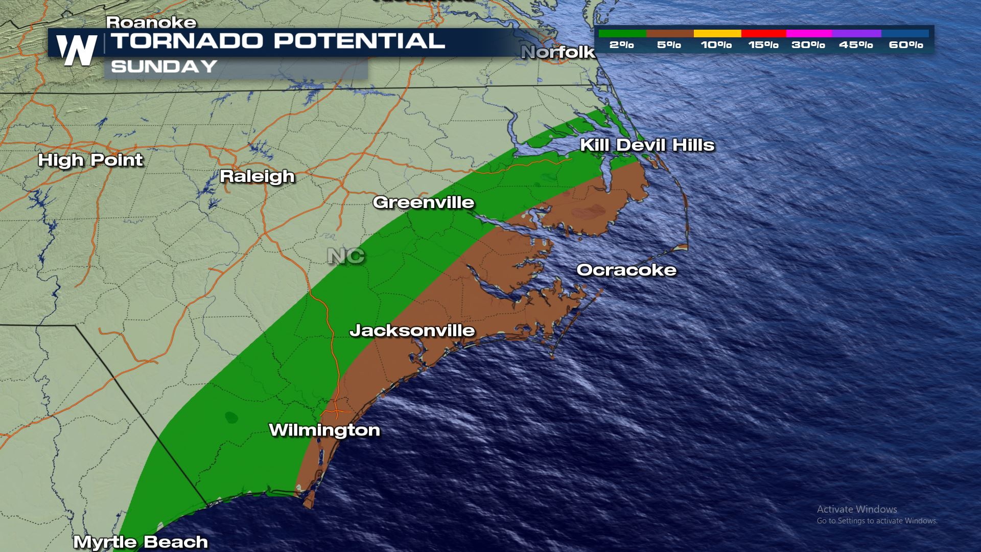 All modes of severe are in the forecast today and this includes a 2-5% risk for tornadoes. With the tornado risk this high, there is a good chance that a tornado watch could be issued later today.
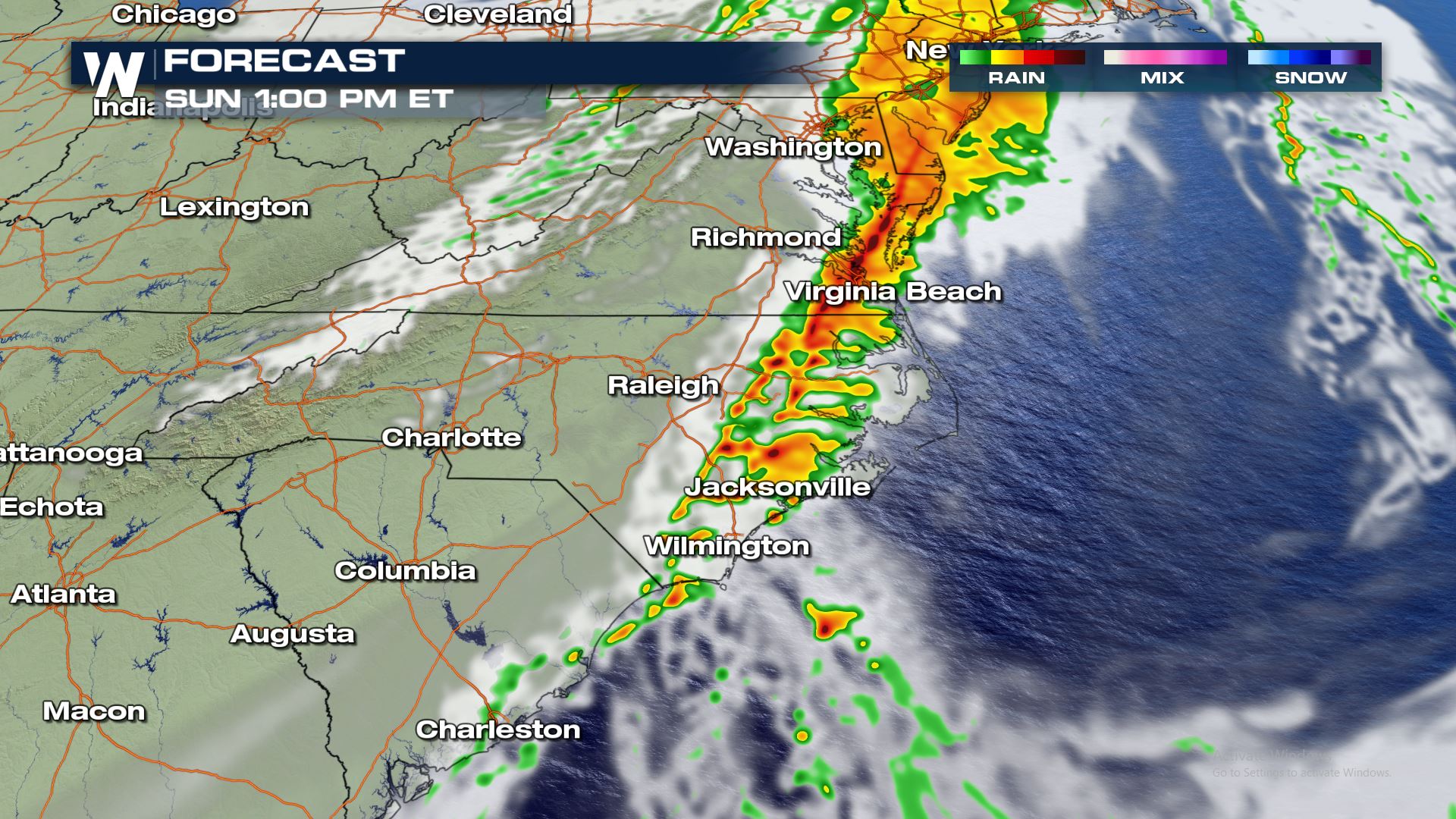
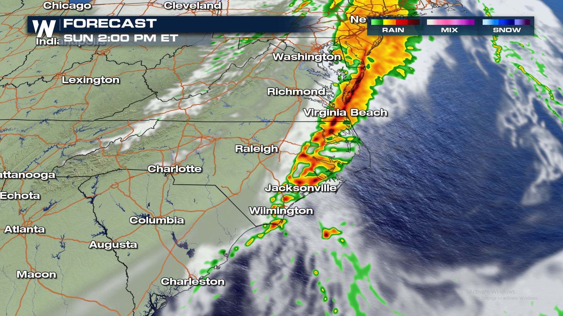
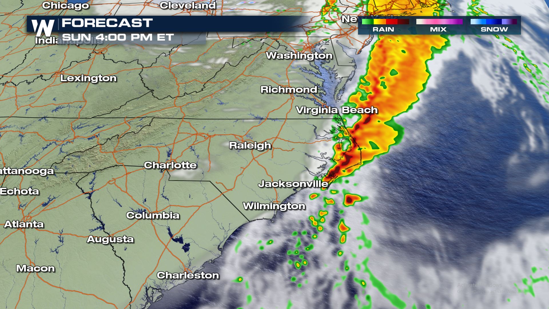 The timing for today's storms will be during the afternoon hours. Anywhere from noon to 5PM is likely when the severe weather will strike.
Keep it tuned to WeatherNation for more updates!
The timing for today's storms will be during the afternoon hours. Anywhere from noon to 5PM is likely when the severe weather will strike.
Keep it tuned to WeatherNation for more updates!
Severe Outlook
A marginal to slight risk has been issued for eastern North Carolina today, including cities like Wilmington and Jacksonville.
Severe Risk
All modes of severe are in the forecast today and this includes a 2-5% risk for tornadoes. With the tornado risk this high, there is a good chance that a tornado watch could be issued later today.
Forecast
The timing for today's storms will be during the afternoon hours. Anywhere from noon to 5PM is likely when the severe weather will strike.
Keep it tuned to WeatherNation for more updates!
All Weather News
More
Wildfire Outbreak in the Pacific Northwest
Conditions have been incredibly dry out west.
2 Aug 2026 1:30 PM

After Reaching Category 5, Genevieve Weakens in the Pacific
PacificGenevieve formed on last Friday south
2 Aug 2026 1:25 PM

More Storms for the East Sunday and Monday
A low-pressure system crashing through the Mi
2 Aug 2026 1:25 PM


Flooding, Severe Storms Target the Midwest Again
After an active week of storms across the nor
1 Aug 2026 1:40 AM

Flooding Risk Increases as Heavy Rain Targets the Tri-State Area
Tuesday, heavy rainfall moved across the Nort
30 Jul 2026 12:25 AM

Severe Weather: Energy From the Midwest Now in the Southeast
UPPER MIDWEST - Through Monday, dangerous tor
29 Jul 2026 10:30 PM