Severe Outlook: More Storms Tuesday and Wednesday

Top Stories
26 Feb 2018 2:06 PM
Another round of severe weather is set to target areas that were hard-hit by storms over the weekend, leading to the potential for damaging winds, large hail, flooding and tornadoes mid-week.
The Storm Prediction Center (SPC) has posted a marginal risk for Tuesday and a slight risk for severe weather on Wednesday (maps below). The primary threat zone will again target the so-called 'ArkLaTex', which saw heavy rain, damaging winds and isolated tornadoes over the weekend.
A strong area of low pressure moving from the West will merge with moisture from the Gulf of Mexico to produce multiple days of strong storms across the South. On Tuesday, limited forcing will likely temper the overall threat for severe weather, but by Wednesday, the energy from the West storm will start to increase the threat for stronger storms in a more widespread fashion. Wednesday will hold the highest chances for severe storms from Dallas, Texas to Memphis, Tennessee. All modes of severe weather will be possible on Wednesday.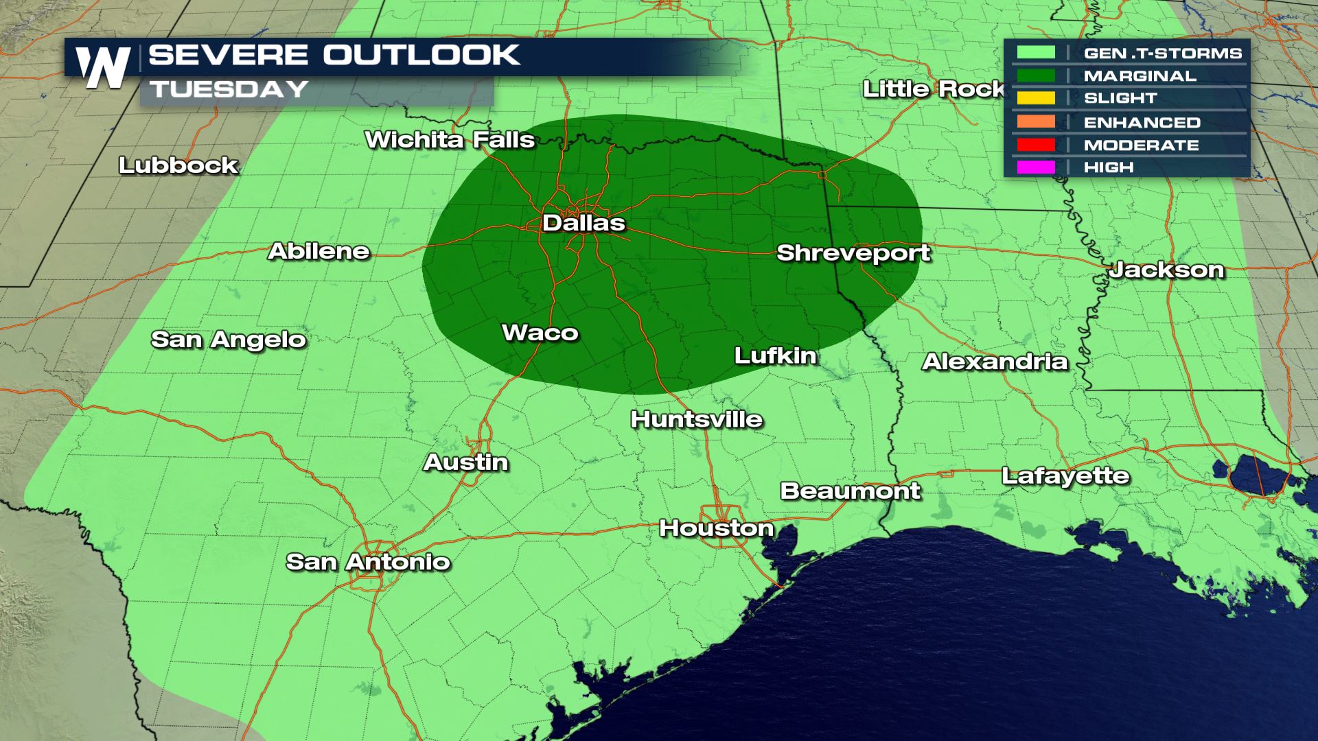
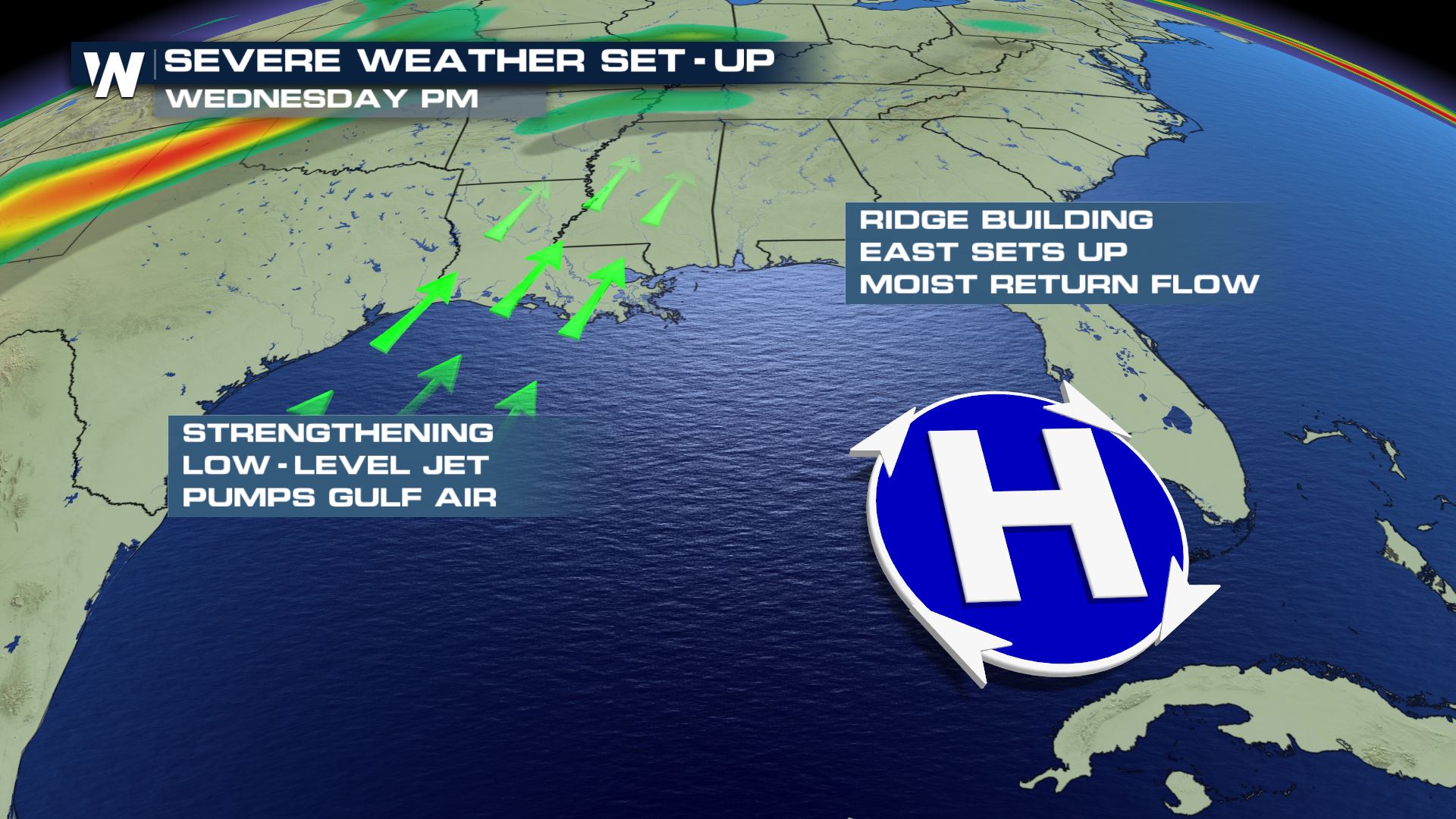
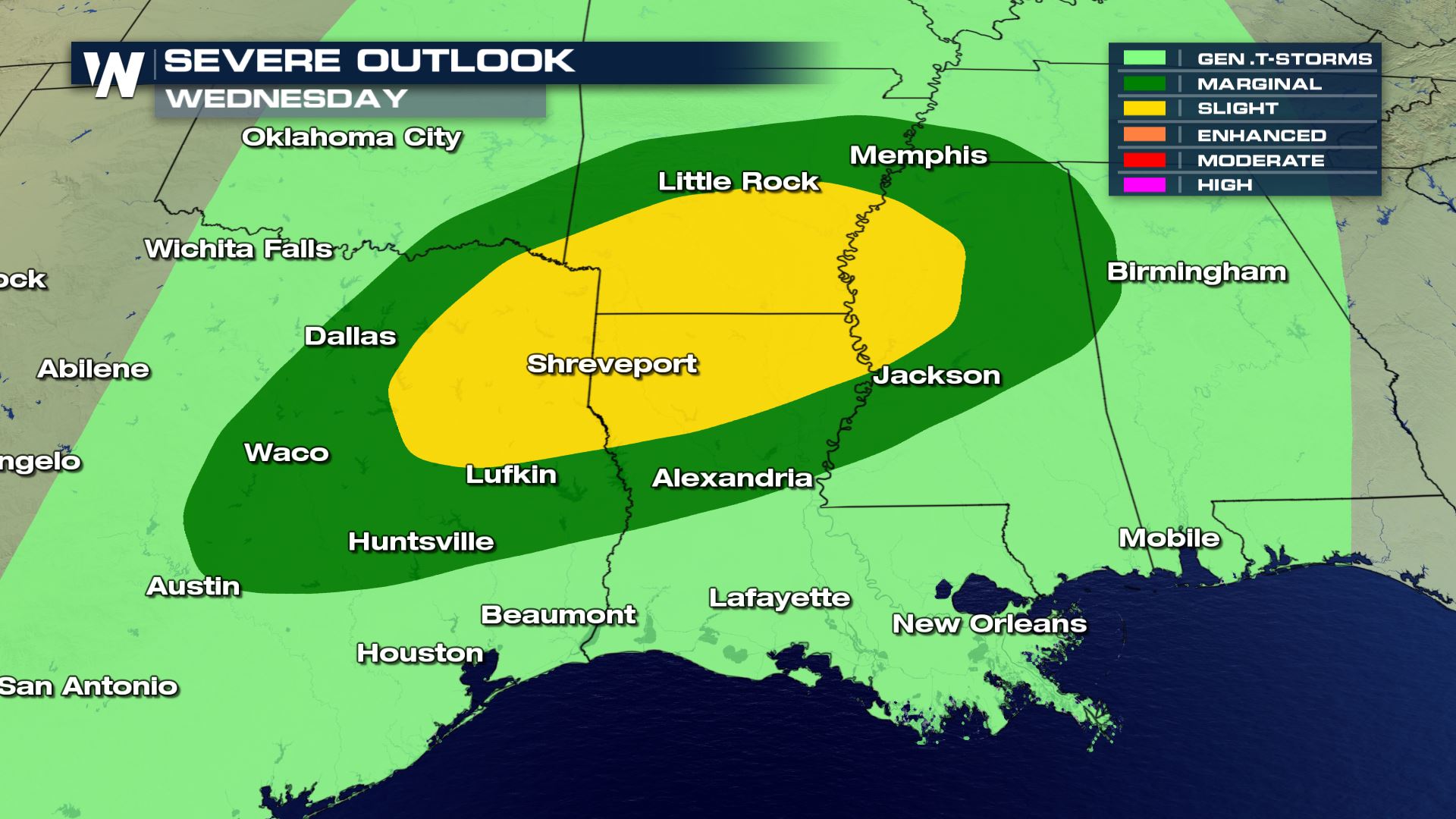 Also, a strong jet stream will help fuel strong storms on Wednesday. By Thursday, the storm will race off towards the East, limiting the threat for strong storms. The storm moves offshore by Friday. A generally calmer severe weather pattern should hold through the upcoming weekend.
Stay with WeatherNation for the latest on these storms and the developing forecast.
For WeatherNation: Meteorologist Chris Bianchi
Also, a strong jet stream will help fuel strong storms on Wednesday. By Thursday, the storm will race off towards the East, limiting the threat for strong storms. The storm moves offshore by Friday. A generally calmer severe weather pattern should hold through the upcoming weekend.
Stay with WeatherNation for the latest on these storms and the developing forecast.
For WeatherNation: Meteorologist Chris BianchiAll Weather News
More
Wildfire Outbreak in the Pacific Northwest
SPOKANE, WA - On Saturday, August 1st, the Ol
2 Aug 2026 7:20 PM

More Storms for the East Through Monday
A low-pressure system that moved through the
2 Aug 2026 7:20 PM


After Reaching Category 5, Genevieve Weakens in the Pacific
PacificGenevieve formed on last Friday south
2 Aug 2026 6:25 PM

Flooding, Severe Storms Target the Midwest Again
After an active week of storms across the nor
1 Aug 2026 1:40 AM

Flooding Risk Increases as Heavy Rain Targets the Tri-State Area
Tuesday, heavy rainfall moved across the Nort
30 Jul 2026 12:25 AM

Severe Weather: Energy From the Midwest Now in the Southeast
UPPER MIDWEST - Through Monday, dangerous tor
29 Jul 2026 10:30 PM