Severe Risk From The Plains to the Great Lakes Tuesday

Top Stories
1 Oct 2019 4:32 AM
Areas across the Plains through the Great Lakes will need to be weather aware today. Severe storms will likely impact these areas Tuesday afternoon and Tuesday evening. Expect large hail, damaging winds and isolated tornadoes from Kansas to New York. Here is the very latest.
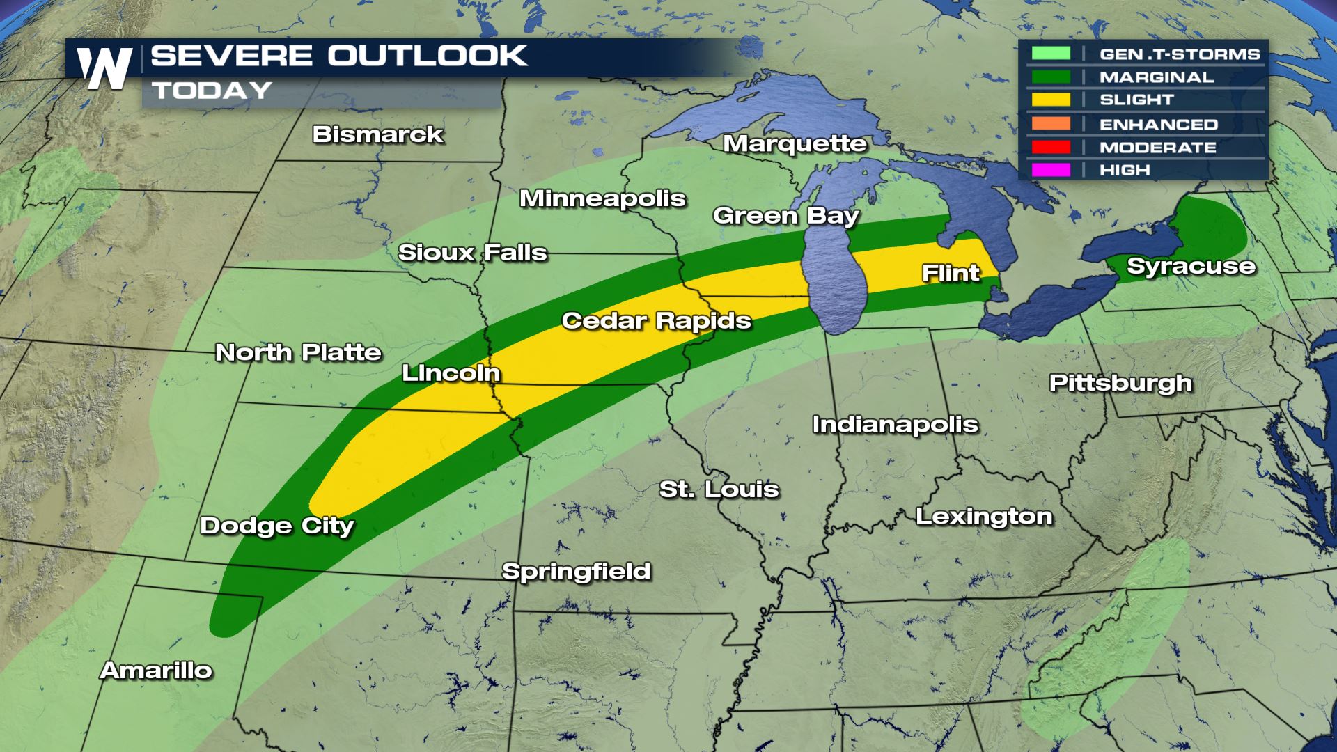 Severe storms in the forecast today from Dodge City, Kansas to Syracuse, New York. We have already seen some morning showers and storms for a lot of these areas, but the intensity will be likely going up by the afternoon and evening.
 Large hail, tornadoes and damaging winds will all be possible today, so you will want to pay close attention to the forecast if you have any outdoor activities.
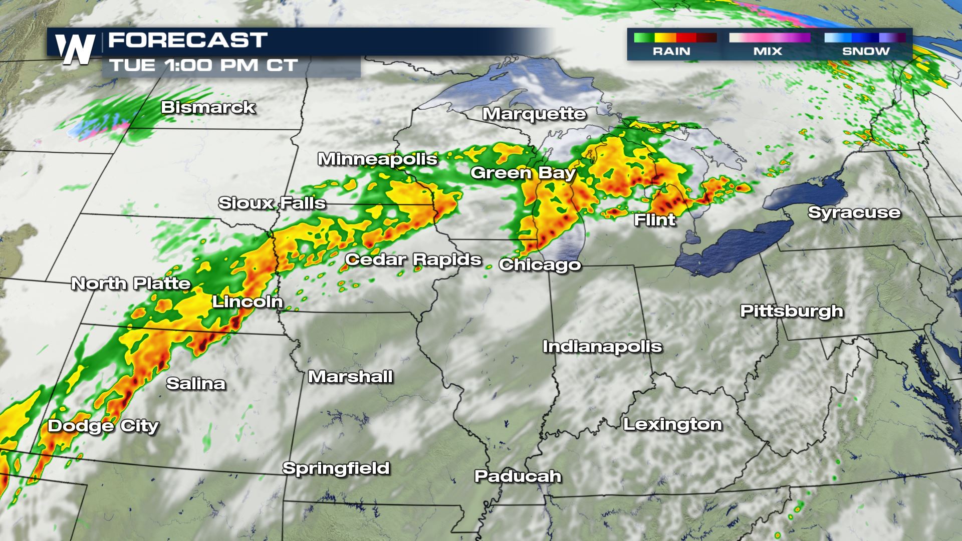
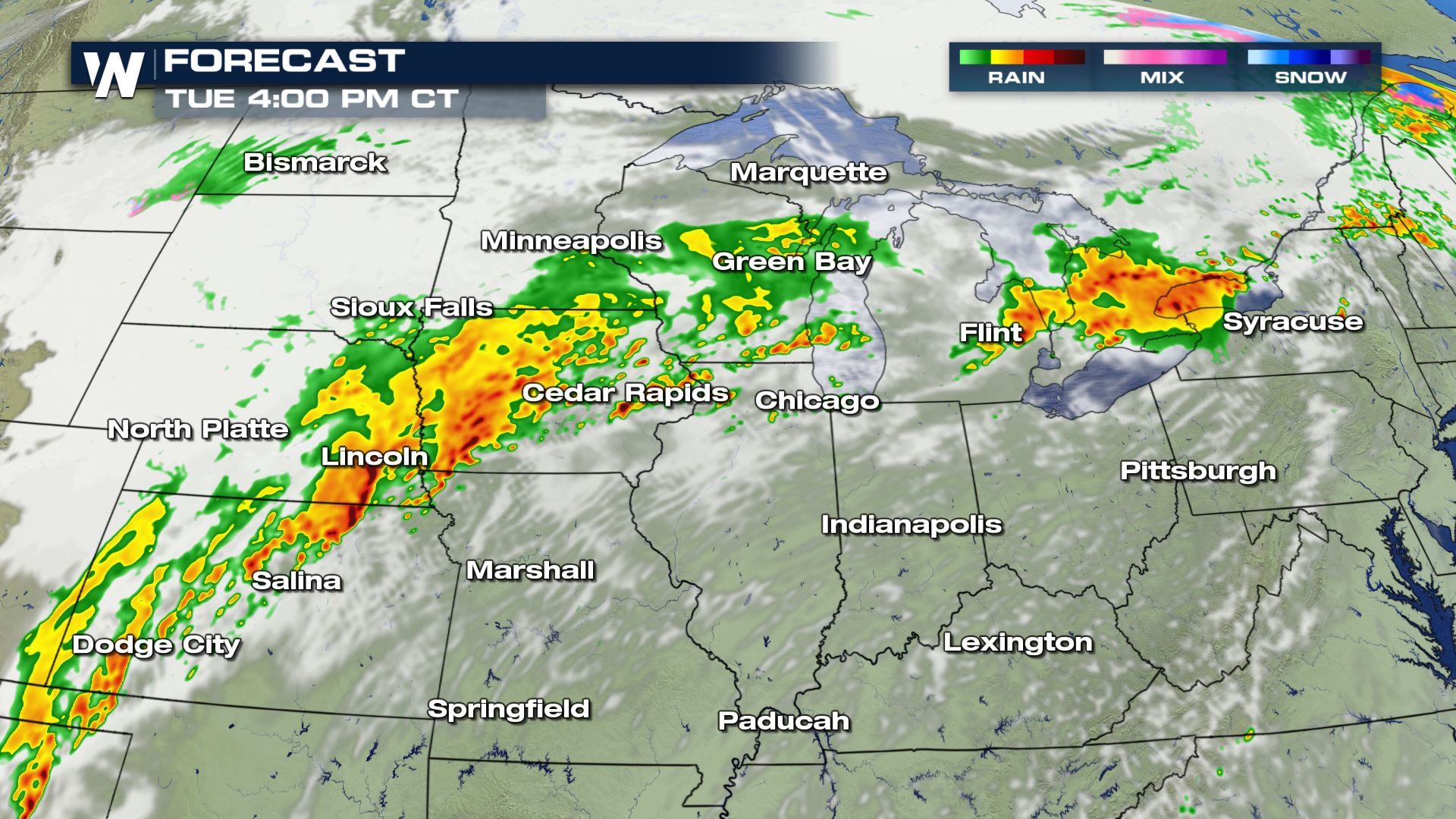
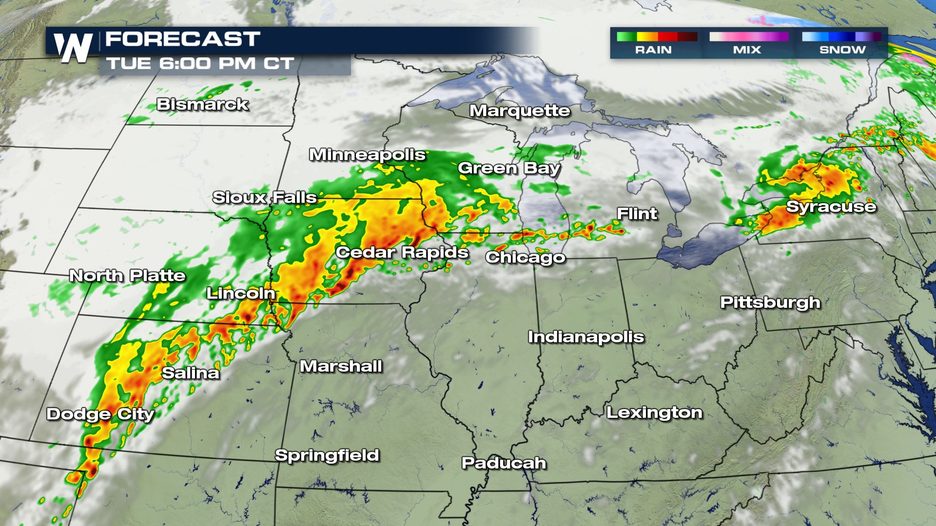
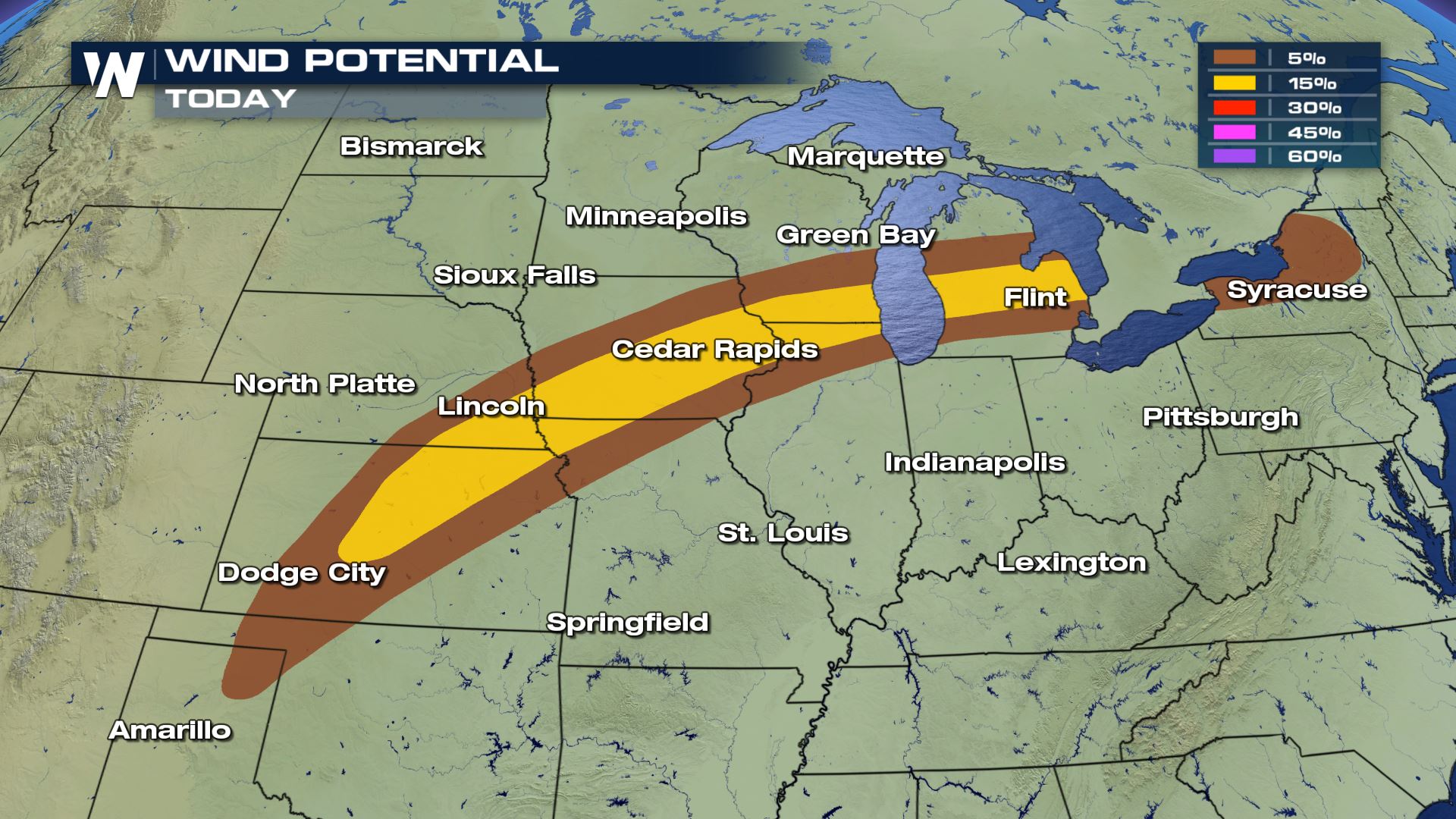
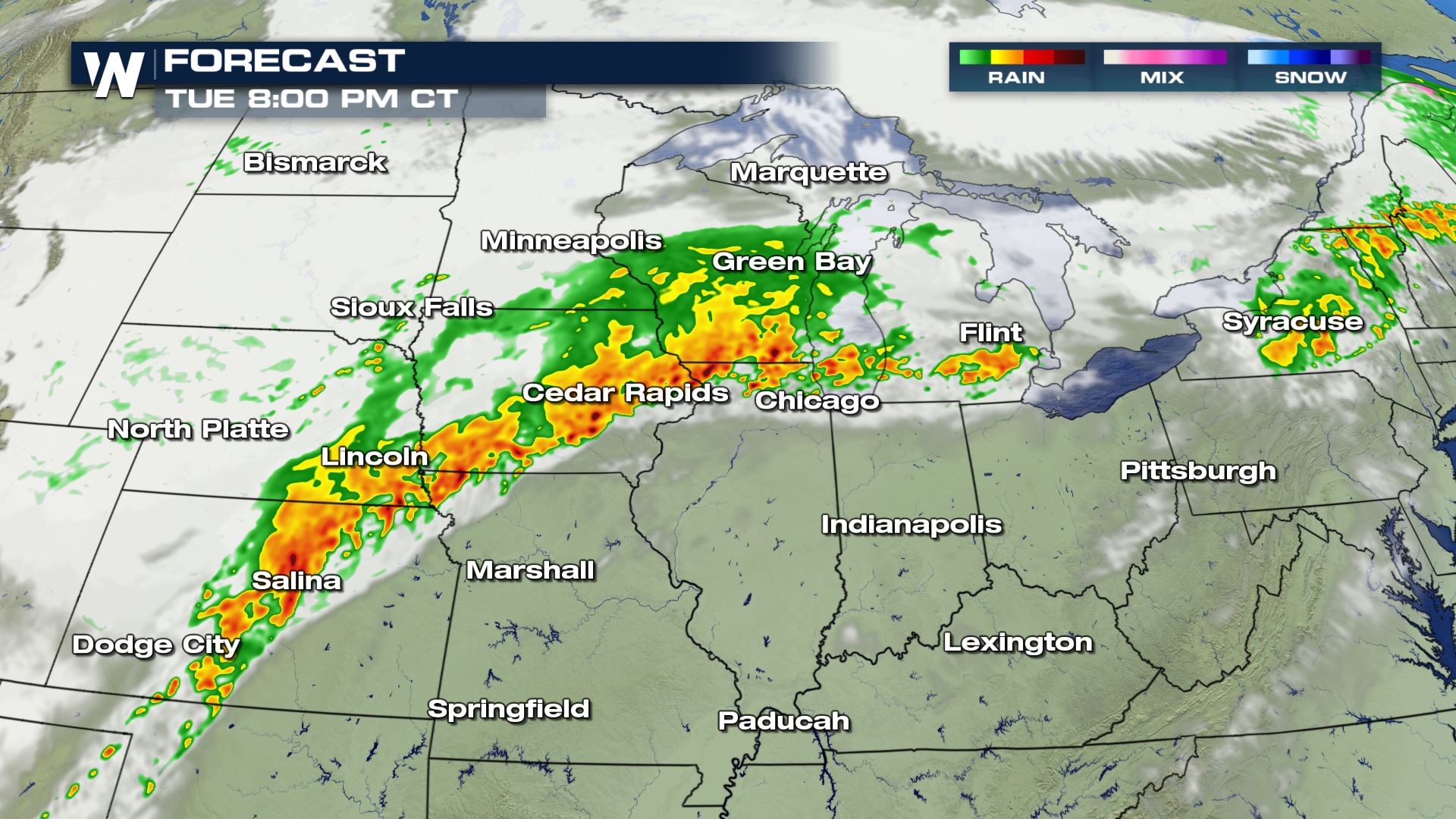 Notice how the forecast intensity really starts to pick up later today and tonight. This is when the storms will likely be severe and contain large hail, wind gusts up to 60 mph and even some strong rotation.
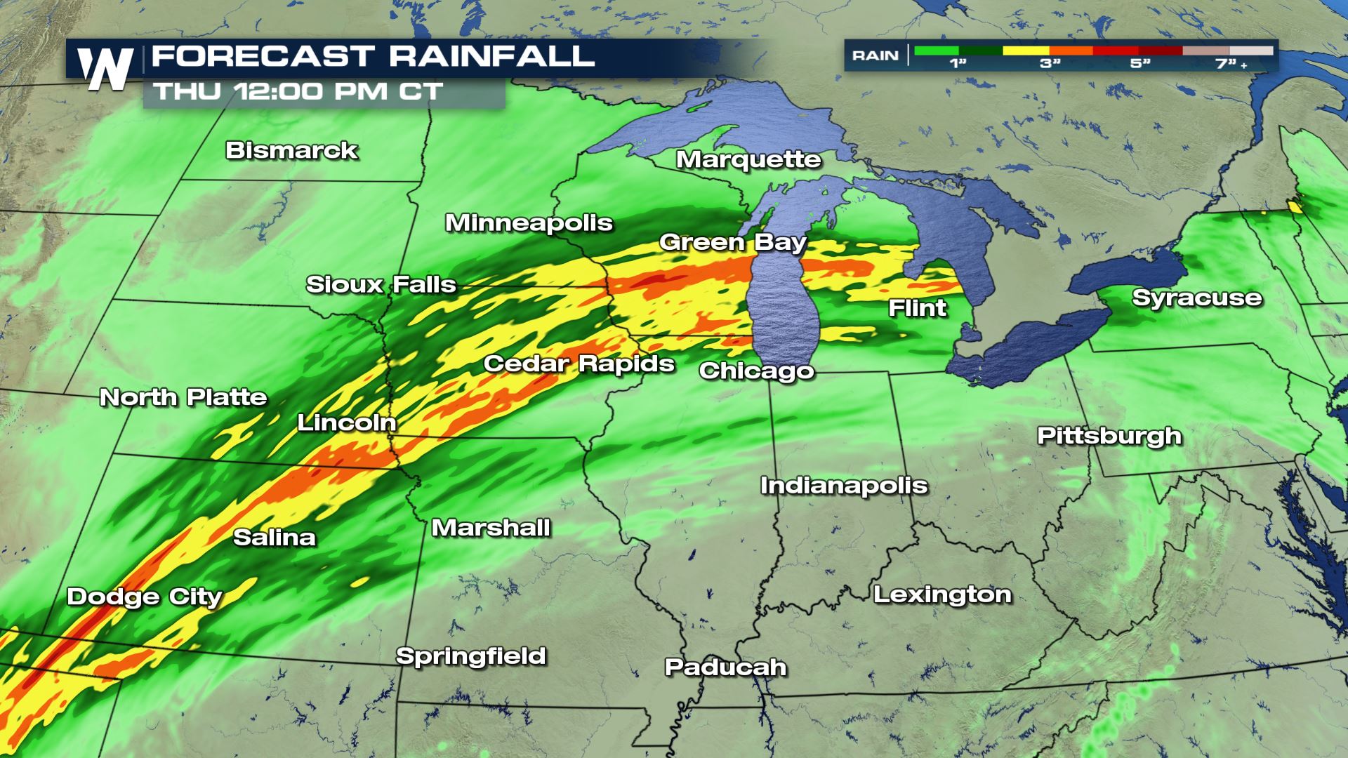 Significant rainfall will also be a severe risk the next few days. Heavy rainfall could lead to the potential of flash flooding from Kansas up through Michigan.
Keep checking with WeatherNation for the very latest updates on today's severe weather chances.
Significant rainfall will also be a severe risk the next few days. Heavy rainfall could lead to the potential of flash flooding from Kansas up through Michigan.
Keep checking with WeatherNation for the very latest updates on today's severe weather chances.
Severe Outlook
Severe storms in the forecast today from Dodge City, Kansas to Syracuse, New York. We have already seen some morning showers and storms for a lot of these areas, but the intensity will be likely going up by the afternoon and evening.
Severe Risks
Large hail, tornadoes and damaging winds will all be possible today, so you will want to pay close attention to the forecast if you have any outdoor activities.
Forecast
Notice how the forecast intensity really starts to pick up later today and tonight. This is when the storms will likely be severe and contain large hail, wind gusts up to 60 mph and even some strong rotation.
Rainfall Potential
Significant rainfall will also be a severe risk the next few days. Heavy rainfall could lead to the potential of flash flooding from Kansas up through Michigan.
Keep checking with WeatherNation for the very latest updates on today's severe weather chances.All Weather News
More
More Storms for the East Through Monday
A low-pressure system that moved through the
2 Aug 2026 10:40 PM

Wildfire Outbreak in the Pacific Northwest
SPOKANE, WA - On Saturday, August 1st, the Ol
2 Aug 2026 10:35 PM


After Reaching Category 5, Genevieve Weakens in the Pacific
PacificGenevieve formed on last Friday south
2 Aug 2026 6:25 PM

Flooding, Severe Storms Target the Midwest Again
After an active week of storms across the nor
1 Aug 2026 1:40 AM

Flooding Risk Increases as Heavy Rain Targets the Tri-State Area
Tuesday, heavy rainfall moved across the Nort
30 Jul 2026 12:25 AM

Severe Weather: Energy From the Midwest Now in the Southeast
UPPER MIDWEST - Through Monday, dangerous tor
29 Jul 2026 10:30 PM