Severe Set Up Early Next Week
Special Stories
14 Dec 2019 11:55 AM
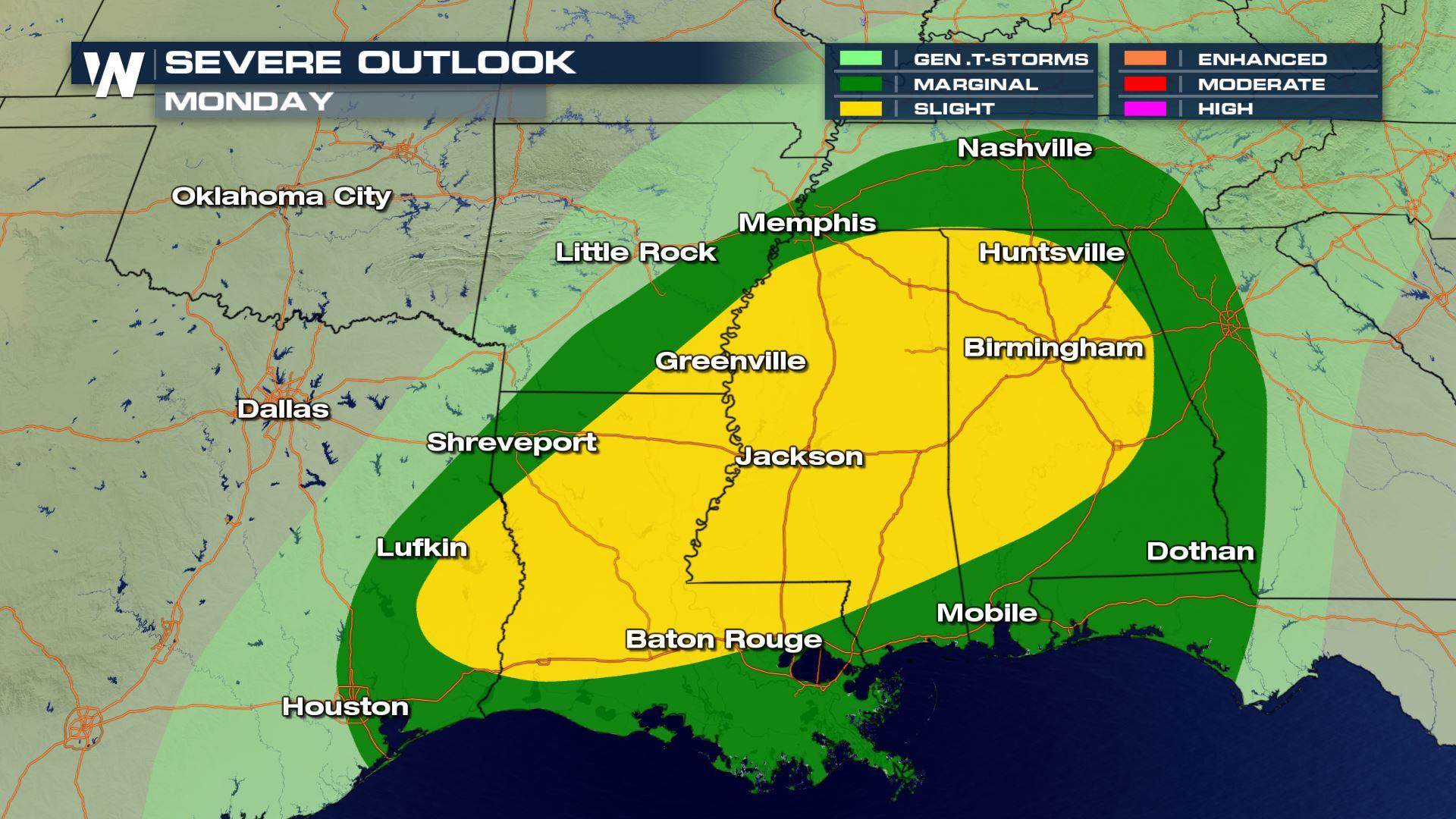
As another round of energy spills into the south late Sunday, the risk of severe weather will do so as well. The storm will gradually shift east into Monday morning, becoming more organized, producing a larger threat of severe storms. The areas shaded in yellow have been added for a Slight risk of severe storms through the day. Cities like Baton Rouge, Jackson, Greenville and Birmingham will have the best chances of strong to severe storms developing.
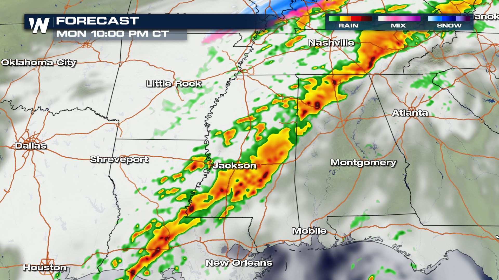
 Here is the expected timing of the line of thunderstorms during the early afternoon hours on Monday as the frontal boundary moves into the area. The largest threats will likely be damaging wind gusts and small hail under the strongest storms.
 The area remains active into the evening hours as the frontal boundary slowly shifts east.
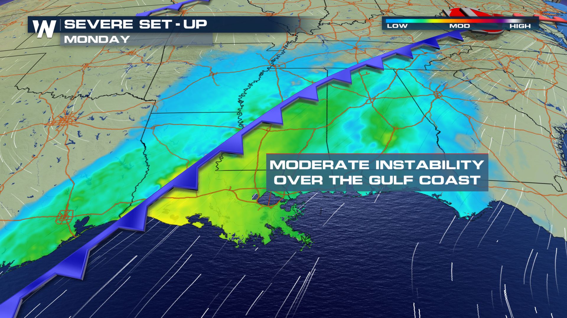
 As the frontal boundary draws in moisture from the Gulf of Mexico, moderate levels of instability will help destabilize the atmosphere, giving way to the stronger storm potential.
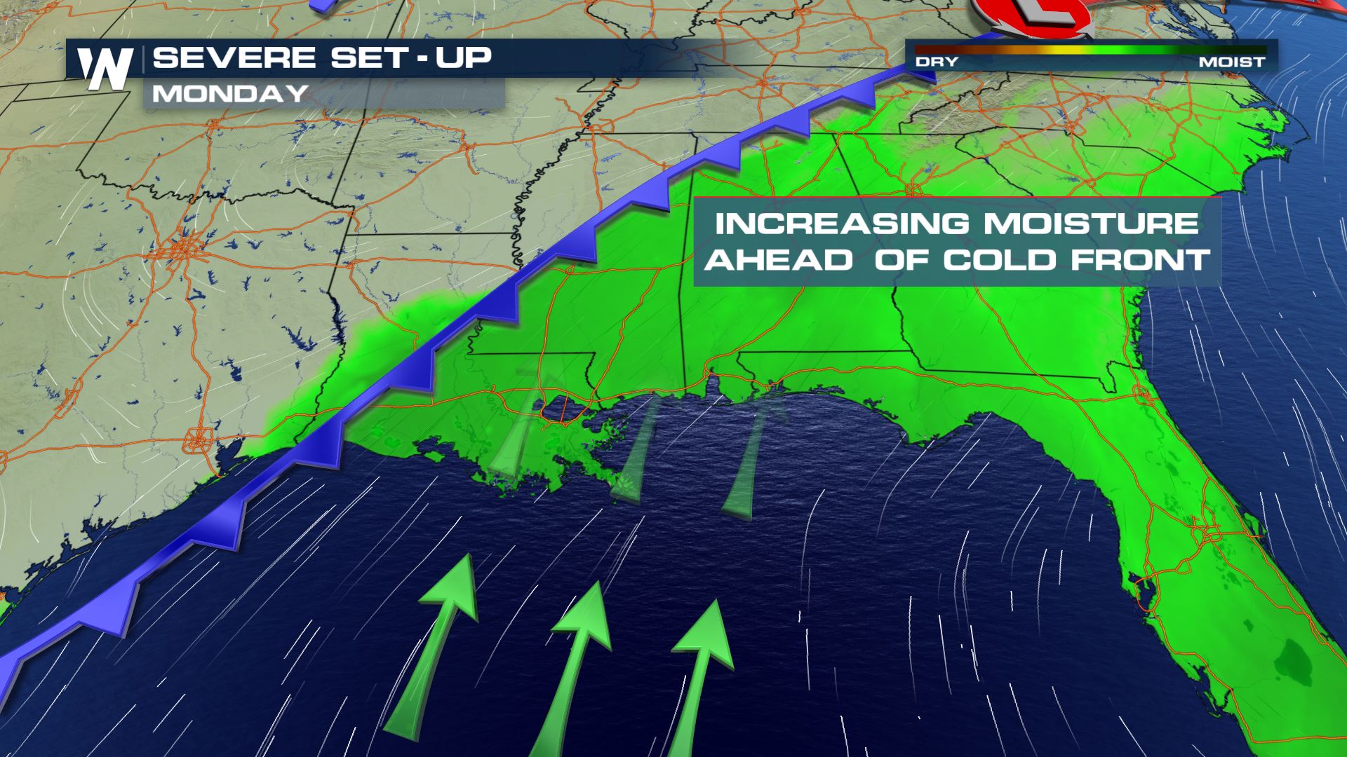
 As moisture streams into the area from the Gulf of Mexico, dew points will remain high, which will continue to fuel showers and thunderstorms throughout the day and into the evening.
Here is the expected timing of the line of thunderstorms during the early afternoon hours on Monday as the frontal boundary moves into the area. The largest threats will likely be damaging wind gusts and small hail under the strongest storms.
The area remains active into the evening hours as the frontal boundary slowly shifts east.
As the frontal boundary draws in moisture from the Gulf of Mexico, moderate levels of instability will help destabilize the atmosphere, giving way to the stronger storm potential.
As moisture streams into the area from the Gulf of Mexico, dew points will remain high, which will continue to fuel showers and thunderstorms throughout the day and into the evening.
All Weather News
More
Tropics: Fausto Heads to Hawaii; Genevieve Will Become a Major Hurricane
Atlantic BasinBertha has dissipated after mov
25 Jul 2026 7:25 PM


Severe Storms Target the Midwest This Weekend
Extreme heat will be a big story this week ac
25 Jul 2026 7:10 PM

Heat Wave Grips Central, Western U.S.
Are you over the summer heat yet? SouthwestEx
25 Jul 2026 5:20 PM

Southeast Flood Risk Lingers Near Stalled Front
A stalled boundary over the Southeast will ke
25 Jul 2026 10:55 AM

Another Round of Storms Targets the Northeast
Tuesday brought severe weather again across p
23 Jul 2026 1:15 AM

Another Round of Severe Weather for the Upper Midwest and Great Lakes
The upper-level low train continues to keep t
21 Jul 2026 1:45 AM