Tornado Causes Damage in Indiana, Severe Threat Moves to the Coast

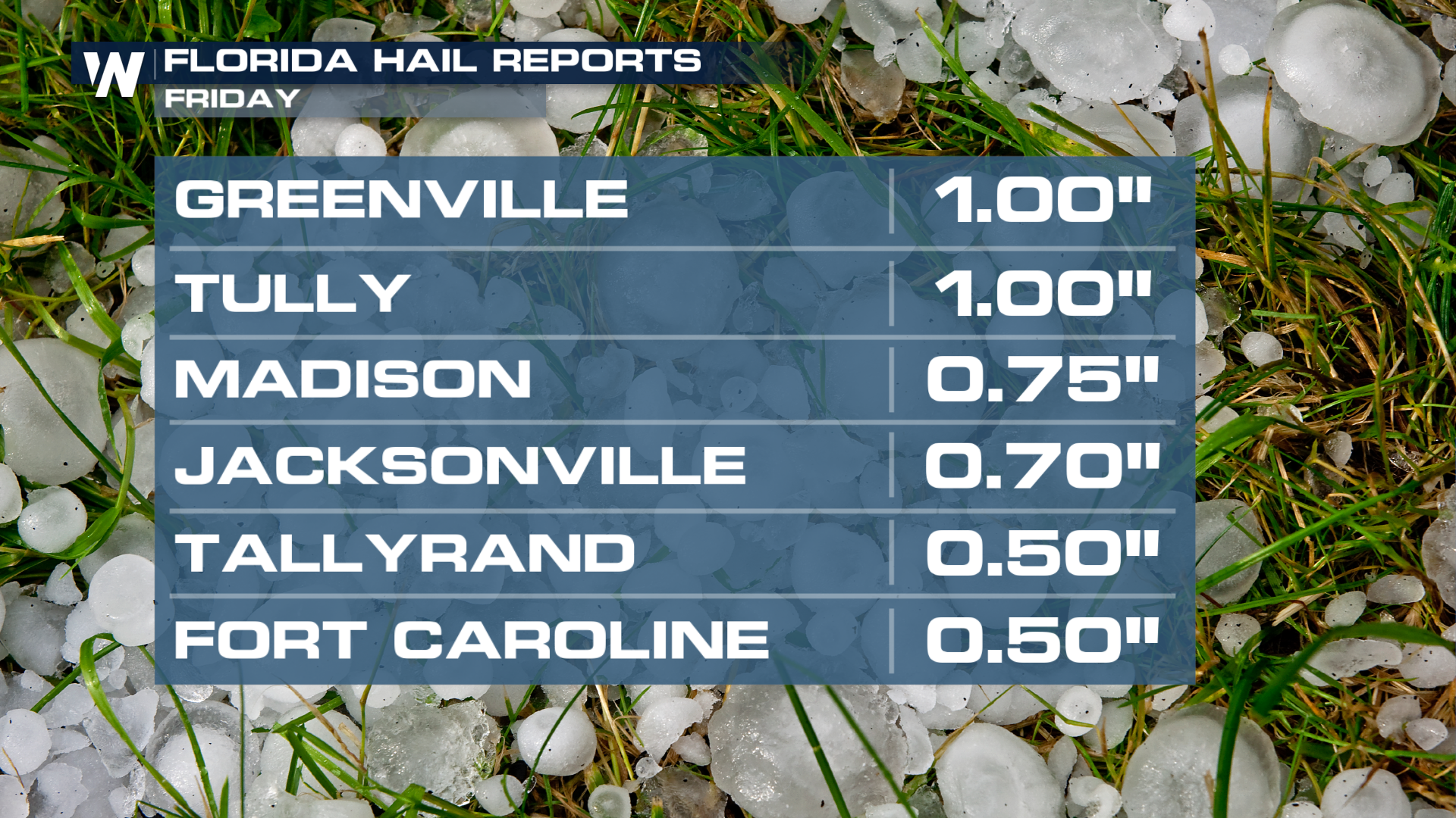
An upper-level low pressure system will continue to produce strong to severe storms through Friday as it heads into the Atlantic. On Thursday, this low spawned numerous severe storms from the Midwest into the Deep South, producing damaging hail, winds, and a tornado that damaged multiple buildings in southern Indiana (top of page). The tornado hi the town of Princeton and has been rated EF-1 after completed damage surveys. Thankfully, no injuries have been reported.
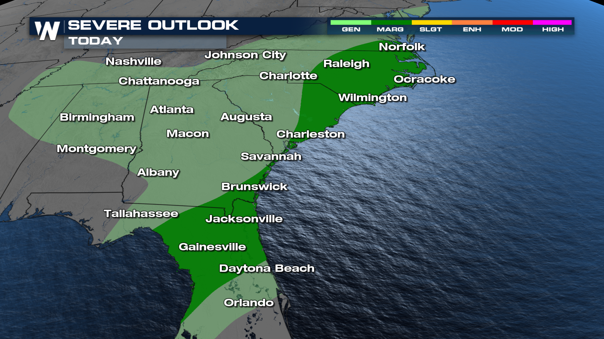
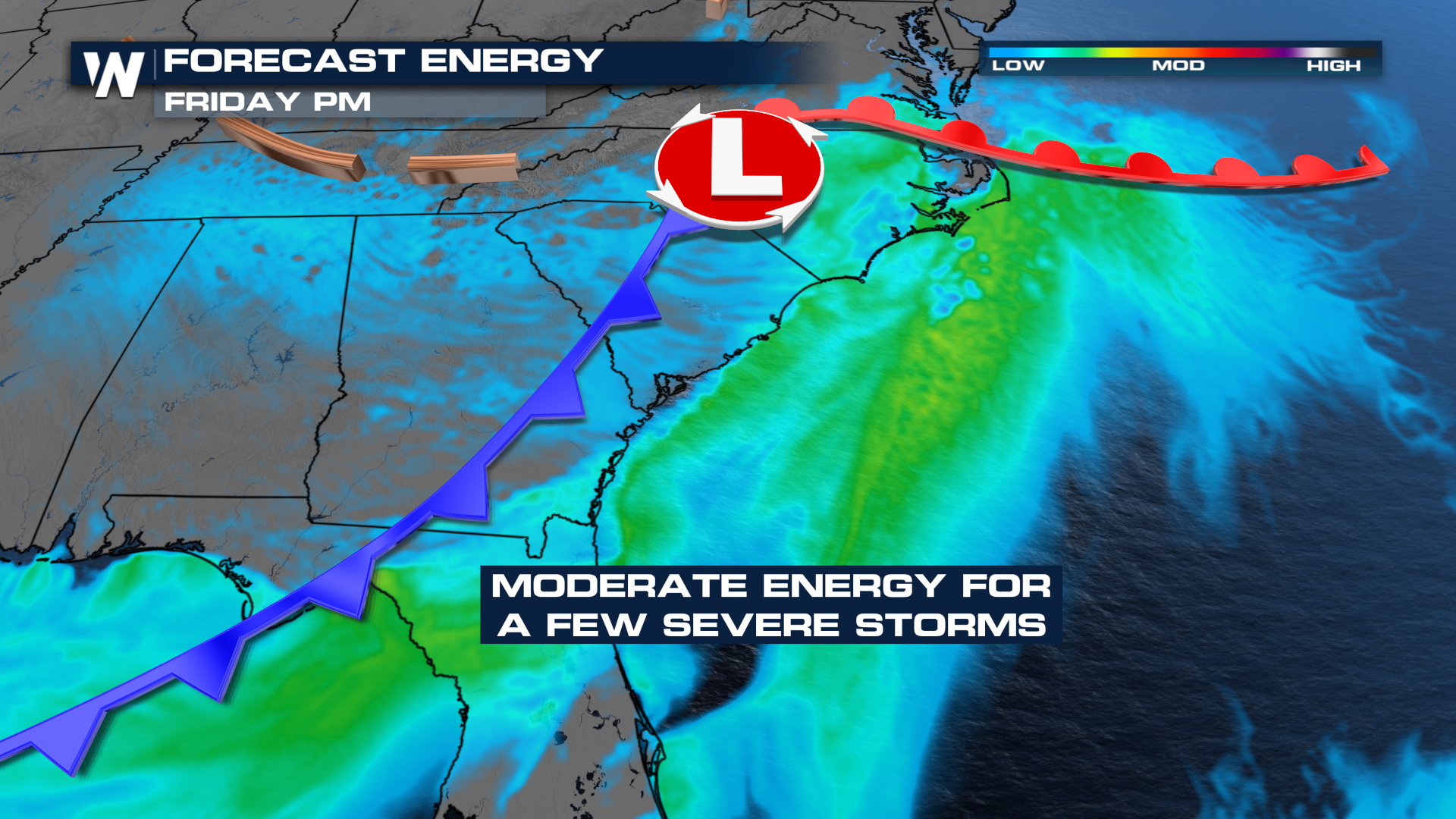 On Friday the risk for severe storms will follow the front to the coast and into the NE Gulf. A few severe storms will be possible from Virginia to Florida, with wind and hail the primary concerns once again. With rotation embedded in the low, don't be surprised to see a tornado or two as well in North Carolina or Virginia.
Forecast
Showers and storms look to reach severe storm criteria (hail over an inch in diameter, gusts 58 mph or stronger) by the mid-to-late afternoon, pushing into the Atlantic waters by the late evening.
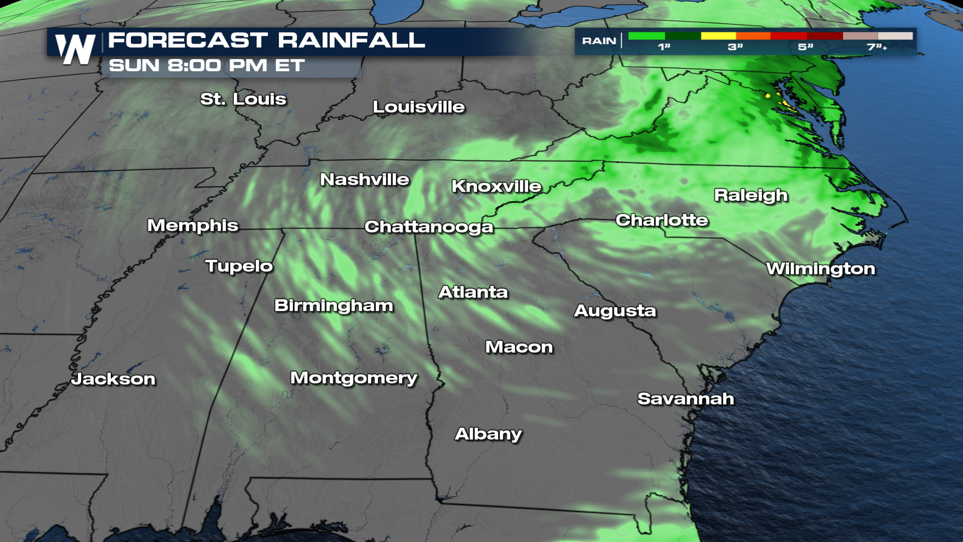
Rainfall totals west of the Appalachians doesn't look very impressive. To the east, a few areas could see 1-3" of rain!