Flood and Severe Weather Continues in Ohio Valley
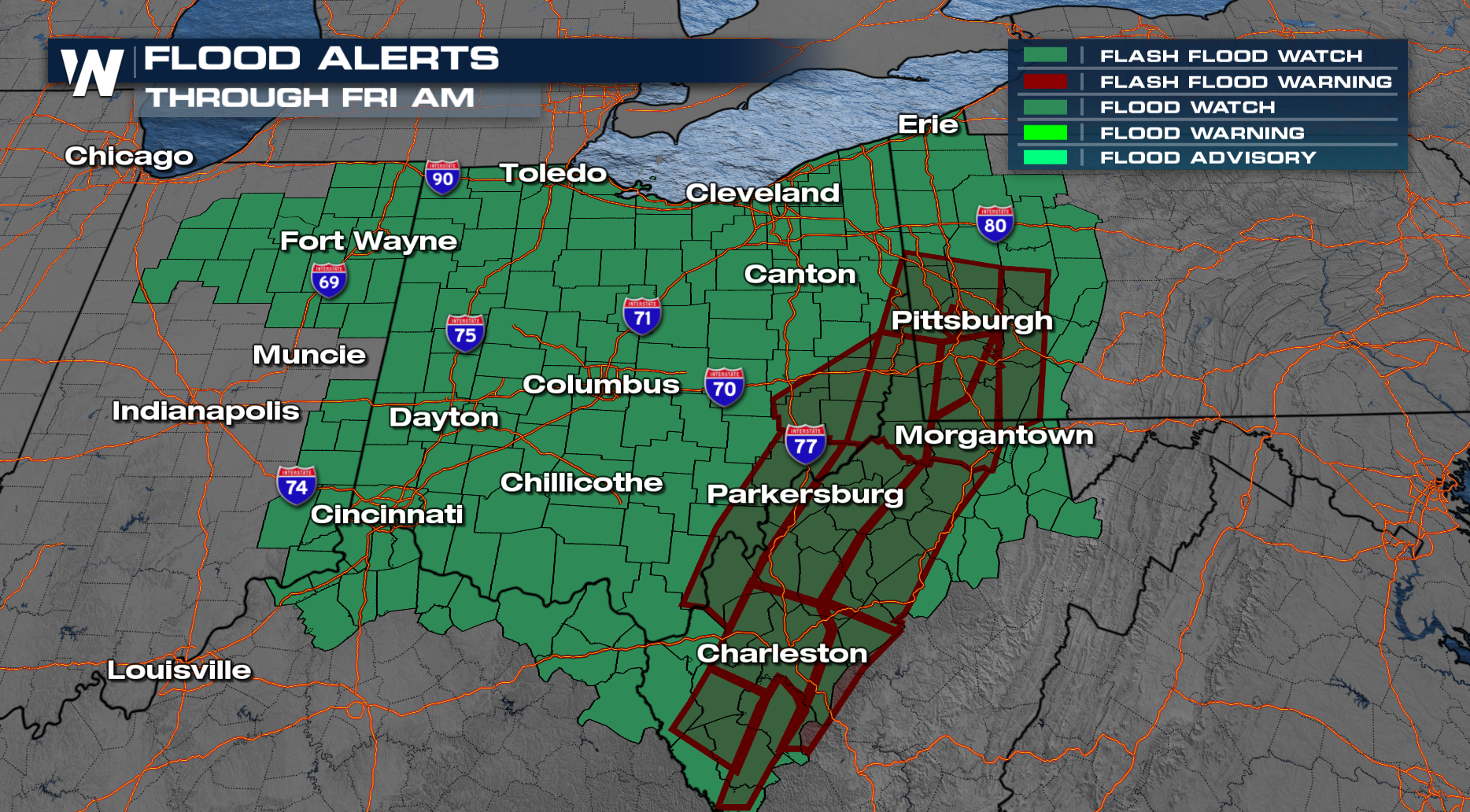
A low pressure system and cold front have been moving across the country the last few days, bringing severe storms and flooding from Texas and the Deep South into the Ohio Valley. Thursday evening, numerous flash flood warnings were issued for the Ohio Valley and Appalachia, including a Flash Flood Emergency just west of Pittsburgh, PA. First responders were called to perform swift water rescues, and creeks and streams overflowed their banks onto many roads. A few homes and businesses were flooded.
Related Article - Snow Potential in the Northeast
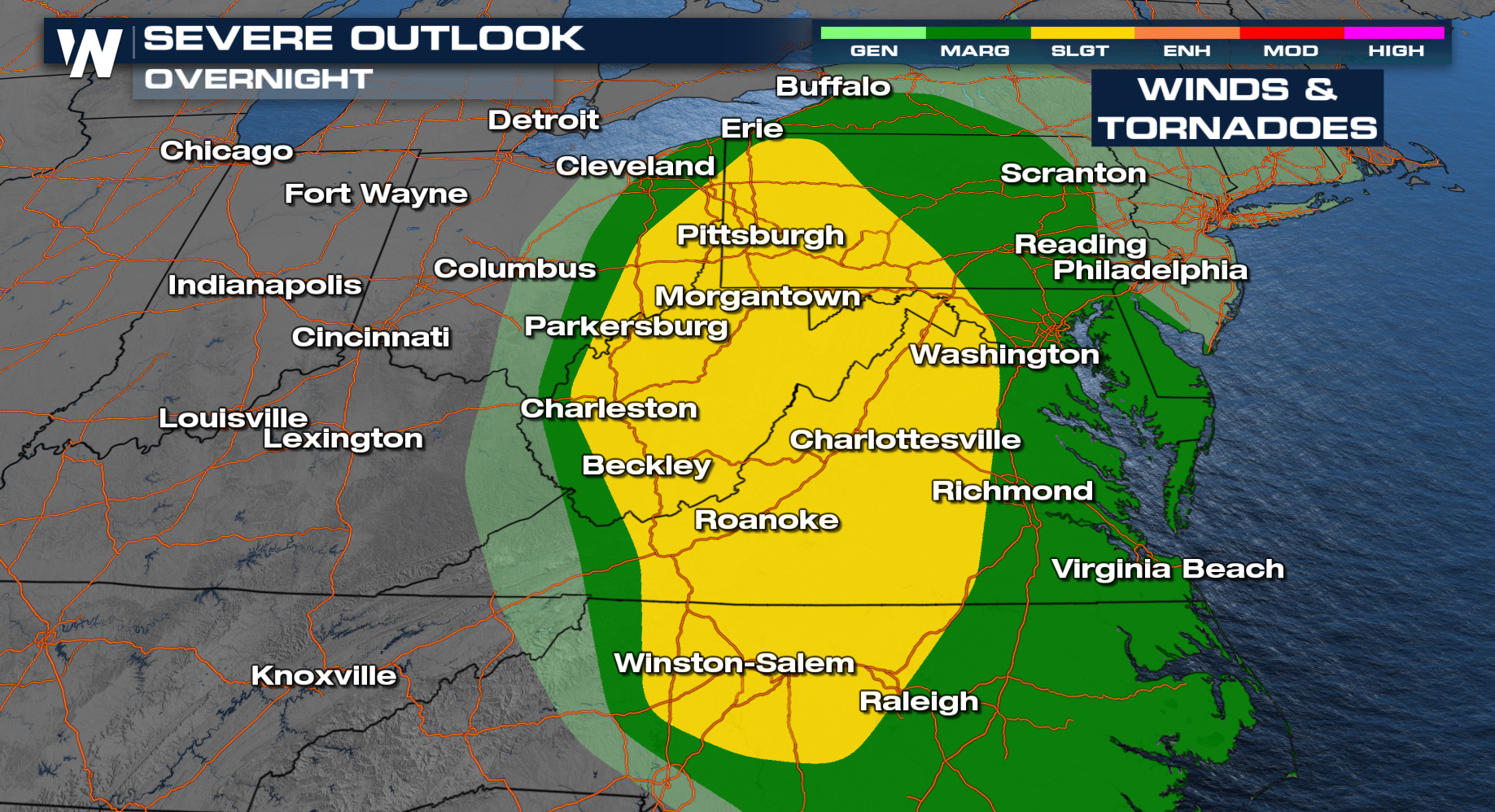
There remains a severe weather threat overnight as the cold front and low move farther east. The primary threat is damaging winds, but there is also an elevated tornado threat as well. Due to the overnight nature of this system, make sure you have multiple ways to receive alerts tonight!
 On the flooding side, a Flood Watch continues for the Ohio Valley through Friday morning! Flooding will be the threat more people will likely see. Heavy rain from earlier this week has saturated the soils in the area, so the ground can't hold much more and rivers, creeks, and streams will be quicker to rise as a result.
 The doesn't stop here in the Ohio Valley. It reaches the Northeast on Friday. A Flood Watch has been issued for parts of New England from snowmelt and heavy rain from the system. Remember TURN AROUND AND DON'T DROWN. By the way, snow is possible with colder air aloft from the upper low on Saturday.
Stay with WeatherNation as we bring you the latest on the severe weather potential this week!