Severe Storms Developing in the High Plains
Special Stories
10 Jul 2018 3:53 PM
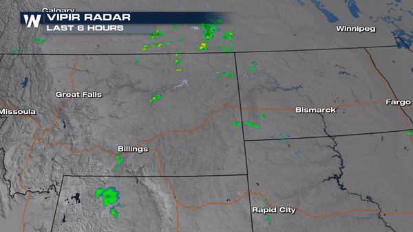
A disturbance moving across the High Plains is triggering strong to severe storms in eastern Montana.
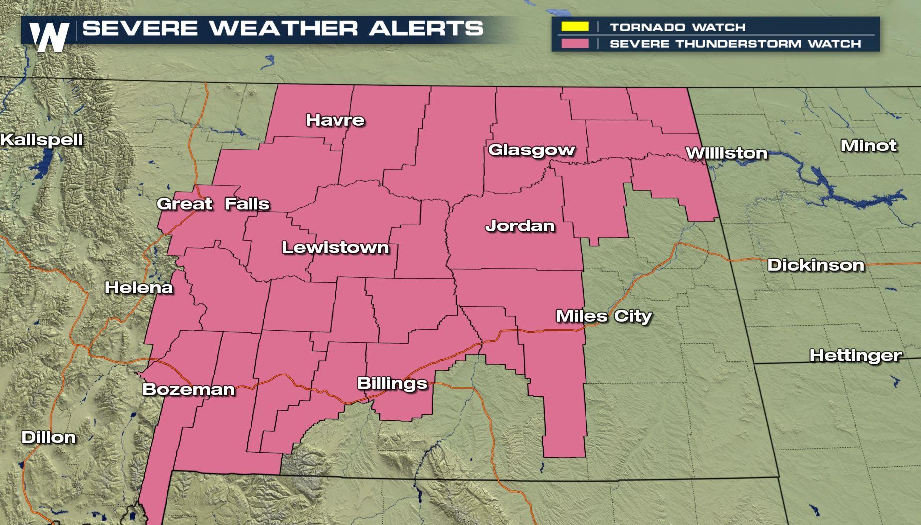
 A Severe Thunderstorm Watch has been issued for many of the counties in Eastern Montana.
https://twitter.com/WeatherNation/status/1016778400898342912
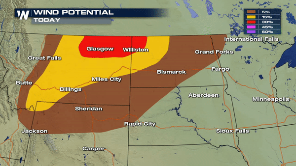
The main concern with severe storms this afternoon and evening will be large hail and damaging winds. Some storms could yield wind gusts as high 70 mph and hail stones could reach 2" in diameter. Alongside the threat with large hail and damaging winds, there is an isolated tornado threat as well.
A Severe Thunderstorm Watch has been issued for many of the counties in Eastern Montana.
https://twitter.com/WeatherNation/status/1016778400898342912
The main concern with severe storms this afternoon and evening will be large hail and damaging winds. Some storms could yield wind gusts as high 70 mph and hail stones could reach 2" in diameter. Alongside the threat with large hail and damaging winds, there is an isolated tornado threat as well.
 Storms will continue to track east through the evening hours. Western counties of North Dakota should stay on high alert for all modes of severe weather for the remainder of the day.
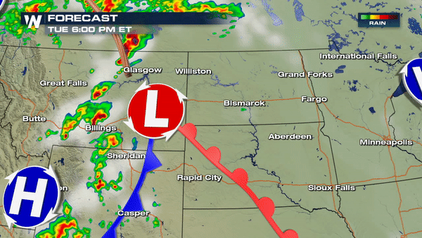 Join us LIVE on WeatherNation as we track these storms through the evening hours.
Meteorologist Merry Matthews
Join us LIVE on WeatherNation as we track these storms through the evening hours.
Meteorologist Merry Matthews
A Severe Thunderstorm Watch has been issued for many of the counties in Eastern Montana.
https://twitter.com/WeatherNation/status/1016778400898342912
The main concern with severe storms this afternoon and evening will be large hail and damaging winds. Some storms could yield wind gusts as high 70 mph and hail stones could reach 2" in diameter. Alongside the threat with large hail and damaging winds, there is an isolated tornado threat as well.
Storms will continue to track east through the evening hours. Western counties of North Dakota should stay on high alert for all modes of severe weather for the remainder of the day.
Join us LIVE on WeatherNation as we track these storms through the evening hours.
Meteorologist Merry MatthewsAll Weather News
More
Wildfire Outbreak in the Pacific Northwest
SPOKANE, WA - On Saturday, August 1st, the Ol
3 Aug 2026 1:55 AM

More Storms for the East Through Monday
A low-pressure system that moved through the
3 Aug 2026 1:50 AM


After Reaching Category 5, Genevieve Weakens in the Pacific
PacificGenevieve formed last Friday south of
3 Aug 2026 12:30 AM

Flooding, Severe Storms Target the Midwest Again
After an active week of storms across the nor
1 Aug 2026 1:40 AM

Flooding Risk Increases as Heavy Rain Targets the Tri-State Area
Tuesday, heavy rainfall moved across the Nort
30 Jul 2026 12:25 AM

Severe Weather: Energy From the Midwest Now in the Southeast
UPPER MIDWEST - Through Monday, dangerous tor
29 Jul 2026 10:30 PM