Severe Storms for High Plains the Next Few Days

Top Stories
4 Jul 2021 7:25 AM
Today's Outlook
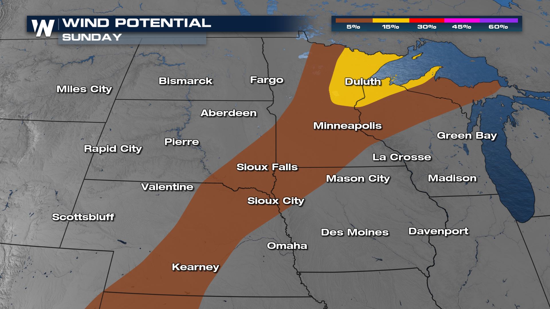
The SPC has added a slight risk for northern Minnesota along with the ongoing marginal risk for scattered storms today.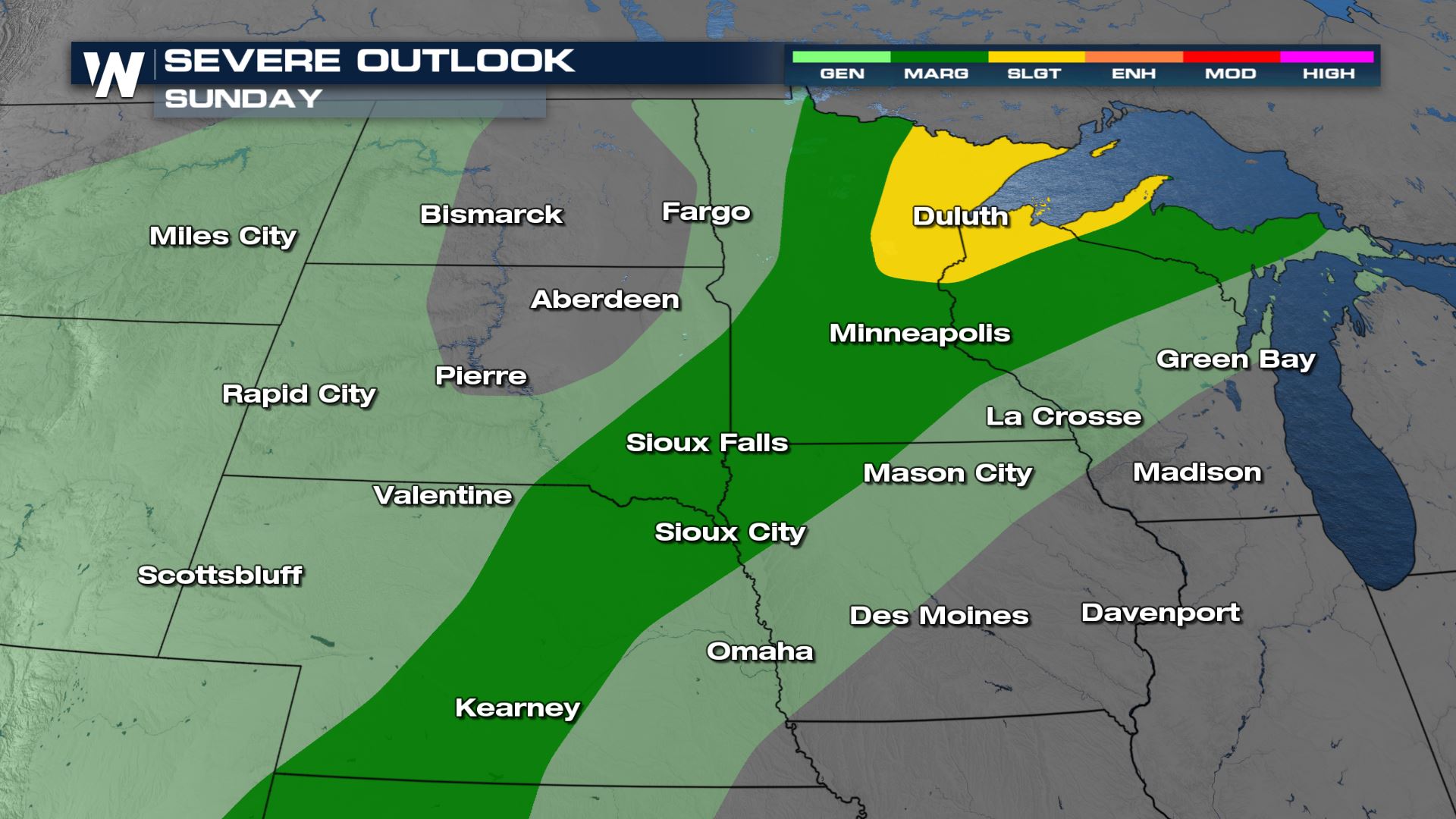 Main threats are damaging wind and large hail. Wind could gust up to 70 mph along with hail stones growing to 1" in diameter.
Timing
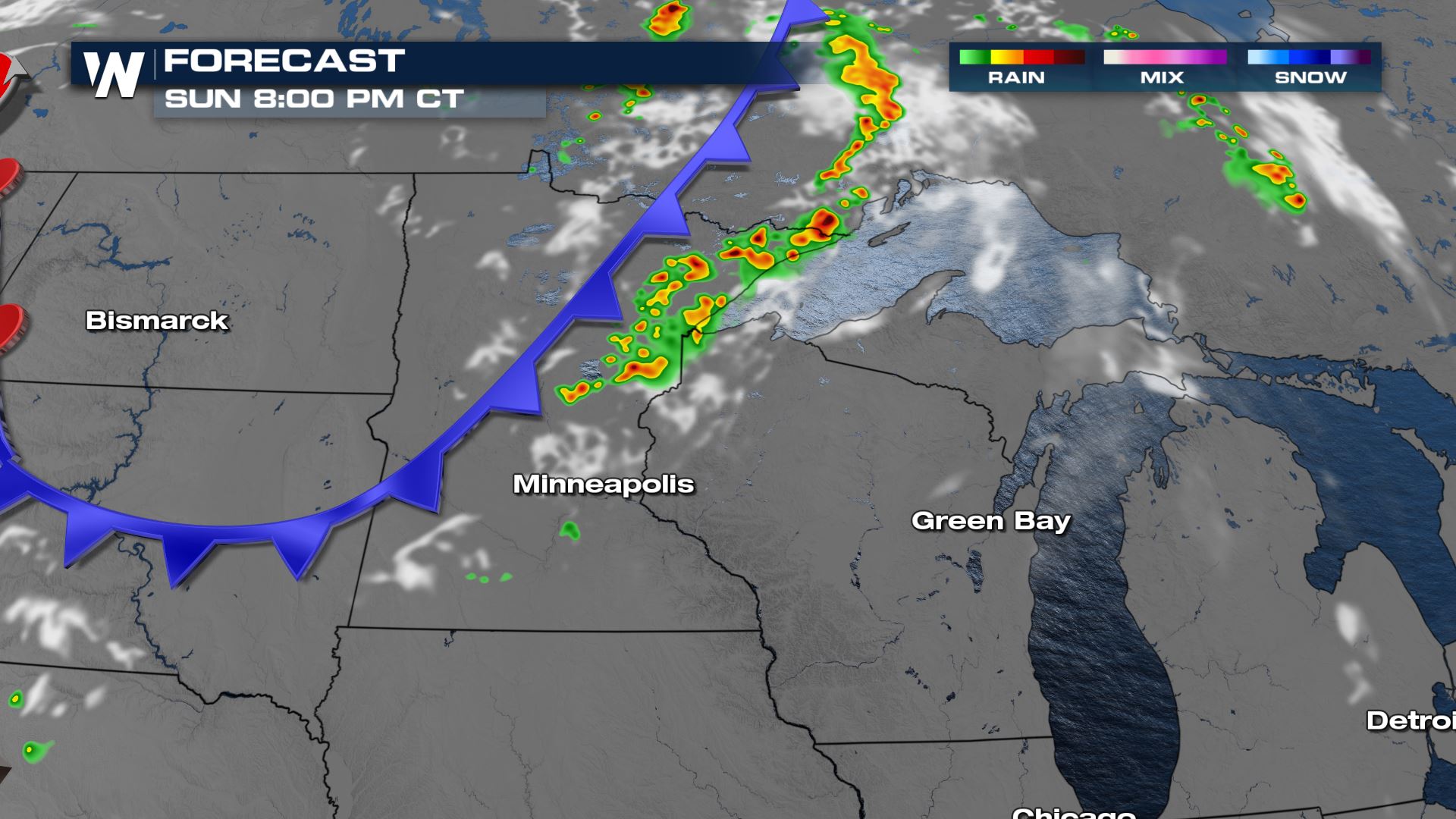
This morning there has already been some scattered storms but the severe storms are expected to develop by this afternoon. The cold front trails from the US and Canada boarder down through Wyoming. Storms will fire along and head of the cold front.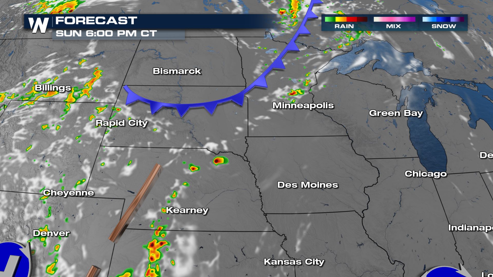 Where the slight risk has been issued, storms will be more numerous in their coverage along with having more intensity to them.
Monday
Any lingering storms in the morning could still have severe strength to them as they move along the cold front through Iowa, Wisconsin, and Michigan. The threat for wind gusting up to 58 mph and small hail is still possible.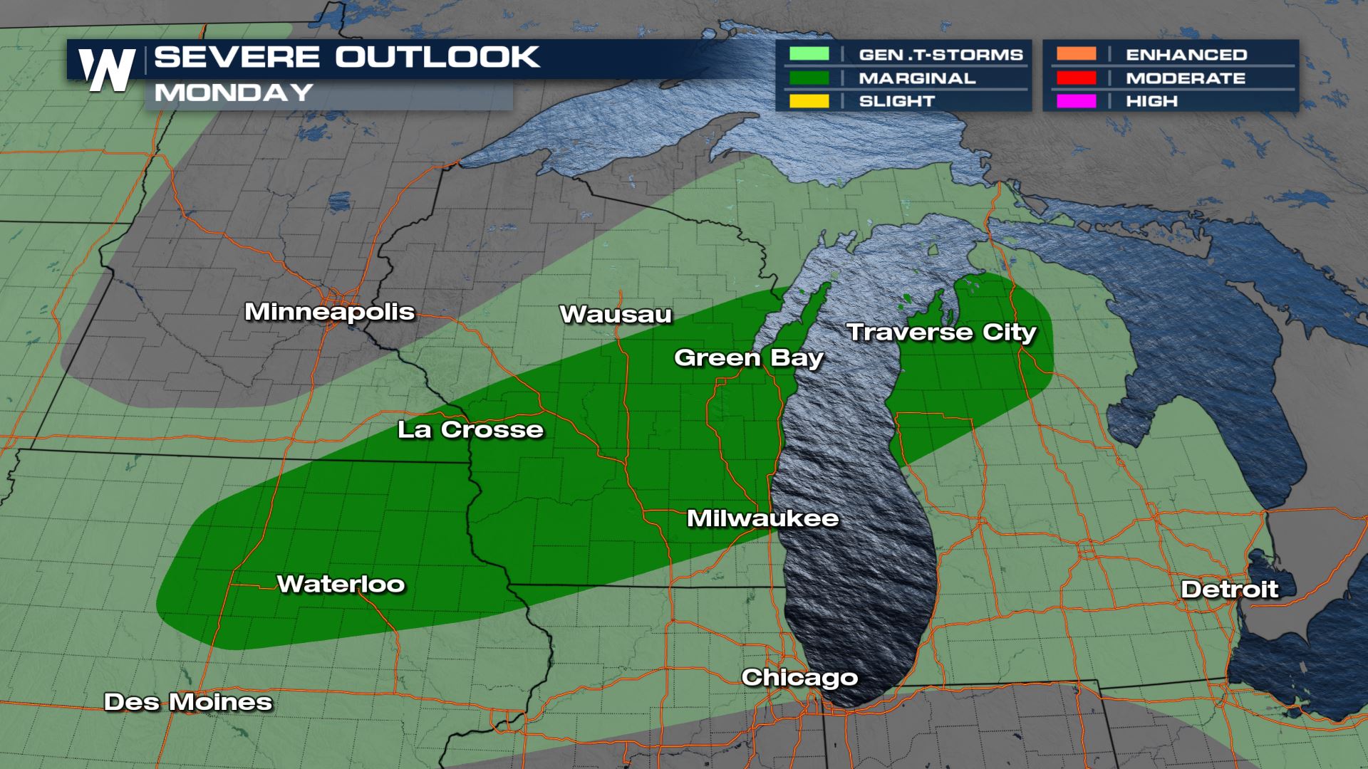 Meanwhile, a new low pressure center develops along the cold front. This means there is a chance for more storms on the tail end of this system.
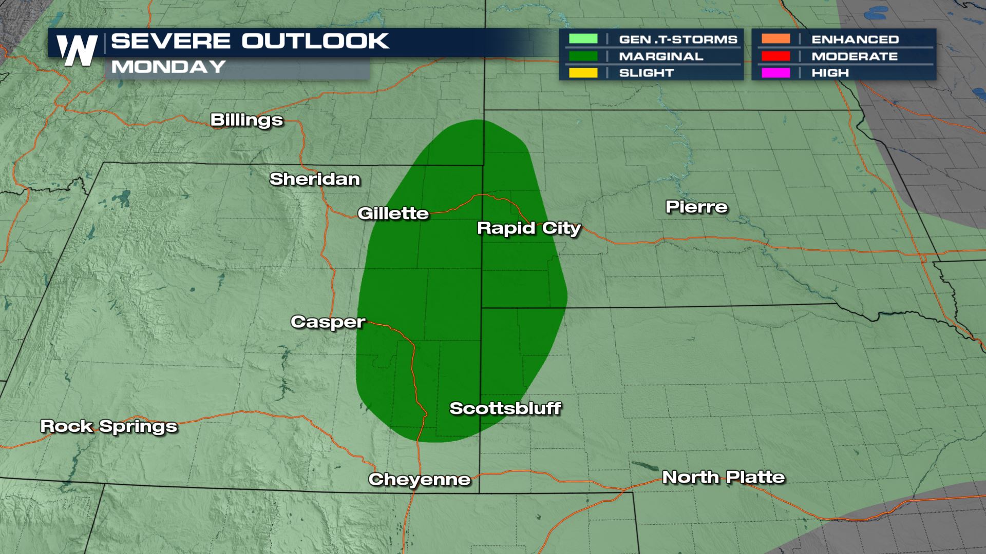 In the warm sector, the instability redevelops and strong storms are likely in Wyoming and South Dakota as the secondary cold front swings out of Canada.
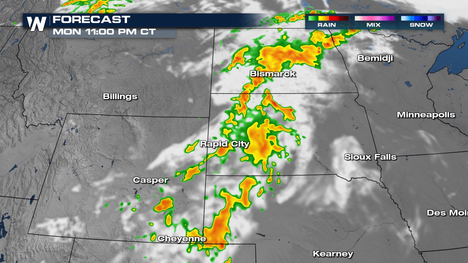
 Rain becomes a lot more widespread by the end of the day on Monday and into Tuesday. This could lead to localized flooding concerns.
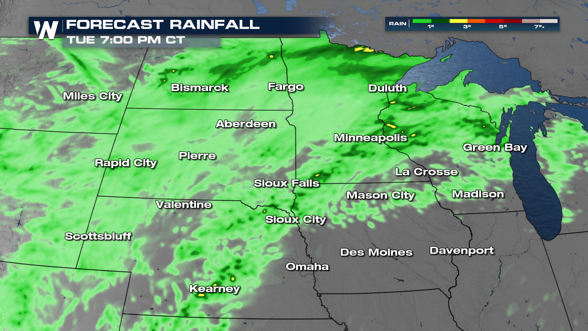
 The forecast rainfall isn't expected to be extreme, with most getting 1" to 2". There will be isolated spots with more and that might cause for some ponding and standing water.
All Weather News
More
Flooding, Severe Storms Target the Midwest Again
After an active week of storms across the nor
31 Jul 2026 4:15 PM


After Reaching Category 5, Genevieve Weakens in the Pacific
PacificFausto is now a post-tropical cyclone.
31 Jul 2026 1:30 AM

Flooding Risk Increases as Heavy Rain Targets the Tri-State Area
Tuesday, heavy rainfall moved across the Nort
30 Jul 2026 12:25 AM

Severe Weather: Energy From the Midwest Now in the Southeast
UPPER MIDWEST - Through Monday, dangerous tor
29 Jul 2026 10:30 PM