Severe Storms Likely from the Central Plains to Wyoming

Special Stories
6 Jun 2018 11:07 AM
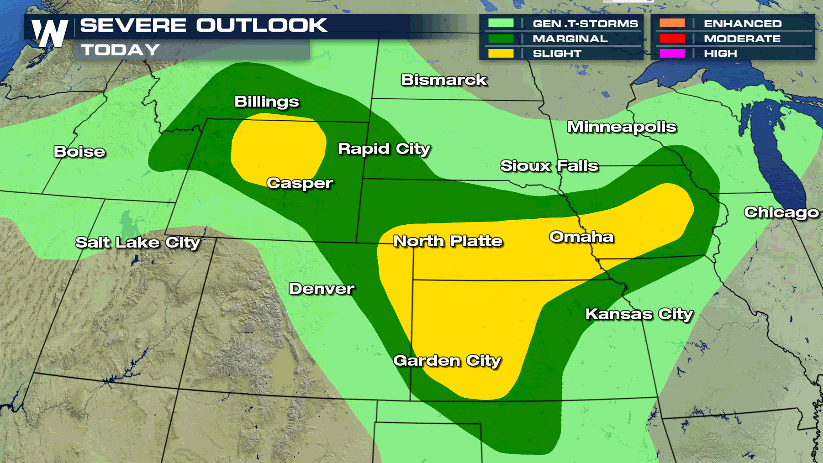
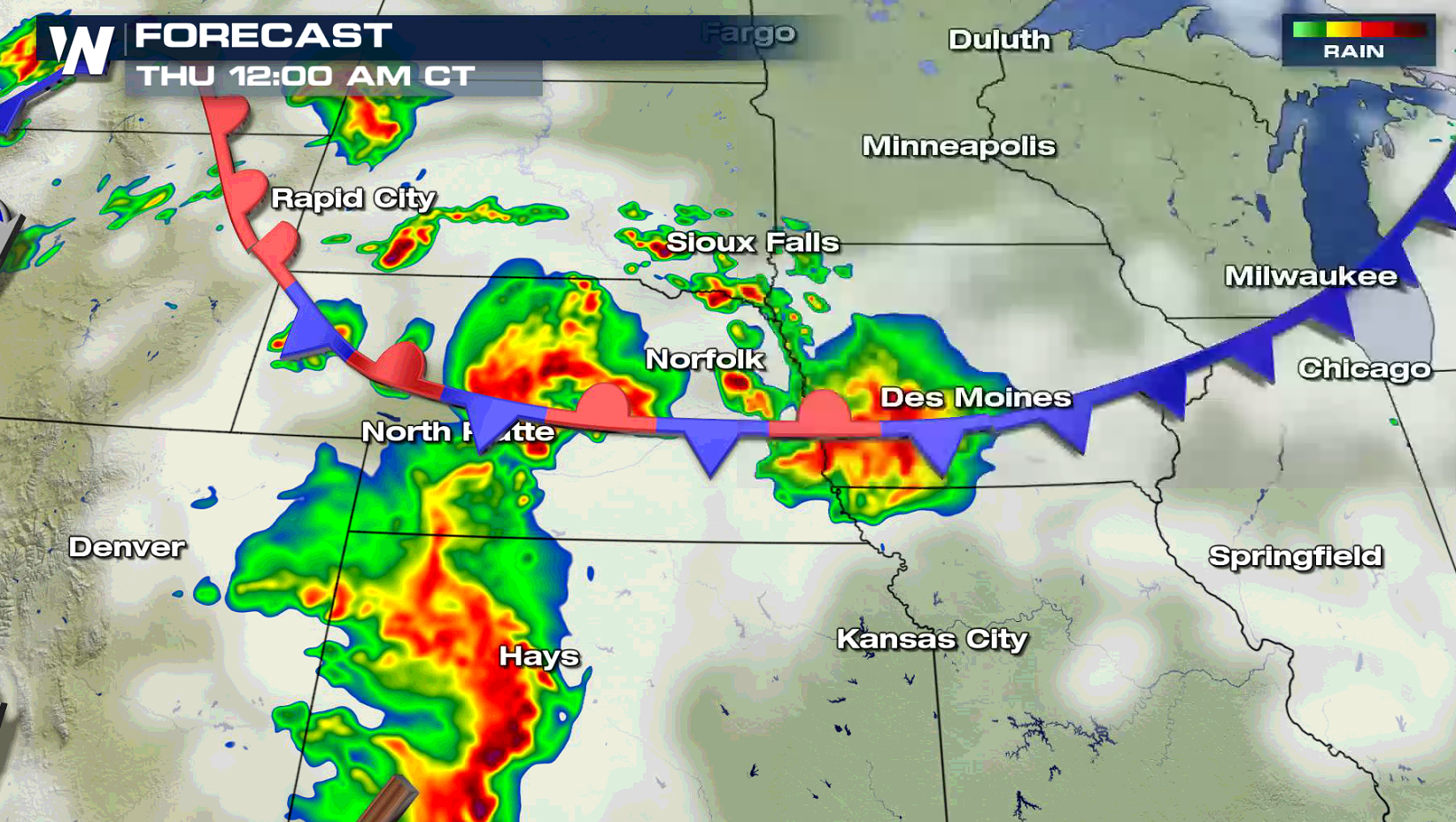
A slow moving storm system in the mid section of the nation will produce numerous showers and thunderstorms throughout the day and a few could become severe. The areas most likely to see severe storms extends from Iowa to Kansas into Wyoming.
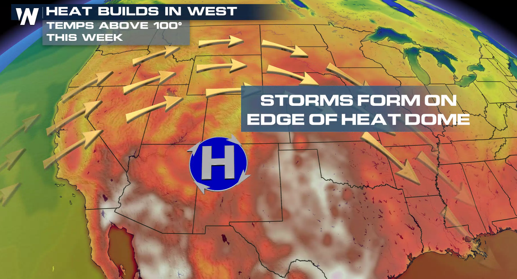
 As an area of heat builds across the West, moisture levels will climb with humidity increasing from southerly winds blowing from the Gulf of Mexico. The energy will help to build and sustain strong storms.
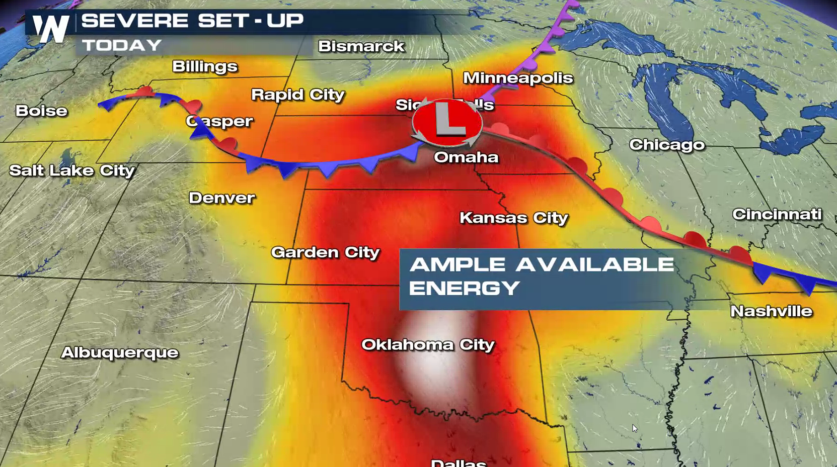
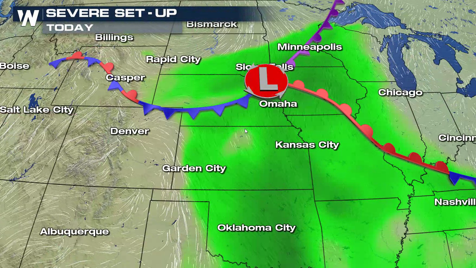
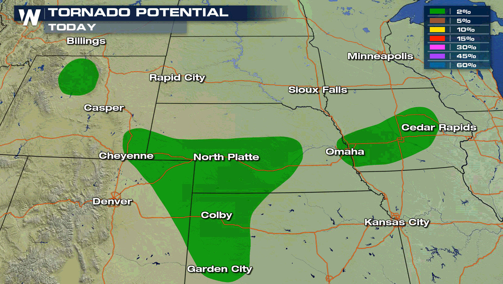
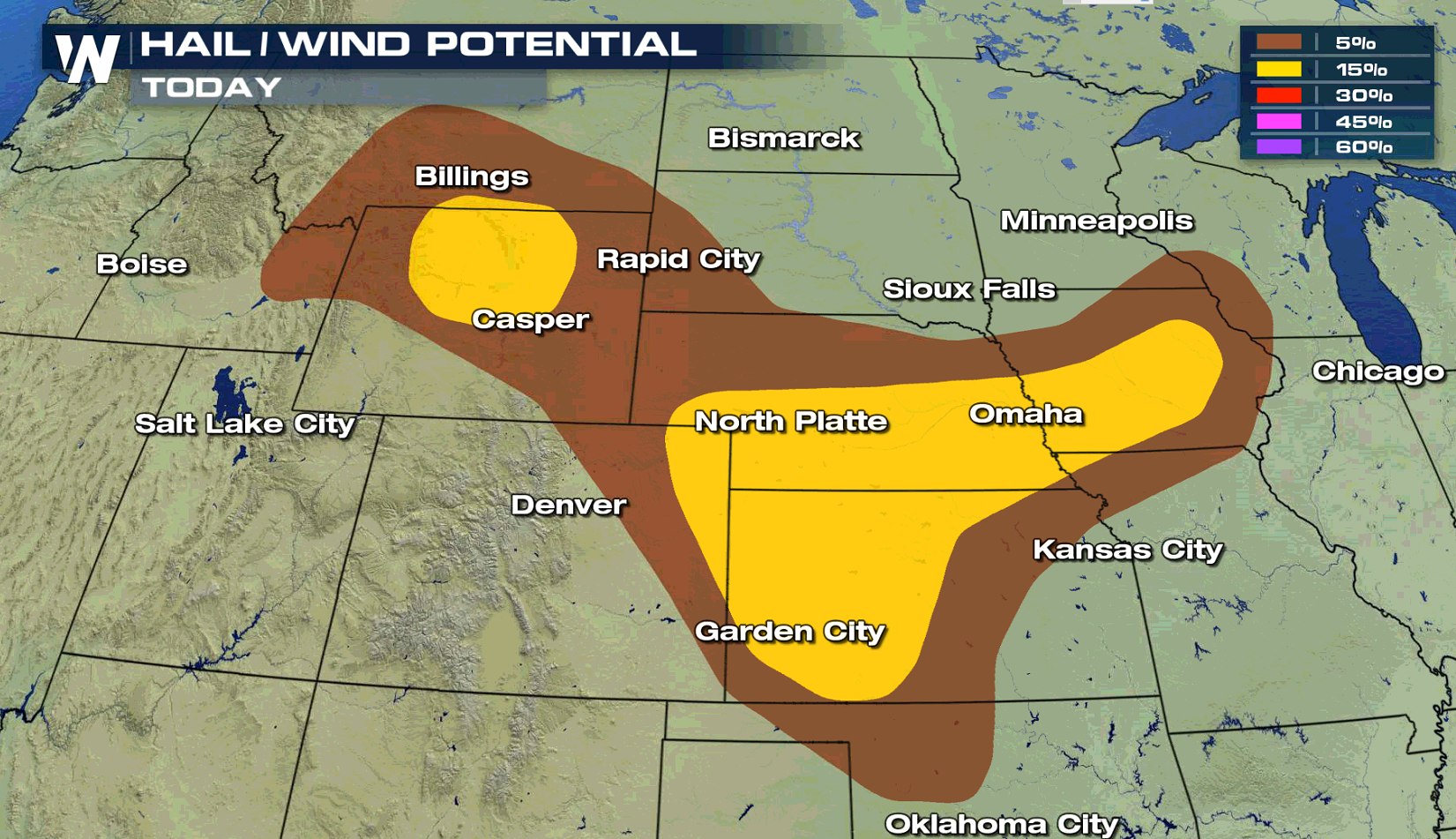
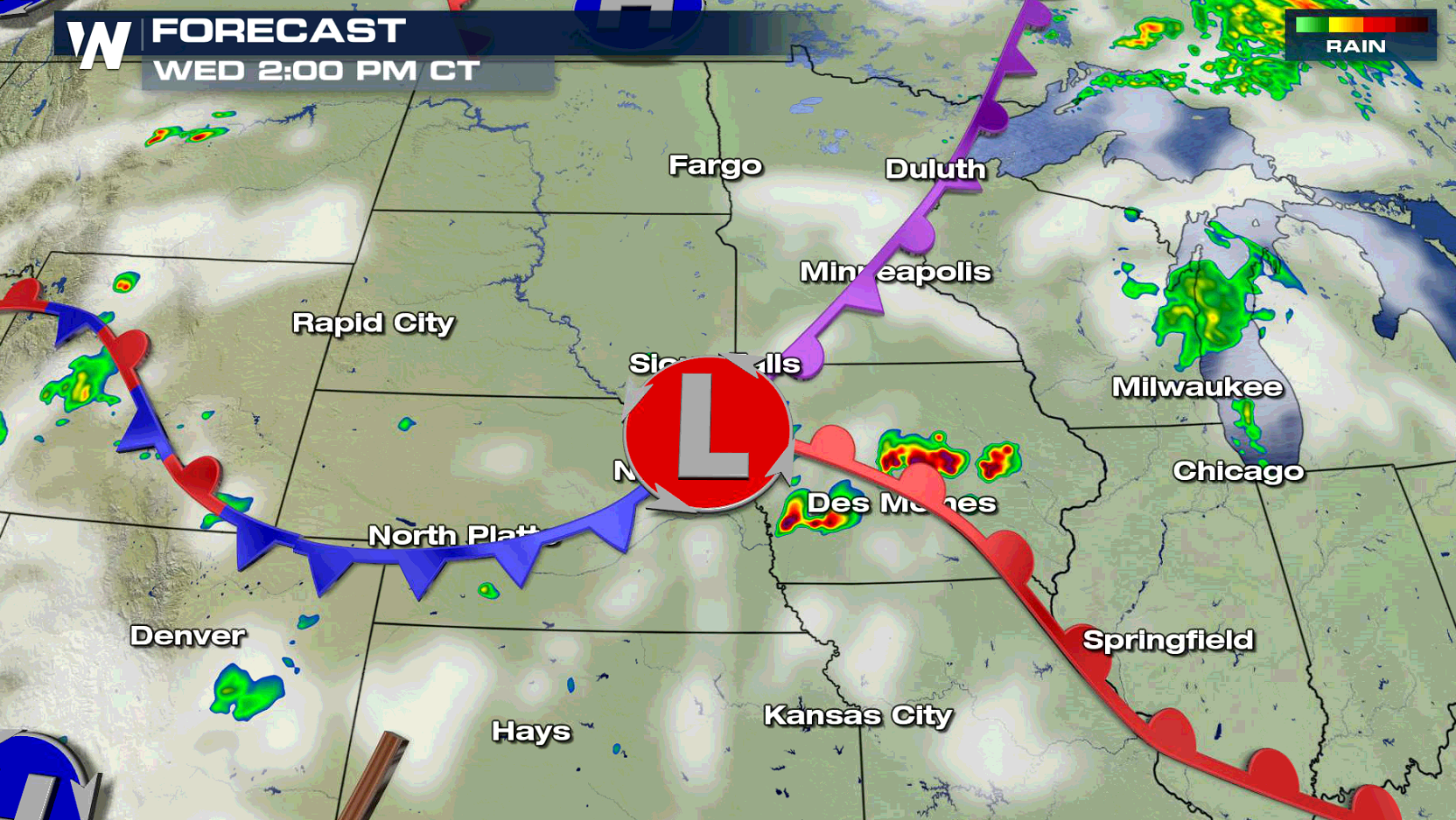
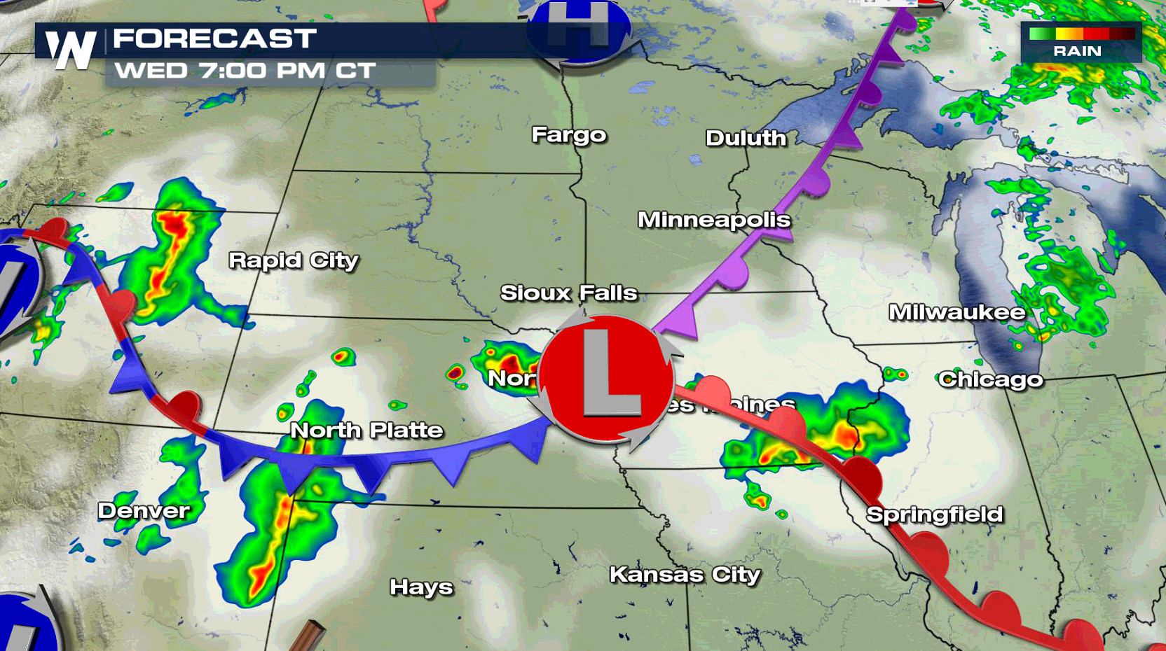
 Most of the thunderstorm activity will form along a series of fronts and near a low pressure center. Large hail and damaging winds are the biggest risks, with the tornado threat low for today (Wednesday).
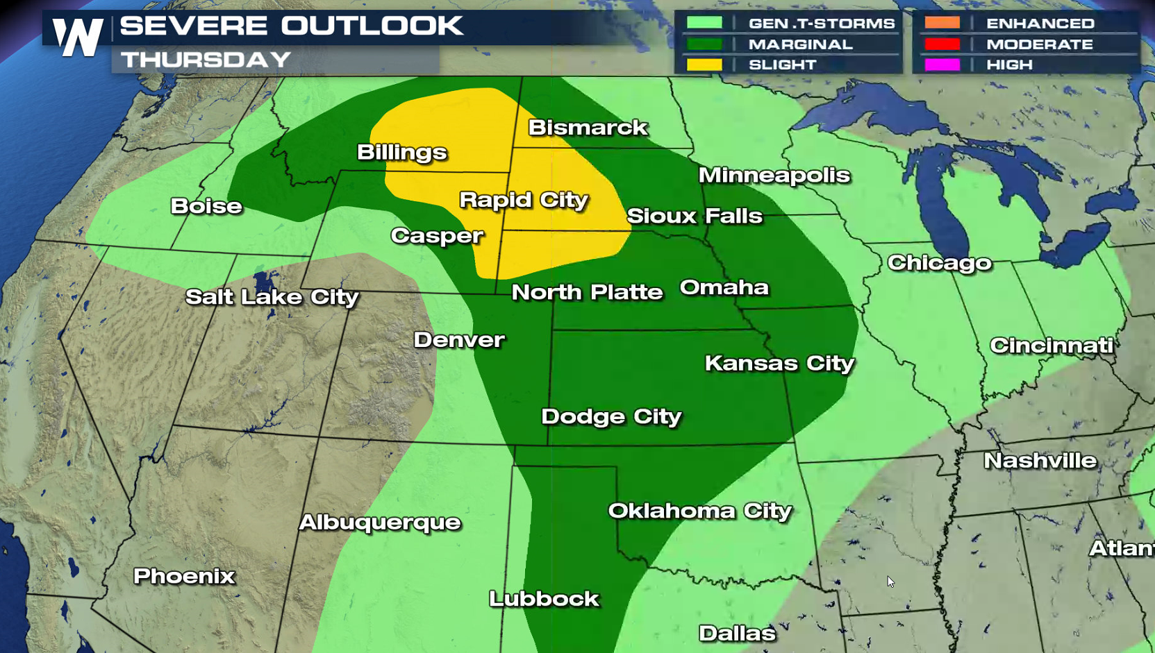
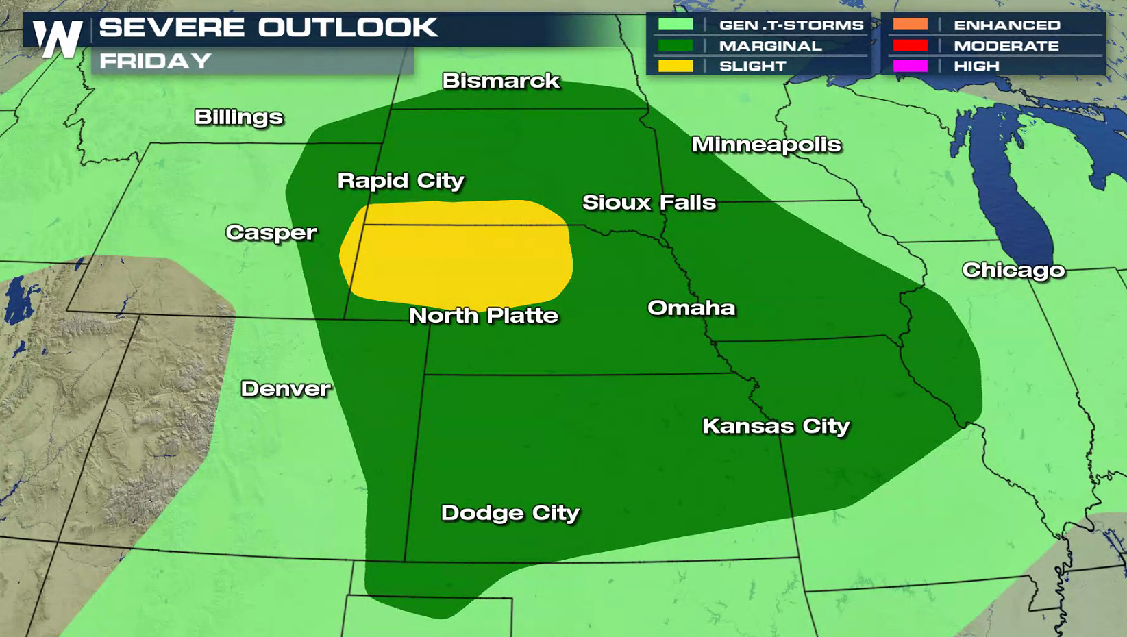
 Similar regions of the nation will have the threat for severe weather on Thursday and Friday. With heat continuing across the West, storm formation is likely on the edge of the heat dome.
 For WeatherNation: Meteorologist Mace Michaels
As an area of heat builds across the West, moisture levels will climb with humidity increasing from southerly winds blowing from the Gulf of Mexico. The energy will help to build and sustain strong storms.
Most of the thunderstorm activity will form along a series of fronts and near a low pressure center. Large hail and damaging winds are the biggest risks, with the tornado threat low for today (Wednesday).
Similar regions of the nation will have the threat for severe weather on Thursday and Friday. With heat continuing across the West, storm formation is likely on the edge of the heat dome.
For WeatherNation: Meteorologist Mace MichaelsAll Weather News
More
East Gears Up for Stormy, Wet Weekend
A low pressure system crashing through the Mi
1 Aug 2026 11:35 AM

Flooding, Severe Storms Target the Midwest Again
After an active week of storms across the nor
1 Aug 2026 1:40 AM


After Reaching Category 5, Genevieve Weakens in the Pacific
PacificFausto is now a post-tropical cyclone.
31 Jul 2026 1:30 AM

Flooding Risk Increases as Heavy Rain Targets the Tri-State Area
Tuesday, heavy rainfall moved across the Nort
30 Jul 2026 12:25 AM

Severe Weather: Energy From the Midwest Now in the Southeast
UPPER MIDWEST - Through Monday, dangerous tor
29 Jul 2026 10:30 PM