Severe Storms Likely in the High Plains
Special Stories
10 Jul 2018 10:06 AM
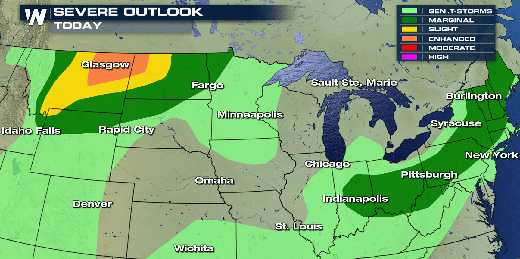
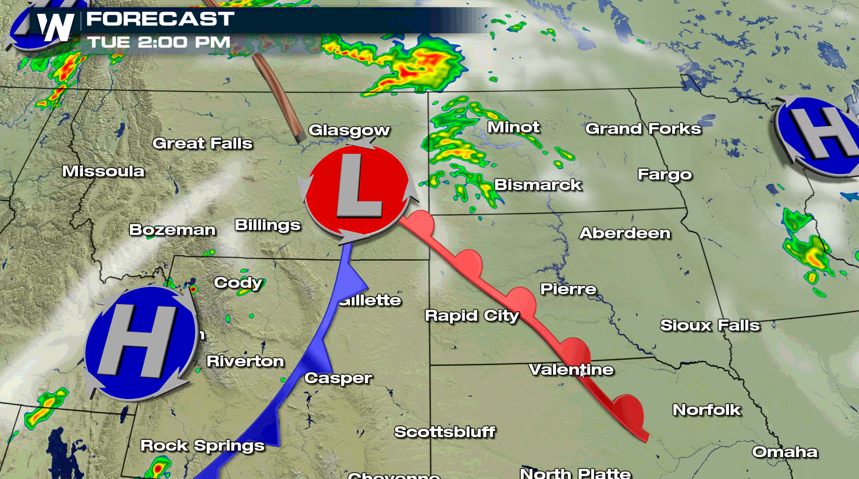
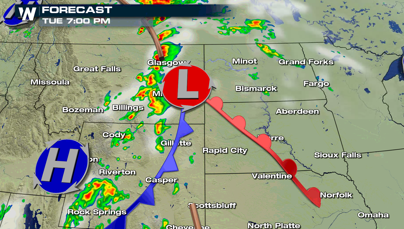
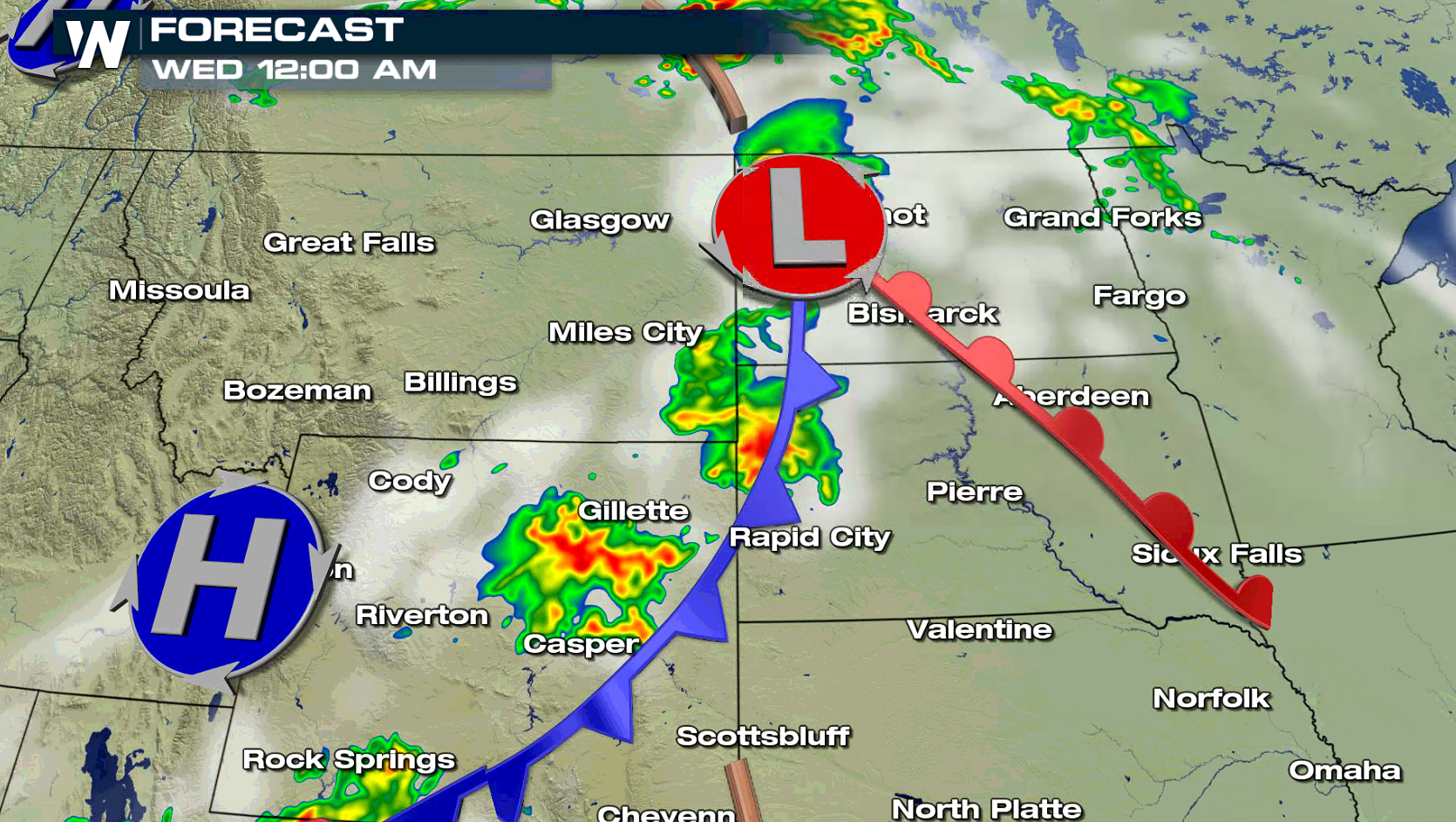
Wind damage will be the biggest concern with severe thunderstorms that are likely to develop in the High Plains today (Tuesday), focused in Montana and North Dakota. Large hail and isolated tornadoes are also possible in the late afternoon and evening. The Northeast may see isolated severe storms as well.
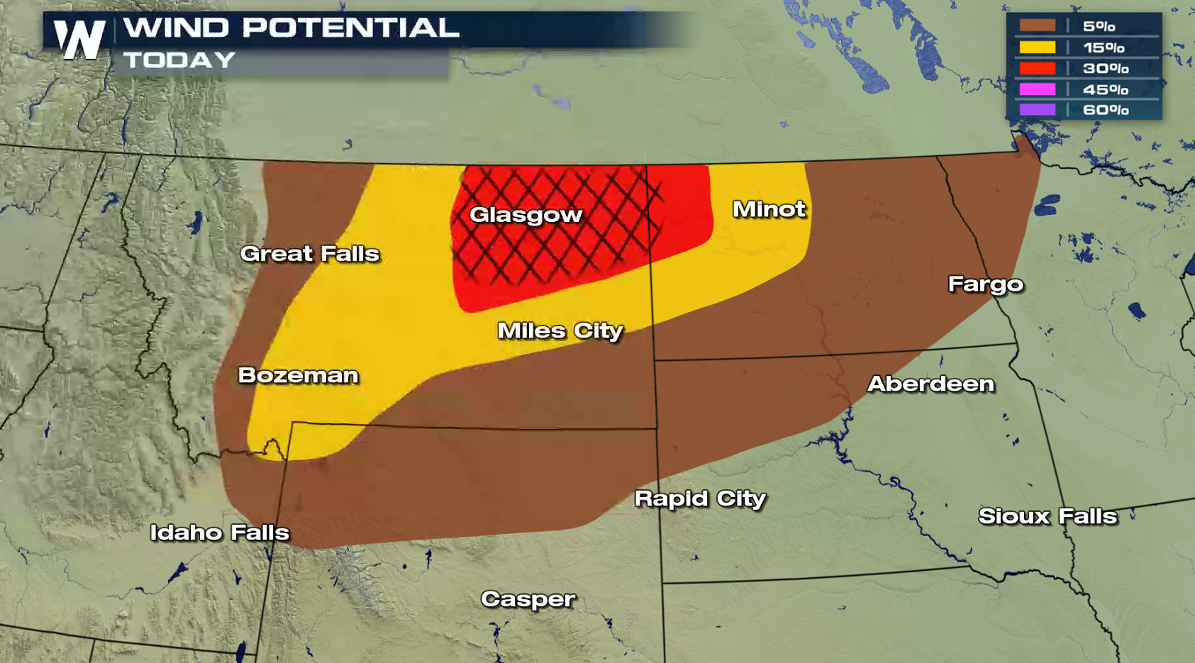
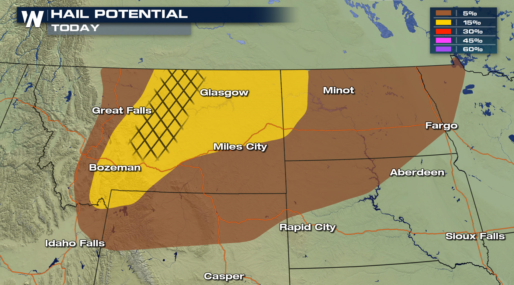
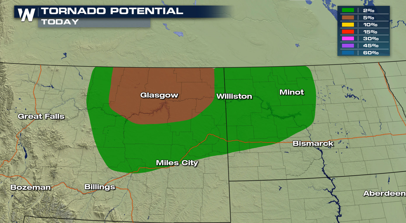 A storm system pulling out of the Rockies will push into the High Plains. Upper level energy will lift across the region, aiding severe weather development. Storms may form into a thunderstorm complex with strong wind gusts into the overnight.
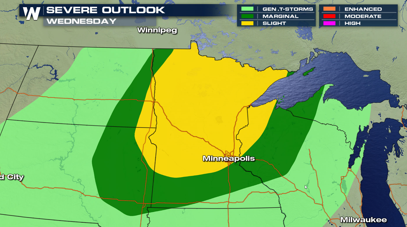
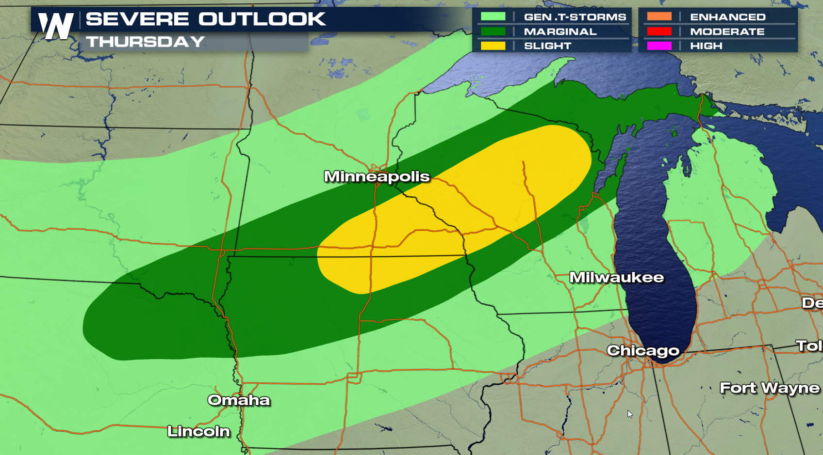
 The low pressure center and fronts will roll into Minnesota and Wisconsin Wednesday and Thursday. The threat for severe weather will move towards the western Great Lakes with heat and humidity building ahead of the storm system, likely leading to a few severe thunderstorms.
 For WeatherNation: Meteorologist Mace Michaels
A storm system pulling out of the Rockies will push into the High Plains. Upper level energy will lift across the region, aiding severe weather development. Storms may form into a thunderstorm complex with strong wind gusts into the overnight.
The low pressure center and fronts will roll into Minnesota and Wisconsin Wednesday and Thursday. The threat for severe weather will move towards the western Great Lakes with heat and humidity building ahead of the storm system, likely leading to a few severe thunderstorms.
For WeatherNation: Meteorologist Mace MichaelsAll Weather News
More
Wildfire Outbreak in the Pacific Northwest
SPOKANE, WA - On Saturday, August 1st, the Ol
3 Aug 2026 1:55 AM

More Storms for the East Through Monday
A low-pressure system that moved through the
3 Aug 2026 1:50 AM


After Reaching Category 5, Genevieve Weakens in the Pacific
PacificGenevieve formed last Friday south of
3 Aug 2026 12:30 AM

Flooding, Severe Storms Target the Midwest Again
After an active week of storms across the nor
1 Aug 2026 1:40 AM

Flooding Risk Increases as Heavy Rain Targets the Tri-State Area
Tuesday, heavy rainfall moved across the Nort
30 Jul 2026 12:25 AM

Severe Weather: Energy From the Midwest Now in the Southeast
UPPER MIDWEST - Through Monday, dangerous tor
29 Jul 2026 10:30 PM