Severe Storms Monday from the Great Lakes to the Tennessee Valley
Top Stories
24 Jun 2019 6:26 AM
A cold front moving into the Ohio Valley today will be the focus for showers and storms today. Isolated to scattered severe storms will be possible with large hail, heavy rain, damaging winds and isolated tornadoes. Here is the very latest.
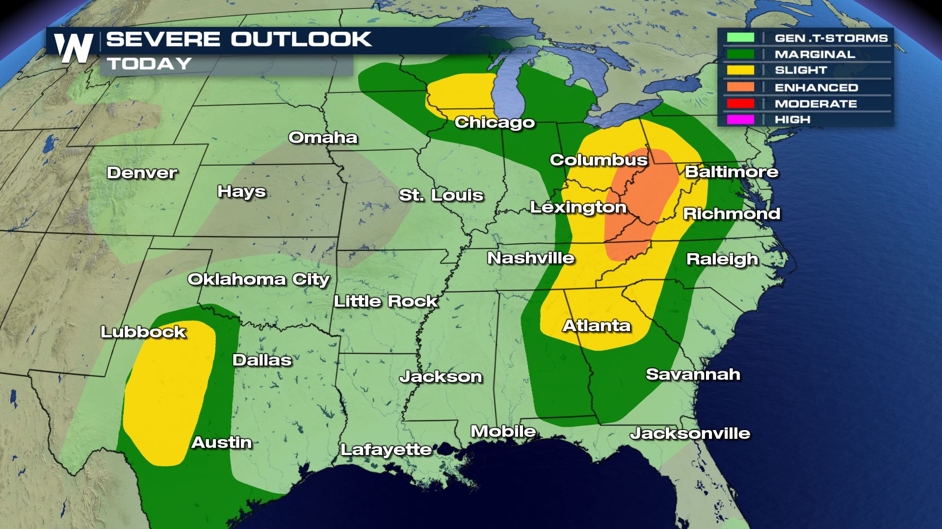 A good portion of the Eastern U.S. could see strong to severe storms today. From Chicago to Atlanta the risk of severe weather is in the forecast.
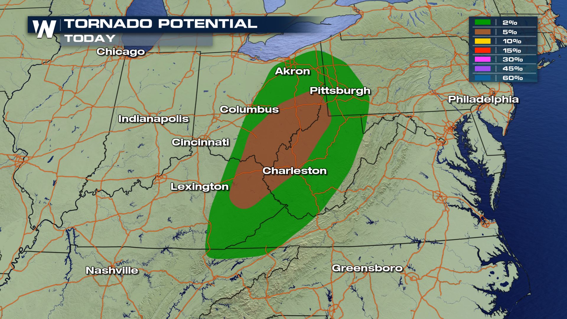
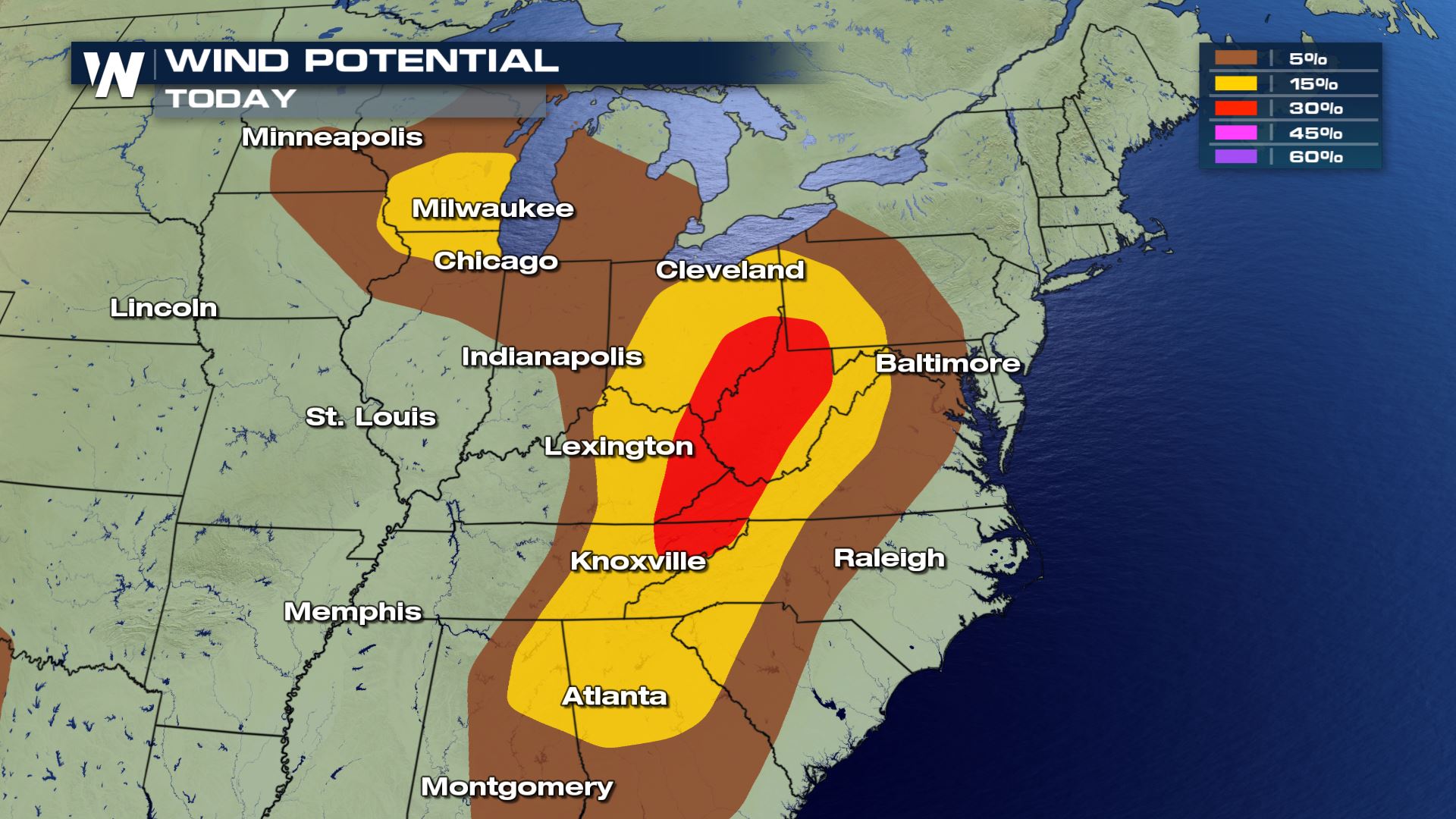
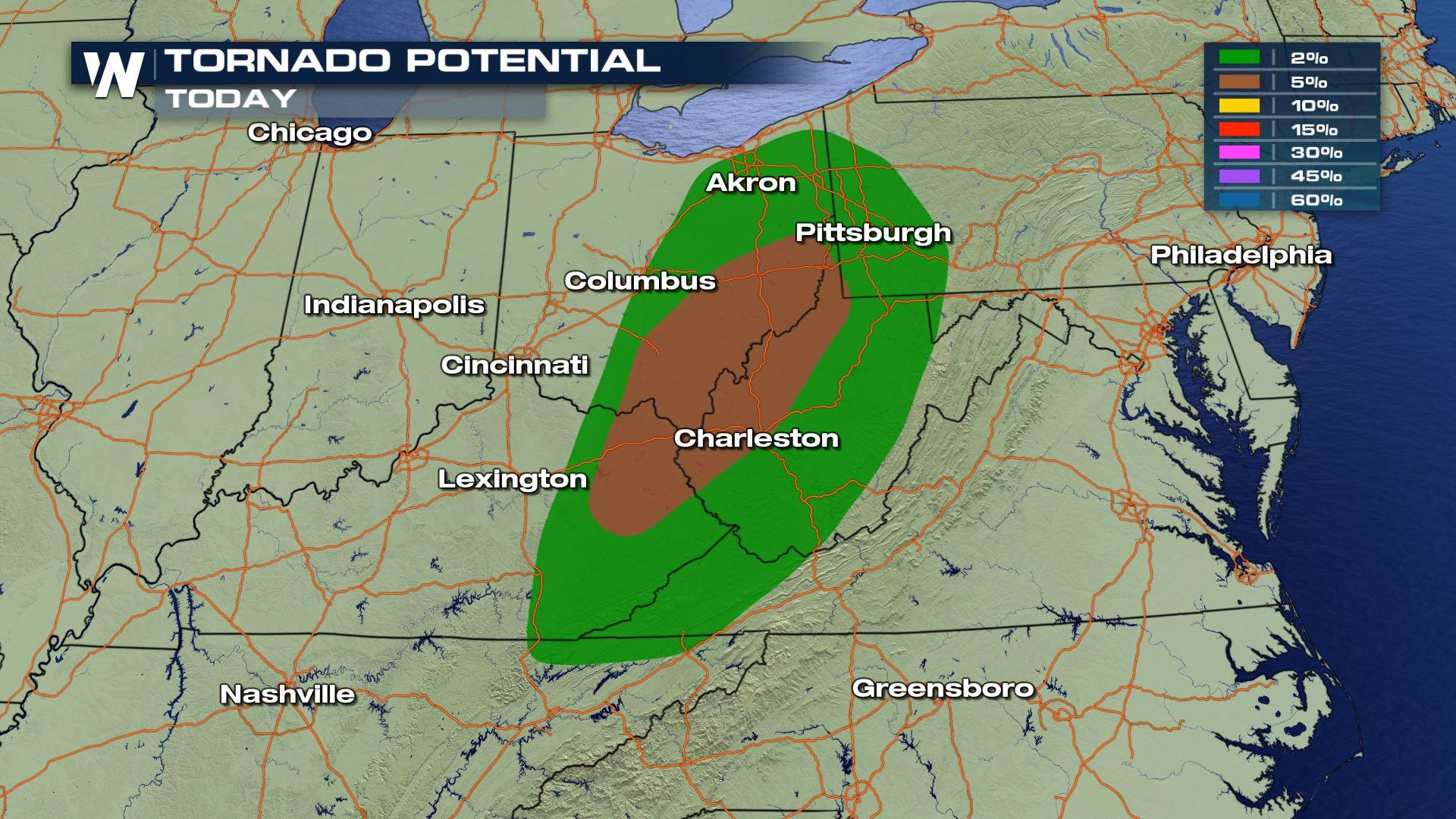
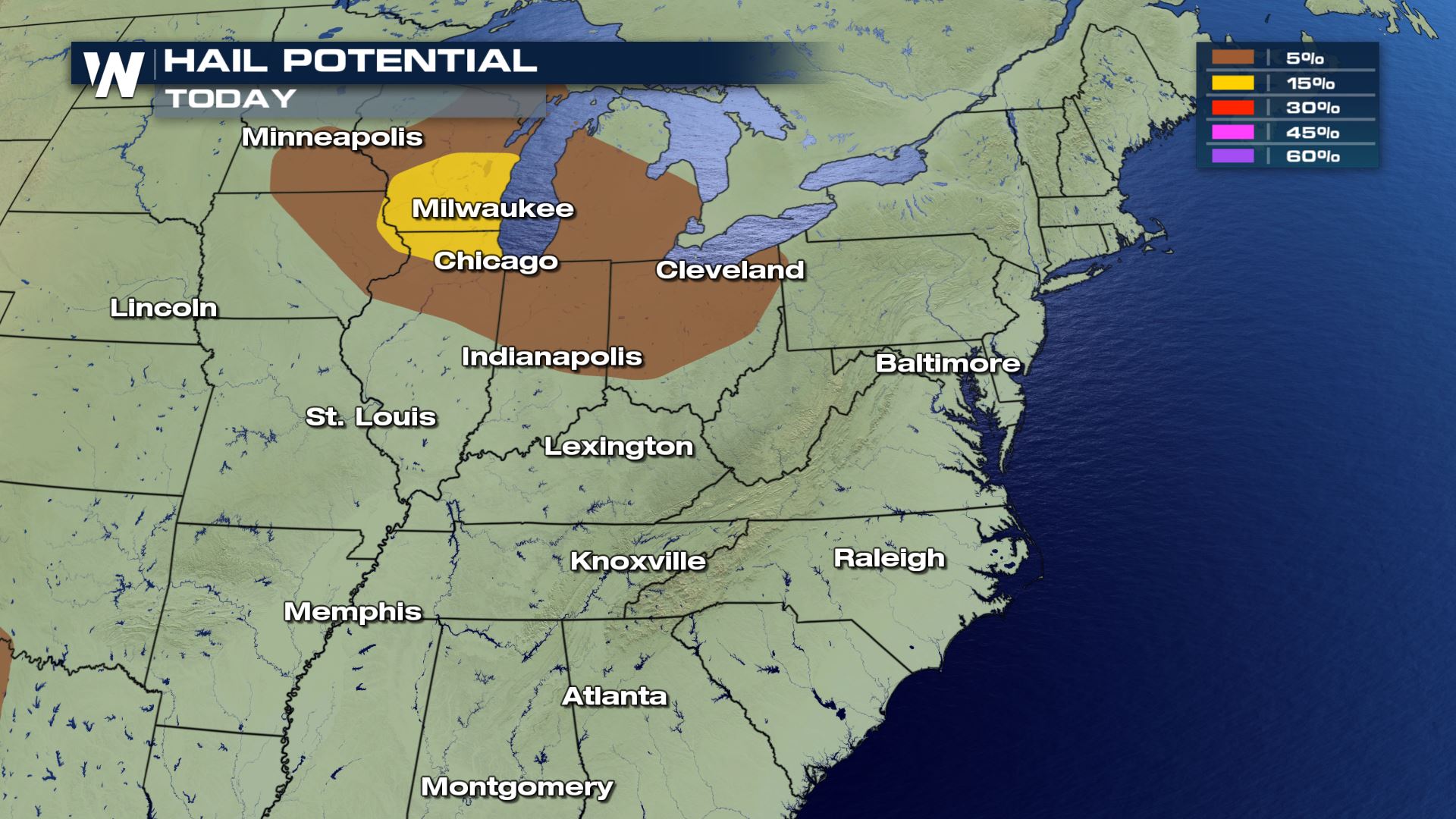 Similar to yesterday, the big weather risk will be damaging winds this afternoon and evening. Isolated tornadoes will also be possible, but winds and hail will be more likely with today's storms.
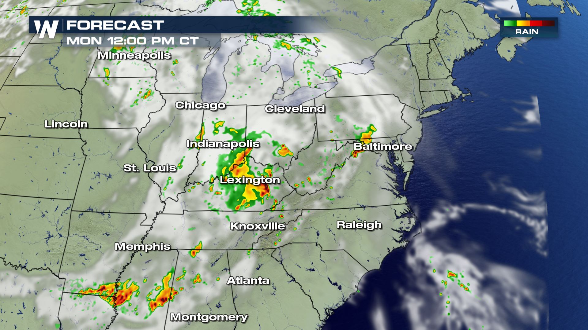
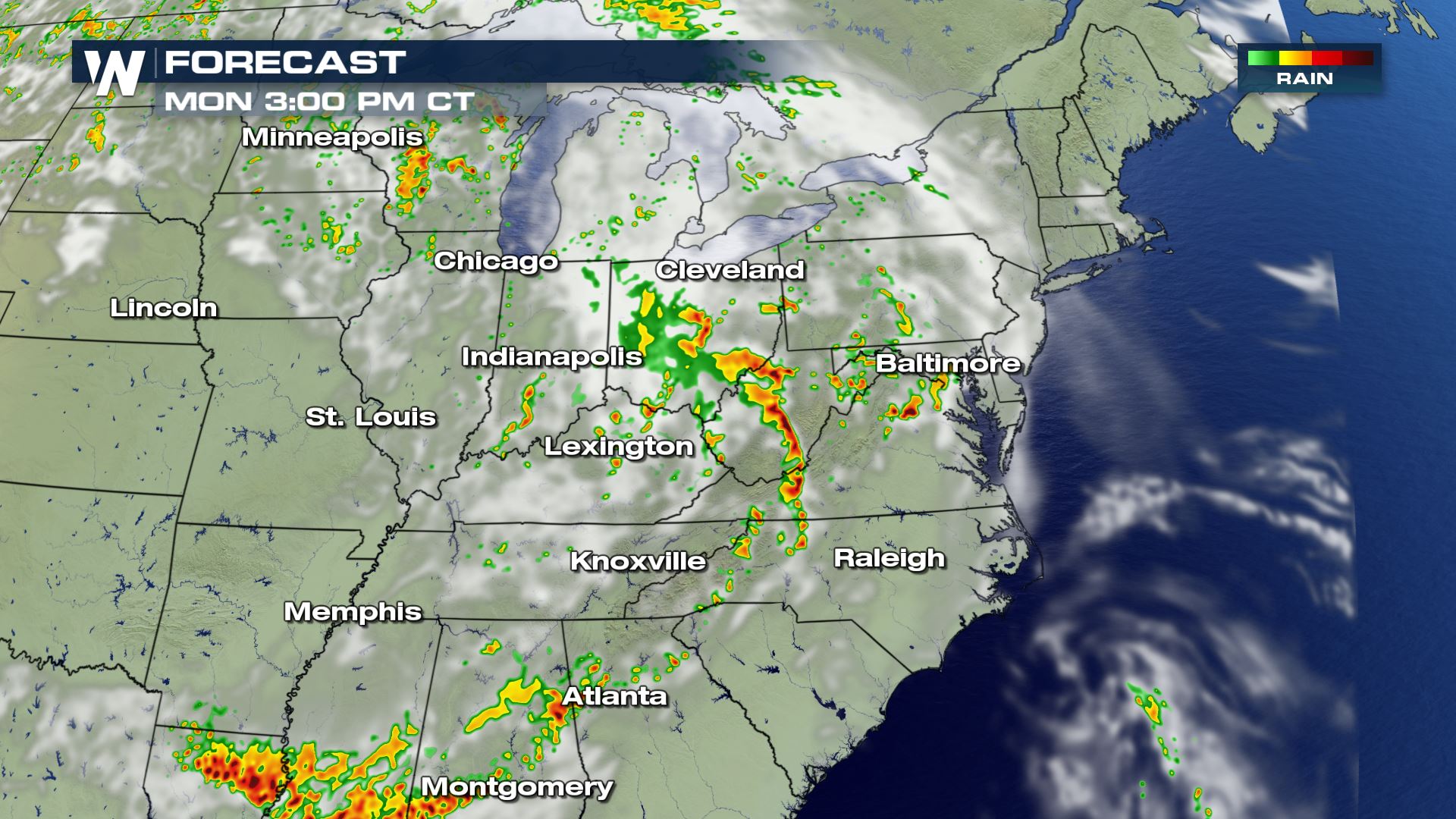
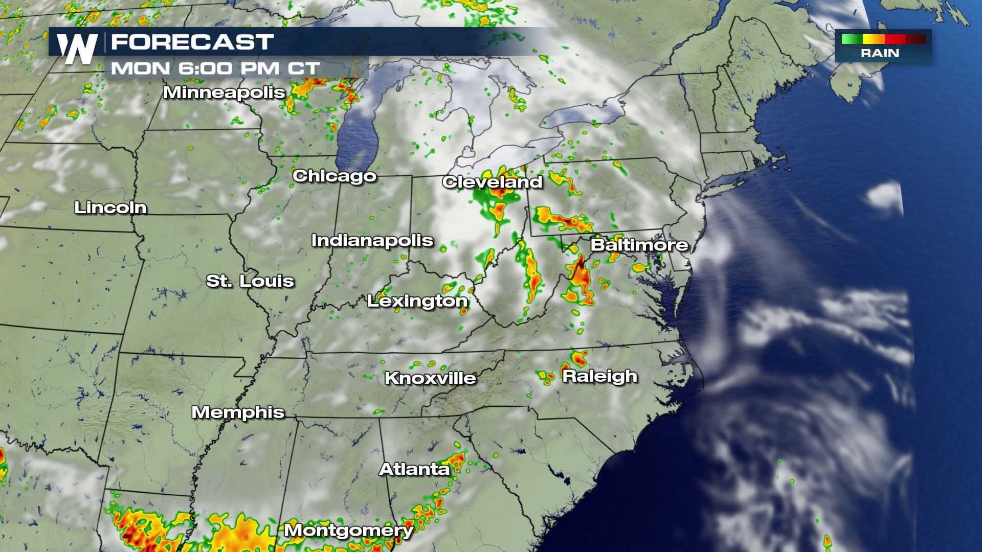 The timing for today's storms will be during the afternoon and evening hours. Some storms could linger into early Tuesday, but the severe risk will be much lower by that time. Keep checking with WeatherNation for the latest severe updates.
Severe Outlook
A good portion of the Eastern U.S. could see strong to severe storms today. From Chicago to Atlanta the risk of severe weather is in the forecast.
Severe Risks
Similar to yesterday, the big weather risk will be damaging winds this afternoon and evening. Isolated tornadoes will also be possible, but winds and hail will be more likely with today's storms.
Forecast
The timing for today's storms will be during the afternoon and evening hours. Some storms could linger into early Tuesday, but the severe risk will be much lower by that time. Keep checking with WeatherNation for the latest severe updates.All Weather News
More
Severe Storms Target the Midwest This Weekend
Extreme heat will be a big story this week ac
26 Jul 2026 2:15 AM

Heat Wave Grips Central, Western U.S.
Are you over the summer heat yet? The heat al
26 Jul 2026 2:05 AM

Tropics: Fausto Heads to Hawaii; Genevieve Will Become a Major Hurricane
Atlantic BasinBertha has dissipated after mov
26 Jul 2026 2:00 AM


Southeast Flood Risk Lingers Near Stalled Front
A stalled boundary over the Southeast will ke
25 Jul 2026 10:55 AM

Another Round of Storms Targets the Northeast
Tuesday brought severe weather again across p
23 Jul 2026 1:15 AM

Another Round of Severe Weather for the Upper Midwest and Great Lakes
The upper-level low train continues to keep t
21 Jul 2026 1:45 AM