Severe Storms Possible in the Midwest and Northwest Wednesday
Special Stories
23 Sep 2020 9:30 AM
Two small areas in the nation have been highlighted by the Storm Prediction Center today (Wednesday) for the potential of severe weather - the Upper Midwest and the Pacific Northwest. Heavy rainfall is a concern as well. Here's a closer look:
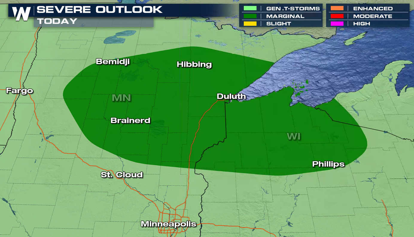
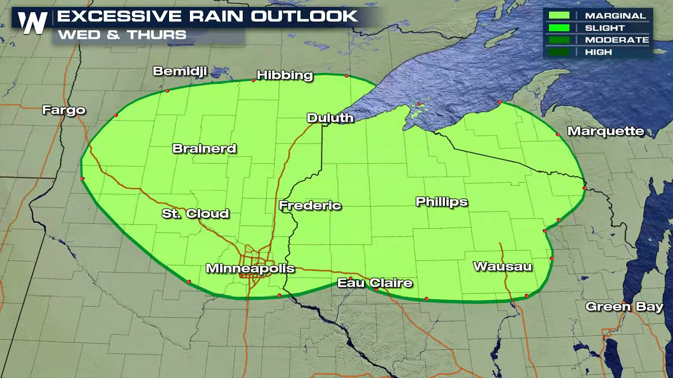
 Northern Minnesota into Northern Wisconsin are under a marginal risk for severe storms (level 1 on a scale of 1 to 5). Isolated storms may create strong wind gusts and large hail as instability builds throughout the day ahead of a low pressure center and front.
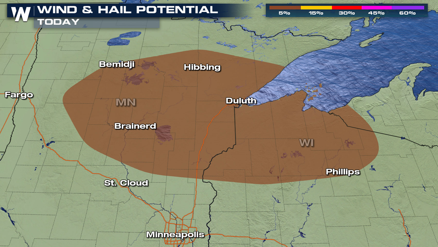
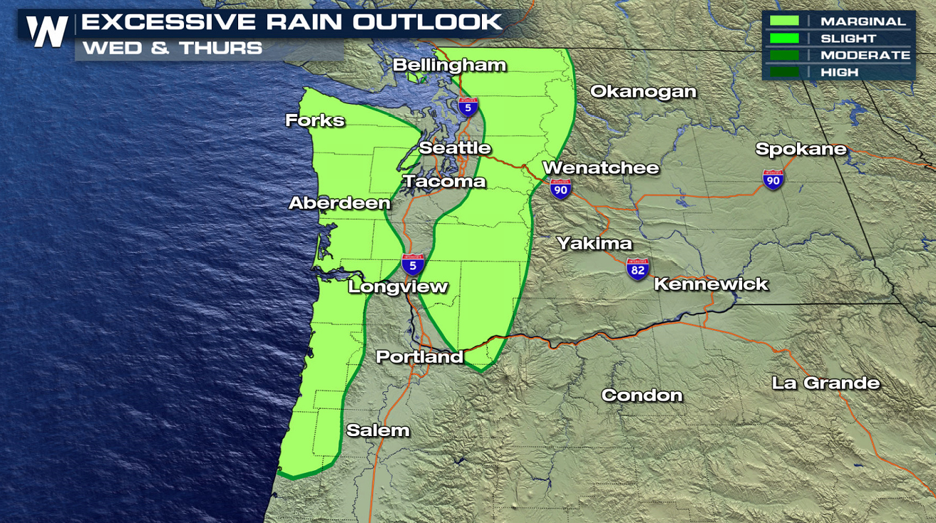
 As moisture increases in the atmosphere, a few storms could create very heavy rain. Thunderstorm coverage is not expected to be widespread, but in isolated areas where storms travel over the same areas, rainfall totals could become excessive and produce flooding.
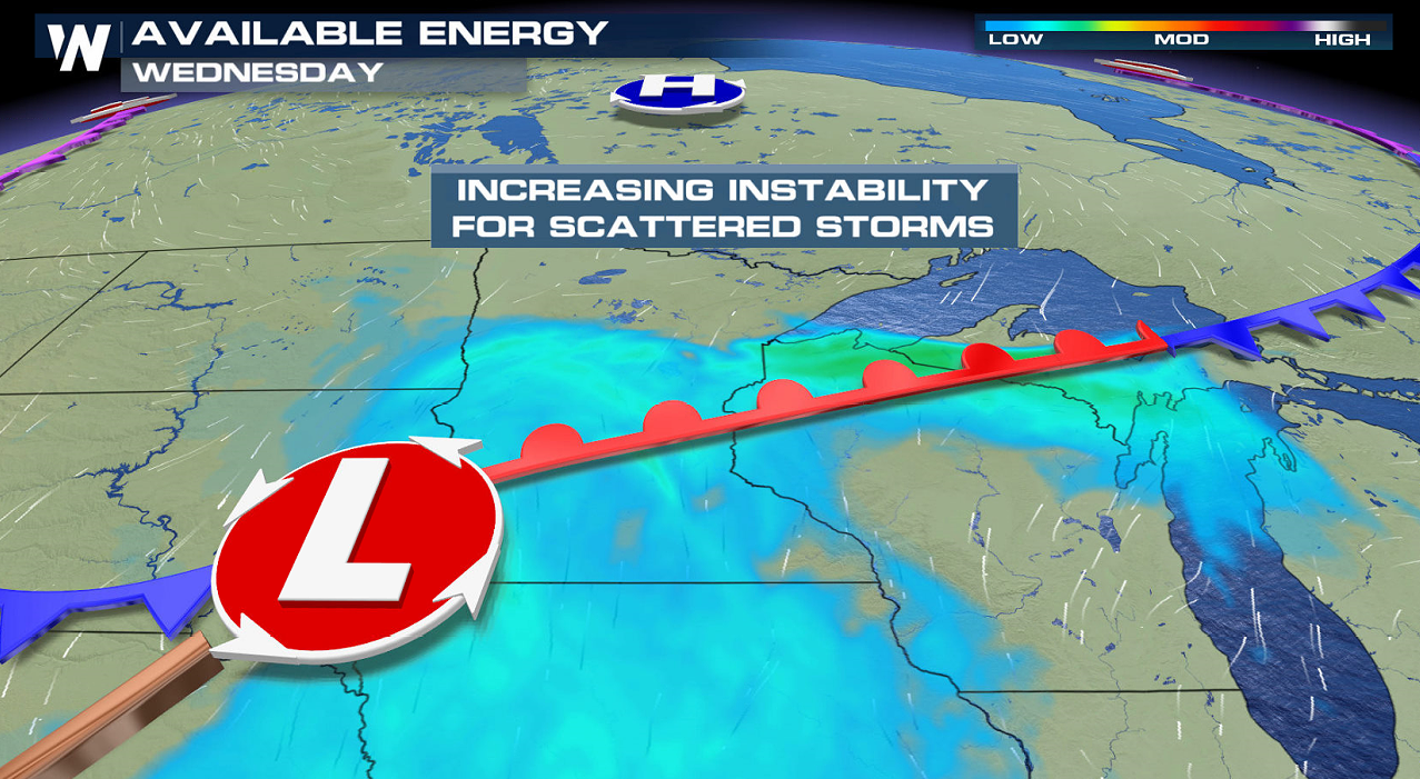
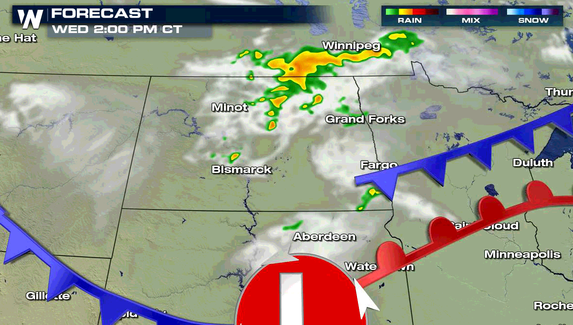
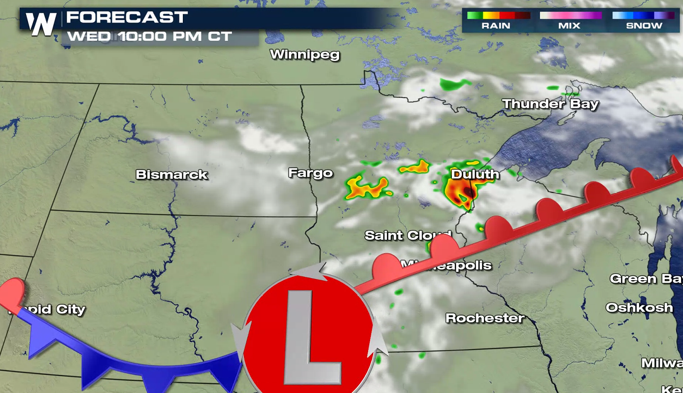
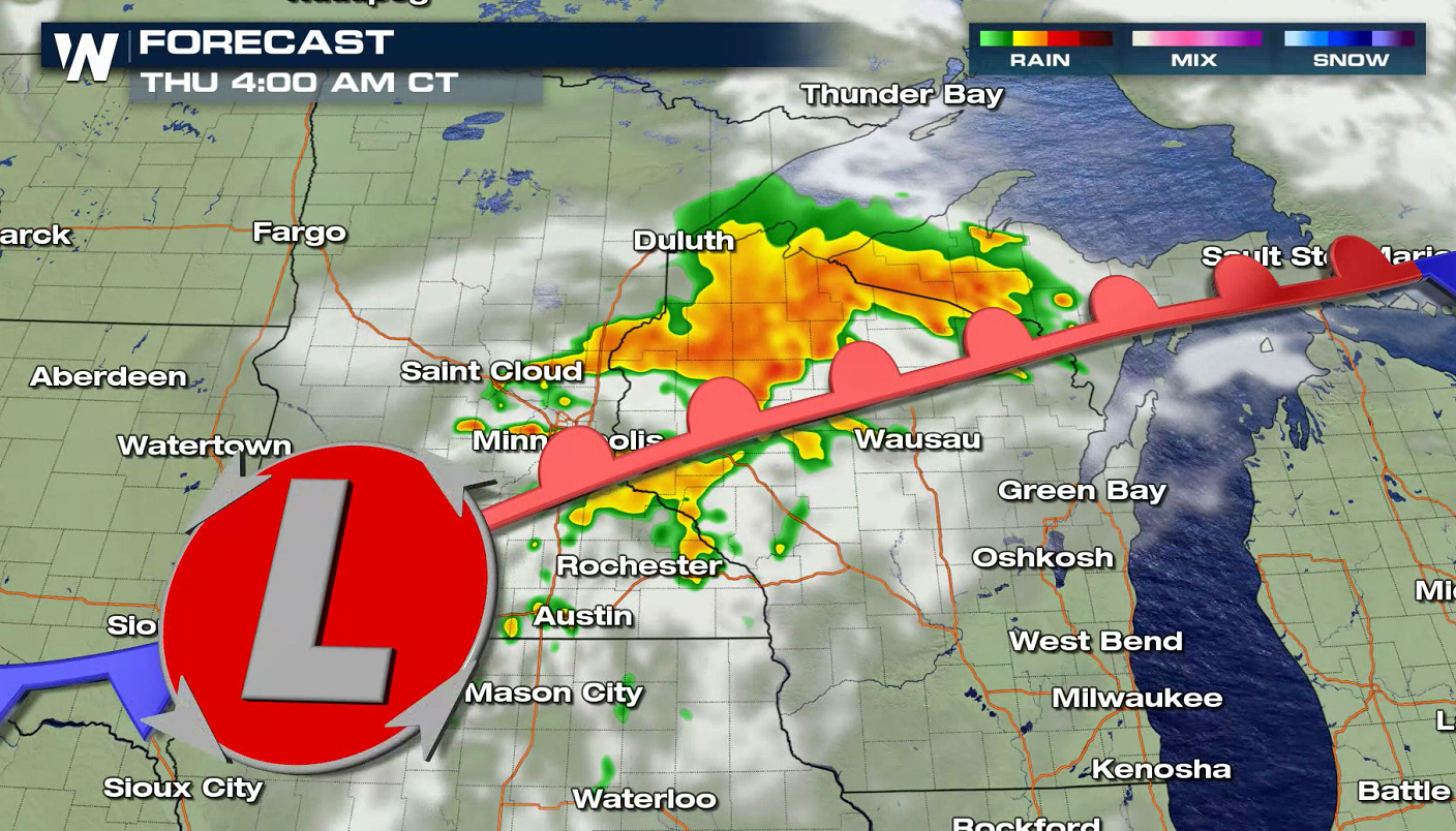
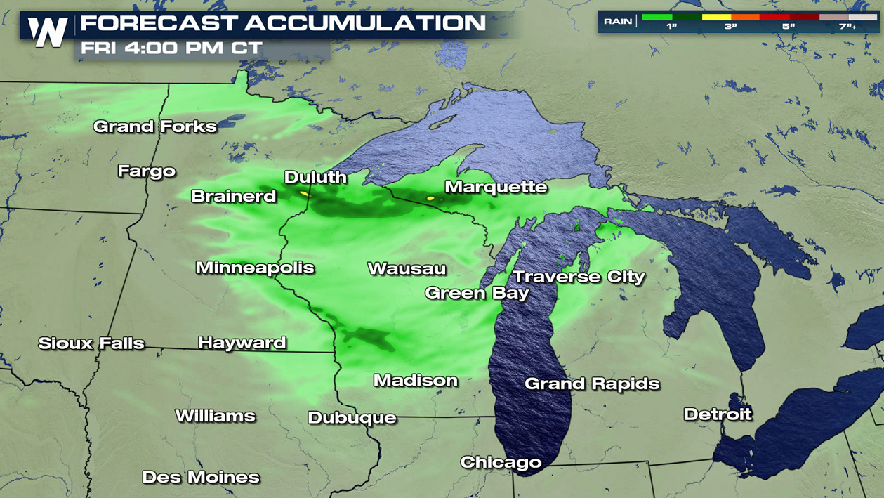 Storms will develop initially in North Dakota and Manitoba aided by an upper level disturbance. Storms will push to the Southeast, and as the disturbance approaches the low pressure center and fronts, coverage and intensity will increase. Thunderstorms may remain strong into Thursday morning.
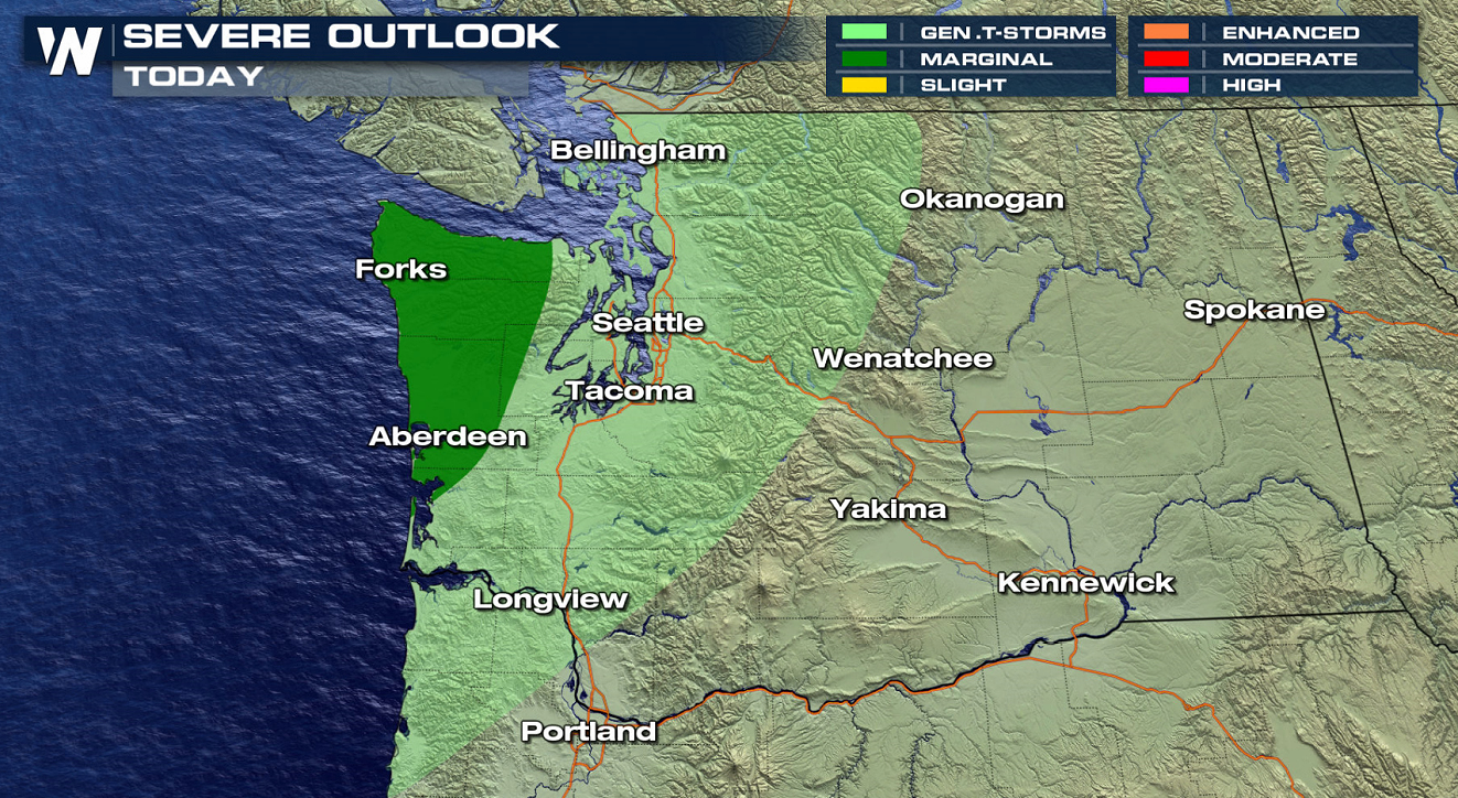
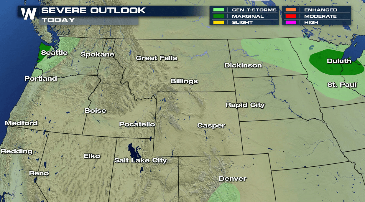
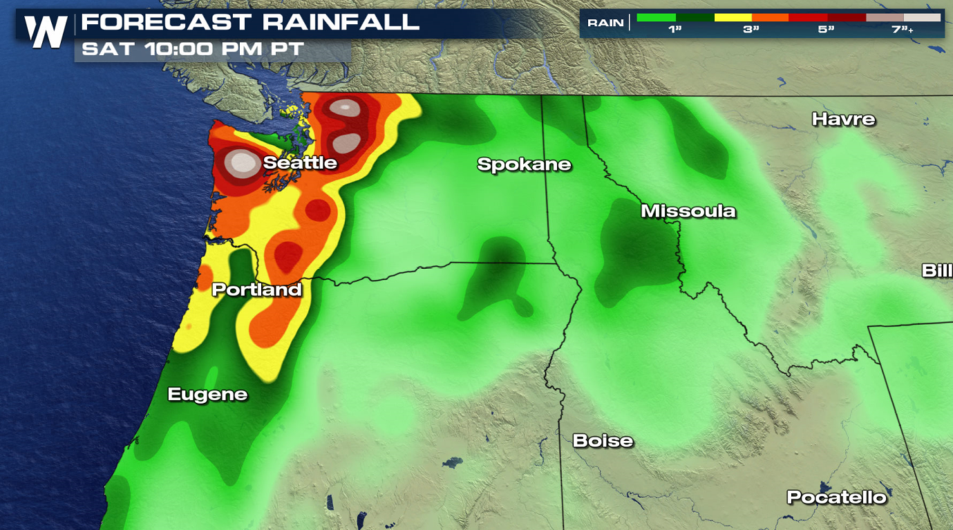
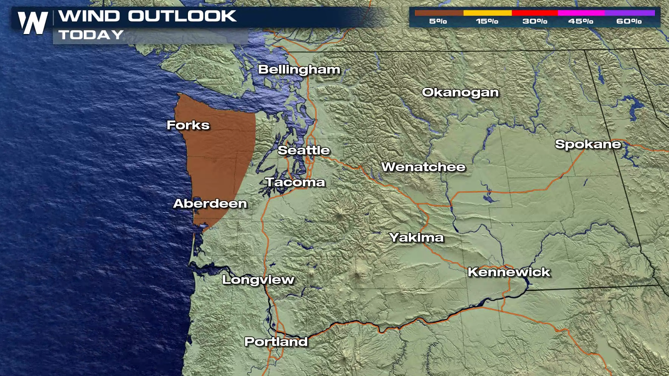 Isolated severe thunderstorms are possible along the Washington Coast west of Puget Sound. A few strong wind gusts are possible as storms develop in the afternoon and evening. Heavy rainfall may also occur with a persistent flow aloft off the Pacific Ocean, increasing humidity.
 WeatherNation will keep you updated on the latest severe weather information on-air and online.
UPPER MIDWEST
Northern Minnesota into Northern Wisconsin are under a marginal risk for severe storms (level 1 on a scale of 1 to 5). Isolated storms may create strong wind gusts and large hail as instability builds throughout the day ahead of a low pressure center and front.
As moisture increases in the atmosphere, a few storms could create very heavy rain. Thunderstorm coverage is not expected to be widespread, but in isolated areas where storms travel over the same areas, rainfall totals could become excessive and produce flooding.
Storms will develop initially in North Dakota and Manitoba aided by an upper level disturbance. Storms will push to the Southeast, and as the disturbance approaches the low pressure center and fronts, coverage and intensity will increase. Thunderstorms may remain strong into Thursday morning.
NORTHWEST
Isolated severe thunderstorms are possible along the Washington Coast west of Puget Sound. A few strong wind gusts are possible as storms develop in the afternoon and evening. Heavy rainfall may also occur with a persistent flow aloft off the Pacific Ocean, increasing humidity.
WeatherNation will keep you updated on the latest severe weather information on-air and online.All Weather News
More
Tropics: Tropical Storm Bertha Forms In the Atlantic, Eastern Pacific Active
AtlanticTropical Storm Bertha continues to mo
22 Jul 2026 2:20 AM

Another Round of Storms Targets the Northeast
Another cold front is dropping east and will
22 Jul 2026 2:05 AM

Pacific Northwest Fires Bringing Down the Air Quality
Conditions have been really dry out west. We'
22 Jul 2026 2:05 AM

Flash Flooding for the Carolinas This Week
Another stalled front in the Carolinas is for
22 Jul 2026 2:00 AM

Another Round of Severe Weather for the Upper Midwest and Great Lakes
The upper-level low train continues to keep t
21 Jul 2026 1:45 AM

Air Quality Improvements in the Forecast
Wildfires burning in Northwestern Ontario, Ca
20 Jul 2026 7:20 PM

Monsoon Moisture Brings Weekend Flood Threat
The monsoon has returned to the southwestern
19 Jul 2026 1:30 AM